Category:Stonehouse Barracks
Jump to navigation
Jump to search
military installation at Stonehouse, Plymouth in the UK .jpg) | |||||
| Upload media | |||||
| Instance of | |||||
|---|---|---|---|---|---|
| Location | Stonehouse, Plymouth, City of Plymouth, Devon, South West England, England | ||||
| Owned by | |||||
| Occupant | |||||
| Operator | |||||
| Inception |
| ||||
 | |||||
Media in category "Stonehouse Barracks"
The following 200 files are in this category, out of 285 total.
(previous page) (next page)-
 10, Millbay Rd - geograph.org.uk - 4896440.jpg 640 × 411; 47 KB
-
 124 - 126, Durnford St - geograph.org.uk - 4942521.jpg 640 × 426; 38 KB
-
 154 - 156, Durnford St - geograph.org.uk - 4942513.jpg 640 × 426; 65 KB
-
 A small quay, Cremyll St - geograph.org.uk - 4935595.jpg 640 × 426; 80 KB
-
 A wet ^ dark Durnford St - geograph.org.uk - 4942525.jpg 640 × 426; 64 KB
-
 Admiral's Hard - geograph.org.uk - 4896517.jpg 640 × 426; 67 KB
-
 Admiral's Hard, Stonehouse - geograph.org.uk - 4612617.jpg 1,920 × 2,661; 1.05 MB
-
 Admiralty St - geograph.org.uk - 4927207.jpg 640 × 426; 59 KB
-
 Admiralty Street - geograph.org.uk - 4243986.jpg 640 × 480; 70 KB
-
 An old crane, Cremyll St - geograph.org.uk - 4935596.jpg 640 × 426; 62 KB
-

-

-
 Artillery Tower - geograph.org.uk - 4935746.jpg 640 × 426; 58 KB
-
-

-
 Boatyard by Stonehouse Pool - geograph.org.uk - 4352919.jpg 640 × 480; 50 KB
-
 Brewhouse, Royal William Victualling Yard - geograph.org.uk - 4612491.jpg 1,920 × 955; 390 KB
-
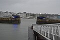
 Brittany Ferries area, Millbay Docks - geograph.org.uk - 4896421.jpg 640 × 375; 53 KB
-
 Brownlow St - geograph.org.uk - 4942867.jpg 640 × 426; 67 KB
-
 Bryon Villa, Stonehouse - geograph.org.uk - 4612666.jpg 1,920 × 1,275; 448 KB
-
 Buildings at Royal William Victualling Yard - geograph.org.uk - 4612542.jpg 1,920 × 1,121; 384 KB
-
 Buildings at Royal William Yard, Plymouth - geograph.org.uk - 4387956.jpg 1,600 × 1,062; 503 KB
-
 Car Park at Brunel Way - geograph.org.uk - 3246099.jpg 640 × 494; 61 KB
-
 Caroline Place - geograph.org.uk - 4896442.jpg 640 × 392; 52 KB
-
 Church of St Paul - geograph.org.uk - 4942518.jpg 426 × 640; 75 KB
-
 Church of St Paul - geograph.org.uk - 4942520.jpg 640 × 426; 85 KB
-
 Church of St Paul - geograph.org.uk - 4942522.jpg 640 × 426; 72 KB
-
 Church of St Paul - geograph.org.uk - 4942523.jpg 426 × 640; 69 KB
-
 Church of St Paul - geograph.org.uk - 4942857.jpg 640 × 426; 73 KB
-
 Citadel Road - geograph.org.uk - 4620850.jpg 4,000 × 1,794; 3.91 MB
-
 Cormorant - geograph.org.uk - 4927136.jpg 640 × 426; 64 KB
-
 Cormorant, Mayflower Marina - geograph.org.uk - 4927144.jpg 640 × 426; 78 KB
-
 Corner of Emma Place - geograph.org.uk - 4896447.jpg 640 × 402; 49 KB
-
 Cremyll St - geograph.org.uk - 4935593.jpg 640 × 426; 50 KB
-
 Cremyll St - geograph.org.uk - 4935594.jpg 640 × 426; 57 KB
-
 Cremyll Street - geograph.org.uk - 4896521.jpg 640 × 391; 43 KB
-
 Deepwater dock at Millbay - geograph.org.uk - 4626740.jpg 4,608 × 3,456; 4.47 MB
-
 Defences at Firestone Bay, Plymouth - geograph.org.uk - 4387918.jpg 1,600 × 1,062; 626 KB
-
 Derelict building, Millbay Rd - geograph.org.uk - 4896405.jpg 640 × 423; 52 KB
-
 Drake's Island - geograph.org.uk - 3834536.jpg 640 × 480; 86 KB
-
 Drake's Island - geograph.org.uk - 4655829.jpg 1,600 × 1,200; 258 KB
-
 Drake's Island, The Sound, Plymouth - geograph.org.uk - 4387355.jpg 1,600 × 1,062; 420 KB
-
 Durnford Hotel (former) - geograph.org.uk - 4935597.jpg 640 × 426; 68 KB
-
 Durnford St - geograph.org.uk - 4927208.jpg 640 × 426; 66 KB
-
 Durnford St - geograph.org.uk - 4927221.jpg 640 × 426; 67 KB
-
 Durnford St - geograph.org.uk - 4942507.jpg 640 × 426; 81 KB
-
 Durnford St - geograph.org.uk - 4942510.jpg 640 × 426; 73 KB
-
 Durnford St Ope - geograph.org.uk - 4896501.jpg 640 × 417; 55 KB
-
 Durnford Street - geograph.org.uk - 4243973.jpg 640 × 480; 69 KB
-
 Durnford Street, Stonehouse - geograph.org.uk - 4603436.jpg 1,920 × 2,110; 579 KB
-
 Eastern King Battery, Stonehouse, Plymouth - geograph.org.uk - 4387373.jpg 1,600 × 1,062; 553 KB
-
 Eastern King Point - geograph.org.uk - 4942500.jpg 640 × 426; 63 KB
-
 Edgcumbe Belle (Cremyll Ferry) - geograph.org.uk - 4896619.jpg 640 × 426; 65 KB
-
 Elvira's Cafe, Stonehouse - geograph.org.uk - 4604647.jpg 1,920 × 1,275; 561 KB
-
 Ferry Terminal, Plymouth - geograph.org.uk - 3473652.jpg 640 × 480; 56 KB
-
 Flats, Millbay Rd - geograph.org.uk - 4896357.jpg 640 × 426; 51 KB
-
 Footpath to Eastern King Point - geograph.org.uk - 4942496.jpg 640 × 426; 56 KB
-
 Footpath to Eastern King Point - geograph.org.uk - 4942498.jpg 640 × 426; 60 KB
-
 Freeman's Wharf - geograph.org.uk - 3957255.jpg 4,000 × 2,664; 1.98 MB
-
 Garden Crescent, Plymouth - geograph.org.uk - 3473651.jpg 640 × 480; 58 KB
-
 Harbour Masters Building at Eastern King Point - geograph.org.uk - 4387369.jpg 1,600 × 1,062; 400 KB
-
 Houses on Durnford Street - geograph.org.uk - 4243975.jpg 640 × 432; 64 KB
-
 Inner Harbour, Royal William Yard - geograph.org.uk - 4655782.jpg 1,200 × 1,600; 379 KB
-
 Jetty, Cremyll Ferry - geograph.org.uk - 4904941.jpg 640 × 426; 84 KB
-
 King Point Marina - geograph.org.uk - 4896394.jpg 640 × 426; 81 KB
-
 King Point Marina - geograph.org.uk - 4896399.jpg 640 × 426; 68 KB
-
 King Point Marina, Millbay Docks - geograph.org.uk - 4212648.jpg 1,600 × 1,200; 578 KB
-
 KW Foods, Durnford Street, Stonehouse - geograph.org.uk - 4604552.jpg 1,920 × 1,248; 480 KB
-
 Landing Craft on Plymouth Sound - geograph.org.uk - 4200647.jpg 2,048 × 1,536; 735 KB
-
 Lookout tower, Eastern King Point - geograph.org.uk - 4942503.jpg 640 × 426; 63 KB
-
 Marina at Millbay - geograph.org.uk - 4626730.jpg 4,608 × 3,456; 4 MB
-
 Marina in Plymouth Harbour - geograph.org.uk - 4083443.jpg 640 × 480; 116 KB
-
 Mayflower Marina - geograph.org.uk - 4896605.jpg 640 × 426; 53 KB
-
 Mayflower Marina - geograph.org.uk - 4905044.jpg 640 × 426; 57 KB
-
 Mayflower Marina - geograph.org.uk - 4905056.jpg 640 × 401; 53 KB
-
 Mayflower Marina - geograph.org.uk - 4905059.jpg 640 × 426; 58 KB
-
 Mayflower Marina - geograph.org.uk - 4927070.jpg 640 × 426; 57 KB
-
 Mayflower Marina - geograph.org.uk - 4927147.jpg 640 × 426; 55 KB
-
 Mayflower Marina and Mount Wise - geograph.org.uk - 4905207.jpg 640 × 426; 53 KB
-
 Memorial Plaque - HMS Devonshire 1929.jpg 1,056 × 1,760; 266 KB
-
 Milestone, Admiral's Hard, Stonehouse - geograph.org.uk - 4604663.jpg 1,389 × 1,805; 768 KB
-
 Millbay Docks - geograph.org.uk - 4896389.jpg 640 × 426; 66 KB
-
 Millbay Docks - geograph.org.uk - 4896413.jpg 640 × 426; 58 KB
-
 Millbay Docks, Stonehouse, Plymouth - geograph.org.uk - 4387347.jpg 1,600 × 1,062; 458 KB
-
 Millbay Pier - geograph.org.uk - 4942504.jpg 640 × 426; 47 KB
-
 Millbay Rd - geograph.org.uk - 4896368.jpg 640 × 426; 61 KB
-
 Millbay, Plymouth - geograph.org.uk - 4626746.jpg 3,456 × 4,608; 3.78 MB
-
 Miller Court Business Park - geograph.org.uk - 4942870.jpg 640 × 426; 61 KB
-
 MOD property - geograph.org.uk - 4942501.jpg 640 × 426; 74 KB
-
 Modern Apartments - geograph.org.uk - 3957247.jpg 4,000 × 2,664; 2.64 MB
-
 Mount Wise - geograph.org.uk - 4905157.jpg 640 × 426; 49 KB
-
 Mount Wise - geograph.org.uk - 4927056.jpg 640 × 426; 41 KB
-
 Mount Wise, Plymouth - geograph.org.uk - 4626682.jpg 4,608 × 3,456; 3.58 MB
-
 Murray Volkswagen - geograph.org.uk - 4896364.jpg 640 × 426; 42 KB
-
 On Cremyll St - geograph.org.uk - 4935592.jpg 640 × 426; 54 KB
-
 Ordnance Survey Flush Bracket S0721 - geograph.org.uk - 4714267.jpg 4,000 × 3,000; 4.46 MB
-
 Phoenix St - geograph.org.uk - 4896360.jpg 640 × 374; 53 KB
-
 Plymouth , City Scenery - geograph.org.uk - 3486607.jpg 4,288 × 2,848; 3.8 MB
-
 Plymouth , City Scenery - geograph.org.uk - 3486698.jpg 4,288 × 2,848; 6.08 MB
-
 Plymouth , City Scenery - geograph.org.uk - 3486702.jpg 4,288 × 2,848; 5.52 MB
-
 Plymouth , Coastal Scenery - geograph.org.uk - 3486667.jpg 4,288 × 2,848; 5.36 MB
-
 Plymouth , Drake's Island - geograph.org.uk - 3486642.jpg 4,288 × 2,848; 5.26 MB
-
 Plymouth , Drake's Island - geograph.org.uk - 3486654.jpg 4,288 × 2,848; 5.24 MB
-
 Plymouth , Drake's Island - geograph.org.uk - 4613592.jpg 4,288 × 2,848; 5.3 MB
-
 Plymouth , Drake's Island - geograph.org.uk - 4613607.jpg 4,119 × 2,736; 6.58 MB
-
 Plymouth , Harbour Scenery - geograph.org.uk - 3486635.jpg 4,288 × 2,848; 4.83 MB
-
 Plymouth , Millbay Docks - geograph.org.uk - 3486676.jpg 4,288 × 2,848; 6.25 MB
-
 Plymouth , Millbay Docks - geograph.org.uk - 3486707.jpg 4,288 × 2,848; 5.14 MB
-
 Plymouth , Millbay Pier - geograph.org.uk - 3486672.jpg 4,288 × 2,848; 5.46 MB
-
 Plymouth , Plymouth Coastline - geograph.org.uk - 3484321.jpg 4,276 × 2,830; 3.61 MB
-
 Plymouth , Plymouth Ferryport - Armorique - geograph.org.uk - 3484292.jpg 4,288 × 2,848; 5.31 MB
-
 Plymouth , Plymouth Ferryport - Armorique - geograph.org.uk - 3484302.jpg 4,288 × 2,848; 5.22 MB
-
 Plymouth , Plymouth Ferryport - Armorique - geograph.org.uk - 3486839.jpg 4,288 × 2,848; 4.48 MB
-
 Plymouth , Plymouth Ferryport - Gangway - geograph.org.uk - 3486828.jpg 2,848 × 4,288; 4.62 MB
-
 Plymouth , Plymouth Ferryport - geograph.org.uk - 3484228.jpg 4,278 × 2,834; 3.32 MB
-
 Plymouth , Plymouth Ferryport - geograph.org.uk - 3484266.jpg 4,288 × 2,848; 5.28 MB
-
 Plymouth , Plymouth Ferryport - geograph.org.uk - 3484282.jpg 4,288 × 2,848; 4.35 MB
-
 Plymouth , Plymouth Ferryport - geograph.org.uk - 3484284.jpg 4,288 × 2,848; 3.98 MB
-
 Plymouth , Plymouth Ferryport - geograph.org.uk - 3484301.jpg 4,288 × 2,848; 4.95 MB
-
 Plymouth , Plymouth Ferryport - geograph.org.uk - 3484305.jpg 4,288 × 2,848; 5.24 MB
-
 Plymouth , Plymouth Ferryport - geograph.org.uk - 3484309.jpg 4,288 × 2,848; 4.48 MB
-
 Plymouth , Plymouth Ferryport - geograph.org.uk - 3486625.jpg 4,288 × 2,848; 5.41 MB
-
 Plymouth , Plymouth Ferryport - geograph.org.uk - 3486728.jpg 4,288 × 2,848; 6.09 MB
-
 Plymouth , Plymouth Ferryport - geograph.org.uk - 3486733.jpg 2,848 × 4,288; 6.33 MB
-
 Plymouth , Plymouth Ferryport - geograph.org.uk - 3486740.jpg 2,848 × 4,288; 6.87 MB
-
 Plymouth , Plymouth Ferryport - geograph.org.uk - 3486744.jpg 2,614 × 4,144; 4.34 MB
-
 Plymouth , Plymouth Ferryport - geograph.org.uk - 3486855.jpg 4,240 × 2,776; 2.73 MB
-
 Plymouth , Plymouth Ferryport - Passenger Check-In - geograph.org.uk - 3486849.jpg 2,848 × 4,288; 4.28 MB
-
 Plymouth , Plymouth Ferryport - Vehicle Check In - geograph.org.uk - 3484272.jpg 2,848 × 4,288; 5.01 MB
-
 Plymouth , Plymouth Ferryport ^ Armorique - geograph.org.uk - 3484296.jpg 4,288 × 2,848; 5.2 MB
-
 Plymouth , Plymouth Ferryport ^ Sound - geograph.org.uk - 3484310.jpg 2,848 × 4,288; 5.26 MB
-
 Plymouth , Plymouth Sound - geograph.org.uk - 3484312.jpg 4,288 × 2,848; 5.21 MB
-
 Plymouth , Road into Plymouth Ferryport - geograph.org.uk - 3484263.jpg 4,214 × 2,730; 3.42 MB
-
 Plymouth , Smeaton's Tower ^ Scenery - geograph.org.uk - 3486690.jpg 2,848 × 4,288; 4.82 MB
-
 Plymouth , The Armorique - geograph.org.uk - 3484315.jpg 4,288 × 2,848; 4.4 MB
-
 Plymouth division Royal Marines Saint Christophers church Choir 28th September 1943.png 2,379 × 2,006; 8.48 MB
-
 Plymouth Docks - geograph.org.uk - 4212657.jpg 1,600 × 1,200; 595 KB
-
 Plymouth Ferry port - geograph.org.uk - 3674289.jpg 1,024 × 768; 116 KB
-
 Plymouth Sound , Milbay Docks - geograph.org.uk - 3486039.jpg 4,288 × 2,848; 4.84 MB
-
 Pound St - geograph.org.uk - 4927211.jpg 640 × 426; 62 KB
-
 Pound St - geograph.org.uk - 4927213.jpg 640 × 426; 55 KB
-
 Pound St - geograph.org.uk - 4942528.jpg 640 × 426; 56 KB
-
 Princess Yachts - geograph.org.uk - 4896539.jpg 640 × 407; 43 KB
-
 Princess Yachts - geograph.org.uk - 4904943.jpg 640 × 426; 50 KB
-
 Princess Yachts - geograph.org.uk - 4905047.jpg 640 × 347; 29 KB
-
 Quay below Richmond Walk - geograph.org.uk - 4626678.jpg 4,608 × 3,456; 4.7 MB
-
 Quay south of Stonehouse Bridge, Plymouth - geograph.org.uk - 4626718.jpg 4,608 × 3,456; 4.12 MB
-
 Quote in the railings - geograph.org.uk - 4212665.jpg 1,600 × 1,200; 613 KB
-
 Redeveloping Millbay Docks - geograph.org.uk - 4212729.jpg 1,600 × 1,200; 569 KB
-
 Refresh Clinic - geograph.org.uk - 4896452.jpg 640 × 426; 53 KB
-

-
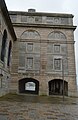
 Royal Marine Barracks, Stonehouse (geograph 2331918).jpg 640 × 446; 69 KB
-
 Royal Marine Barracks, Stonehouse - geograph.org.uk - 2333470.jpg 480 × 640; 102 KB
-
 Royal Marine Barracks, Stonehouse - geograph.org.uk - 2375630.jpg 768 × 1,024; 190 KB
-

-

-

-
-

-
-
-
 Royal William Victualling Yard - geograph.org.uk - 4612585.jpg 3,192 × 1,754; 688 KB
-
 Royal William Victualling Yard - geograph.org.uk - 4896595.jpg 640 × 426; 53 KB
-
 Royal William Victualling Yard - geograph.org.uk - 4905048.jpg 640 × 426; 49 KB
-

-
-
-

-

-

-

-

-

-

-

-
-

-

-

-
-

-

-

-

-

-

-

-

-

-

-

-
-
-

-

-
-

-

-

-


_-_geograph.org.uk_-_4935597.jpg)


_-_geograph.org.uk_-_4896619.jpg)


