Category:Stone walls in the Metropolitan Borough of Kirklees
Jump to navigation
Jump to search
Subcategories
This category has only the following subcategory.
Media in category "Stone walls in the Metropolitan Borough of Kirklees"
The following 48 files are in this category, out of 48 total.
-
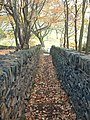
 "Follow the walled path through the wood" - geograph.org.uk - 4450537.jpg 1,024 × 768; 214 KB
-
 6 Lanes Junction, Heckmondwike - geograph.org.uk - 2025795.jpg 800 × 600; 288 KB
-
 A path to Lower Green Owlers - geograph.org.uk - 2988493.jpg 800 × 600; 176 KB
-

-
 Abandoned farm building, near Marsden - geograph.org.uk - 2660475.jpg 4,320 × 3,240; 2.94 MB
-
 Albion Street, Heckmondwike - geograph.org.uk - 5578261.jpg 1,024 × 683; 190 KB
-
 Bank Foot Lane - Armitage Road - geograph.org.uk - 2153831.jpg 480 × 640; 85 KB
-
 Bank Street - looking towards Moorside - geograph.org.uk - 3017130.jpg 640 × 480; 109 KB
-
 Bank Top - Hill Top Road - geograph.org.uk - 5050195.jpg 480 × 640; 72 KB
-
 Battye Street - Crackenedge Lane - geograph.org.uk - 3622543.jpg 640 × 480; 71 KB
-

-
 Bridge over Marsden Clough - geograph.org.uk - 1507960.jpg 480 × 640; 149 KB
-
 Bridleway leading to Holt Head Road - geograph.org.uk - 5900966.jpg 1,600 × 1,064; 619 KB
-
 Bridleway leading to Norwood Road - geograph.org.uk - 5755648.jpg 1,600 × 1,065; 707 KB
-
 Bridleway towards Halifax Old Road - geograph.org.uk - 5755664.jpg 1,600 × 1,065; 1.02 MB
-
 Church Lane and the Beaumont Arms, Kirkheaton - geograph.org.uk - 2545857.jpg 3,296 × 2,472; 1.07 MB
-

-
 Cut benchmark on a wall above Blakeley Reservoir - geograph.org.uk - 3058374.jpg 2,048 × 1,536; 734 KB
-
 Dewsbury Station - geograph.org.uk - 4624519.jpg 640 × 426; 57 KB
-
 Dewsbury Station - geograph.org.uk - 4624522.jpg 640 × 426; 75 KB
-
 Double decker bus filter, Marsden. - geograph.org.uk - 145692.jpg 640 × 480; 96 KB
-

-
 Elizabeth II postbox on Moor End Road - geograph.org.uk - 5972892.jpg 3,476 × 3,110; 2.16 MB
-
 Farm on Flight Hill, Scholes - geograph.org.uk - 1251883.jpg 640 × 436; 75 KB
-
 Footpath Cockley Hill - geograph.org.uk - 84107.jpg 480 × 640; 170 KB
-
 Footpath in Pighill Wood - geograph.org.uk - 2563190.jpg 640 × 480; 194 KB
-
-
 King Street - geograph.org.uk - 6183737.jpg 2,000 × 1,155; 1.59 MB
-
 M ^ Ms - Newsagents - Swan Lane - geograph.org.uk - 1939794.jpg 640 × 554; 82 KB
-
 Meal Hill Road JandI School - geograph.org.uk - 502247.jpg 640 × 480; 74 KB
-
 Pighill Wood from Lower Hirst, near Outlane - geograph.org.uk - 3369984.jpg 4,320 × 3,240; 2.98 MB
-
 Pits Lane, Clifton - geograph.org.uk - 216487.jpg 640 × 484; 122 KB
-

-
 Quaker Gate - geograph.org.uk - 637648.jpg 480 × 640; 117 KB
-
 St Saviour, Ravensthorpe (21404597343).jpg 2,742 × 2,509; 6.14 MB
-
 Sheepfold by Wessenden Reservoir - geograph.org.uk - 2323664.jpg 1,600 × 1,200; 479 KB
-
 Street life Life in the north (5745933270).jpg 4,256 × 2,832; 2.67 MB
-
 Targets in Ramsden Clough - geograph.org.uk - 3265356.jpg 1,600 × 1,200; 523 KB
-
 The Beaconsfield Gallery - geograph.org.uk - 729058.jpg 640 × 427; 61 KB
-
 The former Slaithwaite Road, Meltham - geograph.org.uk - 749605.jpg 640 × 436; 96 KB
-
 The Lumb (3339507854).jpg 2,212 × 1,920; 3.5 MB
-
 Toftshaw Lane - Toftshaw New Road - geograph.org.uk - 2479488.jpg 640 × 480; 73 KB
-

-

-
 Up the hill to Soothill - geograph.org.uk - 1555303.jpg 640 × 480; 109 KB
-

-
 Wellhouse Moravian Church - Wellhouse - geograph.org.uk - 1428426.jpg 640 × 408; 199 KB
-
 WestEndMiddleSchool.jpg 640 × 416; 68 KB


.jpg)

.jpg)


.jpg)


