Category:Stone walls in the City of Leeds
Jump to navigation
Jump to search
Subcategories
This category has the following 2 subcategories, out of 2 total.
Media in category "Stone walls in the City of Leeds"
The following 129 files are in this category, out of 129 total.
-
 127 miles to Liverpool (geograph 4521214).jpg 640 × 480; 102 KB
-
 78 St Michael's Road, Headingley - geograph.org.uk - 6822749.jpg 1,024 × 768; 171 KB
-
 A path leading to Lawns Lane - geograph.org.uk - 2763753.jpg 800 × 600; 117 KB
-

-
 Ancient pathway, Buslingthorpe, Leeds - geograph.org.uk - 2732430.jpg 3,872 × 2,592; 3.68 MB
-

-

-
 Approaching roundabout on Gelderd Road (A62) - geograph.org.uk - 5274511.jpg 1,024 × 683; 227 KB
-
 Approaching the Woods above Hawksworth - geograph.org.uk - 3332067.jpg 4,320 × 3,240; 3.75 MB
-

-
 Asket Hill, looking down towards Wetherby Road - geograph.org.uk - 5837734.jpg 1,024 × 768; 306 KB
-
 Back De Lacy Mount - Morris Lane - geograph.org.uk - 665494.jpg 640 × 480; 39 KB
-
 Back Grosvenor Terrace - geograph.org.uk - 6717053.jpg 1,024 × 768; 289 KB
-
 Back of De Lacey Mount - geograph.org.uk - 276153.jpg 640 × 480; 81 KB
-
 Bankhouse (road) at Bankhouse Bottom, Pudsey - geograph.org.uk - 3968757.jpg 1,600 × 1,064; 767 KB
-
 Beside the railway - geograph.org.uk - 5721081.jpg 640 × 427; 176 KB
-
 Billingbauk, Bramley, Leeds - geograph.org.uk - 4968320.jpg 1,280 × 853; 836 KB
-
 Blackett Street, Calverley, Leeds - geograph.org.uk - 4899329.jpg 1,280 × 720; 721 KB
-
 Blind Lane Farm. - geograph.org.uk - 118712.jpg 640 × 480; 78 KB
-

-
 Broken wall to a railway cutting - geograph.org.uk - 5278851.jpg 1,024 × 768; 466 KB
-
 Calverley Lane, Farsley, Leeds (34673593753).jpg 3,840 × 2,160; 4.77 MB
-

-
 Church Street, Guiseley - geograph.org.uk - 6807954.jpg 1,024 × 768; 276 KB
-
 Copley Hill approaching Bridge MDL1-52 - geograph.org.uk - 5278439.jpg 1,024 × 683; 188 KB
-
 Damaged wall at Wyther Lane bridge - geograph.org.uk - 5234194.jpg 1,024 × 768; 252 KB
-
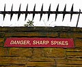 Danger, Sharp Spikes (2317245738).jpg 2,132 × 1,717; 3.18 MB
-
 Drainage outfall into the canal near Rodley - geograph.org.uk - 4840350.jpg 1,024 × 768; 193 KB
-
 Dry Stone Walling, Bank Top - geograph.org.uk - 1440734.jpg 1,024 × 683; 195 KB
-
 DSC 0086 (3) (35892308545).jpg 5,946 × 3,237; 12.92 MB
-
 Elm Tree Close, Pudsey - geograph.org.uk - 5132513.jpg 768 × 1,024; 200 KB
-

-
 Entrance to Cross Flatts Park from Beeston Road - geograph.org.uk - 5265995.jpg 1,024 × 683; 260 KB
-
-
 Entrance to Moorfield Grange, Headingley - geograph.org.uk - 6528154.jpg 1,024 × 768; 233 KB
-
 Eroded stone wall on Armley Ridge Road - detail - geograph.org.uk - 5621669.jpg 1,024 × 768; 220 KB
-
 Eroded stone wall on Armley Ridge Road - geograph.org.uk - 5621665.jpg 1,024 × 768; 164 KB
-
 Eroded stone wall on Cave Lane - geograph.org.uk - 6487203.jpg 1,024 × 768; 342 KB
-
 Fallen Tree and Benchmarked Wall - geograph.org.uk - 2884409.jpg 1,024 × 682; 291 KB
-
 Fishtail sign, by the canal, Leeds (2281656979).jpg 1,920 × 2,560; 3.63 MB
-
 Follow the yellow arrows (2719767929).jpg 1,635 × 2,454; 4.51 MB
-
 Footpath - Bondgate - geograph.org.uk - 1251447.jpg 480 × 640; 325 KB
-
 Footpath - end of Noster Terrace - geograph.org.uk - 2964990.jpg 480 × 640; 74 KB
-
 Footpath approaching Bagley Lane, Rodley - geograph.org.uk - 5304326.jpg 1,500 × 2,000; 1.22 MB
-
 Footpath to Fulneck - Mill Hill - geograph.org.uk - 2238030.jpg 480 × 640; 74 KB
-
 Freight train held at Armley Junction - geograph.org.uk - 6187232.jpg 1,024 × 768; 198 KB
-
 Gate and alleyway behind Roker Lane - geograph.org.uk - 5162815.jpg 810 × 1,024; 183 KB
-
 Gate Piers And Boundary Wall To Gledhow Manor.jpg 3,264 × 2,448; 1.86 MB
-

-
 Gledhow Lane - geograph.org.uk - 413996.jpg 640 × 480; 122 KB
-
 Guiseley (39328289122).jpg 6,000 × 4,000; 8.89 MB
-
 Hall Lane towards Farnley - geograph.org.uk - 6392344.jpg 800 × 600; 66 KB
-
 Harrogate Road outside LiDL carpark - geograph.org.uk - 5268599.jpg 1,024 × 683; 249 KB
-
 Harrogate Road, Moor Allerton, Leeds - geograph.org.uk - 5844840.jpg 1,600 × 1,065; 701 KB
-
 Heights House, Pudsey, Leeds - geograph.org.uk - 4916670.jpg 1,280 × 720; 750 KB
-
 Houghley Lane - geograph.org.uk - 510220.jpg 640 × 387; 42 KB
-
 Houghly Ghyll, Bramley, Leeds (35947093981).jpg 3,840 × 2,160; 5.14 MB
-
 Hunslet cemetery - boundary stones - geograph.org.uk - 6759947.jpg 1,024 × 768; 274 KB
-
 Hutchinson's Place, Kirkstall, Leeds - geograph.org.uk - 843724.jpg 640 × 480; 95 KB
-
 Intake Road - Swinnow Road - geograph.org.uk - 1159623.jpg 640 × 480; 277 KB
-
 Kirkstall Forge. Leeds (34555057295).jpg 1,280 × 851; 846 KB
-
 Leeds and Liverpool Canal, Armley - geograph.org.uk - 260257.jpg 640 × 480; 82 KB
-

-
 Leeds University (36680724733).jpg 3,840 × 2,160; 2.23 MB
-
 Olivet Chapel, Bradford Road, Leeds - geograph.org.uk - 366711.jpg 636 × 497; 58 KB
-
 Leigh House, Varley Street - geograph.org.uk - 366718.jpg 637 × 442; 59 KB
-
 Location of boundary stone on the A658 - geograph.org.uk - 3705042.jpg 2,000 × 1,440; 984 KB
-
 Long Causeway - geograph.org.uk - 766989.jpg 640 × 480; 86 KB
-
 Makeshift gate (4069996458).jpg 2,560 × 1,920; 5.63 MB
-
 Market Cross, Aberford (4072658933).jpg 1,647 × 2,452; 4.36 MB
-
 St Mary the Less - Allerton Bywater - geograph.org.uk - 741090.jpg 640 × 508; 60 KB
-
 Milestone on Leeds Road, Rawdon (geograph 6608508).jpg 1,600 × 995; 574 KB
-
 Northcote Street, Farsley, Leeds (35672341340).jpg 4,191 × 2,358; 3.97 MB
-

-
 Nursery Lane - Harrogate Road - geograph.org.uk - 3336386.jpg 640 × 480; 52 KB
-
 Oakland Road, Leeds (36020466476).jpg 5,312 × 2,988; 7.42 MB
-
 Oaklands Road, Rodley, Leeds (36020500476).jpg 5,312 × 2,988; 8.95 MB
-
 Ordnance Survey Flush Bracket S8679 - geograph.org.uk - 3028988.jpg 3,264 × 2,448; 2.97 MB
-
 Outwood Lane, Horsforth - geograph.org.uk - 854572.jpg 640 × 480; 100 KB
-
 Path leading to Fartown, Pudsey - geograph.org.uk - 3968761.jpg 1,600 × 1,064; 628 KB
-
 Path leading to Fartown, Pudsey - geograph.org.uk - 3969217.jpg 1,600 × 1,064; 699 KB
-
 Path leading to Fartown, Pudsey - geograph.org.uk - 3969220.jpg 1,600 × 1,064; 854 KB
-
 Path leading to Fartown, Pudsey - geograph.org.uk - 3969223.jpg 1,600 × 1,064; 850 KB
-
 Path leading to Fartown, Pudsey - geograph.org.uk - 3969225.jpg 1,600 × 1,064; 719 KB
-
 Peel Ings Foundry, Rodley Lane, Rodley, Leeds - geograph.org.uk - 4945736.jpg 1,280 × 852; 710 KB
-
 People (36908271993).jpg 1,280 × 669; 489 KB
-
 Pill Box (33909354743).jpg 3,850 × 2,563; 4.07 MB
-
 Prison wall, Hall Lane, Armley - geograph.org.uk - 5621747.jpg 1,024 × 768; 100 KB
-

-
 Railway at Holbeck, looking east - geograph.org.uk - 4809187.jpg 1,024 × 576; 293 KB
-
 Rebuilding a wall on Lower Town Street - geograph.org.uk - 5448187.jpg 1,024 × 768; 875 KB
-

-
 Regent Street - Woodland Lane - geograph.org.uk - 1448292.jpg 640 × 480; 281 KB
-
 Regent Street, Chapel Allerton, Leeds (35933891915).jpg 3,840 × 2,160; 5.01 MB
-
 River Aire (34474217293).jpg 5,099 × 2,658; 4.57 MB
-
 Rodley (24565959957).jpg 3,840 × 2,160; 3.98 MB
-
 Rodley (38554005805).jpg 5,312 × 2,988; 6.54 MB
-
 Rodley (38723975484).jpg 3,840 × 2,160; 3.54 MB
-
 St Johns Roundhay.JPG 3,264 × 2,448; 3.97 MB
-
 Scene of an Accident on Bingley Road - geograph.org.uk - 2289646.jpg 640 × 427; 93 KB
-
 Snicket in Headingley. - geograph.org.uk - 543540.jpg 427 × 640; 298 KB
-

-
 St Mary’s Church, Whitkirk (34323534183).jpg 6,000 × 4,000; 12.33 MB
-
 Stables North West Of Chapel Allerton Hospital.jpg 3,264 × 2,448; 1.38 MB
-

-
 Stanningley (39433774541).jpg 6,000 × 4,000; 5.97 MB
-
 Stile on the old road, Farnley - geograph.org.uk - 2460588.jpg 1,435 × 2,000; 846 KB
-
 Swinnow Moor House - 128 Swinnow Road - geograph.org.uk - 450815.jpg 640 × 325; 68 KB
-
 Tarmac wagons at Armley Junction - geograph.org.uk - 6187233.jpg 1,024 × 768; 215 KB
-
 The lane to Owlet Farm - geograph.org.uk - 363842.jpg 640 × 480; 162 KB
-
 The old road to Gildersome, Farnley - geograph.org.uk - 2460594.jpg 2,000 × 1,500; 1.26 MB
-
 Top of Rigton Bank - geograph.org.uk - 212625.jpg 640 × 475; 121 KB
-

-
 Utility cabinet with bee and sunflowers design - geograph.org.uk - 6569765.jpg 1,024 × 768; 266 KB
-
 V.R. Post Box - Wetherby Road - geograph.org.uk - 3821265.jpg 466 × 640; 86 KB
-
 Vesper Lodge, Vesper Lane - geograph.org.uk - 6500316.jpg 1,024 × 768; 276 KB
-
 Viaduct Street - geograph.org.uk - 594539.jpg 640 × 419; 22 KB
-
 View along Hough Lane - geograph.org.uk - 5855295.jpg 1,024 × 683; 245 KB
-

-
 Wall and bus stop, Armley Ridge Road, Wyther - geograph.org.uk - 4679483.jpg 1,024 × 768; 569 KB
-
 Wall and parked vehicles on Clarendon Road - geograph.org.uk - 3581164.jpg 1,024 × 683; 222 KB
-
 Wall by a field, Newlay - geograph.org.uk - 787742.jpg 450 × 600; 158 KB
-

-
-
 Water Lane, Leeds (34048403990).jpg 6,000 × 4,000; 16.81 MB
-
 Water Lane, Leeds (36330184833).jpg 5,312 × 2,988; 9.09 MB
-
 Weak bridge over the Leeds and Liverpool Canal - geograph.org.uk - 3892176.jpg 4,000 × 2,248; 6.39 MB
-
 Whitehall Road at junction with footpath - geograph.org.uk - 5274583.jpg 1,024 × 683; 187 KB
-
 Wood Lane - geograph.org.uk - 604465.jpg 640 × 390; 51 KB
.jpg)


_-_geograph.org.uk_-_5274511.jpg)


_at_Bankhouse_Bottom,_Pudsey_-_geograph.org.uk_-_3968757.jpg)


.jpg)


.jpg)


_(35892308545).jpg)


.jpg)
.jpg)


.jpg)


.jpg)


.jpg)


.jpg)


.jpg)
.jpg)

.jpg)
.jpg)


.jpg)
.jpg)


.jpg)
.jpg)


.jpg)
.jpg)
.jpg)
.jpg)
.jpg)


.jpg)


.jpg)


.jpg)
.jpg)


