Category:Stone walls in Gwynedd
Jump to navigation
Jump to search
Media in category "Stone walls in Gwynedd"
The following 25 files are in this category, out of 25 total.
-
 Abandoned sheepfold on the Tyddyn-du path - geograph.org.uk - 496560.jpg 640 × 480; 116 KB
-
 An Ancient Way - geograph.org.uk - 525307.jpg 640 × 480; 126 KB
-
 Benchmark on wall along public footpath^3, Bangor - geograph.org.uk - 2427307.jpg 3,000 × 4,000; 1.47 MB
-
 Brynteg. - geograph.org.uk - 395165.jpg 640 × 480; 138 KB
-
 Caernafon Castle (8074246329).jpg 1,600 × 1,068; 631 KB
-
 Camfa Garreg. Stone Stile. - geograph.org.uk - 390787.jpg 640 × 480; 145 KB
-
 Christ Church, Deiniolen - geograph.org.uk - 808517.jpg 517 × 640; 72 KB
-
 Drystone Wall on the Precipice Walk - geograph.org.uk - 4180231.jpg 5,184 × 3,456; 5.67 MB
-
 Enclosed footpath leading to Hen-gaeau - geograph.org.uk - 623656.jpg 640 × 480; 102 KB
-
 Head of the valley - geograph.org.uk - 455852.jpg 640 × 480; 88 KB
-
-

-

-

-

-
 Old walls - geograph.org.uk - 478115.jpg 640 × 480; 88 KB
-
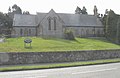
 Eglwys Santes Helen (CinW) - geograph.org.uk - 447552.jpg 640 × 480; 79 KB
-
 Santes Helen Church Hall - geograph.org.uk - 711494.jpg 640 × 480; 96 KB
-
 Sheep pasture - geograph.org.uk - 429976.jpg 640 × 480; 90 KB
-

-
 Stone walls - geograph.org.uk - 478132.jpg 640 × 480; 86 KB
-

-
 Winding Green Road - geograph.org.uk - 234062.jpg 640 × 480; 96 KB
-
 Overlooking the upper Mawddach valley - geograph.org.uk - 492965.jpg 640 × 315; 77 KB
-
 Rough Rhinog Country - geograph.org.uk - 525286.jpg 640 × 480; 136 KB


.jpg)


_-_geograph.org.uk_-_447552.jpg)


