Category:Stone roofs in Oxfordshire
Jump to navigation
Jump to search
Media in category "Stone roofs in Oxfordshire"
The following 88 files are in this category, out of 88 total.
-
 Abingdon ConduitHouse SE.jpg 840 × 1,280; 828 KB
-
 Abingdon ConduitHouse SW.jpg 853 × 1,280; 753 KB
-
 Ardley StMary.JPG 3,008 × 2,000; 3.51 MB
-
 Bridge Street, Bampton - geograph.org.uk - 1546643.jpg 640 × 427; 96 KB
-
 Blacks Head Inn, Bletchingdon - geograph.org.uk - 635048.jpg 640 × 480; 64 KB
-
 Bletchingdon BlacksHead.JPG 3,000 × 1,800; 2.49 MB
-
 Bletchingdon OldRedLion.JPG 3,000 × 1,800; 2.3 MB
-
 Bletchingdon TerracedCottages.JPG 3,000 × 1,800; 2.37 MB
-
 The Trigger Pond pub, Bucknell - geograph.org.uk - 64196.jpg 640 × 480; 111 KB
-
 Crossroads in Burford - geograph.org.uk - 1564623.jpg 640 × 480; 87 KB
-
 High St., Burford. - geograph.org.uk - 1613699.jpg 640 × 480; 122 KB
-
 Chadlington StNicholas southeast.JPG 2,000 × 2,500; 742 KB
-
 Hill Farm - geograph.org.uk - 1627892.jpg 640 × 480; 62 KB
-
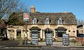
 The Red Cow pub, Chesterton - geograph.org.uk - 1416358.jpg 640 × 441; 80 KB
-
 Chesterton RedCow.JPG 2,850 × 1,710; 1.4 MB
-
 Combe StLaurence SE.JPG 2,660 × 1,900; 695 KB
-
 CurbridgeFarmCottages.jpg 1,280 × 719; 569 KB
-
 Deddington DeddingtonArmsHotel.jpg 1,280 × 660; 444 KB
-
 White Horse Inn Public House - geograph.org.uk - 386104.jpg 640 × 425; 208 KB
-
 Duxford Farm - geograph.org.uk - 91575.jpg 640 × 481; 68 KB
-

-
 RockOfGibraltar Enslow.JPG 2,700 × 1,800; 539 KB
-
 The Rock of Gibraltar - geograph.org.uk - 92029.jpg 640 × 481; 53 KB
-
 Fifield village.jpg 640 × 480; 120 KB
-
 Finstock Manor southeast.JPG 2,760 × 1,840; 686 KB
-
 Garford MillettsFarmCottages.jpg 1,024 × 683; 458 KB
-
 Goosey AllSaints BellTurret NE.jpg 614 × 1,024; 315 KB
-
 GreatCoxwell StGiles ChancelSouth.jpg 1,024 × 1,280; 913 KB
-
 GreatCoxwell StGiles NaveSE.jpg 1,280 × 853; 728 KB
-
 GreatCoxwell StGiles NaveSW.jpg 1,280 × 845; 632 KB
-
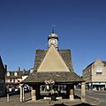
 GreatFaringdon MarketPlace 23-24.JPG 3,000 × 2,000; 2.31 MB
-
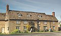
 GreatTew FalklandArms southwest (cropped).JPG 2,795 × 1,797; 652 KB
-
 GreatTew FalklandArms southwest.JPG 2,925 × 1,950; 726 KB
-
 GreatTew School.JPG 3,000 × 2,000; 711 KB
-
 Hardwick StMaryV north.jpg 1,280 × 719; 619 KB
-
 Hardwick StMaryV south.jpg 1,280 × 853; 777 KB
-
 Hardwick StMaryV SSE.jpg 1,280 × 727; 610 KB
-
 Kidlington old village.jpg 640 × 480; 175 KB
-
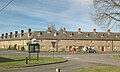
 Kidlington Almshouses.JPG 2,970 × 1,980; 1.85 MB
-
 Kidlington ChurchStreet 52.jpg 1,280 × 717; 578 KB
-
 Kidlington KingsArms SW.jpg 839 × 412; 212 KB
-
 Kidlington MillLane 108.jpg 1,280 × 719; 543 KB
-
 Kidlington MortonAlmshouses.jpg 1,280 × 719; 620 KB
-
 Kingham ChurchStreet cottages.jpg 1,280 × 720; 590 KB
-
-
 Lych gate roof, Kingston Lisle cemetery - geograph.org.uk - 666896.jpg 640 × 480; 177 KB
-
 Kirtlington Dashwood.JPG 3,000 × 1,800; 2.18 MB
-
 Kirtlington OldBakehouse southwest.jpg 1,280 × 663; 522 KB
-
 Leafield TheFox.JPG 2,950 × 1,770; 753 KB
-
 Rose Cottage, Tuck's Lane, Longworth - geograph.org.uk - 1439316.jpg 640 × 480; 89 KB
-
 LowerHeyford BellInn southwest.jpg 1,280 × 667; 583 KB
-
 LowerHeyford BellInn SW trees.jpg 1,280 × 589; 427 KB
-
 LowerHeyford BellInn west.jpg 1,280 × 661; 476 KB
-
 LowerHeyford TheBell.JPG 2,885 × 1,816; 2.2 MB
-
 MinsterLovell OldSwan.JPG 2,900 × 1,740; 657 KB
-
 Old Manor House, Shutford - geograph.org.uk - 375472.jpg 640 × 480; 142 KB
-
 The Plain in Oxford - geograph.org.uk - 1419138.jpg 640 × 419; 120 KB
-
 Oxford MagdalenCollege NewSchoolRoom south.jpg 1,280 × 1,025; 680 KB
-
 Oxford MagdalenCollege NewSchoolRoom SW.jpg 1,280 × 1,280; 758 KB
-
 Ramsden AkemanCottage RoyalOak.JPG 3,000 × 1,800; 698 KB
-
 Rectory Farm Northmoor - geograph.org.uk - 747690.jpg 640 × 480; 97 KB
-
 ShiptonOnCherwell ManorOutbuilding.jpg 3,000 × 2,000; 2.74 MB
-
 Shrivenham ChurchHouse.JPG 3,000 × 1,800; 872 KB
-
 Shrivenham MemorialHall southwest.JPG 3,000 × 1,500; 717 KB
-
 SibfordGower StickleysHouse east.jpg 1,280 × 1,280; 902 KB
-

-
 Stanford itV HighSt OrchardHouse.jpg 1,280 × 712; 624 KB
-
 Derelict barn - geograph.org.uk - 324573.jpg 640 × 480; 118 KB
-
 Mangers - geograph.org.uk - 325191.jpg 640 × 480; 120 KB
-
 The Manor Elsfield.jpg 480 × 640; 89 KB
-
 UpperHeyford ManorFarm granary east.jpg 1,280 × 1,280; 718 KB
-
 WaterEaton Chapel bell-gable.jpg 855 × 1,280; 606 KB
-
 WaterEaton Chapel GableCrosses.jpg 1,280 × 854; 560 KB
-
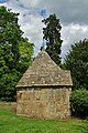
 WaterEaton Dovecote cupola.jpg 1,280 × 853; 388 KB
-
 WaterEaton DoveCote pigeons.jpg 853 × 1,280; 786 KB
-
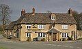
 Wendlebury RedLion.JPG 3,000 × 1,800; 525 KB
-
 WestcottBarton TheFox.JPG 3,000 × 2,000; 820 KB
-
 Weston DovecoteCottage.JPG 2,950 × 1,770; 2 MB
-
 Wilcote Grange Barn.JPG 3,000 × 2,000; 2.61 MB
-
 Wilcote Manor east.JPG 2,950 × 1,770; 1.77 MB
-
 Wilcote StPeter northeast.JPG 2,955 × 1,970; 734 KB
-
 Wilcote StPeter southeast.JPG 2,800 × 2,000; 950 KB
-
 Witney ButterCross east.jpg 1,280 × 1,280; 709 KB
-
 Witney ButterCross west.jpg 1,273 × 1,280; 738 KB
-
 Wolvercote RedLion.jpg 2,850 × 1,710; 1.85 MB
-
 Wytham WhiteHart barn.JPG 2,900 × 1,740; 853 KB
-
 Wytham WhiteHart dovecote.jpg 1,980 × 2,640; 2.15 MB
-
 Wytham YewTreeCottage.jpg 3,000 × 1,800; 1.92 MB


.JPG)


