Category:Stone barns in Lancashire
Jump to navigation
Jump to search
Ceremonial counties of England: Buckinghamshire · Cambridgeshire · Cornwall · Cumbria · Derbyshire · Devon · Dorset · Durham · East Sussex · Gloucestershire · Hampshire · Herefordshire · Lancashire · Lincolnshire · Merseyside · Norfolk · North Yorkshire · Northamptonshire · Northumberland · Oxfordshire · Shropshire · Somerset · South Yorkshire · Staffordshire · Warwickshire · West Sussex · West Yorkshire · Wiltshire · Worcestershire
City-counties:
Former historic counties:
Other former counties:
City-counties:
Former historic counties:
Other former counties:
Media in category "Stone barns in Lancashire"
The following 44 files are in this category, out of 44 total.
-
 A barn called Bradley - geograph.org.uk - 517176.jpg 640 × 426; 335 KB
-
 Abandoned Barn, Grane - geograph.org.uk - 1177753.jpg 640 × 480; 68 KB
-

-
 Aisled Barn, Wycoller - geograph.org.uk - 1282288.jpg 1,024 × 683; 222 KB
-
 Back of Hill Barn - geograph.org.uk - 702453.jpg 640 × 480; 63 KB
-
 Bark Barn - geograph.org.uk - 467233.jpg 640 × 480; 102 KB
-
 Barn - geograph.org.uk - 551324.jpg 640 × 480; 115 KB
-
 Barn at Catlow - geograph.org.uk - 1462017.jpg 640 × 480; 88 KB
-
 Barn at Causeway House Farm - geograph.org.uk - 412062.jpg 640 × 480; 210 KB
-
 Barn at Fair Oak Farm, Bowland-with-Leagram 01.jpg 3,000 × 4,000; 4.35 MB
-
 Barn at Fair Oak Farm, Bowland-with-Leagram 02.jpg 4,000 × 3,000; 4.96 MB
-
 Barn at Meadow Bark Farm, Barley - geograph.org.uk - 622733.jpg 640 × 480; 140 KB
-
 Barn at Smithells Farm - geograph.org.uk - 412040.jpg 640 × 480; 195 KB
-
 Barn C15 Metres South Of Love Clough Farmhouse.jpg 4,032 × 3,024; 6.02 MB
-
 Barn C30 Metres North-East Of Goodshaw Fold Farmhouse.jpg 4,032 × 3,024; 5.16 MB
-
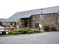
 Barn conversions, Lathom. - geograph.org.uk - 1227918.jpg 640 × 443; 96 KB
-
 Barn in Downham, Lancashire.jpg 4,000 × 3,000; 4.79 MB
-
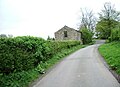
 Barn near Lanshaw Farm - geograph.org.uk - 536495.jpg 640 × 480; 65 KB
-
 Barn with an impressive pile of logs - geograph.org.uk - 1583732.jpg 640 × 480; 55 KB
-
 Barn, near Hurstwood Hall - geograph.org.uk - 1120392.jpg 640 × 480; 89 KB
-
 Barn, South Clifton Street, Lytham - geograph.org.uk - 848797.jpg 640 × 480; 107 KB
-
 Bashall Barn - geograph.org.uk - 413109.jpg 640 × 480; 118 KB
-
 Bents Barn - geograph.org.uk - 1747983.jpg 640 × 480; 90 KB
-
 Field Barn - geograph.org.uk - 1002300.jpg 640 × 480; 56 KB
-
 Field Barn at Shays Farm - geograph.org.uk - 987812.jpg 640 × 480; 63 KB
-
 Higher Whitewell Farm - geograph.org.uk - 2918453.jpg 640 × 480; 133 KB
-
 Isolated Barn - geograph.org.uk - 1246279.jpg 640 × 480; 92 KB
-
 Knot Barn - geograph.org.uk - 1735825.jpg 640 × 480; 67 KB
-
 New Barn, Easington - geograph.org.uk - 1537894.jpg 640 × 480; 61 KB
-
 Old Barn (1729) at Fair Oak Farm (geograph 2519506).jpg 4,000 × 3,000; 4.27 MB
-
 Stone Barn above Smithies Brook - geograph.org.uk - 1736759.jpg 2,816 × 2,112; 2.09 MB
-
 Stone barn at Bowland Forest Low, Lancashire.jpg 640 × 480; 102 KB
-
 Stone barn at Bowland-with-Leagram, Lancashire.jpg 640 × 426; 176 KB
-
 Stone barn at Duckmire - geograph.org.uk - 739529.jpg 640 × 480; 161 KB
-
 Stone barn at Marshaw in Over Wyresdale, Lancashire.jpg 640 × 480; 173 KB
-
 Stone barn at Wiswell, Lancashire.jpg 635 × 458; 95 KB
-
 Stone barn in Copster Green, Salesbury, Lancashire.jpg 640 × 426; 131 KB
-
 Stone barn in Newton-in-Bowland, Lancashire.jpg 640 × 480; 104 KB
-
 Trough Barn - geograph.org.uk - 409706.jpg 640 × 480; 225 KB
-
 Troulsmire Barn - geograph.org.uk - 1748220.jpg 640 × 480; 97 KB
-
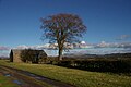
 Windy Bank Barn - geograph.org.uk - 302255.jpg 640 × 480; 95 KB
-
 Barn at Hydes Farm - geograph.org.uk - 483070.jpg 640 × 480; 164 KB
-
 Barn at Wardsley Farm - geograph.org.uk - 509566.jpg 640 × 480; 168 KB
-
 Trough Barn in the Trough of Bowland - geograph.org.uk - 348969.jpg 640 × 425; 251 KB


_at_Fair_Oak_Farm_(geograph_2519506).jpg)


