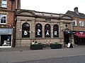
Category:Stone, Staffordshire
Jump to navigation
Jump to search
English: Stone is an old market town in Staffordshire, England, situated about seven miles north of Stafford, and around seven miles south of the city of Stoke-on-Trent. It is the second town, after Stafford itself, in the Borough of Stafford, and has long been of importance from the point of view of communications. Stone gave its name to both an urban district council and a rural district council before becoming part of the borough in 1974. In 2001 it had a population of 14,555.
Italiano: Stone è una cittadina di 14.258 abitanti, situata nella contea dello Staffordshire in Inghilterra.
Nederlands: Stone is een plaats in het bestuurlijke gebied Stafford, in het Engelse graafschap Staffordshire. De plaats telt 14.258 inwoners.
Română: Stone este un oraş în comitatul Staffordshire, regiunea West Midlands, Anglia. Oraşul se află în districtul Stafford.
market town in Staffordshire, England  | |||||
| Upload media | |||||
| Instance of | |||||
|---|---|---|---|---|---|
| Location | Stafford, Staffordshire, West Midlands, England | ||||
 | |||||
Subcategories
This category has the following 10 subcategories, out of 10 total.
J
- Jervis Mausoleum (4 F)
P
S
- St Michael's Church, Stone (19 F)
- Stone Meadows (4 F)
- Stone Priory, Staffordshire (3 F)
- Stone railway station (38 F)
T
Media in category "Stone, Staffordshire"
The following 200 files are in this category, out of 398 total.
(previous page) (next page)-
 'Christina' statue at Workhouse Bridge - geograph.org.uk - 1539944.jpg 480 × 640; 331 KB
-
 A clear frosty morning on Walton Heath - geograph.org.uk - 1116582.jpg 480 × 640; 109 KB
-
 A shady spot - geograph.org.uk - 592097.jpg 640 × 480; 179 KB
-
 A34 approaching Aldi store - geograph.org.uk - 3531795.jpg 640 × 387; 119 KB
-

-
 A34 approaching Walton roundabout - geograph.org.uk - 2727757.jpg 640 × 480; 68 KB
-
 A34 at The Fillybrooks - geograph.org.uk - 1964177.jpg 640 × 480; 58 KB
-
 A34 footbridge, Walton - geograph.org.uk - 2727753.jpg 640 × 480; 77 KB
-
 A34 just north of the A51 roundabout - geograph.org.uk - 2727749.jpg 640 × 480; 55 KB
-
 A34 near Aston-by-Stone - geograph.org.uk - 2727752.jpg 640 × 480; 68 KB
-
 A34 near Stone Meadows - geograph.org.uk - 2727766.jpg 640 × 480; 60 KB
-
 A34 railway overbridge - geograph.org.uk - 2727770.jpg 640 × 480; 60 KB
-

-
 Across the rooftops in Stone, Staffordshire - geograph.org.uk - 6275523.jpg 1,440 × 960; 1.51 MB
-
 Aldi Supermarket - Walton - geograph.org.uk - 3931070.jpg 4,186 × 2,176; 3.42 MB
-
 Alma Street, Stone - geograph.org.uk - 1134335.jpg 640 × 428; 113 KB
-
 Alma Street, Stone - geograph.org.uk - 4590578.jpg 1,600 × 1,200; 563 KB
-
 Andre Mills Bridge in Stone, Staffordshire - geograph.org.uk - 6450765.jpg 1,440 × 960; 1.92 MB
-
 Andre Mills Bridge in Stone, Staffordshire - geograph.org.uk - 6450768.jpg 1,280 × 960; 1.77 MB
-
 Aston Lodge Stables - geograph.org.uk - 280085.jpg 640 × 427; 58 KB
-
 B5025 entering Stone - geograph.org.uk - 3140331.jpg 640 × 480; 103 KB
-
 B5026 leaving Stone - geograph.org.uk - 3142257.jpg 640 × 453; 62 KB
-
 B5027, Little Stoke - geograph.org.uk - 4839953.jpg 640 × 293; 37 KB
-
-
 Benchmark on Walton Bridge - geograph.org.uk - 4251758.jpg 2,560 × 1,920; 1.03 MB
-
 Beside the M6 in Staffordshire - geograph.org.uk - 592082.jpg 640 × 480; 123 KB
-

-
 Blue Stone - geograph.org.uk - 1135043.jpg 426 × 640; 64 KB
-
 Boatyard moorings in Stone, Staffordshire - geograph.org.uk - 6450783.jpg 1,440 × 960; 1.95 MB
-

-

-

-

-

-
 Brassworks Farmhouse at Little Stoke in Stone, Staffordshire - geograph.org.uk - 6449947.jpg 1,440 × 1,080; 2.08 MB
-

-

-

-

-

-
 Bungalows on Spring Gardens, Stone - geograph.org.uk - 6259877.jpg 800 × 600; 115 KB
-
 Bushberry Close, Stone - geograph.org.uk - 2716873.jpg 640 × 428; 69 KB
-
 Canal and boatyard in Stone in Staffordshire - geograph.org.uk - 6318940.jpg 1,440 × 1,080; 1.42 MB
-
 Canal and housing at Little Stoke, Staffordshire - geograph.org.uk - 6449894.jpg 1,440 × 1,080; 1.49 MB
-
 Canal and St Dominic's School in Stone - geograph.org.uk - 6339573.jpg 1,440 × 1,080; 1.6 MB
-
 Canal at Little Stoke in Stone, Staffordshire - geograph.org.uk - 6449051.jpg 1,600 × 900; 1.4 MB
-
 Canal below Stone Bottom Lock in Staffordshire - geograph.org.uk - 6359747.jpg 1,440 × 960; 1.73 MB
-
 Canal boat hire base in Stone, Staffordshire - geograph.org.uk - 6361468.jpg 1,600 × 900; 1.56 MB
-
 Canal boatyard in Stone, Staffordshire - geograph.org.uk - 6450792.jpg 960 × 1,280; 1.46 MB
-
 Canal by Newcastle Road in Stone, Staffordshire - geograph.org.uk - 6361529.jpg 1,440 × 960; 1.65 MB
-
 Canal in Stone, Staffordshire - geograph.org.uk - 6359741.jpg 1,440 × 960; 1.68 MB
-
 Canal in Stone, Staffordshire - geograph.org.uk - 6359743.jpg 1,280 × 960; 1.56 MB
-
 Canalside housing at Little Stoke in Staffordshire - geograph.org.uk - 6449070.jpg 1,280 × 960; 1.44 MB
-
 Canalside housing at Little Stoke in Staffordshire - geograph.org.uk - 6449096.jpg 1,280 × 960; 1.65 MB
-
 Canalside housing at Little Stoke in Staffordshire - geograph.org.uk - 6449131.jpg 1,440 × 960; 1.46 MB
-
 Canalside housing in Stone, Staffordshire - geograph.org.uk - 6359732.jpg 1,280 × 960; 1.48 MB
-
 Canalside school development in Stone, Staffordshire - geograph.org.uk - 6339530.jpg 1,440 × 1,080; 2.18 MB
-
 Canalside school development in Stone, Staffordshire - geograph.org.uk - 6339545.jpg 960 × 1,280; 1.69 MB
-
 Canoers Bench - geograph.org.uk - 4673269.jpg 800 × 600; 179 KB
-
 Car park at the end of Mill St - geograph.org.uk - 6523358.jpg 1,024 × 681; 108 KB
-
 Catholic Church, Stone, Staffs - geograph.org.uk - 1542317.jpg 640 × 480; 77 KB
-
 Christ Church C of E First School - geograph.org.uk - 4892079.jpg 1,200 × 799; 359 KB
-
 Christ Church C of E First School - geograph.org.uk - 4892083.jpg 1,200 × 799; 400 KB
-
 Christ Church Stone - geograph.org.uk - 355812.jpg 640 × 480; 68 KB
-
 Christchurch First School, Stone - geograph.org.uk - 3142528.jpg 640 × 427; 62 KB
-
 Church Lane Crossing looking north east - geograph.org.uk - 1097272.jpg 640 × 479; 250 KB
-

-
 Church of St John - geograph.org.uk - 6523360.jpg 800 × 1,024; 126 KB
-

-
 Contractor’s yard at Stone - geograph.org.uk - 4199679.jpg 1,024 × 768; 168 KB
-

-
 Converted Mill buildings - geograph.org.uk - 410289.jpg 640 × 429; 52 KB
-
 Coppice Mill - geograph.org.uk - 551568.jpg 480 × 640; 143 KB
-
 Coppice Mill - geograph.org.uk - 668773.jpg 640 × 427; 109 KB
-
 Costa Coffee, Stone - geograph.org.uk - 6173570.jpg 800 × 600; 133 KB
-
 Covered wharf at Stone in Staffordshire - geograph.org.uk - 6361461.jpg 1,440 × 960; 1.72 MB
-
 Cows grazing near Andre Mills bridge - geograph.org.uk - 4595944.jpg 640 × 427; 76 KB
-
 Crossing closed - geograph.org.uk - 5128758.jpg 480 × 640; 288 KB
-
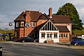
 Crown and Anchor - geograph.org.uk - 6299410.jpg 4,032 × 3,024; 2.07 MB
-
 Crown and Anchor View - geograph.org.uk - 4672833.jpg 800 × 600; 123 KB
-
 Crown Street (A520), Stone - geograph.org.uk - 6173565.jpg 800 × 600; 93 KB
-
 Crown Street and Christchurch Way - geograph.org.uk - 6272726.jpg 6,000 × 4,000; 4.95 MB
-
 Cumberland House - geograph.org.uk - 5581053.jpg 1,199 × 1,600; 323 KB
-
 Cumberland House, Stone - geograph.org.uk - 962519.jpg 640 × 480; 66 KB
-
 Darlaston Park - geograph.org.uk - 287301.jpg 640 × 427; 78 KB
-
 Defibrillator on the High Street, Stone - geograph.org.uk - 6173568.jpg 787 × 800; 175 KB
-
 Development site, Walton Way, Walton - geograph.org.uk - 3453345.jpg 640 × 480; 107 KB
-
 Dilapidated scout building in Stone, Staffordshire - geograph.org.uk - 5520939.jpg 960 × 1,280; 1.01 MB
-

-
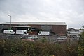 Distribution warehouse, Stone - geograph.org.uk - 4378032.jpg 640 × 430; 48 KB
-
 Double aperture Elizabeth II postbox on High Street, Stone - geograph.org.uk - 6171413.jpg 3,176 × 4,275; 1.93 MB
-
 Eagle No 5 at Stone in Staffordshire - geograph.org.uk - 6337612.jpg 1,280 × 960; 1.36 MB
-
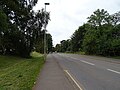
 Eccleshall Road - geograph.org.uk - 1964161.jpg 640 × 480; 67 KB
-
 Eccleshall Road, Stone - B5026 - geograph.org.uk - 346431.jpg 640 × 480; 90 KB
-
 Eccleshall Road, Stone - geograph.org.uk - 6259879.jpg 800 × 600; 123 KB
-
 Electrical sub-station - geograph.org.uk - 3319948.jpg 640 × 430; 97 KB
-

-
 Elizabeth II postbox on Newcastle Road, Stone - geograph.org.uk - 6171421.jpg 2,791 × 4,931; 3.81 MB
-

-
 Farmland to the west of Darlaston Park - geograph.org.uk - 592093.jpg 640 × 480; 123 KB
-
 Field, Walton - geograph.org.uk - 3140401.jpg 640 × 469; 72 KB
-
 Field, Walton - geograph.org.uk - 3140410.jpg 640 × 443; 70 KB
-
 Fillybrooks House, Stone - geograph.org.uk - 5314686.jpg 3,945 × 2,958; 2.83 MB
-
 Fish Van Queue - geograph.org.uk - 4673258.jpg 600 × 800; 122 KB
-
 Fleur Tea Rooms - geograph.org.uk - 5580873.jpg 1,600 × 1,064; 387 KB
-
 Footpath at Stone - geograph.org.uk - 3553176.jpg 640 × 481; 342 KB
-
 Footpath off Mount Road - geograph.org.uk - 6170277.jpg 800 × 628; 166 KB
-
 Former brewery warehouse in Stone, Staffordshire - geograph.org.uk - 6361515.jpg 1,280 × 960; 1.48 MB
-
 Former brewery warehouse in Stone, Staffordshire - geograph.org.uk - 6361519.jpg 1,280 × 960; 1.42 MB
-
 Former fire station tower in Stone, Staffordshire - geograph.org.uk - 6319000.jpg 1,280 × 1,280; 1.45 MB
-
 Former offices of Stone Brewery - geograph.org.uk - 1544570.jpg 480 × 640; 202 KB
-

-
 Former scout premises in Stone, Staffordshire - geograph.org.uk - 5520944.jpg 1,440 × 1,004; 1.5 MB
-
 Former Trent Hospital and Workhouse - geograph.org.uk - 1544298.jpg 640 × 480; 213 KB
-
 From the railway bridge on Pingle Lane - geograph.org.uk - 1092927.jpg 640 × 480; 242 KB
-
 Fuel Filling Station - Walton - geograph.org.uk - 3931075.jpg 2,647 × 1,781; 2.11 MB
-
-
 George and Dragon Public House.jpg 4,000 × 2,672; 3.87 MB
-
 Gingers - geograph.org.uk - 1134989.jpg 640 × 428; 90 KB
-
 Gone fishing - geograph.org.uk - 669902.jpg 640 × 427; 71 KB
-
 Granvilles, Stone - geograph.org.uk - 6173586.jpg 800 × 600; 107 KB
-
 Grazing cattle - geograph.org.uk - 5367695.jpg 4,128 × 2,322; 2.63 MB
-
 Grazing near the River Trent, Stone - geograph.org.uk - 5564508.jpg 640 × 447; 73 KB
-
 Ground rising to the east of the A520 - geograph.org.uk - 586513.jpg 640 × 480; 134 KB
-
 Hallahan House on Mount Road, Stonefield - geograph.org.uk - 4567412.jpg 1,024 × 735; 197 KB
-
 Hayes Mill - Thingumajig - geograph.org.uk - 668771.jpg 640 × 427; 85 KB
-
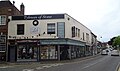
 High Street in Stone - geograph.org.uk - 5055049.jpg 4,000 × 3,000; 2.63 MB
-
 High Street, Stone - geograph.org.uk - 5580304.jpg 3,776 × 2,520; 2.84 MB
-
 High Street, Stone - geograph.org.uk - 6173572.jpg 800 × 600; 135 KB
-
 High Street, Stone - geograph.org.uk - 6272752.jpg 6,000 × 4,000; 4.38 MB
-
 Highgrove in Little Stoke, Stone, Staffordshire - geograph.org.uk - 6449102.jpg 1,440 × 960; 1.51 MB
-
 Hire boats at Stone, Staffordshire - geograph.org.uk - 4207441.jpg 1,280 × 819; 434 KB
-
 Hospital Bridge in Stone, Staffordshire - geograph.org.uk - 6319025.jpg 1,440 × 960; 1.51 MB
-
 House on Station Road, Stone - geograph.org.uk - 6171400.jpg 5,184 × 3,888; 3.07 MB
-

-
 Houses in Highgrove, Little Stoke, Staffordshire - geograph.org.uk - 4206030.jpg 1,024 × 686; 415 KB
-
 Houses on Mount Rd - geograph.org.uk - 3319946.jpg 640 × 267; 42 KB
-
 Houses on Old Road, Stone - geograph.org.uk - 4892061.jpg 1,200 × 862; 330 KB
-
 Houses on Pirehill Lane, Stone - geograph.org.uk - 6259878.jpg 800 × 514; 94 KB
-
 Houses on Station Road, Stone - geograph.org.uk - 3142501.jpg 640 × 497; 71 KB
-
 Houses, Chestnut Grove - geograph.org.uk - 4880956.jpg 640 × 426; 76 KB
-
 Housing in Stone, Staffordshire - geograph.org.uk - 6275520.jpg 1,440 × 1,080; 1.67 MB
-

-

-

-
 In Lime Kiln Lock at Stone, Staffordshire - geograph.org.uk - 6318977.jpg 960 × 1,280; 1.34 MB
-

-
 Industrial Estate, Stone - geograph.org.uk - 4378034.jpg 640 × 430; 46 KB
-
 Industry by Stone Station - geograph.org.uk - 4880973.jpg 640 × 426; 70 KB
-
 Industry in Stone - geograph.org.uk - 4325138.jpg 640 × 430; 55 KB
-
 Industry in Stone - geograph.org.uk - 4751085.jpg 640 × 426; 43 KB
-

-
 John Joule Brewery, Trent ^ Mersey Canal, Stone - geograph.org.uk - 5598073.jpg 1,500 × 1,000; 1.19 MB
-
 Joule's Brewery - geograph.org.uk - 6272821.jpg 6,000 × 4,000; 7.75 MB
-

-
 Joule's Warehouse in Stone, Staffordshire - geograph.org.uk - 4207622.jpg 768 × 1,024; 506 KB
-
 Joules Court in Stone, Staffordshire - geograph.org.uk - 6361061.jpg 1,440 × 960; 1.35 MB
-
 Joules Fire Station, Stone - geograph.org.uk - 6173564.jpg 800 × 479; 64 KB
-
 King's Avenue, Stone - geograph.org.uk - 4590606.jpg 1,600 × 1,200; 694 KB
-

-
 Level crossing on Mount Road, Stonefield - geograph.org.uk - 4567451.jpg 1,024 × 767; 201 KB
-

-

-
 Level crossing, Stone - geograph.org.uk - 1134231.jpg 640 × 427; 89 KB
-
 Lime Kiln Lock at Stone, Staffordshire - geograph.org.uk - 6318988.jpg 1,440 × 960; 1.54 MB
-
 Lime Kiln Lock at Stone, Staffordshire - geograph.org.uk - 6318992.jpg 960 × 1,280; 1.26 MB
-

-
 Longton Road, Stone - geograph.org.uk - 4590570.jpg 1,600 × 1,200; 504 KB
-
 M6 motorway and bridge - geograph.org.uk - 272378.jpg 640 × 480; 91 KB
-
 Meadow Way - geograph.org.uk - 1964150.jpg 640 × 480; 73 KB
-

-
 Milepost at Little Stoke - geograph.org.uk - 4595954.jpg 427 × 640; 72 KB
-

-
 Moored narrowboat at Stone in Staffordshire - geograph.org.uk - 6337611.jpg 1,440 × 1,080; 1.95 MB
-
 Moored narrowboats in Stone, Staffordshire - geograph.org.uk - 6450782.jpg 1,280 × 960; 1.81 MB
-
 Motorway Bridge - geograph.org.uk - 275799.jpg 640 × 480; 91 KB
-
 Mount Road Level Crossing, Stone - geograph.org.uk - 1097367.jpg 640 × 482; 182 KB
-
 Mount Road, Stone - geograph.org.uk - 6170283.jpg 800 × 600; 135 KB
-
 Muddy Farm Track - geograph.org.uk - 287101.jpg 640 × 427; 79 KB
-
 Mushrooms for sale! Stone, Staffordshire - geograph.org.uk - 2790276.jpg 642 × 800; 387 KB
-
 My train approaches - geograph.org.uk - 5128817.jpg 640 × 480; 214 KB
-
 Narrow Boat at Stone Lock, Staffordshire - geograph.org.uk - 488606.jpg 427 × 640; 146 KB
-
 Narrowboat at Meaford Locks in Staffordshire - geograph.org.uk - 6339637.jpg 1,440 × 960; 1.68 MB
-

-

-
 New canalside brewery in Stone, Staffordshire - geograph.org.uk - 6318997.jpg 1,440 × 1,080; 1.57 MB
-
 New development by the A34 - geograph.org.uk - 2727772.jpg 640 × 480; 53 KB
-
 New Housing by the A34 - geograph.org.uk - 3931090.jpg 3,636 × 2,230; 3.63 MB
-

-

-
 Newcastle Road (B5027), Stone - geograph.org.uk - 5564505.jpg 640 × 391; 59 KB
-
 Newcastle Road Bridge in Stone, Staffordshire - geograph.org.uk - 6361539.jpg 1,440 × 960; 1.76 MB
-
 Newcastle Road in Stone, Staffordshire - geograph.org.uk - 6361599.jpg 1,440 × 960; 1.18 MB
-
 Newcastle Street in Stone, Staffordshire - geograph.org.uk - 6361602.jpg 1,440 × 960; 1.49 MB
-
 Newcastle Street, Stone - geograph.org.uk - 5580338.jpg 3,776 × 2,520; 2.92 MB
-
 North Pirehill Farm - geograph.org.uk - 345140.jpg 640 × 480; 69 KB
-
 Oak Farm, Pirehill Lane, Stone - geograph.org.uk - 346410.jpg 640 × 480; 97 KB
-

-
 Old Road, Stone - geograph.org.uk - 4590623.jpg 1,600 × 1,200; 486 KB
-
 Ordnance Survey Cut Mark with Bolt - geograph.org.uk - 5055080.jpg 4,000 × 3,000; 4.1 MB


,_Stone_-_geograph.org.uk_-_6173565.jpg)


_in_Stone,_Staffordshire_-_geograph.org.uk_-_4207625.jpg)


,_Stone_-_geograph.org.uk_-_5564505.jpg)


.jpg)

