Category:Stone, Kent
Jump to navigation
Jump to search
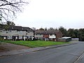
English: Stone, also known as Stone-next-Dartford, is one of a string of villages lying along the Dartford to Gravesend road on the south bank of the River Thames in Kent, England.
village and civil parish in Dartford, Kent, United Kingdom _speed_camera_-_geograph.org.uk_-_1291931.jpg) | |||||
| Upload media | |||||
| Instance of | |||||
|---|---|---|---|---|---|
| Location | Dartford, Kent, South East England, England | ||||
| Located in or next to body of water | |||||
| Population |
| ||||
| Said to be the same as | Stone (Wikimedia duplicated page, civil parish) | ||||
 | |||||
Subcategories
This category has the following 6 subcategories, out of 6 total.
Media in category "Stone, Kent"
The following 200 files are in this category, out of 385 total.
(previous page) (next page)-
 'Castle' at Bluewater - geograph.org.uk - 5770518.jpg 4,000 × 3,000; 4.49 MB
-
 23-28 Sanderling Way - geograph.org.uk - 2551791.jpg 480 × 640; 124 KB
-
 23-28 Sanderling Way - geograph.org.uk - 2551792.jpg 480 × 640; 96 KB
-
 480 bus on London Road (A226) - geograph.org.uk - 6524088.jpg 1,024 × 768; 334 KB
-
 A very hot day at Bluewater - geograph.org.uk - 5824089.jpg 4,000 × 3,000; 4.54 MB
-
 A206 - geograph.org.uk - 3729560.jpg 640 × 430; 79 KB
-

-
 A206 bridge, A282 - geograph.org.uk - 5729132.jpg 640 × 426; 53 KB
-
 A226 London Road - geograph.org.uk - 6524134.jpg 1,024 × 768; 275 KB
-
 A282 - geograph.org.uk - 3729638.jpg 640 × 401; 50 KB
-
 Acacia Road, Stone - geograph.org.uk - 3748566.jpg 3,488 × 2,616; 2.19 MB
-
 Aggregate wharf, Greenhithe - geograph.org.uk - 1861677.jpg 2,592 × 1,944; 1.05 MB
-
 An angry looking Heron at Bluewater - geograph.org.uk - 4165241.jpg 4,320 × 3,240; 5.83 MB
-
 Angling lake, Stone Marshes - geograph.org.uk - 2774624.jpg 640 × 482; 59 KB
-

-
 Approaching the Dartford Crossing - geograph.org.uk - 2584900.jpg 640 × 430; 59 KB
-
 Approaching the Dartford Crossing - geograph.org.uk - 4069592.jpg 1,600 × 1,117; 1.2 MB
-
 Approaching the Dartford Tunnel (2) - geograph.org.uk - 4817769.jpg 3,466 × 2,675; 2.95 MB
-
 Approaching the Dartford Tunnel - geograph.org.uk - 4817760.jpg 4,576 × 3,414; 4.3 MB
-
 Argles Close, Greenhithe - geograph.org.uk - 4708775.jpg 3,264 × 2,448; 1.53 MB
-
 ASDA car park - geograph.org.uk - 3106972.jpg 640 × 480; 79 KB
-
 ASDA warehouse Dartford - geograph.org.uk - 1291944.jpg 640 × 480; 64 KB
-
 Beach Huts at Bluewater - geograph.org.uk - 897878.jpg 640 × 481; 104 KB
-
 Beacon at Stone, Kent - geograph.org.uk - 6427582.jpg 1,024 × 747; 157 KB
-
 Bell Close, Greenhithe - geograph.org.uk - 3748490.jpg 3,488 × 2,616; 2.21 MB
-
 Birch Place, Stone - geograph.org.uk - 3748562.jpg 3,488 × 2,616; 2.21 MB
-
 Bluewater - geograph.org.uk - 2024864.jpg 640 × 426; 72 KB
-
 Bluewater - geograph.org.uk - 3400662.jpg 640 × 425; 363 KB
-
 Bluewater bus station - geograph.org.uk - 3997702.jpg 3,488 × 2,616; 2.16 MB
-
 Bluewater Bus Station - geograph.org.uk - 4278580.jpg 3,264 × 2,448; 2.92 MB
-
 Bluewater Shopping Centre - geograph.org.uk - 3624170.jpg 640 × 427; 78 KB
-
 Bluewater Shopping Centre - geograph.org.uk - 894673.jpg 640 × 481; 91 KB
-
 Bluewater Shopping Centre - geograph.org.uk - 894676.jpg 640 × 481; 104 KB
-
 Bluewater Shopping Centre from the old quarry edge - geograph.org.uk - 4158462.jpg 4,320 × 3,240; 5.74 MB
-
 Bluewater shopping centre, Greenhithe - geograph.org.uk - 2045917.jpg 2,048 × 1,536; 1.19 MB
-

-
 Bluewater, Kent - geograph.org.uk - 2519299.jpg 4,000 × 3,000; 5.11 MB
-
 Bluewater, Lake and Food Court Entrance - geograph.org.uk - 4198071.jpg 3,104 × 2,328; 2.09 MB
-
 Boating lake at Bluewater Shopping Centre, Kent - geograph.org.uk - 4163902.jpg 4,320 × 3,240; 5.28 MB
-
 Boating lake, Bluewater Retail Park - geograph.org.uk - 6224116.jpg 5,184 × 3,456; 7.24 MB
-
 Borland Close, Greenhithe - geograph.org.uk - 4708767.jpg 3,264 × 2,448; 1.69 MB
-
 Bow Arrow Lane Cemetery, Dartford - geograph.org.uk - 5635204.jpg 640 × 360; 82 KB
-
 Bow Arrow Lane, Dartford - geograph.org.uk - 4821027.jpg 3,264 × 2,448; 2.2 MB
-
 Branton Road, Horns Cross - geograph.org.uk - 3748499.jpg 3,488 × 2,616; 2.26 MB
-
 Bridge and former chalk quarry face at Bluewater - geograph.org.uk - 4163976.jpg 4,320 × 3,240; 5.37 MB
-
 Bridge Close, near Dartford - geograph.org.uk - 6180552.jpg 1,024 × 768; 140 KB
-
 Bridge leading over to pontoon on the River Thames - geograph.org.uk - 3935900.jpg 3,488 × 2,616; 1.84 MB
-
 Bridge to The Village, Bluewater Shopping Centre - geograph.org.uk - 4163979.jpg 4,320 × 3,240; 5.9 MB
-

-
 Bullivant Close, Greenhithe - geograph.org.uk - 4708796.jpg 3,264 × 2,448; 1.83 MB
-
 Burger King, Stone - geograph.org.uk - 2012899.jpg 2,048 × 1,536; 1.12 MB
-
 Bus img 8163 (16198548812).jpg 3,072 × 2,304; 1.97 MB
-
 Businesses on London Road, Stone - geograph.org.uk - 3962084.jpg 2,560 × 1,920; 2.02 MB
-
 Car park ramp - Bluewater - geograph.org.uk - 3106966.jpg 640 × 480; 77 KB
-
 Car park, Bluewater shopping centre - geograph.org.uk - 2001712.jpg 3,072 × 2,304; 2.3 MB
-
 Carlton Avenue, Stone - geograph.org.uk - 3748539.jpg 3,488 × 2,616; 2.18 MB
-
 Castle Street, Greenhithe - geograph.org.uk - 3935929.jpg 3,488 × 2,616; 1.87 MB
-
 Castle Street, Greenhithe - geograph.org.uk - 4708973.jpg 3,264 × 2,448; 1.72 MB
-
 Chalk workings in the former quarry at Bluewater - geograph.org.uk - 4158532.jpg 4,320 × 3,240; 6.08 MB
-
 Chambers Close, Greenhithe - geograph.org.uk - 4708779.jpg 2,530 × 1,896; 1.1 MB
-
 Chapels, Stone Cemetery - geograph.org.uk - 2284193.jpg 640 × 425; 75 KB
-
 Charles Street, Greenhithe - geograph.org.uk - 3748481.jpg 3,488 × 2,616; 2.26 MB
-
 Charles Street, Greenhithe - geograph.org.uk - 3748482.jpg 3,488 × 2,616; 2.18 MB
-
 Chichester Road, Horns Cross - geograph.org.uk - 3748498.jpg 3,488 × 2,616; 2.19 MB
-

-
 Christmas Reindeer on Roundabout - geograph.org.uk - 1084325.jpg 640 × 481; 94 KB
-
 Church Hill - geograph.org.uk - 2413815.jpg 425 × 640; 112 KB
-

-
 Clare Causeway - geograph.org.uk - 3106967.jpg 640 × 480; 88 KB
-
 Clarendon Gardens - geograph.org.uk - 2284176.jpg 640 × 425; 86 KB
-
 Clarendon Gardens, Dartford - geograph.org.uk - 4681566.jpg 2,272 × 1,704; 895 KB
-
 Clear pedestrian walkway - geograph.org.uk - 3106965.jpg 640 × 480; 74 KB
-
 Conveyor at Lafarge Aggregates, Greenhithe - geograph.org.uk - 5135684.jpg 3,072 × 2,048; 771 KB
-
 Conveyor, Stone Cement Works 1974 - geograph.org.uk - 133793.jpg 640 × 404; 67 KB
-
 Corner house, Stone - geograph.org.uk - 6523575.jpg 1,024 × 768; 434 KB
-
 Costa Coffee Shop, Greenhithe - geograph.org.uk - 2489546.jpg 3,072 × 2,304; 2.04 MB
-
 Cotton Lake - geograph.org.uk - 1302591.jpg 640 × 480; 54 KB
-
 Cowley Avenue, Greenhithe - geograph.org.uk - 4708773.jpg 3,264 × 2,448; 1.8 MB
-
 Crossing Queen Elizabeth II Bridge (3) - geograph.org.uk - 4619006.jpg 2,277 × 3,050; 1.83 MB
-
 Crossways Boulevard (A206) - geograph.org.uk - 3103704.jpg 640 × 464; 54 KB
-
 Crossways Boulevard - geograph.org.uk - 2549939.jpg 640 × 480; 71 KB
-
 Crossways Boulevard - geograph.org.uk - 5726324.jpg 640 × 426; 54 KB
-
 Crossways Boulevard, Greenhithe - geograph.org.uk - 3748484.jpg 3,488 × 2,616; 1.64 MB
-

-
 Customer carpark - geograph.org.uk - 3106970.jpg 640 × 480; 79 KB
-
 Dartford - 2007 - geograph.org.uk - 3472652.jpg 2,272 × 1,704; 493 KB
-
 Dartford - 2007 - geograph.org.uk - 3472656.jpg 2,272 × 1,704; 742 KB
-
 Dartford - 2007 - geograph.org.uk - 3472663.jpg 2,272 × 1,704; 499 KB
-
 Dartford Bridge, from mid-Thames - geograph.org.uk - 3591274.jpg 1,200 × 1,600; 214 KB
-
 Dartford Crossing - geograph.org.uk - 2003570.jpg 4,288 × 2,848; 4.4 MB
-
 Dartford Crossing - geograph.org.uk - 3935889.jpg 3,488 × 2,616; 1.69 MB
-
 Dartford Crossing - geograph.org.uk - 3935891.jpg 3,488 × 2,616; 2.16 MB
-
 Dartford Crossing - geograph.org.uk - 3935894.jpg 3,488 × 2,616; 1.76 MB
-
 Dartford Crossing Toll Point - geograph.org.uk - 4427298.jpg 1,600 × 1,008; 356 KB
-
 Dartford Crossing, A282 southbound toll point - geograph.org.uk - 5595773.jpg 2,304 × 1,704; 783 KB
-

-
 Dartford Crossings - geograph.org.uk - 3311504.jpg 640 × 409; 44 KB
-
 Dartford Tunnel entrance - geograph.org.uk - 2584911.jpg 640 × 418; 56 KB
-
 Dartford Tunnel Toll - geograph.org.uk - 3450051.jpg 1,815 × 1,255; 1.08 MB
-
 Dartford Tunnel, Right Hand Tunnel Going North - geograph.org.uk - 4128862.jpg 1,024 × 768; 101 KB
-

-
 Dartford, Crossways Boulevard - DA2 - geograph.org.uk - 3102886.jpg 800 × 516; 77 KB
-
 Dartford, Crossways Business Pk - DA2 - geograph.org.uk - 3102629.jpg 1,024 × 736; 260 KB
-
 Dartford, Crossways Business Pk - DA2 - geograph.org.uk - 3102639.jpg 800 × 614; 180 KB
-
 Dartford, Crossways Business Pk - DA2 - geograph.org.uk - 3102655.jpg 1,024 × 709; 197 KB
-

-
 Dartford, Q. E. Bridge - DA2 - geograph.org.uk - 3103260.jpg 1,024 × 794; 157 KB
-
 Dartford, Q.E. Bridge Approach - DA2 - geograph.org.uk - 3102917.jpg 800 × 685; 164 KB
-
 Dartford, Q.E. Bridge Area - DA2 - geograph.org.uk - 3102948.jpg 800 × 585; 126 KB
-
 Dartford, queues likely indeed - geograph.org.uk - 2988949.jpg 640 × 480; 58 KB
-
 Dartford, toll plaza queues - geograph.org.uk - 2988950.jpg 640 × 480; 44 KB
-
 Davies Turner - geograph.org.uk - 5726315.jpg 640 × 426; 54 KB
-
 Davies Turner Depot - geograph.org.uk - 3753237.jpg 640 × 430; 65 KB
-
 Dawes Close, Greenhithe - geograph.org.uk - 4708923.jpg 3,264 × 2,448; 1.45 MB
-
 Dewlands Avenue, Dartford - geograph.org.uk - 4681583.jpg 2,272 × 1,704; 910 KB
-

-
 Doubletree Hilton, Dartford Crossing - geograph.org.uk - 5726327.jpg 640 × 425; 47 KB
-
 Dropping down to the Dartford Tunnel - geograph.org.uk - 2223341.jpg 1,024 × 768; 136 KB
-
 Ebony Pumping Station - geograph.org.uk - 388588.jpg 640 × 480; 97 KB
-
 Elm Road, Stone - geograph.org.uk - 3748560.jpg 3,488 × 2,616; 2.16 MB
-
 Fasttrack Buses at Bluewater Shopping Centre - geograph.org.uk - 2489580.jpg 3,072 × 2,304; 1.59 MB
-
 Flats overlooking Bluewater - geograph.org.uk - 2827124.jpg 640 × 480; 95 KB
-
 Flats, Alamein Gardens - geograph.org.uk - 2827927.jpg 640 × 480; 95 KB
-
 Flats, Alamein Gardens - geograph.org.uk - 6524116.jpg 1,024 × 768; 347 KB
-
 Flowers and The Village, Bluewater Shopping Centre - geograph.org.uk - 4165282.jpg 4,320 × 3,240; 5.34 MB
-
 Flowers near The Village, Bluewater Shopping Centre - geograph.org.uk - 4165257.jpg 4,320 × 3,240; 5.78 MB
-
 Foot and cycleway along old road - geograph.org.uk - 6524339.jpg 1,024 × 768; 541 KB
-
 Foot and cycleway along old road - geograph.org.uk - 6524363.jpg 1,024 × 768; 495 KB
-

-
 Fountain near Bluewater - geograph.org.uk - 1302586.jpg 640 × 480; 103 KB
-
 Fusion Apartments at Waterstone Park - geograph.org.uk - 900942.jpg 640 × 481; 73 KB
-
 Galleon at Bluewater - geograph.org.uk - 5770468.jpg 4,000 × 3,000; 4.85 MB
-
 Galleon at Bluewater - geograph.org.uk - 5770515.jpg 4,000 × 3,000; 4.92 MB
-
 Gap between the car parks - geograph.org.uk - 3106964.jpg 640 × 480; 100 KB
-
 Giant human skull found in old chalk quarry near Dartford - geograph.org.uk - 4163924.jpg 4,320 × 3,240; 5.74 MB
-
 Greenline Bus - geograph.org.uk - 896866.jpg 640 × 480; 72 KB
-
 Guildhall Upper Level Ramp and the White Cliffs - geograph.org.uk - 3293287.jpg 1,740 × 2,618; 775 KB
-
 Hall, Alamein Gardens - geograph.org.uk - 6524106.jpg 1,024 × 768; 314 KB
-
 Hayes Road, Stone - geograph.org.uk - 4687212.jpg 2,272 × 1,704; 789 KB
-
 Hedge Place Road - geograph.org.uk - 2416630.jpg 640 × 425; 86 KB
-
 Hedge Place Road, Horns Cross - geograph.org.uk - 3748506.jpg 3,488 × 2,616; 2.23 MB
-
 Hedge Place Road, Stone - geograph.org.uk - 4687235.jpg 2,272 × 1,704; 744 KB
-
 High Trees, Dartford - geograph.org.uk - 4821030.jpg 3,264 × 2,448; 1.74 MB
-
 Hillhouse Road, Dartford - geograph.org.uk - 4681572.jpg 2,272 × 1,704; 752 KB
-
 Hillhouse Road, Stone - geograph.org.uk - 3748577.jpg 3,488 × 2,616; 2.26 MB
-
 Hilton Hotel - geograph.org.uk - 2735263.jpg 640 × 430; 75 KB
-

-
 Houses on London Road, Stone - geograph.org.uk - 3963435.jpg 2,560 × 1,920; 1.98 MB
-
 Houses on Oak Road, Stone - geograph.org.uk - 6524189.jpg 1,024 × 768; 310 KB
-
 I was pleasantly surprised - geograph.org.uk - 3102785.jpg 800 × 577; 121 KB
-
 Invicta Road, Dartford - geograph.org.uk - 3748587.jpg 3,488 × 2,616; 2.32 MB
-
 It's not Saturday - geograph.org.uk - 3103705.jpg 640 × 474; 76 KB
-
 Jackson Close, Greenhithe - geograph.org.uk - 4708915.jpg 2,945 × 1,867; 1.22 MB
-
 Jessamine Place, Dartford - geograph.org.uk - 4681574.jpg 2,272 × 1,704; 731 KB
-
 Jetties and Power station near Dartford - geograph.org.uk - 2506106.jpg 1,024 × 490; 77 KB
-
 John Lewis Warehouse - Greenhithe - geograph.org.uk - 3102803.jpg 640 × 471; 72 KB
-
 Just in Kent on the Queen Elizabeth II Bridge, Dartford - geograph.org.uk - 4158281.jpg 3,401 × 2,102; 1.95 MB
-
 King Edward Road, Greenhithe - geograph.org.uk - 3748475.jpg 3,488 × 2,616; 1.88 MB
-
 King Edward Road, Greenhithe - geograph.org.uk - 3935928.jpg 3,488 × 2,616; 1.7 MB
-
 Kissing Gate on Saxon Shore Way - geograph.org.uk - 470076.jpg 427 × 640; 86 KB
-
 Lads of the Village - geograph.org.uk - 2413781.jpg 640 × 425; 88 KB
-
 Lads Of The Village, Stone - geograph.org.uk - 5635216.jpg 640 × 360; 52 KB
-
 Lafarge Aggregates, Greenhithe - geograph.org.uk - 5135686.jpg 3,072 × 2,048; 2.76 MB
-
 Lafarge jetty, West Thurrock - geograph.org.uk - 3159400.jpg 640 × 428; 86 KB
-
 Laing O'Rourke - geograph.org.uk - 5726320.jpg 640 × 425; 55 KB
-
 Lake and Pirate Cove, Bluewater - geograph.org.uk - 4198061.jpg 3,104 × 2,328; 2.03 MB
-
 Lake at The Village, Bluewater Retail Park - geograph.org.uk - 6224519.jpg 5,179 × 3,451; 4.26 MB
-
 Lake by Bluewater - geograph.org.uk - 3997706.jpg 3,488 × 2,616; 2.17 MB
-
 Lake by Bluewater - geograph.org.uk - 3997709.jpg 3,488 × 2,616; 2.22 MB
-
 Lake by Bluewater - geograph.org.uk - 3997711.jpg 3,488 × 2,616; 2.19 MB
-
 Lake in Crossways Business Park - geograph.org.uk - 2489557.jpg 3,072 × 2,304; 2.63 MB
-
 Lake next to The Village, Bluewater Shopping Centre - geograph.org.uk - 4165226.jpg 4,320 × 3,240; 5.98 MB
-
 Lake, Bluewater Shopping Centre - geograph.org.uk - 3624176.jpg 640 × 427; 60 KB
-
 Land north of London Road - geograph.org.uk - 6524054.jpg 1,024 × 768; 437 KB
-
 Land north of London Road - geograph.org.uk - 6524060.jpg 1,024 × 768; 441 KB
-
 Land west of Stone - geograph.org.uk - 6523985.jpg 1,024 × 768; 383 KB
-
 Landscaped former quarry at Bluewater, Kent - geograph.org.uk - 4158613.jpg 4,320 × 3,240; 5.86 MB
-
 Large Ships near the Dartford Crossing, London - geograph.org.uk - 3713216.jpg 1,024 × 577; 502 KB
-

-
 London Road at the junction of Invicta Road - geograph.org.uk - 3963250.jpg 2,560 × 1,920; 2.01 MB
-
 London Road, Dartford - geograph.org.uk - 3963291.jpg 2,560 × 1,920; 2.02 MB
-
 London Road, Stone - geograph.org.uk - 3748556.jpg 3,488 × 2,616; 1.6 MB
-
 London Road, Stone - geograph.org.uk - 3963302.jpg 2,560 × 1,920; 1.98 MB
-
 London Road, Stone - geograph.org.uk - 3963398.jpg 2,560 × 1,920; 1.97 MB
-

-
 Looking towards London Road, Greenhithe - geograph.org.uk - 2356216.jpg 1,280 × 960; 635 KB
-
 Lorries descending from the Queen Elizabeth bridge, Dartford - geograph.org.uk - 1927423.jpg 3,390 × 2,604; 2.36 MB
-
 Louvain Road, Stone - geograph.org.uk - 4687201.jpg 2,272 × 1,704; 622 KB
-
 Low Close, Greenhithe - geograph.org.uk - 4708960.jpg 3,264 × 2,448; 1.7 MB
-
 Marks and Spencer, Bluewater - geograph.org.uk - 2001706.jpg 3,072 × 2,304; 2.45 MB
-
 McDonald's on London Road, Greenhithe - geograph.org.uk - 3962124.jpg 2,560 × 1,920; 2.16 MB
-
 Meadow Way, Dartford - geograph.org.uk - 4681576.jpg 2,272 × 1,704; 753 KB
-
 Memorial Stone - geograph.org.uk - 1338884.jpg 480 × 640; 59 KB
-
 Milestone Road, Dartford - geograph.org.uk - 3748589.jpg 3,488 × 2,616; 2.24 MB
-
 Morgan Drive - geograph.org.uk - 2804600.jpg 640 × 480; 59 KB
-
 Morgan Drive, Stone - geograph.org.uk - 4687207.jpg 2,272 × 1,704; 656 KB
-
 Motte^ Bell Close playground, Stone - geograph.org.uk - 1861666.jpg 2,592 × 1,944; 876 KB
-
 Mounts Road at the junction of the B255 - geograph.org.uk - 3961716.jpg 2,560 × 1,920; 2 MB
-
 Multi-storey Car Park - geograph.org.uk - 2024869.jpg 1,600 × 1,064; 288 KB
-
 MV Admiral at Purfleet - geograph.org.uk - 5134969.jpg 3,072 × 2,048; 489 KB


_-_geograph.org.uk_-_6524088.jpg)


_-_geograph.org.uk_-_4817769.jpg)


.jpg)


_-_geograph.org.uk_-_4619006.jpg)
_-_geograph.org.uk_-_3103704.jpg)


