Category:Stolwijkersluis
Jump to navigation
Jump to search
| Object location | | View all coordinates using: OpenStreetMap |
|---|
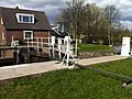
canal lock in the Netherlands _Sluisdeuren.JPG) | |||||
| Upload media | |||||
| Instance of | |||||
|---|---|---|---|---|---|
| Location | Stolwijkersluis, Gouda, South Holland, Netherlands | ||||
| Street address |
| ||||
| Heritage designation |
| ||||
| Date of official opening |
| ||||
| Date of official closure |
| ||||
 | |||||
Meer informatie Stolwijkersluis
|
This is a category about rijksmonument number 333059
|
| Address |
|
Media in category "Stolwijkersluis"
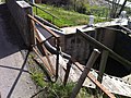
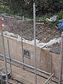
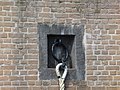
The following 48 files are in this category, out of 48 total.
-
 Fragment kaart van Gouda 1585.png 963 × 543; 1.11 MB
-
 Gouderaksedijk ter hoogte van de Stolwijkersluis - Gouda - 20387986 - RCE.jpg 1,200 × 1,200; 524 KB
-
 Overzicht - Stolwijkersluis - 20206220 - RCE.jpg 3,036 × 3,048; 2.24 MB
-
 Overzicht - Stolwijkersluis - 20206221 - RCE.jpg 3,036 × 3,065; 2.2 MB
-
 Overzicht - Stolwijkersluis - 20206222 - RCE.jpg 3,048 × 3,083; 2.47 MB
-
 Overzicht - Stolwijkersluis - 20206223 - RCE.jpg 3,030 × 3,048; 2.13 MB
-
 Overzicht - Stolwijkersluis - 20206224 - RCE.jpg 3,042 × 3,065; 1.89 MB
-
 Overzicht - Stolwijkersluis - 20206225 - RCE.jpg 3,036 × 3,059; 2.09 MB
-
 Overzicht met houten puntdeur van de schutsluis - Gouda - 20387971 - RCE.jpg 1,200 × 1,200; 652 KB
-

-
 Overzicht richting de brug over de Stolwijkse Vliet - Gouda - 20387969 - RCE.jpg 1,200 × 1,200; 464 KB
-
 Overzicht van de houten puntdeuren van de schutsluis - Gouda - 20387981 - RCE.jpg 1,200 × 1,200; 552 KB
-
 Overzicht van de houten puntdeuren van de schutsluis - Gouda - 20387983 - RCE.jpg 1,200 × 1,200; 472 KB
-
 Overzicht van de houten puntdeuren van de schutsluis - Gouda - 20387984 - RCE.jpg 1,200 × 1,200; 467 KB
-
 Overzicht van de schutsluis met de groene omgeving - Gouda - 20387978 - RCE.jpg 1,200 × 1,200; 487 KB
-

-
 Stolwijkersluis (01).JPG 1,936 × 2,592; 1.65 MB
-
 Stolwijkersluis (02).JPG 2,592 × 1,936; 1.77 MB
-
 Stolwijkersluis (03).JPG 2,592 × 1,936; 2.06 MB
-
 Stolwijkersluis (04).JPG 2,592 × 1,936; 1.92 MB
-
 Stolwijkersluis (05).JPG 2,592 × 1,936; 1.65 MB
-
 Stolwijkersluis (06).JPG 1,936 × 2,592; 1.78 MB
-
 Stolwijkersluis (07).JPG 1,936 × 2,592; 1.66 MB
-
 Stolwijkersluis (08).JPG 2,592 × 1,936; 2.6 MB
-
 Stolwijkersluis (09).JPG 2,592 × 1,936; 1.93 MB
-
 Stolwijkersluis (10).JPG 1,936 × 2,592; 1.97 MB
-
 Stolwijkersluis (11).JPG 2,592 × 1,936; 1.79 MB
-
 Stolwijkersluis (12).JPG 2,592 × 1,936; 2.28 MB
-
 Stolwijkersluis (13).JPG 2,592 × 1,936; 1.78 MB
-
 Stolwijkersluis (14).JPG 2,592 × 1,936; 2.27 MB
-
 Stolwijkersluis (15).JPG 1,936 × 2,592; 2.52 MB
-
 Stolwijkersluis 1.jpg 3,648 × 2,736; 4.31 MB
-
 Stolwijkersluis 1799.jpg 2,348 × 2,232; 2.36 MB
-
 Stolwijkersluis 2.jpg 3,648 × 2,736; 4.25 MB
-
 Stolwijkersluis 3.jpg 2,736 × 3,648; 3.41 MB
-
 Stolwijkersluis in Gouda (1) Informatiebord.jpg 4,320 × 3,240; 9.72 MB
-
 Stolwijkersluis in Gouda (2) Sluisdeuren.jpg 4,320 × 3,240; 6.86 MB
-
 Stolwijkersluis in Gouda (3) Sluisdeuren.jpg 4,320 × 3,240; 8.54 MB
-
 Stolwijkersluis in Gouda (4).jpg 4,320 × 3,240; 9.04 MB
-
 Stolwijkersluis in Gouda (5) Bewegingsmechanisme.jpg 3,240 × 4,320; 6.69 MB
-
 Stolwijkersluis in Gouda (6) Bewegingsmechanisme.JPG 3,240 × 4,320; 4.68 MB
-
 Stolwijkersluis in Gouda (7) Aanlegring.JPG 4,320 × 3,240; 5.67 MB
-
 Stolwijkersluis in Gouda (8) Sluisdeuren.JPG 4,320 × 3,240; 5.95 MB
-
 Tekening in bezit van Rijksarchief te Den Haag - Stolwijkersluis - 20206228 - RCE.jpg 1,192 × 1,200; 207 KB
-
 Tekening in bezit van Rijksarchief te Den Haag - Stolwijkersluis - 20206229 - RCE.jpg 1,195 × 1,200; 228 KB
-
 Tekening in bezit van Rijksarchief te Den Haag - Stolwijkersluis - 20206230 - RCE.jpg 1,192 × 1,200; 143 KB
-
 Tekening in bezit van Rijksarchief te Den Haag - Stolwijkersluis - 20206231 - RCE.jpg 1,200 × 1,200; 217 KB
-


.JPG)
.JPG)
.JPG)
.JPG)
.JPG)
.JPG)
.JPG)
.JPG)
.JPG)
.JPG)
.JPG)
.JPG)
.JPG)
.JPG)
.JPG)


_Informatiebord.jpg)
_Sluisdeuren.jpg)
_Sluisdeuren.jpg)
.jpg)
_Bewegingsmechanisme.jpg)
_Bewegingsmechanisme.JPG)
_Aanlegring.JPG)


