Category:Stoke St Michael
Jump to navigation
Jump to search
English: Stoke St Michael is a village and civil parish on the Mendip Hills west of Frome, in the Mendip district of Somerset, England.

village and civil parish in Somerset, United Kingdom  | |||||
| Upload media | |||||
| Instance of | |||||
|---|---|---|---|---|---|
| Location | Mendip, Somerset, South West England, England | ||||
| Population |
| ||||
 | |||||
Subcategories
This category has the following 2 subcategories, out of 2 total.
K
M
Media in category "Stoke St Michael"
The following 86 files are in this category, out of 86 total.
-
 2011 , Footpath and hayfield west of Oakhill - geograph.org.uk - 2462689.jpg 3,525 × 2,690; 2.3 MB
-
 2011 , Hay field near Blakes Farm - geograph.org.uk - 2457517.jpg 3,564 × 2,744; 3.43 MB
-
 2011 , Home sweet home, portable pig parlour - geograph.org.uk - 2462704.jpg 3,368 × 2,593; 3.94 MB
-
 2011 , Looking east near the end of Tadhill Lane - geograph.org.uk - 2267402.jpg 1,600 × 1,258; 1.02 MB
-
 2011 , Mowing grass near Tanyard Farm, Oakhill - geograph.org.uk - 2462678.jpg 3,379 × 2,936; 3.69 MB
-
 2011 , Panoramic view from Tadhill Lane ^1 - geograph.org.uk - 2264427.jpg 4,745 × 2,510; 4.41 MB
-
 2011 , Panoramic view from Tadhill Lane ^2 - geograph.org.uk - 2267293.jpg 4,732 × 2,497; 6.33 MB
-
 2011 , Panoramic view from Tadhill Lane ^3 - geograph.org.uk - 2267348.jpg 4,693 × 2,438; 2.45 MB
-
 2011 , Tadhill Lane looking west - geograph.org.uk - 2267382.jpg 3,084 × 2,634; 3.09 MB
-
 A harrowing experience - geograph.org.uk - 4797699.jpg 2,304 × 1,704; 1.72 MB
-
 At the end of Marsh Lane - geograph.org.uk - 1281688.jpg 640 × 478; 159 KB
-
 Avoiding Giddy Lane - geograph.org.uk - 4797726.jpg 2,304 × 1,704; 1.92 MB
-
 Bridleway, Three Ashes - geograph.org.uk - 1558892.jpg 640 × 480; 197 KB
-
 Bridleway, Three Ashes - geograph.org.uk - 1558898.jpg 640 × 480; 168 KB
-
 Cattle, Frog Lane - geograph.org.uk - 1558928.jpg 640 × 480; 144 KB
-
 Chimneys hiding in the woods - geograph.org.uk - 4797716.jpg 2,304 × 1,704; 1.61 MB
-
 Cottages at Fairy Cave Quarry about 1969 - geograph.org.uk - 4014992.jpg 2,751 × 1,830; 1.28 MB
-

-

-

-
 Down to Stoke Bottom - geograph.org.uk - 4797731.jpg 2,304 × 1,704; 1.75 MB
-
 E ll R postbox, near Somer's Farm - geograph.org.uk - 1431576.jpg 640 × 609; 276 KB
-
 Fairy Cave Quarry - geograph.org.uk - 1197955.jpg 640 × 426; 76 KB
-
 Fairy Cave Quarry about 1970 - geograph.org.uk - 4014998.jpg 2,137 × 1,535; 1.06 MB
-
 Fairy Cave Quarry and fault plane - geograph.org.uk - 5027681.jpg 1,920 × 1,440; 939 KB
-
 Fairy Cave Quarry from the South East - geograph.org.uk - 5027678.jpg 1,920 × 1,440; 932 KB
-
 Falling into the stream - geograph.org.uk - 4797674.jpg 2,304 × 1,704; 1.66 MB
-
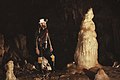
 Fernhill Cave - geograph.org.uk - 2349801.jpg 480 × 640; 88 KB
-
 Fernhill Cave - geograph.org.uk - 2349805.jpg 480 × 640; 69 KB
-
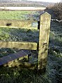
 Field with footpath, Stoke St Michael - geograph.org.uk - 1558939.jpg 640 × 480; 121 KB
-
 Folly Wood - geograph.org.uk - 4797735.jpg 2,304 × 1,704; 1.7 MB
-
 Frosty needles - geograph.org.uk - 4797746.jpg 1,704 × 2,304; 2.02 MB
-
 Giddy Lane - geograph.org.uk - 4797685.jpg 1,704 × 2,304; 2.12 MB
-
 Given up walking - geograph.org.uk - 4797689.jpg 1,704 × 2,304; 2.36 MB
-
 Houses on the edge of Stoke St Michael - geograph.org.uk - 5513930.jpg 640 × 480; 194 KB
-
 Keeping the levels - geograph.org.uk - 4797702.jpg 2,304 × 1,704; 1.78 MB
-

-
 Lane heading to Town's End - geograph.org.uk - 5530596.jpg 640 × 480; 172 KB
-
 Lane junction east of Stoke St Michael - geograph.org.uk - 5530594.jpg 640 × 480; 184 KB
-
 Leaving Frog Lane - geograph.org.uk - 4797719.jpg 1,704 × 2,304; 2.05 MB
-
 Looking north from Frog Lane - geograph.org.uk - 1293061.jpg 640 × 482; 204 KB
-
 Looking over the quarry - geograph.org.uk - 5513927.jpg 640 × 480; 157 KB
-
 Looking south at the end of Marsh Lane - geograph.org.uk - 1292983.jpg 640 × 473; 167 KB
-
 Manor House Farm, Stoke St Michael - geograph.org.uk - 137650.jpg 640 × 480; 138 KB
-
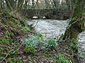
 Mells River - geograph.org.uk - 346558.jpg 640 × 480; 118 KB
-
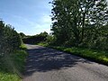
 Minor road to Frome from Wells - geograph.org.uk - 1427577.jpg 640 × 539; 152 KB
-
 North east from Frog Lane - geograph.org.uk - 1295943.jpg 640 × 477; 112 KB
-
 North west from Frog Lane - geograph.org.uk - 1295951.jpg 640 × 493; 119 KB
-
 Not a reassuring sign - geograph.org.uk - 4797664.jpg 1,704 × 2,304; 2.35 MB
-
 Old chapel, Stoke St. Michael - geograph.org.uk - 1296118.jpg 640 × 548; 145 KB
-

-

-
 Peaceful here - geograph.org.uk - 1294810.jpg 640 × 427; 127 KB
-
 Pool House, East End, Stoke St Michael - geograph.org.uk - 137652.jpg 640 × 480; 153 KB
-
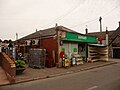
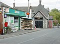 Post Office and village store - geograph.org.uk - 1296048.jpg 640 × 475; 137 KB
-
 Quarry Above Stoke Lane Slocker - geograph.org.uk - 6503670.jpg 3,456 × 4,608; 7.11 MB
-
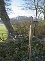
 Signpost near Stoke St Michael - geograph.org.uk - 1558917.jpg 640 × 480; 171 KB
-
 Somerbus 776 to Shepton Mallet - geograph.org.uk - 1489689.jpg 640 × 521; 162 KB
-
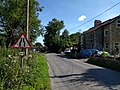
 Stoke Hill, Stoke St. Michael - geograph.org.uk - 1296103.jpg 640 × 501; 168 KB
-
 Stoke Lane Slocker - geograph.org.uk - 1195310.jpg 640 × 426; 51 KB
-
 Stoke Lane Slocker - geograph.org.uk - 1195316.jpg 640 × 426; 90 KB
-
 Stoke Lane Slocker - geograph.org.uk - 1195322.jpg 640 × 433; 108 KB
-
 Stoke Lane Slocker - geograph.org.uk - 6503666.jpg 4,608 × 3,456; 1.95 MB
-
 Stoke Lane Slocker entrance.jpg 3,072 × 2,304; 2.6 MB
-
 Stoke Lane Slocker. - geograph.org.uk - 1197959.jpg 640 × 426; 77 KB
-
 Stoke St Michael, Tower Hill - geograph.org.uk - 915369.jpg 640 × 427; 197 KB
-
 Stoke St. Michael, draughtsboard - geograph.org.uk - 1317706.jpg 480 × 640; 113 KB
-
 Stoke St. Michael, Millennium Green - geograph.org.uk - 1317687.jpg 640 × 480; 105 KB
-
-
-

-
 Thank the Mendip Ramblers - geograph.org.uk - 4797728.jpg 1,704 × 2,304; 2.03 MB
-
 The Mells Stream between Edford and Ham - geograph.org.uk - 4793236.jpg 3,648 × 2,048; 3 MB
-
 The Square, Stoke St. Michael - geograph.org.uk - 1296070.jpg 640 × 545; 137 KB
-
 Weather vane, Three Ashes - geograph.org.uk - 1558904.jpg 640 × 480; 76 KB
-
 West from Frog Lane - geograph.org.uk - 1295962.jpg 640 × 482; 133 KB
-
 Withyhill Cave, Fairy Cave Quarry - geograph.org.uk - 4014966.jpg 2,976 × 3,968; 4.88 MB
-
 Withyhill Cave, Fairy Cave Quarry - geograph.org.uk - 4014973.jpg 2,408 × 2,917; 4.99 MB
-
 Withyhill Cave, Fairy Cave Quarry - geograph.org.uk - 4014981.jpg 2,976 × 3,968; 5.2 MB
-
 WL Cave, Fairy Cave Quarry - geograph.org.uk - 2349806.jpg 640 × 480; 104 KB
-
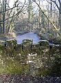
 Bridge over Mells River - geograph.org.uk - 346550.jpg 640 × 480; 157 KB
-

-
 Cows driven across Burnt House Lane - geograph.org.uk - 1427596.jpg 640 × 516; 191 KB
-
 Fental Lane from Old Wells Road - geograph.org.uk - 1435967.jpg 640 × 483; 203 KB
-
 Footpath to Withybrook - geograph.org.uk - 468056.jpg 640 × 480; 60 KB
-
 Hyatt's Hill - geograph.org.uk - 346563.jpg 640 × 480; 78 KB


