Category:Stoke Orchard
Jump to navigation
Jump to search
village and civil parish in Gloucestershire, United Kingdom  | |||||
| Upload media | |||||
| Instance of | |||||
|---|---|---|---|---|---|
| Location | Tewkesbury, Gloucestershire, South West England, England | ||||
| Population |
| ||||
 | |||||
English: Stoke Orchard is a village or hamlet north-west of Cheltenham in Gloucestershire, England. Locally the village is often known as 'Stoke'.
Subcategories
This category has the following 2 subcategories, out of 2 total.
C
- Cleeve railway station (3 F)
S
Media in category "Stoke Orchard"
The following 154 files are in this category, out of 154 total.
-
-
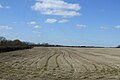
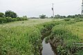
 Arable land near Stoke Orchard - geograph.org.uk - 759717.jpg 640 × 426; 64 KB
-

-
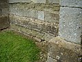
 Benchmark on Stoke Orchard Church - geograph.org.uk - 4094127.jpg 2,560 × 1,920; 1.02 MB
-
 Benchmark on Tredington Church - geograph.org.uk - 4094116.jpg 2,560 × 1,920; 1.02 MB
-
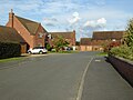
 Bloor Homes development, Stoke Orchard - geograph.org.uk - 5397178.jpg 1,024 × 576; 123 KB
-

-
 Bozard's lane - geograph.org.uk - 4212139.jpg 800 × 534; 309 KB
-
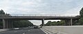
 Bridge over M5 near Phillant Farm - geograph.org.uk - 3192035.jpg 1,024 × 768; 473 KB
-
 Bridge over M5 near Stoke Orchard - geograph.org.uk - 761586.jpg 640 × 426; 51 KB
-
 Bridge over M5 near Warders Farm - geograph.org.uk - 3192043.jpg 1,024 × 768; 538 KB
-
 Bridge over the M5 - geograph.org.uk - 2288739.jpg 640 × 315; 34 KB
-
 Bridge over the M5 - geograph.org.uk - 3697144.jpg 4,249 × 1,788; 1.41 MB
-
 Bridge over the M5 near Warders Farm - geograph.org.uk - 3697151.jpg 3,867 × 2,446; 1.8 MB
-
 Bridleway near Tredington Park - geograph.org.uk - 5804834.jpg 6,000 × 4,000; 6.49 MB
-
 Bridleway to Fiddington - geograph.org.uk - 4212149.jpg 800 × 534; 293 KB
-

-
 Bus shelter in Stoke Orchard - geograph.org.uk - 5397913.jpg 1,024 × 768; 278 KB
-

-
 Bus stop at Tredington - geograph.org.uk - 5804818.jpg 6,000 × 4,000; 6.66 MB
-
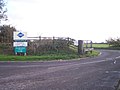
 Cattery entrance - geograph.org.uk - 1119699.jpg 640 × 480; 185 KB
-
 Chapel gable end, Stoke Orchard - geograph.org.uk - 1610561.jpg 640 × 426; 109 KB
-
 Cheltenham to Birmingham line - geograph.org.uk - 4212153.jpg 800 × 451; 188 KB
-
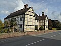
 Court Farm, Stoke Orchard - geograph.org.uk - 1119704.jpg 640 × 480; 219 KB
-
 Crop field near Court Farm - geograph.org.uk - 4382364.jpg 640 × 404; 50 KB
-
 Cross in Tredington churchyard - geograph.org.uk - 5168865.jpg 600 × 800; 188 KB
-
 Detail in a church wall - geograph.org.uk - 5397947.jpg 1,024 × 768; 419 KB
-
 Detail on wall of Stoke Orchard chapel - geograph.org.uk - 5397942.jpg 1,024 × 768; 456 KB
-
 Edge of Fiddington Brake - geograph.org.uk - 4212141.jpg 800 × 534; 233 KB
-
 Farm Traffic Near Fiddington Brake - geograph.org.uk - 5578019.jpg 640 × 472; 156 KB
-
 Farmland to the south of Fiddington - geograph.org.uk - 1003645.jpg 640 × 426; 99 KB
-
 Fiddington Brake View - geograph.org.uk - 5578015.jpg 640 × 426; 91 KB
-
 Field beside the M5 - geograph.org.uk - 2760545.jpg 640 × 338; 38 KB
-
 Field boundary near Gothic Farm - geograph.org.uk - 2986827.jpg 640 × 297; 41 KB
-
 Footpath across open farmland - geograph.org.uk - 3091825.jpg 1,200 × 676; 431 KB
-
 Footpath north from Stoke Orchard - geograph.org.uk - 4276135.jpg 800 × 600; 403 KB
-
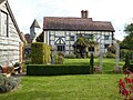
 Former chapel in Stoke Orchard - geograph.org.uk - 1610555.jpg 640 × 426; 89 KB
-
 Former chapel, Stoke Orchard - geograph.org.uk - 1610551.jpg 640 × 426; 72 KB
-
 Gravestone in Tredington churchyard - geograph.org.uk - 5168848.jpg 600 × 800; 147 KB
-
 Grazing land near Stoke Orchard - geograph.org.uk - 1611731.jpg 640 × 426; 94 KB
-
 Grazing near Gothic Farm - geograph.org.uk - 4380986.jpg 640 × 460; 39 KB
-
 Harvested Fields Near Stoke Orchard - geograph.org.uk - 5577985.jpg 640 × 426; 110 KB
-
 House in Tredington - geograph.org.uk - 6719197.jpg 1,200 × 815; 1.03 MB
-
 Interior of Stoke Orchard church - geograph.org.uk - 5397884.jpg 1,024 × 768; 162 KB
-
-
 Large fields adjacent to railway line - geograph.org.uk - 4664994.jpg 1,600 × 606; 190 KB
-
 Level crossing near Fiddington - geograph.org.uk - 1003662.jpg 640 × 426; 60 KB
-
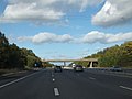
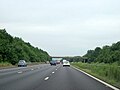
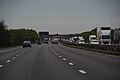
 M5 Motorway - geograph.org.uk - 6719207.jpg 1,200 × 802; 917 KB
-

-

-

-
 M5 Motorway near Fiddington - geograph.org.uk - 2046450.jpg 640 × 480; 52 KB
-

-
 M5 near Stoke Orchard - geograph.org.uk - 4688452.jpg 2,011 × 1,219; 709 KB
-
 M5 northbound towards junction 9 - geograph.org.uk - 4326356.jpg 1,600 × 1,200; 865 KB
-
 M5 northbound towards junction 9 - geograph.org.uk - 4326360.jpg 1,600 × 1,200; 1.15 MB
-
 M5 southbound near Tredington - geograph.org.uk - 4688557.jpg 2,100 × 1,348; 877 KB
-

-
 Main Street, Stoke Orchard - geograph.org.uk - 1121112.jpg 640 × 480; 225 KB
-
 Mainline Service - geograph.org.uk - 5577036.jpg 640 × 409; 80 KB
-
 Manor Farmhouse, Tredington - geograph.org.uk - 5168887.jpg 800 × 600; 105 KB
-
 Manor Farmhouse, Tredington - geograph.org.uk - 5168892.jpg 800 × 600; 106 KB
-
 Manor Farmhouse, Tredington - geograph.org.uk - 5168898.jpg 800 × 600; 140 KB
-
 Mill Farm, Stoke Orchard - geograph.org.uk - 1611382.jpg 640 × 426; 96 KB
-
 Mill Farmhouse, Tredington (geograph 6823497).jpg 1,024 × 768; 182 KB
-
 Mill Lane - geograph.org.uk - 2979680.jpg 1,024 × 577; 303 KB
-
 Mill Lane, Stoke Orchard - geograph.org.uk - 1121117.jpg 640 × 480; 227 KB
-
 Mill Lane, Stoke Orchard - geograph.org.uk - 1611402.jpg 640 × 426; 89 KB
-

-

-
 Modern housing in Tredington - geograph.org.uk - 5168913.jpg 1,024 × 768; 178 KB
-
 New Housing in Stoke Orchard - geograph.org.uk - 5577982.jpg 640 × 426; 120 KB
-
 Old station approach - geograph.org.uk - 1119696.jpg 640 × 480; 202 KB
-
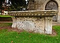 Old Tablestone at Tredington - geograph.org.uk - 5577999.jpg 640 × 458; 129 KB
-
 Ophelia at Tredington Church - geograph.org.uk - 5578000.jpg 640 × 420; 72 KB
-
 Ophelia on the M5 - geograph.org.uk - 5578007.jpg 640 × 441; 88 KB
-

-
-
 Overbridge near Tredington - geograph.org.uk - 4741038.jpg 640 × 387; 122 KB
-
 Pasture land at Court Farm - geograph.org.uk - 1119706.jpg 640 × 480; 217 KB
-
 Pasture west of the railway line - geograph.org.uk - 1119709.jpg 640 × 480; 202 KB
-
 Pond in Stoke Orchard - geograph.org.uk - 1610583.jpg 640 × 426; 118 KB
-
 Poplar trees, Stoke Orchard - geograph.org.uk - 1611389.jpg 640 × 426; 102 KB
-
 Porch and tower, Tredington church - geograph.org.uk - 5168833.jpg 600 × 800; 111 KB
-

-
 Railway at Fiddington - geograph.org.uk - 6392290.jpg 1,200 × 805; 1.22 MB
-
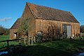
 Red-brick barn in Stoke Orchard - geograph.org.uk - 1610581.jpg 640 × 426; 75 KB
-
 Red-brick barn, Stoke Orchard - geograph.org.uk - 1610577.jpg 640 × 426; 74 KB
-
 River Swilgate - geograph.org.uk - 6719198.jpg 1,200 × 802; 1.21 MB
-
 Road junction near Fiddington - geograph.org.uk - 6719215.jpg 1,200 × 800; 1.24 MB
-
 Road near Fiddington - geograph.org.uk - 6719210.jpg 1,200 × 800; 1.06 MB
-
 Road near Fiddington - geograph.org.uk - 6720517.jpg 1,200 × 802; 985 KB
-
 Road near Tredington - geograph.org.uk - 6719206.jpg 1,200 × 800; 1.08 MB
-
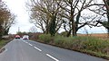
 Road to Bishop's Cleeve - geograph.org.uk - 1119715.jpg 640 × 480; 170 KB
-
 Sherdons Golf Centre - geograph.org.uk - 3091827.jpg 1,200 × 900; 532 KB
-
 St John the Baptist, Tredington - Font - geograph.org.uk - 3301399.jpg 520 × 842; 606 KB
-
 St John the Baptist, Tredington - geograph.org.uk - 3301395.jpg 547 × 735; 523 KB
-
 Stoke Orchard , M5 Motorway - geograph.org.uk - 6283982.jpg 6,000 × 4,000; 4.63 MB
-
 Stoke Orchard , M5 Motorway - geograph.org.uk - 6283983.jpg 6,000 × 4,000; 4.56 MB
-
 Stoke Orchard church - geograph.org.uk - 5397186.jpg 1,024 × 768; 301 KB
-
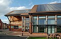 Stoke Orchard Community Centre - geograph.org.uk - 5577983.jpg 640 × 417; 95 KB
-

-
 Stoke Road - geograph.org.uk - 4276139.jpg 800 × 451; 293 KB
-
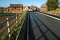
 Stoke Road Bridge - geograph.org.uk - 1690685.jpg 1,500 × 955; 202 KB
-
 Stoke Road bridge over M5 - geograph.org.uk - 4741033.jpg 640 × 385; 45 KB
-

-
 Stubble field near Gothic Farm - geograph.org.uk - 4379508.jpg 640 × 410; 53 KB
-
 Stubble field near Stoke Orchard - geograph.org.uk - 4380988.jpg 640 × 425; 48 KB
-
 Sunny wall - geograph.org.uk - 4212170.jpg 800 × 535; 340 KB
-
 Tablestone at Tredington - geograph.org.uk - 5577997.jpg 515 × 640; 148 KB
-
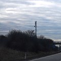 Telecommunications mast by the M5 - geograph.org.uk - 2288738.jpg 640 × 634; 44 KB
-
 Tewkesbury , M5 Motorway Roadworks - geograph.org.uk - 2794499.jpg 4,288 × 2,848; 5.08 MB
-
 Tewkesbury , M5 Motorway Roadworks - geograph.org.uk - 2794535.jpg 4,288 × 2,848; 4.48 MB
-
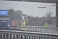
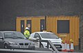 Tewkesbury , M5 Motorway Roadworks Hut - geograph.org.uk - 2794504.jpg 4,188 × 2,688; 3.42 MB
-
 Tewkesbury , The M5 Motorway - geograph.org.uk - 2794515.jpg 4,288 × 2,848; 4.76 MB
-
 Tewkesbury , The M5 Motorway - geograph.org.uk - 2794528.jpg 4,194 × 2,700; 3.83 MB
-
 Tewkesbury , The M5 Motorway Northbound - geograph.org.uk - 2794544.jpg 4,206 × 2,720; 2.99 MB
-
 Tewkesbury , The M5 Motorway Roadworks - geograph.org.uk - 2795413.jpg 4,288 × 2,848; 4.64 MB
-
 Tewkesbury , The M5 Motorway Roadworks - geograph.org.uk - 2795414.jpg 4,288 × 2,848; 4.16 MB
-
 Tewkesbury , The M5 Motorway Roadworks - geograph.org.uk - 2795415.jpg 4,214 × 2,730; 3.15 MB
-
 Tewkesbury , The M5 Motorway Southbound - geograph.org.uk - 2795416.jpg 4,288 × 2,848; 4.66 MB
-
 Tewkesbury Borough , M5 Motorway - geograph.org.uk - 5951412.jpg 6,000 × 4,000; 6.58 MB
-
 Tewkesbury Borough , M5 Motorway - geograph.org.uk - 5951414.jpg 6,000 × 4,000; 6.69 MB
-
 Tewkesbury District , Grassy Field - geograph.org.uk - 4930149.jpg 5,584 × 3,723; 7.76 MB
-
 Tewkesbury District , The M5 Motorway - geograph.org.uk - 4930147.jpg 6,000 × 4,000; 6.45 MB
-
 Tewkesbury District , The M5 Motorway - geograph.org.uk - 4930152.jpg 6,000 × 4,000; 6.24 MB
-
-
 The Distribution Centre, Stoke Orchard - geograph.org.uk - 1119712.jpg 640 × 480; 191 KB
-
 The M5 near Tredington - geograph.org.uk - 1003635.jpg 640 × 426; 86 KB
-
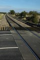
 The railway line to Birmingham - geograph.org.uk - 1690684.jpg 1,500 × 978; 215 KB
-
 The River Swilgate near Tredington - geograph.org.uk - 5804800.jpg 6,000 × 4,000; 4.29 MB
-
 The River Swilgate near Tredington - geograph.org.uk - 5804806.jpg 6,000 × 4,000; 4.57 MB
-
 Tower of Tredington church - geograph.org.uk - 5168836.jpg 600 × 800; 121 KB
-
 Track and bridleway near Waterloo Farm - geograph.org.uk - 1611429.jpg 640 × 426; 102 KB
-
 Track and bridleway to Stoke Orchard - geograph.org.uk - 1611416.jpg 640 × 426; 99 KB
-
 Tredington church - geograph.org.uk - 5168828.jpg 800 × 600; 138 KB
-
 Tredington Court (geograph 6823491).jpg 1,024 × 768; 213 KB
-
 Tredington pasture land - geograph.org.uk - 4212160.jpg 800 × 534; 249 KB
-

-
 View over fields at Stoke Orchard - geograph.org.uk - 5301773.jpg 1,024 × 683; 191 KB
-
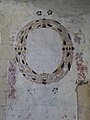
 Wall paintings, Stoke Orchard ^1 - geograph.org.uk - 5397888.jpg 1,024 × 768; 166 KB
-
 Wall paintings, Stoke Orchard ^2 - geograph.org.uk - 5397892.jpg 1,024 × 768; 190 KB
-
 Wall paintings, Stoke Orchard ^3 - geograph.org.uk - 5397895.jpg 1,024 × 768; 174 KB
-
 Wall paintings, Stoke Orchard ^4 - geograph.org.uk - 5397898.jpg 1,024 × 768; 167 KB
-
 Wall paintings, Stoke Orchard ^5 - geograph.org.uk - 5397900.jpg 768 × 1,024; 172 KB
-
 Wall paintings, Stoke Orchard ^6 - geograph.org.uk - 5397903.jpg 768 × 1,024; 159 KB
-
 Wall paintings, Stoke Orchard ^7 - geograph.org.uk - 5397906.jpg 1,024 × 1,024; 204 KB
-
 Wall paintings, Stoke Orchard ^8 - geograph.org.uk - 5397908.jpg 600 × 800; 105 KB
-
 Waterlogged meadow at Stoke Orchard - geograph.org.uk - 1611722.jpg 640 × 426; 85 KB
-
 Weird Light From Ophelia - geograph.org.uk - 5578011.jpg 640 × 461; 125 KB
-
 Wingmoor Landfill Site - geograph.org.uk - 2153367.jpg 800 × 600; 330 KB
-

-
 Overgrown Chapel, Stoke Orchard - geograph.org.uk - 79042.jpg 640 × 479; 118 KB
-


.jpg)


_-_geograph.org.uk_-_759693.jpg)


.jpg)


