Category:Stoke, Worcestershire
Jump to navigation
Jump to search
civil parish in Bromsgrove, Worcestershire, England | |||||
| Upload media | |||||
| Instance of | |||||
|---|---|---|---|---|---|
| Location | Bromsgrove, Worcestershire, West Midlands, England | ||||
 | |||||
Subcategories
This category has the following 3 subcategories, out of 3 total.
S
- Stoke Works (17 F)
Media in category "Stoke, Worcestershire"
The following 200 files are in this category, out of 725 total.
(previous page) (next page)-

-
 "Voyager" Trains Passing - geograph.org.uk - 2534233.jpg 640 × 462; 82 KB
-
 'Gate Hangs Well' and Road Junction - geograph.org.uk - 3826672.jpg 640 × 454; 43 KB
-
 'Voyager' at Navigation Bridge - geograph.org.uk - 2884197.jpg 640 × 426; 112 KB
-
 1930s Roadmender's Cabin - geograph.org.uk - 5120562.jpg 1,600 × 1,200; 444 KB
-
 A Snowy Woodgate Road - geograph.org.uk - 3302021.jpg 640 × 480; 83 KB
-

-

-

-

-

-

-

-

-
 Aerial photograph - geograph.org.uk - 3409576.jpg 640 × 427; 73 KB
-
 AFH House, Buntsford Drive, Bromsgrove - geograph.org.uk - 5215765.jpg 800 × 721; 135 KB
-
 Aldham House - geograph.org.uk - 4363226.jpg 1,024 × 680; 263 KB
-
 Aldham House, Stoke Prior - geograph.org.uk - 6025658.jpg 1,600 × 1,200; 567 KB
-
 Aldi supermarket, Bromsgrove - geograph.org.uk - 5248463.jpg 800 × 427; 92 KB
-

-
 Approaching Bridge 45 Worcester - Birmingham Canal - geograph.org.uk - 6021907.jpg 1,600 × 1,200; 584 KB
-
 Approaching lock No 26 near Stoke Wharf, Worcestershire - geograph.org.uk - 6023237.jpg 1,600 × 1,200; 494 KB
-

-

-
 Approaching Tardebigge Lock No 32 - geograph.org.uk - 2249191.jpg 800 × 536; 301 KB
-

-
 Aston Fields industrial estate, Bromsgrove - geograph.org.uk - 6024305.jpg 1,600 × 1,200; 472 KB
-
 Astwood Bridge, No 41, Worcestershire - geograph.org.uk - 2240889.jpg 640 × 480; 163 KB
-
 Astwood Bridge, No 41, Worcestershire - geograph.org.uk - 2240899.jpg 640 × 480; 156 KB
-
 Astwood Bridge, Worcester ^ Birmingham Canal - geograph.org.uk - 4725920.jpg 1,280 × 851; 275 KB
-
 Astwood Lane - geograph.org.uk - 3018656.jpg 640 × 480; 150 KB
-
 Astwood Lane - geograph.org.uk - 5473220.jpg 640 × 480; 59 KB
-
 Astwood Lane, brick built three storey house - geograph.org.uk - 2792129.jpg 3,264 × 2,448; 1.75 MB
-
 Austin Road houses, Bromsgrove - geograph.org.uk - 5240923.jpg 800 × 693; 131 KB
-
 Avon Close, Bromsgrove - geograph.org.uk - 5240885.jpg 800 × 590; 94 KB
-
 Avoncroft Mini-Roundabout - geograph.org.uk - 2351104.jpg 640 × 480; 69 KB
-
 Avoncroft Museum - chain shop - geograph.org.uk - 2678939.jpg 640 × 480; 119 KB
-
 Avoncroft Museum - geograph.org.uk - 2629666.jpg 480 × 640; 109 KB
-
 Avoncroft Museum - geograph.org.uk - 5400099.jpg 3,674 × 2,758; 4.05 MB
-
 Avoncroft Museum - geograph.org.uk - 5400101.jpg 3,720 × 2,793; 3.78 MB
-
 Avoncroft Museum - geograph.org.uk - 5400104.jpg 3,674 × 2,758; 5.46 MB
-
 Avoncroft Museum - geograph.org.uk - 5400110.jpg 3,674 × 2,758; 5.69 MB
-
 Avoncroft Museum - geograph.org.uk - 5400119.jpg 3,674 × 2,758; 5.8 MB
-
 Avoncroft Museum - geograph.org.uk - 5400129.jpg 3,674 × 2,758; 6.48 MB
-
 Avoncroft Museum - geograph.org.uk - 5400140.jpg 3,674 × 2,758; 5.21 MB
-
 Avoncroft Museum - geograph.org.uk - 5400144.jpg 3,674 × 2,758; 7.15 MB
-
 Avoncroft Museum - geograph.org.uk - 5400149.jpg 3,674 × 2,758; 7.47 MB
-
 Avoncroft Museum - geograph.org.uk - 5400166.jpg 3,674 × 2,758; 3.94 MB
-

-

-
 B4091 approaching Stoke Wharf - geograph.org.uk - 2021399.jpg 1,600 × 1,200; 1.69 MB
-
 B4091 at Navigation Bridge, Stoke Prior - geograph.org.uk - 3784433.jpg 1,224 × 918; 506 KB
-
 B4091 passing under Worcester-Birmingham railway - geograph.org.uk - 3500532.jpg 1,024 × 511; 110 KB
-
 Barn, Poolhouse Farm - geograph.org.uk - 5473230.jpg 640 × 480; 66 KB
-
 Bassington Bridge - geograph.org.uk - 6396989.jpg 800 × 533; 153 KB
-
 Bayer Warehouse, Stoke Works - geograph.org.uk - 3405006.jpg 640 × 351; 43 KB
-
 Bayer Warehouse, Stoke Works, 1983 - geograph.org.uk - 2590695.jpg 640 × 480; 63 KB
-
 BDHT Building, Bromsgrove - geograph.org.uk - 2350584.jpg 640 × 480; 63 KB
-
 BDHT donations bin, Bromsgrove - geograph.org.uk - 5215741.jpg 800 × 549; 114 KB
-

-
 Bend on the River Salwarpe - geograph.org.uk - 3845457.jpg 1,469 × 1,102; 834 KB
-
 Between Whitford Bridge and Thompson's Bridge - geograph.org.uk - 6023901.jpg 1,600 × 1,200; 374 KB
-
-

-
 Black Prince Holidays - 1 - geograph.org.uk - 1346128.jpg 640 × 480; 97 KB
-
 Black Prince Holidays - 2 - geograph.org.uk - 1346130.jpg 640 × 480; 96 KB
-
 Black Prince Holidays, Stoke Wharf, Stoke Prior - geograph.org.uk - 6021897.jpg 1,600 × 1,200; 334 KB
-
-
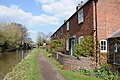
 Boat Works, Stoke Wharf - geograph.org.uk - 1355220.jpg 640 × 455; 85 KB
-
 Boat ^ Railway Pub, Canal Side, 1983 - geograph.org.uk - 2590703.jpg 640 × 476; 67 KB
-

-
 Brickhouse Lane, near Stoke Heath, Worcs - geograph.org.uk - 5517283.jpg 1,024 × 681; 275 KB
-
 Brickhouse Lane, near Stoke Heath, Worcs - geograph.org.uk - 5517388.jpg 1,024 × 681; 258 KB
-
 Bridge 45 from Lock 24, Worcester - Birmingham Canal - geograph.org.uk - 6022018.jpg 1,600 × 1,200; 588 KB
-
 Bridge 46, Worcester and Birmingham Canal - geograph.org.uk - 3433060.jpg 1,024 × 680; 252 KB
-
 Bridge 47 Worcester and Birmingham Canal - geograph.org.uk - 2467898.jpg 4,000 × 3,000; 2.27 MB
-
 Bridge 47, Worcester and Birmingham Canal - geograph.org.uk - 3433043.jpg 1,024 × 680; 231 KB
-
 Bridge 48 and the Queen's Head - geograph.org.uk - 3175386.jpg 1,024 × 768; 165 KB
-
 Bridge 48 Worcester and Birmingham Canal - geograph.org.uk - 2467975.jpg 4,000 × 3,000; 2.31 MB
-
 Bridge 49 Worcester and Birmingham Canal - geograph.org.uk - 2468021.jpg 4,000 × 3,000; 2.39 MB
-

-

-

-

-

-

-
 Bridge number 49 - geograph.org.uk - 6397015.jpg 533 × 800; 93 KB
-
 Bridge Over Railway, Stoke Pound Lane - geograph.org.uk - 2328662.jpg 4,592 × 3,056; 5.06 MB
-
 Bridleway off Holmes Lane - geograph.org.uk - 3826685.jpg 1,224 × 918; 733 KB
-
 Broadway Meadow Farm - geograph.org.uk - 5473235.jpg 640 × 480; 62 KB
-
 Bromsgrove District Housing Trust - geograph.org.uk - 5473748.jpg 640 × 472; 54 KB
-
-
 Bromsgrove Motor Factors in Bromsgrove - geograph.org.uk - 5433495.jpg 800 × 541; 111 KB
-
 Bromsgrove New Station - geograph.org.uk - 3889256.jpg 640 × 480; 101 KB
-

-

-
 Bromsgrove Pre-Preparatory and Pre-School from the rear - geograph.org.uk - 6065362.jpg 1,600 × 1,200; 496 KB
-

-
 Buntsford Court, Bromsgrove - geograph.org.uk - 5215737.jpg 800 × 543; 97 KB
-
 Buntsford Drive, Bromsgrove - geograph.org.uk - 2351075.jpg 640 × 480; 75 KB
-
 Buntsford Drive, Bromsgrove, Worcs - geograph.org.uk - 3920204.jpg 1,024 × 691; 116 KB
-
 Buntsford Hill - geograph.org.uk - 5473747.jpg 640 × 480; 82 KB
-

-

-
 Buntsford Park Rd Looking North - geograph.org.uk - 3528494.jpg 640 × 480; 86 KB
-

-
 Business park at Bromsgrove - geograph.org.uk - 4361413.jpg 800 × 531; 87 KB
-

-

-

-
 Canal approaching cottages at Whitford Bridge - geograph.org.uk - 6023381.jpg 1,600 × 1,200; 313 KB
-

-
-

-

-
 Canal bridge and the Queens Head Inn - geograph.org.uk - 3433035.jpg 1,024 × 680; 225 KB
-
 Canal bridge at Stoke Wharf - geograph.org.uk - 3500526.jpg 1,024 × 768; 208 KB
-
 Canal Cottages at Whitford Bridge - geograph.org.uk - 6023386.jpg 1,600 × 1,200; 546 KB
-
 Canal Lock at Stoke Pound - geograph.org.uk - 2395209.jpg 640 × 480; 105 KB
-
 Canalside at Stoke Wharf - geograph.org.uk - 6272635.jpg 1,024 × 683; 223 KB
-
 Canalside back gardens, off Shaw Lane - geograph.org.uk - 3121569.jpg 1,024 × 768; 127 KB
-

-

-
 Canalside Cottages at Whitford Bridge - geograph.org.uk - 1170313.jpg 640 × 480; 204 KB
-
-
 Canalside grazing land, near Stoke Pound - geograph.org.uk - 3175367.jpg 1,024 × 768; 156 KB
-
 Canalside house on Shaw Lane - geograph.org.uk - 3121564.jpg 1,024 × 768; 118 KB
-
-
 Car park, The Queen's Head, Stoke Pound - geograph.org.uk - 6120869.jpg 1,280 × 1,280; 785 KB
-
 Cattle at Poolhouse Farm - geograph.org.uk - 6052129.jpg 1,600 × 1,200; 271 KB
-
 CEF in Bromsgrove - geograph.org.uk - 5433544.jpg 800 × 653; 151 KB
-
 Cereal crop near Sharpway Gate Farm - geograph.org.uk - 5473215.jpg 640 × 480; 72 KB
-
 Church Hill House by the River Salwarpe - geograph.org.uk - 6024999.jpg 1,600 × 1,200; 536 KB
-
 Church Hill House entrance - geograph.org.uk - 6025644.jpg 1,600 × 1,200; 572 KB
-
 Church Hill House, Fish House Lane - geograph.org.uk - 6025640.jpg 1,600 × 1,200; 456 KB
-
 Class 47 at Navigation Bridge, 1980 - geograph.org.uk - 3185466.jpg 638 × 455; 130 KB
-

-

-
 Class 66s South of Bromsgrove - geograph.org.uk - 2818444.jpg 640 × 394; 45 KB
-
 Close the lock after you, please - geograph.org.uk - 6023875.jpg 1,600 × 1,200; 412 KB
-
 Coalash Lane - geograph.org.uk - 3018694.jpg 640 × 480; 159 KB
-
 Coalash Lane crossing a brook - geograph.org.uk - 3018696.jpg 640 × 480; 149 KB
-
 Coalash Lane, Woodgate - geograph.org.uk - 6073738.jpg 1,600 × 1,200; 599 KB
-
-

-
-
 Copyholt Lane - geograph.org.uk - 2367075.jpg 4,000 × 3,000; 4.26 MB
-

-
 Copyholt Lane looking east - geograph.org.uk - 3018715.jpg 640 × 480; 210 KB
-
 Copyholt Lane looking west - geograph.org.uk - 3018711.jpg 640 × 480; 170 KB
-
 Coriander Close - geograph.org.uk - 2803194.jpg 640 × 449; 59 KB
-
 Cottage at Vicarage Farm - geograph.org.uk - 2803213.jpg 640 × 480; 101 KB
-

-
 Cottages beside the canal - geograph.org.uk - 3433074.jpg 1,024 × 680; 237 KB
-
 Council refuse facility, Bromsgrove - geograph.org.uk - 2331661.jpg 2,048 × 1,536; 1.43 MB
-

-
 Cross Country High Speed Train - geograph.org.uk - 2705264.jpg 640 × 426; 48 KB
-
 Crossroads at Harbours Hill - geograph.org.uk - 3500506.jpg 1,024 × 768; 124 KB
-
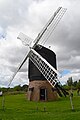 Danzey Green Windmill - geograph.org.uk - 5108837.jpg 1,064 × 1,600; 241 KB
-
 Dark Lane - geograph.org.uk - 4361427.jpg 1,024 × 680; 268 KB
-

-
 Derelict farm building on Whitford Bridge Road (2) - geograph.org.uk - 6023464.jpg 1,600 × 1,200; 412 KB
-
 Derelict farm building on Whitford Bridge Road - geograph.org.uk - 6023460.jpg 1,600 × 1,200; 368 KB
-

-
 DMU at Stoke Prior, 1989 - geograph.org.uk - 2743965.jpg 640 × 433; 118 KB
-
 DRS Class 66 at Little Intall Fields - geograph.org.uk - 2705251.jpg 640 × 426; 53 KB
-
 East end of Austin Road, Charford - geograph.org.uk - 6026012.jpg 1,024 × 768; 111 KB
-
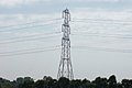 Electricity Pylon - geograph.org.uk - 2393369.jpg 640 × 426; 36 KB
-
 Electricity pylon on Harbours Hill - geograph.org.uk - 3500513.jpg 1,024 × 512; 62 KB
-
 Elizabeth II postbox on Hanbury Road, Harbours Hill - geograph.org.uk - 5474201.jpg 2,136 × 2,848; 1.23 MB
-
 Elms Farm buildings on Weston Hall Road, Stoke Prior - geograph.org.uk - 5792836.jpg 1,600 × 1,200; 585 KB
-
 Elms Farmhouse, Stoke Prior, Bromsgrove - geograph.org.uk - 5792839.jpg 1,600 × 1,200; 637 KB
-
 Entrance of the Stoke Prior Sports and Country Club - geograph.org.uk - 5792815.jpg 1,600 × 1,200; 579 KB
-

-
 Entrance to Corbett Business Park, Stoke Prior - geograph.org.uk - 5792819.jpg 1,600 × 1,200; 402 KB
-

-
-

-

-
 Ewe and Lamb on Hanbury Road - geograph.org.uk - 6065021.jpg 1,600 × 1,200; 380 KB
-
 EXcool at Corbett Business Park, Stoke Prior - geograph.org.uk - 5792821.jpg 1,600 × 1,200; 362 KB
-
 Fallen tree by the River Salwarpe - geograph.org.uk - 6024994.jpg 1,600 × 1,200; 541 KB
-
 Farm buildings off Stoke Pound Lane - geograph.org.uk - 4370038.jpg 640 × 376; 47 KB
-
 Farmland east of Piper's Hill - geograph.org.uk - 2792138.jpg 3,264 × 2,448; 1.82 MB
-
 Farmland near Woodgate Farm - geograph.org.uk - 2307581.jpg 1,024 × 680; 272 KB
-
 Farmland on the west side of the canal - geograph.org.uk - 3121577.jpg 1,024 × 768; 128 KB
-
 Fibre glass spire. - geograph.org.uk - 2050296.jpg 480 × 640; 172 KB
-
 Field boundary with trees - geograph.org.uk - 3175320.jpg 1,024 × 768; 185 KB
-
 Field entrance off Moorgate Road - geograph.org.uk - 5473225.jpg 640 × 480; 56 KB
-
 Field near Stoke Pound - geograph.org.uk - 2986192.jpg 640 × 358; 42 KB
-
 Field, farmhouse and bonfire in waiting - geograph.org.uk - 2792123.jpg 3,264 × 2,448; 1.58 MB
-
 Fields near Whitford Bridge - geograph.org.uk - 2331669.jpg 2,048 × 1,536; 1.31 MB
-
 Filling station at Morrisons supermarket - geograph.org.uk - 3503974.jpg 1,024 × 768; 118 KB
-
 Finstall Footpath Crossroad Sign - geograph.org.uk - 5182967.jpg 480 × 640; 87 KB
-
 Finstall Hedge,Footpath ^ Field - geograph.org.uk - 5182968.jpg 640 × 480; 74 KB
-
 Fish House Lane - geograph.org.uk - 2340918.jpg 4,000 × 3,000; 4.01 MB
-
 Fish House Lane next to the mill - geograph.org.uk - 6024981.jpg 1,600 × 1,200; 573 KB
-
 Five Mile House, Stoke Wharf - geograph.org.uk - 6021129.jpg 1,600 × 1,200; 318 KB
-

-
 Flood across Fish House Lane - geograph.org.uk - 3852534.jpg 1,469 × 1,102; 790 KB


_-_geograph.org.uk_-_6023464.jpg)


