Category:Stockland, Devon
Jump to navigation
Jump to search
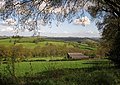
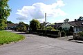
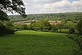
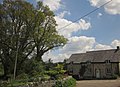
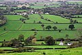
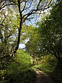
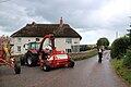
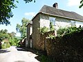
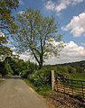
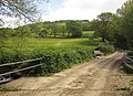
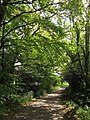
English: Stockland is a small rural village in Devon, close to the Somerset boundary. It has a Village Hall, a Pub (The King's Arms Inn), a School (Stockland primary School), a Church, a playing field, and a children's play area. The village is within the Blackdown Hills Area of Outstanding Natural Beauty.
village and civil parish in Devon, United Kingdom  | |||||
| Upload media | |||||
| Instance of | |||||
|---|---|---|---|---|---|
| Location | East Devon, Devon, South West England, England | ||||
| Population |
| ||||
| Area |
| ||||
 | |||||
Subcategories
This category has the following 4 subcategories, out of 4 total.
K
- Kings Arms, Stockland, Devon (2 F)
M
Media in category "Stockland, Devon"
The following 200 files are in this category, out of 442 total.
(previous page) (next page)-
 'Long Bridge' over the River Yarty - geograph.org.uk - 2256847.jpg 640 × 480; 123 KB
-

-
 A wet Waterhouse Lane - geograph.org.uk - 3525112.jpg 640 × 480; 129 KB
-
 Above Snodland - geograph.org.uk - 4492099.jpg 800 × 533; 206 KB
-
 Across the Corry Brook valley - geograph.org.uk - 3257747.jpg 640 × 444; 77 KB
-
 Approaching Ridge Cross - geograph.org.uk - 3485830.jpg 504 × 640; 120 KB
-
 Approaching Shore Bottom - geograph.org.uk - 3491066.jpg 640 × 482; 94 KB
-
 Approaching Stockland - geograph.org.uk - 2256834.jpg 640 × 480; 111 KB
-
 Arable field, Shore Head - geograph.org.uk - 3491052.jpg 640 × 467; 77 KB
-
 Ash leaves, Long Bridge - geograph.org.uk - 3469586.jpg 445 × 640; 73 KB
-
 Back Lane - geograph.org.uk - 3489976.jpg 640 × 480; 89 KB
-
 Barn at Ridge Farm - geograph.org.uk - 5713665.jpg 1,024 × 768; 170 KB
-
 Barn Park - geograph.org.uk - 4492104.jpg 800 × 533; 188 KB
-
 Barns at Hay Close Bungalow - geograph.org.uk - 3469354.jpg 640 × 452; 100 KB
-
 Barns near Burnside - geograph.org.uk - 2992052.jpg 640 × 374; 58 KB
-
 Barns, at Hillgrounds Farm - geograph.org.uk - 1272481.jpg 640 × 480; 68 KB
-
 Battens, Stockland (geograph 4693411).jpg 640 × 428; 81 KB
-
 Beacon Hill Lane - geograph.org.uk - 3489212.jpg 640 × 426; 74 KB
-
 Beacon Hill Lane - geograph.org.uk - 3489392.jpg 553 × 640; 117 KB
-
 Beacon Hill Lane - geograph.org.uk - 3489501.jpg 470 × 640; 136 KB
-
 Beckford Packhorse Bridege - geograph.org.uk - 4697240.jpg 640 × 428; 139 KB
-
 BELT MOUNT (FindID 386209).jpg 201 × 254; 30 KB
-
 Blocked route, Millhayes - geograph.org.uk - 3492633.jpg 480 × 640; 134 KB
-
 Bluebells by Beacon Hill Lane - geograph.org.uk - 3489720.jpg 480 × 640; 126 KB
-
 Bluebells by Witch Lane - geograph.org.uk - 3469513.jpg 640 × 446; 113 KB
-
 Bluebells in the Yarty valley - geograph.org.uk - 3525008.jpg 640 × 455; 111 KB
-
 Bluebells on Horner Hill - geograph.org.uk - 3487819.jpg 480 × 640; 142 KB
-
 Bluebells on Horner Hill - geograph.org.uk - 3487866.jpg 515 × 640; 146 KB
-
 Boniford Cross Ford - geograph.org.uk - 5420961.jpg 3,000 × 2,000; 7.09 MB
-
 Bridge over the Umborne Brook - geograph.org.uk - 427060.jpg 640 × 480; 128 KB
-
 Bridge, Shore Bottom - geograph.org.uk - 3491277.jpg 480 × 640; 139 KB
-
 Bridleway on Horner Hill - geograph.org.uk - 3487513.jpg 480 × 640; 126 KB
-
 Bridleway reaching Beacon Hill Lane - geograph.org.uk - 3489176.jpg 454 × 640; 129 KB
-
 Bridleway, Horner Hill - geograph.org.uk - 3487883.jpg 480 × 640; 138 KB
-
 Bridleway, Horner Hill - geograph.org.uk - 3487960.jpg 480 × 640; 141 KB
-
 Bridleway, Horner Hill - geograph.org.uk - 3488481.jpg 486 × 640; 153 KB
-
 Bridleway, Horner Hill - geograph.org.uk - 3489167.jpg 507 × 640; 174 KB
-
 Broadhayes Cross - geograph.org.uk - 3251832.jpg 1,024 × 768; 603 KB
-
 Broadhayes Cross - geograph.org.uk - 5404084.jpg 1,024 × 768; 215 KB
-
 BUCKLE (FindID 384030).jpg 188 × 149; 31 KB
-
 Buildings at Ham - geograph.org.uk - 3485992.jpg 640 × 401; 62 KB
-
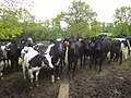 Bullocks, Millhayes - geograph.org.uk - 3491316.jpg 640 × 480; 90 KB
-
 Bungalow near Baggatton Farm - geograph.org.uk - 5595052.jpg 1,024 × 768; 333 KB
-
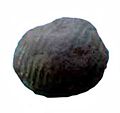 BUTTON (FindID 384024).jpg 178 × 167; 28 KB
-
 Can I help you^ - geograph.org.uk - 5713670.jpg 1,024 × 799; 305 KB
-
 Cattle grid by Stockland Hill - geograph.org.uk - 2991850.jpg 640 × 360; 75 KB
-
 Cattle grid, near Barn-Park Farm - geograph.org.uk - 1272336.jpg 640 × 480; 100 KB
-

-
 Channel to Channel (115) - geograph.org.uk - 4175017.jpg 800 × 600; 249 KB
-
 Channel to Channel (116) - geograph.org.uk - 4175023.jpg 800 × 600; 238 KB
-
 Channel to Channel (128) - geograph.org.uk - 4175922.jpg 800 × 600; 117 KB
-
 Churchstyle Farm and Aller Farm, Stockland - geograph.org.uk - 5007561.jpg 3,456 × 2,304; 3.05 MB
-
 Clearance in the Woods - geograph.org.uk - 4712837.jpg 640 × 428; 112 KB
-
 Clouds, above Sndwell Farm - geograph.org.uk - 1272327.jpg 640 × 480; 69 KB
-
 Cokers Elm Cross - geograph.org.uk - 5348465.jpg 1,024 × 807; 188 KB
-
 Corner of field by Post Lane - geograph.org.uk - 2991767.jpg 640 × 439; 95 KB
-
 Corry Brook - geograph.org.uk - 3487279.jpg 480 × 640; 124 KB
-
 Corry Brook above Millhayes - geograph.org.uk - 3492596.jpg 640 × 400; 75 KB
-
 Corry Brook above Millhayes - geograph.org.uk - 3492696.jpg 640 × 480; 91 KB
-
 Corry Brook valley - geograph.org.uk - 3257829.jpg 554 × 640; 109 KB
-
 Corry Brook valley - geograph.org.uk - 3492684.jpg 640 × 416; 70 KB
-
 Cotleigh Bridge - geograph.org.uk - 3251718.jpg 800 × 600; 152 KB
-
 Cottage near Millhayes - geograph.org.uk - 3491306.jpg 491 × 640; 86 KB
-
 Cottage, on Blackhayes Lane - geograph.org.uk - 1272476.jpg 640 × 480; 114 KB
-
 Country Lane - geograph.org.uk - 4693473.jpg 640 × 428; 101 KB
-
 Country Lane near Hillgrounds - geograph.org.uk - 4685678.jpg 640 × 428; 123 KB
-
 Crandons Cross - geograph.org.uk - 5348491.jpg 1,024 × 718; 116 KB
-
 Cut grass by Post Lane - geograph.org.uk - 2991780.jpg 640 × 381; 72 KB
-
 Dalwood, towards Cotleigh - geograph.org.uk - 226378.jpg 640 × 427; 245 KB
-
 Dalwood, track to Court Place Farm - geograph.org.uk - 226377.jpg 640 × 427; 255 KB
-
 Damaged Road Sign at Ford - geograph.org.uk - 4621104.jpg 640 × 481; 171 KB
-
 Dandelions, at Post Farm - geograph.org.uk - 1272312.jpg 640 × 480; 139 KB
-
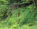 Deer, Horner Hill - geograph.org.uk - 3487559.jpg 640 × 505; 158 KB
-
 Dencroft Lane - geograph.org.uk - 3490149.jpg 480 × 640; 84 KB
-
 Dencroft Lane - geograph.org.uk - 3490650.jpg 480 × 640; 110 KB
-
 Dencroft Lane - geograph.org.uk - 3490674.jpg 511 × 640; 69 KB
-
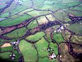 Devon fieldscape - geograph.org.uk - 4309525.jpg 3,264 × 2,448; 4.62 MB
-
 Ditch by Post Lane - geograph.org.uk - 2991799.jpg 565 × 640; 131 KB
-
 Ditch, on the side of Old Chard Road - geograph.org.uk - 1273849.jpg 640 × 480; 91 KB
-
 East Devon , Stockland Hill transmitting station - geograph.org.uk - 5527856.jpg 3,796 × 5,695; 6.56 MB
-
 East Devon , Stockland Hill transmitting station - geograph.org.uk - 5527857.jpg 5,853 × 3,901; 7.56 MB
-
 East Horner Lane - geograph.org.uk - 5007640.jpg 3,456 × 2,304; 7.67 MB
-
 East Horner Lane - geograph.org.uk - 5007645.jpg 2,304 × 3,456; 3.54 MB
-
 East Horner Lane - geograph.org.uk - 5007649.jpg 2,304 × 3,456; 4.49 MB
-
 Electricity power lines near Lower Corry - geograph.org.uk - 5595245.jpg 1,024 × 817; 170 KB
-
 Entering Stockland - geograph.org.uk - 3493460.jpg 640 × 480; 97 KB
-
 Entrance to Trimshayes Farm - geograph.org.uk - 3469560.jpg 640 × 480; 79 KB
-
 Entrance to Wilmington Hayes - geograph.org.uk - 4610498.jpg 640 × 428; 114 KB
-
 Entrance, Broadhayes House - geograph.org.uk - 5404275.jpg 1,024 × 790; 245 KB
-
 Farm Buildings South Mill - geograph.org.uk - 4620831.jpg 640 × 428; 114 KB
-
 Farm House Renovation, South Mill - geograph.org.uk - 4620823.jpg 640 × 505; 99 KB
-
 Farm lane to Lillington Farm - geograph.org.uk - 2991837.jpg 640 × 409; 50 KB
-
 Farm Name Sign on North Hill Lane - geograph.org.uk - 4622295.jpg 640 × 428; 137 KB
-
 Farm track near Cokers Ash - geograph.org.uk - 5348484.jpg 1,024 × 768; 274 KB
-
 Farm Track near Stockland - geograph.org.uk - 4693418.jpg 428 × 640; 147 KB
-
 Farmland around Ashlands - geograph.org.uk - 3469120.jpg 640 × 484; 72 KB
-
 Farmland in the Axe Valley - geograph.org.uk - 5620593.jpg 1,024 × 768; 329 KB
-
 Farmland west of Stockland - geograph.org.uk - 3493316.jpg 640 × 387; 73 KB
-
 Farmland, Ham - geograph.org.uk - 3486418.jpg 640 × 436; 72 KB
-
 Field and pylons on Horner Hill - geograph.org.uk - 3257880.jpg 640 × 480; 70 KB
-
 Field at Ford - geograph.org.uk - 3490867.jpg 640 × 461; 76 KB
-
 Field at Hornshayes Knap Cross - geograph.org.uk - 3492918.jpg 640 × 473; 82 KB
-
 Field at Lillington Farm - geograph.org.uk - 2991880.jpg 640 × 426; 82 KB
-
 Field below Horner Hill - geograph.org.uk - 3487533.jpg 640 × 424; 55 KB
-
 Field below Horner Hill - geograph.org.uk - 3487547.jpg 640 × 432; 67 KB
-
 Field boundary by Post Lane - geograph.org.uk - 2991741.jpg 640 × 391; 95 KB
-
 Field boundary, Horner Hill - geograph.org.uk - 3487943.jpg 640 × 451; 84 KB
-
 Field by Beacon Hill Lane - geograph.org.uk - 3489429.jpg 640 × 432; 78 KB
-
 Field by Hayne Lane - geograph.org.uk - 3484623.jpg 480 × 640; 127 KB
-
 Field by Jeremy's Wood - geograph.org.uk - 3485276.jpg 507 × 640; 96 KB
-
 Field by Lye Lane - geograph.org.uk - 3469529.jpg 640 × 480; 73 KB
-
 Field by Post Lane - geograph.org.uk - 2991681.jpg 640 × 422; 45 KB
-
 Field by the Corry Brook - geograph.org.uk - 3256324.jpg 640 × 426; 65 KB
-
 Field by the Corry Brook - geograph.org.uk - 3257843.jpg 640 × 455; 85 KB
-
 Field by the Corry Brook - geograph.org.uk - 3490827.jpg 640 × 415; 62 KB
-
 Field entrance and gate, Shore Head - geograph.org.uk - 3491042.jpg 640 × 436; 73 KB
-
 Field near Crandons Cross - geograph.org.uk - 4693477.jpg 640 × 428; 99 KB
-
 Field near Heathstock - geograph.org.uk - 3490340.jpg 640 × 480; 103 KB
-
 Field Near Prophet's Down - geograph.org.uk - 4623593.jpg 640 × 428; 109 KB
-
 Field on Horner Hill - geograph.org.uk - 3487551.jpg 640 × 480; 103 KB
-
 Field on Stockland Hill - geograph.org.uk - 2991922.jpg 640 × 441; 71 KB
-
 Field patterns below Heathstock - geograph.org.uk - 5010872.jpg 3,456 × 2,304; 2.45 MB
-
 Fields at Barn Park Farm - geograph.org.uk - 4606839.jpg 640 × 487; 69 KB
-
 Fields at Goren Farm - geograph.org.uk - 4620866.jpg 640 × 428; 90 KB
-
 Fields at Hornshayes Knap Cross - geograph.org.uk - 4622260.jpg 640 × 428; 103 KB
-
 Fields at Lower Corry - geograph.org.uk - 4617545.jpg 640 × 428; 95 KB
-
 Fields below Rower Hill - geograph.org.uk - 4979278.jpg 3,456 × 2,304; 3.51 MB
-
 Fields in the Corry Brook valley - geograph.org.uk - 3491527.jpg 640 × 480; 98 KB
-
 Fields near Hill Grounds - geograph.org.uk - 3469243.jpg 640 × 444; 93 KB
-
 Fields near Hillgrounds - geograph.org.uk - 4623632.jpg 640 × 428; 82 KB
-
 Fields near Rakehill Farm - geograph.org.uk - 4693470.jpg 640 × 428; 91 KB
-
 Fields on Groundhead Road - geograph.org.uk - 4621117.jpg 640 × 428; 112 KB
-
 Foot bridge over the River Yarty - geograph.org.uk - 5007567.jpg 3,456 × 2,304; 4.82 MB
-
 Footbridge over the Yarty - geograph.org.uk - 3493702.jpg 640 × 463; 124 KB
-
 Footpath at Cuckold's Pit - geograph.org.uk - 5578304.jpg 3,456 × 2,304; 1.15 MB
-
 Footpath by Marsh Lane - geograph.org.uk - 3493646.jpg 640 × 480; 97 KB
-
 Footpath near Lillington Farm - geograph.org.uk - 4607217.jpg 640 × 428; 121 KB
-
 Ford at Membury - geograph.org.uk - 4186797.jpg 3,872 × 2,592; 4.64 MB
-
 Ford at Millhayes - geograph.org.uk - 5420946.jpg 3,000 × 2,000; 6.81 MB
-
 Former chapel, Millhayes - geograph.org.uk - 3491358.jpg 640 × 466; 85 KB
-

-
 Gate above the Corry Brook - geograph.org.uk - 3492713.jpg 640 × 480; 99 KB
-
 Gateway below Horner Hill - geograph.org.uk - 5595036.jpg 1,024 × 804; 266 KB
-
 Gateway by Marsh Lane - geograph.org.uk - 3493690.jpg 640 × 486; 102 KB
-
 Golden Square at Shortmoor - geograph.org.uk - 4309519.jpg 3,264 × 2,448; 4.48 MB
-
 Groundhead Lane - geograph.org.uk - 4622267.jpg 640 × 428; 107 KB
-
 Groundhead Road - geograph.org.uk - 3492812.jpg 512 × 640; 83 KB
-
 Groundhead Road - geograph.org.uk - 3492907.jpg 640 × 505; 89 KB
-
 Groundhead Road - geograph.org.uk - 4621133.jpg 640 × 428; 133 KB
-
 Ham from Horner Hill - geograph.org.uk - 5578302.jpg 3,456 × 2,304; 539 KB
-
 Hayne Lane - geograph.org.uk - 3484370.jpg 493 × 640; 126 KB
-
 Hayne Lane - geograph.org.uk - 3484375.jpg 480 × 640; 139 KB
-
 Hayne Lane - geograph.org.uk - 3484637.jpg 480 × 640; 130 KB
-
 Hayne Lane - geograph.org.uk - 3485790.jpg 480 × 640; 126 KB
-
 Hayne Lane - geograph.org.uk - 3485815.jpg 480 × 640; 134 KB
-
 Hayne Lane - geograph.org.uk - 4712829.jpg 640 × 428; 89 KB
-
 Hayne Lane and the valley of the Umborne - geograph.org.uk - 3251983.jpg 767 × 1,024; 595 KB
-
 Hayne Lane railway bridge - geograph.org.uk - 3251988.jpg 1,024 × 769; 704 KB
-
 Heathstock - geograph.org.uk - 3490039.jpg 463 × 640; 73 KB
-
 Heathstock Farm - geograph.org.uk - 5010867.jpg 3,456 × 2,304; 2.23 MB
-
 Heathstock Farm - geograph.org.uk - 5594515.jpg 1,024 × 768; 195 KB
-
 Higher Longbridge - geograph.org.uk - 5594497.jpg 1,024 × 835; 264 KB
-
 Hillside meadow, Horner Hill - geograph.org.uk - 3257809.jpg 509 × 640; 108 KB
-
 Hooper's Cottage - geograph.org.uk - 5713691.jpg 1,024 × 794; 272 KB
-
 Hornshayes Knap Cross - geograph.org.uk - 3492915.jpg 500 × 640; 106 KB
-
 House at Lower Corry - geograph.org.uk - 5595244.jpg 1,024 × 769; 175 KB
-
 House next to Greasehayes Farm - geograph.org.uk - 4692714.jpg 640 × 428; 96 KB
-
 House, Millhayes - geograph.org.uk - 3491464.jpg 497 × 640; 116 KB
-
 House, Millhayes - geograph.org.uk - 3491475.jpg 502 × 640; 88 KB
-
 Houses at Broadhayes - geograph.org.uk - 5404296.jpg 1,024 × 768; 213 KB
-
 Jeremy's Wood - geograph.org.uk - 4490259.jpg 800 × 600; 318 KB
-
 Junction near V Lot - geograph.org.uk - 3258601.jpg 480 × 640; 120 KB
-
 Junction on Stockland Hill - geograph.org.uk - 3469233.jpg 640 × 480; 68 KB
-
 Junction with Whites Lane - geograph.org.uk - 3493387.jpg 640 × 480; 86 KB
-
 Junction, Lower Ridge - geograph.org.uk - 3485959.jpg 480 × 640; 117 KB
-
 Junction, Lower Ridge - geograph.org.uk - 3485969.jpg 480 × 640; 130 KB
-
 Lane along the Yarty valley - geograph.org.uk - 3525094.jpg 481 × 640; 83 KB
-
 Lane at Ford - geograph.org.uk - 3490700.jpg 480 × 640; 109 KB
-
 Lane at Ford - geograph.org.uk - 3490731.jpg 640 × 523; 121 KB
-
 Lane at Ford - geograph.org.uk - 3490798.jpg 498 × 640; 111 KB
-
 Lane from Shore Head - geograph.org.uk - 3490978.jpg 640 × 480; 86 KB
-
 Lane Junction Near Cuckford farm - geograph.org.uk - 4695525.jpg 640 × 428; 128 KB
-
 Lane junction, Ford - geograph.org.uk - 3490716.jpg 540 × 640; 86 KB
-
 Lane junction, Millhayes - geograph.org.uk - 3491382.jpg 484 × 640; 99 KB
-
 Lane near Rull Farm - geograph.org.uk - 3490927.jpg 640 × 421; 55 KB
-
 Lane near The Rising Sun - geograph.org.uk - 4362940.jpg 1,920 × 1,440; 665 KB
-
 Lane north of Ham - geograph.org.uk - 3486534.jpg 502 × 640; 104 KB
-
 Lane north of Ham - geograph.org.uk - 3486555.jpg 480 × 640; 118 KB
-
 Lane over Corry Brook - geograph.org.uk - 3486669.jpg 640 × 465; 103 KB
-
 Lane to Boniford Cross - geograph.org.uk - 3486643.jpg 521 × 640; 149 KB
-
 Lane to Ford - geograph.org.uk - 3490892.jpg 511 × 640; 69 KB
-
 Lane to Ham - geograph.org.uk - 3485977.jpg 480 × 640; 138 KB
-
 Lane to Heathstock - geograph.org.uk - 3487301.jpg 480 × 640; 123 KB
-
 Lane to Heathstock - geograph.org.uk - 3487314.jpg 480 × 640; 124 KB
-
 Lane to Hornshayes Bridge - geograph.org.uk - 3492922.jpg 640 × 480; 84 KB
-
 Lane to Long Bridge - geograph.org.uk - 3469543.jpg 511 × 640; 76 KB
-
 Lane to Shore Head - geograph.org.uk - 3490965.jpg 640 × 450; 69 KB
-
 Lane to South Mill Farm - geograph.org.uk - 3486560.jpg 491 × 640; 135 KB
-
 Lane to the Corry Brook - geograph.org.uk - 3469367.jpg 640 × 480; 118 KB
-
 Lark Rise - geograph.org.uk - 3493407.jpg 640 × 480; 78 KB


.jpg)

.jpg)


.jpg)


.jpg)


_-_geograph.org.uk_-_4606818.jpg)
_-_geograph.org.uk_-_4175017.jpg)
_-_geograph.org.uk_-_4175023.jpg)
_-_geograph.org.uk_-_4175922.jpg)


