Category:Stixwould and Woodhall
Jump to navigation
Jump to search
civil parish in Lincolnshire, UK  | |||||
| Upload media | |||||
| Instance of | |||||
|---|---|---|---|---|---|
| Location | East Lindsey, Lincolnshire, East Midlands, England | ||||
| Area |
| ||||
 | |||||
Subcategories
This category has the following 5 subcategories, out of 5 total.
A
G
O
S
Media in category "Stixwould and Woodhall"
The following 153 files are in this category, out of 153 total.
-
 "...but I go on for ever" - geograph.org.uk - 3006465.jpg 480 × 640; 83 KB
-
 "Daisies" by the Water Rail Way - geograph.org.uk - 3006476.jpg 640 × 480; 126 KB
-
 "For men may come and men may go..." - geograph.org.uk - 3006464.jpg 480 × 640; 85 KB
-

-
 A Quiet Lane - geograph.org.uk - 2439514.jpg 3,264 × 2,448; 4.65 MB
-
 Along the Water Rail Way - geograph.org.uk - 2519754.jpg 1,600 × 1,200; 666 KB
-
 Approaching Old Woodhall from the south - geograph.org.uk - 5872701.jpg 3,648 × 2,736; 2.31 MB
-
 Bend ahead - geograph.org.uk - 5514301.jpg 1,024 × 651; 131 KB
-
 Bend in Unnamed road - geograph.org.uk - 3534526.jpg 2,256 × 1,504; 2.33 MB
-
 Black Horse Drain Pumping Station - geograph.org.uk - 2519738.jpg 1,024 × 768; 137 KB
-
 Boston rowing marathon-Stixwold-Geograph-978158-by-Richard-Croft.jpg 640 × 427; 59 KB
-
 Carving on the Spa Trail - geograph.org.uk - 3180576.jpg 480 × 640; 138 KB
-
 Catchwater Drain - geograph.org.uk - 2413193.jpg 640 × 480; 93 KB
-
 Catchwater Drain - geograph.org.uk - 2413978.jpg 640 × 480; 116 KB
-
 Catchwater Drain - geograph.org.uk - 4595996.jpg 3,776 × 2,520; 4.26 MB
-
 Catchwater Drain - geograph.org.uk - 4778336.jpg 1,500 × 2,000; 579 KB
-
 Church of St Peter in Stixwould - geograph.org.uk - 5996020.jpg 1,200 × 1,600; 840 KB
-
 Churchyard, St Peter, Stixwould - geograph.org.uk - 5996024.jpg 1,600 × 1,200; 1.09 MB
-

-

-
 Cut Mark, Stixwould, Station Road - geograph.org.uk - 5746206.jpg 960 × 1,280; 652 KB
-
 Cut Mark, Stixwould, Station Road, Red Bridge - geograph.org.uk - 5746902.jpg 1,280 × 960; 528 KB
-
-
-

-
 Cyclist on the Water Rail Way - geograph.org.uk - 3006466.jpg 640 × 480; 88 KB
-
 Cyclist on the Water Rail Way - geograph.org.uk - 3006482.jpg 640 × 480; 164 KB
-
 Daisies by Mick Burns - geograph.org.uk - 2441566.jpg 3,264 × 2,448; 1.8 MB
-
 Derelict farm buildings at Old Woodhall - geograph.org.uk - 4305905.jpg 1,024 × 682; 325 KB
-
-

-
-
 Duckpool Bridge, Stixwould - geograph.org.uk - 5544081.jpg 640 × 427; 85 KB
-
 Duckpool Bridge, Stixwould - geograph.org.uk - 5544150.jpg 640 × 427; 60 KB
-
 Duckpool Lane - geograph.org.uk - 3636543.jpg 2,256 × 1,504; 2.63 MB
-
 Duckpool Lane on Duckpool Bridge - geograph.org.uk - 4778317.jpg 2,000 × 1,500; 984 KB
-
 Duckpool Lane, Stixwould - geograph.org.uk - 2239249.jpg 800 × 600; 313 KB
-
 Edlington Moor (road) near Woodhall Spa - geograph.org.uk - 2239277.jpg 800 × 600; 344 KB
-
 Engine Drain - geograph.org.uk - 2433964.jpg 640 × 480; 160 KB
-
 Entering Old Woodhall on an unnamed lane - geograph.org.uk - 3628655.jpg 2,256 × 1,504; 2.79 MB
-
 Entering Stixwould, Lincolnshire - geograph.org.uk - 2239235.jpg 800 × 600; 246 KB
-
 Entering Woodhall Spa, Lincolnshire - geograph.org.uk - 2239304.jpg 800 × 600; 292 KB
-
 Entrance to Glebe farm - geograph.org.uk - 5514302.jpg 1,024 × 594; 117 KB
-
 Entrance to Stixwould Wood - geograph.org.uk - 2652077.jpg 1,280 × 960; 485 KB
-
 Farm Building - geograph.org.uk - 1004899.jpg 640 × 480; 122 KB
-
 Farm buildings on Bergamoor - geograph.org.uk - 4778349.jpg 2,000 × 1,500; 1.1 MB
-
 Farmland near Old Woodhall - geograph.org.uk - 5514294.jpg 1,024 × 702; 122 KB
-
 Farmland near Reeds Beck - geograph.org.uk - 3593877.jpg 640 × 480; 56 KB
-
 Fern Seat, Spa Trail - geograph.org.uk - 3180584.jpg 480 × 640; 100 KB
-
 Field and Farm machinery, near Edlington Scrubbs - geograph.org.uk - 2654555.jpg 1,280 × 960; 367 KB
-
 Footpath at Woodhall Spa - geograph.org.uk - 937522.jpg 640 × 480; 101 KB
-
 Footpath Bridge - geograph.org.uk - 2439500.jpg 3,264 × 2,448; 4.83 MB
-
 Footpath Stile - geograph.org.uk - 5872697.jpg 3,648 × 2,736; 3.65 MB
-
 Footpath to High Ridge Farm - geograph.org.uk - 3263200.jpg 2,256 × 1,504; 1.81 MB
-
 Footpath to Stixwould Wood - geograph.org.uk - 3963913.jpg 1,024 × 683; 387 KB
-
 Green Lane - geograph.org.uk - 3965961.jpg 1,024 × 683; 254 KB
-
 Green Lane barn - geograph.org.uk - 2412887.jpg 640 × 480; 132 KB
-

-
-
 Highall Farm - geograph.org.uk - 3593953.jpg 640 × 472; 55 KB
-

-
 Lane heading south - geograph.org.uk - 3593880.jpg 640 × 480; 71 KB
-
 Lane heading towards Reeds Beck - geograph.org.uk - 3593874.jpg 640 × 480; 66 KB
-
 Lincoln Longwool Sheep - geograph.org.uk - 3006474.jpg 640 × 480; 180 KB
-
 Lincoln Longwool Sheep by Sally Matthews - geograph.org.uk - 2441599.jpg 3,264 × 2,448; 4.94 MB
-

-

-
 Looking across the Witham to Black Horse Farm - geograph.org.uk - 4598819.jpg 3,776 × 2,520; 4.13 MB
-
 Looking towards Stixwould Road - geograph.org.uk - 5305249.jpg 5,312 × 2,988; 7.31 MB
-
 Main Road, Stixwould - geograph.org.uk - 5544066.jpg 640 × 427; 89 KB
-
 Main Road, Stixwould - geograph.org.uk - 5544087.jpg 640 × 427; 91 KB
-
 Minor road through old Woodhall - geograph.org.uk - 4363304.jpg 640 × 427; 49 KB
-
 Monk's Drain - geograph.org.uk - 3963890.jpg 1,024 × 683; 408 KB
-
 Monkey Puzzle Tree on Sandy Lane - geograph.org.uk - 3264212.jpg 2,256 × 1,504; 768 KB
-
 Moor Lane - geograph.org.uk - 3963902.jpg 1,024 × 683; 235 KB
-
 Moorside Farm - geograph.org.uk - 2412166.jpg 640 × 480; 65 KB
-
 Moorside Farm Cottage - geograph.org.uk - 2412169.jpg 640 × 480; 85 KB
-
 Moorside Farm cottage - geograph.org.uk - 4306868.jpg 1,024 × 682; 211 KB
-
 Newstead Farm - geograph.org.uk - 2412941.jpg 640 × 480; 113 KB
-
 Newstead House - geograph.org.uk - 2412936.jpg 640 × 480; 130 KB
-
 Oilseed rape - geograph.org.uk - 3965950.jpg 1,024 × 683; 316 KB
-
 Old Woodhall - geograph.org.uk - 4306844.jpg 1,024 × 683; 350 KB
-
-
 On the edge of Low Dar Wood just before sunset - geograph.org.uk - 5872707.jpg 3,648 × 2,736; 7.13 MB
-
 On the Viking Way passing Bergamoor - geograph.org.uk - 2664751.jpg 4,000 × 3,000; 2.88 MB
-
 Ordnance Survey Cut Mark - geograph.org.uk - 3057825.jpg 3,264 × 2,448; 2.69 MB
-
 Ordnance Survey Cut Mark - geograph.org.uk - 3057835.jpg 3,264 × 2,448; 2.62 MB
-
 Ordnance Survey Rivet with Cut Mark - geograph.org.uk - 3057820.jpg 3,264 × 2,448; 2.44 MB
-

-
 Pasture by Main Road, Stixwould - geograph.org.uk - 5544068.jpg 640 × 427; 111 KB
-
 Petwood Hotel, Woodhall Spa, aerial 2018 - geograph.org.uk - 5931631.jpg 800 × 533; 133 KB
-

-
 Ploughed Fields near Old Woodhall - geograph.org.uk - 3263204.jpg 2,256 × 1,504; 1.23 MB
-
 Public Footpath entrance - geograph.org.uk - 3628796.jpg 1,504 × 2,256; 2.96 MB
-
-
 Pumping Station at Black Horse Drain - geograph.org.uk - 771599.jpg 640 × 480; 81 KB
-
 RAFWARMA - winter walk 2008 - geograph.org.uk - 1004934.jpg 640 × 480; 118 KB
-
 Red Bridge - geograph.org.uk - 2413168.jpg 640 × 480; 131 KB
-
 Reed's Beck - geograph.org.uk - 2412921.jpg 640 × 480; 100 KB
-
 Reed's Beck - geograph.org.uk - 2413172.jpg 640 × 480; 109 KB
-
 Reed's Beck dredging - geograph.org.uk - 2412950.jpg 640 × 480; 90 KB
-
 Reeds Beck - geograph.org.uk - 1004908.jpg 640 × 480; 77 KB
-
 Reeds Beck Farm - geograph.org.uk - 5746652.jpg 1,600 × 1,200; 688 KB
-
 Reeds Beck road junction - geograph.org.uk - 5514304.jpg 1,024 × 594; 109 KB
-
 River Pillar by Nigel Sardeson - geograph.org.uk - 2449649.jpg 3,264 × 2,448; 5.57 MB
-
 River Pillar on the Water Rail Way - geograph.org.uk - 3006468.jpg 480 × 640; 87 KB
-
 River View - geograph.org.uk - 2441895.jpg 3,264 × 2,448; 1.35 MB
-
 River Witham - geograph.org.uk - 2649420.jpg 640 × 480; 105 KB
-

-

-
-
 Rivet, Stixwould, Reeds Beck Bridge - geograph.org.uk - 5746232.jpg 1,280 × 960; 583 KB
-
 Road to Hall Farm at Old Woodhall - geograph.org.uk - 3628675.jpg 1,965 × 1,292; 2.75 MB
-
 Road to Highall Farm - geograph.org.uk - 5746661.jpg 1,600 × 1,200; 406 KB
-

-
 Silage making at Holmes Farm - geograph.org.uk - 3006469.jpg 640 × 480; 99 KB
-
 Silage making at Holmes Farm - geograph.org.uk - 3006470.jpg 640 × 480; 90 KB
-
 Silage making at Holmes Farm - geograph.org.uk - 3006471.jpg 640 × 480; 91 KB
-
 Site of Stixwould Abbey, aerial 2018 - geograph.org.uk - 5931629.jpg 640 × 427; 60 KB
-

-
 Southern entrance to the Spa Trail - geograph.org.uk - 3190324.jpg 640 × 480; 136 KB
-
 Spa Trail - geograph.org.uk - 1906053.jpg 640 × 426; 108 KB
-
 Spa Trail - geograph.org.uk - 2617018.jpg 640 × 480; 111 KB
-
 Spa trail sculpture and Highall Woods - geograph.org.uk - 1960239.jpg 2,736 × 3,648; 5.84 MB
-
 Station Road - geograph.org.uk - 3965943.jpg 1,024 × 683; 335 KB
-
 Stixwould Grange, aerial (2) - geograph.org.uk - 5839654.jpg 533 × 800; 94 KB
-
 Stixwould Road - geograph.org.uk - 2412879.jpg 640 × 480; 158 KB
-
 Stixwould Wood - geograph.org.uk - 3963853.jpg 1,024 × 683; 380 KB
-
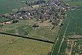 Stixwould, aerial 2019 - geograph.org.uk - 6134011.jpg 800 × 533; 96 KB
-
 Stixwould, Station Road, Red Bridge - geograph.org.uk - 5746907.jpg 1,280 × 960; 266 KB
-
 Straight ahead on minor road - geograph.org.uk - 5514299.jpg 1,024 × 670; 232 KB
-

-
 Summer sunday near Old Woodhall - geograph.org.uk - 5514295.jpg 1,024 × 706; 166 KB
-
 The River Witham and Brooks Farm - geograph.org.uk - 6233331.jpg 1,024 × 769; 196 KB
-

-

-
 The Spa Trail - geograph.org.uk - 3190329.jpg 640 × 480; 132 KB
-
 The Spa Trail - geograph.org.uk - 4779848.jpg 1,600 × 1,200; 842 KB
-
 The Viking Way crossing Reeds Beck - geograph.org.uk - 2664761.jpg 4,000 × 3,000; 2.86 MB
-
 The Viking Way on Stixwould Road - geograph.org.uk - 2664783.jpg 4,000 × 3,000; 2.92 MB
-
 The Water Rail Way - geograph.org.uk - 6233321.jpg 1,024 × 768; 258 KB
-
 The Water Rail Way near Woodhall Spa - geograph.org.uk - 5398827.jpg 1,280 × 853; 362 KB
-
 Track to Newstead Farm - geograph.org.uk - 3533518.jpg 2,256 × 1,504; 2.22 MB
-
 Traffic jam on the Water Rail Way - geograph.org.uk - 3006473.jpg 640 × 480; 104 KB
-

-

-
 Viking Way along edge of Long Wood - geograph.org.uk - 2664724.jpg 4,000 × 3,000; 2.96 MB
-
 Viking Waymark - geograph.org.uk - 1906062.jpg 426 × 640; 89 KB
-
 Water Rail Way - geograph.org.uk - 2413207.jpg 640 × 480; 104 KB
-
 Water Rail Way - geograph.org.uk - 2433995.jpg 640 × 480; 156 KB
-
 Water Rail Way - geograph.org.uk - 3455519.jpg 640 × 427; 117 KB
-
 Water Rail Way sculpture - geograph.org.uk - 2413212.jpg 480 × 640; 75 KB
-


_south_of_Old_Woodhall_-_geograph.org.uk_-_4363286.jpg)
_-_geograph.org.uk_-_5931626.jpg)


_near_Woodhall_Spa_-_geograph.org.uk_-_2239277.jpg)


_-_geograph.org.uk_-_5839654.jpg)


_-_geograph.org.uk_-_3891570.jpg)
_-_geograph.org.uk_-_3891579.jpg)