Category:Steyrtalradweg
Jump to navigation
Jump to search
Deutsch: Der Steyrtalradweg in Oberösterreich ist 23,7 km lang und überwindet 150 Höhenmeter. Er verläuft auf einem stillgelegten Teilstück der Steyrtalbahn von Untergrünburg bis Klaus an der Pyhrnbahn.
| Upload media | |||||
| Instance of | |||||
|---|---|---|---|---|---|
| Location |
| ||||
| official website | |||||
| |||||
Subcategories
This category has the following 2 subcategories, out of 2 total.
P
- Plangrabenbrücke (2 F)
T
- Tiefengrabenbrücke (5 F)
Media in category "Steyrtalradweg"
The following 20 files are in this category, out of 20 total.
-
 Aussichtsplattform am Steyrtalradweg 1.jpg 7,020 × 4,680; 37.45 MB
-
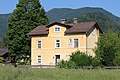 Ehemaliger Mollner Bahnhof.jpg 3,888 × 2,592; 9.92 MB
-
 Grosser Landsberg in Gruenburg 1.jpg 3,891 × 2,346; 6.15 MB
-
 Klaus ad Pyhrnbahn Steyrflussbrücken-5733.jpg 6,048 × 4,024; 25.29 MB
-
 Klaus ad Pyhrnbahn Steyrflussbrücken-5740-2.jpg 6,048 × 4,024; 17.89 MB
-
 Klaus ad Pyhrnbahn Steyrflussbrücken-5742.jpg 6,048 × 4,024; 15.94 MB
-
 Kremstalradweg Ende (Schild).jpg 2,522 × 3,842; 4.29 MB
-
 Kremstalradweg Ende.jpg 3,888 × 2,592; 10.23 MB
-
 Schilder am Steyrtalradweg 1.tif 2,592 × 3,888; 13.09 MB
-
 Schloss Leonstein (Oberösterreich).jpg 3,888 × 2,592; 2.61 MB
-
 Steinwaend in Micheldorf in Oberoesterreich 1.jpg 3,888 × 2,592; 8.37 MB
-
 Steinwänd (Micheldorf in Oberösterreich).png 3,888 × 2,592; 17 MB
-
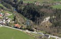
 Steyrschlucht in Leonstein 2.jpg 3,785 × 2,433; 11.08 MB
-
 Steyrschlucht in Leonstein und Molln 1.tif 3,785 × 2,433; 16.99 MB
-
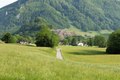
 Steyrtalradweg in der Leonsteiner Au 1 II.jpg 3,888 × 2,592; 13.81 MB
-
 Steyrtalradweg in der Leonsteiner Au 1.tif 3,888 × 2,592; 19.44 MB
-
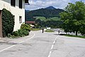
 Steyrtalradweg in Leonstein 1.jpg 3,888 × 2,592; 9.39 MB
-
 Steyrtalradweg in Steyrdurchbruch 1.tif 3,888 × 2,592; 17.23 MB
-
 Steyrtalradweg nahe Schloss Leonstein.jpg 3,888 × 2,592; 9.1 MB
-
 Steyrtalstrasse in Leonstein 2.jpg 3,805 × 2,461; 5.98 MB


.jpg)

.jpg)

.png)


