Category:Stewartby
Jump to navigation
Jump to search
village and civil parish in Bedfordshire, UK  | |||||
| Upload media | |||||
| Instance of | |||||
|---|---|---|---|---|---|
| Location | Bedford, Bedfordshire, East of England, England | ||||
| Population |
| ||||
 | |||||
English: Stewartby is a model village and civil parish in Bedfordshire, originally built for the workers of The London Brick Company. It was a later and more modern development than such better-known Victorian model villages as Saltaire.
Subcategories
This category has the following 2 subcategories, out of 2 total.
K
S
- Stewartby railway station (6 F)
Media in category "Stewartby"
The following 96 files are in this category, out of 96 total.
-
 A moat off Manor Road - geograph.org.uk - 3821732.jpg 1,600 × 1,068; 429 KB
-
 A421 bypassing Bedford - geograph.org.uk - 5624268.jpg 640 × 428; 69 KB
-
 A421 eastbound - geograph.org.uk - 4873413.jpg 640 × 480; 36 KB
-
 An old flooded clay pit - geograph.org.uk - 4741116.jpg 640 × 270; 33 KB
-
 Approach to Marsh Leys Junction - geograph.org.uk - 2670326.jpg 640 × 412; 32 KB
-
 Arable land - geograph.org.uk - 4786193.jpg 640 × 426; 39 KB
-
 At Stewartby station on the Marston Vale line - geograph.org.uk - 6218929.jpg 4,608 × 3,456; 3.65 MB
-

-
 Brickworks site - geograph.org.uk - 3595436.jpg 1,600 × 1,068; 350 KB
-
 Bridleway off the old Bedford road - geograph.org.uk - 3595594.jpg 1,600 × 1,068; 399 KB
-
 Bungalows on The Crescent - geograph.org.uk - 3595397.jpg 1,600 × 1,068; 405 KB
-
 Chimney Corner - geograph.org.uk - 4660953.jpg 1,453 × 968; 226 KB
-
 Chimney quartet, Stewartby - geograph.org.uk - 6218925.jpg 4,608 × 3,456; 3.99 MB
-
 Clay pit fishing lake - geograph.org.uk - 3821685.jpg 1,600 × 1,068; 449 KB
-
 Coronation Brickworks, Chimney Corner - geograph.org.uk - 4660998.jpg 1,463 × 977; 260 KB
-

-
 Farmland looking towards Marsh Leys - geograph.org.uk - 3770211.jpg 1,600 × 1,067; 547 KB
-
 Field at Wootton Broadmead - geograph.org.uk - 2714248.jpg 3,264 × 2,448; 2.73 MB
-
 Fields Road to Wootton over Woburn Road - geograph.org.uk - 3770223.jpg 1,600 × 1,070; 536 KB
-
 Flooded clay pits - geograph.org.uk - 4741117.jpg 640 × 351; 41 KB
-
 Footpath across a soggy field - geograph.org.uk - 3821720.jpg 1,600 × 1,068; 600 KB
-
 Footpath by Broadmead Farm - geograph.org.uk - 3821753.jpg 1,600 × 1,068; 665 KB
-
 Footpath by the railway line - geograph.org.uk - 3595404.jpg 1,200 × 1,600; 399 KB
-
 Footpath onto Woburn Road - geograph.org.uk - 3770221.jpg 1,600 × 1,066; 503 KB
-
 Footpath over the field to Kempston Hardwick - geograph.org.uk - 3821750.jpg 1,600 × 1,068; 482 KB
-
 Footpath to Bedford - geograph.org.uk - 3821684.jpg 1,600 × 1,068; 600 KB
-
 Footpath to Kempston Hardwick - geograph.org.uk - 3770226.jpg 1,200 × 1,600; 752 KB
-
 Footpath to Manor Road - geograph.org.uk - 3821728.jpg 1,200 × 1,600; 850 KB
-
 Footpath towards Wootton - geograph.org.uk - 3821726.jpg 1,600 × 1,067; 618 KB
-
 Forders Sidings - geograph.org.uk - 2196127.jpg 640 × 447; 91 KB
-
 Former brickworks at Stewartby - geograph.org.uk - 5440007.jpg 4,608 × 3,456; 4.12 MB
-
 Four industrial chimneys at Stewartby - geograph.org.uk - 5440017.jpg 4,608 × 3,456; 4.46 MB
-
 George V postbox at Stewartby - geograph.org.uk - 3595427.jpg 1,200 × 1,600; 637 KB
-
 Green Lane from Stewartby - geograph.org.uk - 2714001.jpg 3,264 × 2,448; 4.17 MB
-
 Hedgerow towards Kempston Hardwick - geograph.org.uk - 3770213.jpg 1,600 × 1,068; 709 KB
-
 House on Broadmead Road - geograph.org.uk - 2714013.jpg 3,264 × 2,448; 4.25 MB
-
 Level crossing on Broadmead Road - geograph.org.uk - 3821757.jpg 1,600 × 1,069; 539 KB
-
 London Brick Company Social Club - geograph.org.uk - 3595432.jpg 1,600 × 1,073; 357 KB
-
 Marston Vale Trail - geograph.org.uk - 3595407.jpg 1,200 × 1,600; 756 KB
-
 Millbrook Vehicle Proving Ground - geograph.org.uk - 3015916.jpg 3,264 × 2,448; 2.93 MB
-
 New look to Marsh Leys junction - geograph.org.uk - 2670327.jpg 640 × 424; 28 KB
-
 New roundabout on Fields Road - geograph.org.uk - 3770218.jpg 1,600 × 1,068; 299 KB
-
 Now, what could I do with a rented chimney^ - geograph.org.uk - 2714244.jpg 2,448 × 3,264; 3.44 MB
-
 On the Marston Vale Trail passing Stewartby - geograph.org.uk - 6218931.jpg 4,608 × 3,456; 5.42 MB
-
 Railway bridge, Stewartby - geograph.org.uk - 3595402.jpg 1,600 × 1,068; 435 KB
-
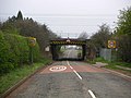 Railway Bridge, Stewartby - geograph.org.uk - 382272.jpg 640 × 480; 133 KB
-
 Sculpture on the Woburn Road roundabout, Kempston - geograph.org.uk - 5427278.jpg 2,014 × 1,490; 892 KB
-

-
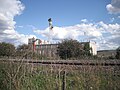
 Stewartby Brick Works - geograph.org.uk - 2115299.jpg 2,592 × 3,872; 2.48 MB
-
 Stewartby brick works - geograph.org.uk - 2144476.jpg 1,024 × 768; 114 KB
-

-
 Stewartby Brickworks - geograph.org.uk - 404079.jpg 640 × 480; 127 KB
-
 Stewartby brickworks - geograph.org.uk - 767165.jpg 640 × 480; 60 KB
-
 Stewartby brickworks - now closed - geograph.org.uk - 767104.jpg 640 × 480; 50 KB
-
 Stewartby chimneys - geograph.org.uk - 767113.jpg 640 × 480; 59 KB
-
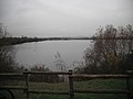
 Stewartby Lake - geograph.org.uk - 569649.jpg 640 × 480; 49 KB
-
 Stewartby Post Office - geograph.org.uk - 3595423.jpg 1,600 × 1,069; 523 KB
-
 Stewartby Post Office - geograph.org.uk - 767123.jpg 640 × 480; 64 KB
-
 Stewartby Post Office-Co-op 1959 - geograph.org.uk - 1095819.jpg 640 × 362; 48 KB
-
 Stewartby railway station on the Marston Vale line - geograph.org.uk - 5440024.jpg 4,608 × 3,456; 3.29 MB
-
 Stewartby Roundabout - geograph.org.uk - 1095716.jpg 574 × 385; 56 KB
-

-
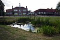 Stewartby School and pond - geograph.org.uk - 3595400.jpg 1,600 × 1,072; 452 KB
-
 Stewartby Station - geograph.org.uk - 3595437.jpg 1,200 × 1,600; 414 KB
-
 Stewartby Station - geograph.org.uk - 6232137.jpg 851 × 1,280; 476 KB
-
 Stewartby Village Centre - geograph.org.uk - 404268.jpg 640 × 480; 138 KB
-
 Stewartby Village Green and Pond - geograph.org.uk - 352301.jpg 640 × 480; 105 KB
-
 Stewartby Village Hall - geograph.org.uk - 767118.jpg 640 × 480; 55 KB
-
 StewartbyIncineratorBeingBuilt.JPG 3,648 × 2,736; 4.88 MB
-
 StewartbyLakeInOctober.JPG 3,648 × 2,736; 4.8 MB
-

-
 Stubble field and Sainsbury's warehouse - geograph.org.uk - 3821697.jpg 1,600 × 1,068; 434 KB
-
 The A421, Kempston - geograph.org.uk - 5309468.jpg 2,012 × 1,486; 696 KB
-
 The A421, Kempston - geograph.org.uk - 5309469.jpg 2,048 × 1,536; 870 KB
-
 The Chimney Corner pub - geograph.org.uk - 4547816.jpg 4,320 × 3,240; 3.02 MB
-
 Vivarail D Train approaching Stewartby - geograph.org.uk - 6227745.jpg 851 × 1,280; 473 KB
-
 Wind turbine on the horizon - geograph.org.uk - 5440028.jpg 4,608 × 3,456; 2.83 MB
-
 Churchill Close, Stewartby - geograph.org.uk - 767128.jpg 640 × 480; 79 KB
-
 Clay pit at Stewartby - geograph.org.uk - 551792.jpg 640 × 480; 58 KB
-

-
 Disused Clay Pit - geograph.org.uk - 37667.jpg 640 × 482; 85 KB
-
 Lake Opposite The Brickworks - geograph.org.uk - 404140.jpg 640 × 480; 176 KB
-
 Lakeside at Forest Vale Country Park - geograph.org.uk - 404114.jpg 640 × 480; 117 KB
-
 Lakeside Signpost - geograph.org.uk - 382285.jpg 640 × 480; 104 KB
-
 Level crossing - geograph.org.uk - 406470.jpg 640 × 480; 110 KB
-
 Level Crossing - geograph.org.uk - 406478.jpg 640 × 480; 87 KB
-
 Level Crossing - geograph.org.uk - 442391.jpg 640 × 427; 79 KB
-
 Modern Sculpture At Industrial Site - geograph.org.uk - 404095.jpg 480 × 611; 90 KB
-
 Pontoon With Sailing Club In The Distance - geograph.org.uk - 404122.jpg 592 × 480; 154 KB
-
 Railway Bridge at Kemspton Hardwick - geograph.org.uk - 430061.jpg 640 × 427; 97 KB
-
 Stewartby lake - geograph.org.uk - 569490.jpg 640 × 480; 52 KB
-
 Stewartby Lake near Bedford - geograph.org.uk - 569489.jpg 480 × 640; 76 KB
-
 Stewartby Watersports Club - geograph.org.uk - 133120.jpg 640 × 457; 79 KB
-

-

-
 This picture is rubbish. - geograph.org.uk - 407426.jpg 640 × 512; 108 KB


