Category:Steventon, Oxfordshire
Jump to navigation
Jump to search
English: Steventon is a village and civil parish in Oxfordshire, England, south of Abingdon and west of Didcot. Until 1974 it was part of Berkshire.
village and civil parish in Vale of White Horse district, England, United Kingdom  | |||||
| Upload media | |||||
| Instance of | |||||
|---|---|---|---|---|---|
| Location | Vale of White Horse, Oxfordshire, South East England, England | ||||
| Population |
| ||||
| Said to be the same as | Steventon (Wikimedia duplicated page, civil parish) | ||||
| official website | |||||
 | |||||
Subcategories
This category has the following 6 subcategories, out of 6 total.
Media in category "Steventon, Oxfordshire"
The following 200 files are in this category, out of 354 total.
(previous page) (next page)-
 A drainage ditch near Steventon - geograph.org.uk - 4642044.jpg 1,500 × 999; 290 KB
-
-
 A Tree Near Steventon - geograph.org.uk - 2700867.jpg 1,600 × 1,225; 794 KB
-
 A34 south of Drayton Park Golf Club - geograph.org.uk - 3284472.jpg 3,648 × 2,432; 1.29 MB
-
 A4130 from the lay by - geograph.org.uk - 2622644.jpg 1,024 × 683; 192 KB
-
 Abingdon Road in Steventon - geograph.org.uk - 1257078.jpg 640 × 427; 125 KB
-
 Abingdon Road where it passes The Green - geograph.org.uk - 2068085.jpg 768 × 1,024; 199 KB
-
 Abingdon Road, Steventon - geograph.org.uk - 6065399.jpg 1,904 × 1,254; 1.17 MB
-
 Across The Green - geograph.org.uk - 2608183.jpg 1,024 × 683; 185 KB
-
 Airstrip - geograph.org.uk - 6004725.jpg 1,024 × 681; 66 KB
-
 Along the stingers - geograph.org.uk - 2621854.jpg 533 × 800; 113 KB
-
 Arable field near Steventon - geograph.org.uk - 4518856.jpg 1,500 × 999; 243 KB
-
 Arable land - geograph.org.uk - 5362682.jpg 640 × 426; 50 KB
-
 Arable landscape - geograph.org.uk - 6616378.jpg 1,024 × 632; 71 KB
-
 B4017 road bridge over Great Western Main Line - geograph.org.uk - 2757937.jpg 1,024 × 683; 149 KB
-
 Barns near 'The Views', Hanney Road - geograph.org.uk - 2757987.jpg 1,024 × 683; 179 KB
-

-
 Benchmark behind the tub - geograph.org.uk - 2617745.jpg 533 × 800; 123 KB
-

-
 Benchmark on building next to Unit 43 - geograph.org.uk - 2760436.jpg 683 × 1,024; 289 KB
-
 Benchmark on Goose Willow Cottage, Hanney Road - geograph.org.uk - 2743681.jpg 683 × 1,024; 264 KB
-
 Benchmark on Rainbow Colour - geograph.org.uk - 2608222.jpg 509 × 800; 178 KB
-
 Benchmark on St Michael ^ All Angels' Church - geograph.org.uk - 5217130.jpg 666 × 1,024; 335 KB
-
 Benchmark on St Michael's School - geograph.org.uk - 5216547.jpg 683 × 1,024; 218 KB
-
 Benchmark on St Michaels School - geograph.org.uk - 2621513.jpg 533 × 800; 159 KB
-
 Benchmark on the Pillar - geograph.org.uk - 2621571.jpg 533 × 800; 209 KB
-

-
 Benchmark on ^160 Hanney Road - geograph.org.uk - 5216483.jpg 678 × 1,024; 220 KB
-
 Benchmark on ^2 High Street ('Rainbow Colours') - geograph.org.uk - 2757884.jpg 683 × 1,024; 273 KB
-
 Benchmark on ^37 Abingdon Road - geograph.org.uk - 3308328.jpg 683 × 1,024; 167 KB
-
 Benchmarked boundary stone beside Steventon Road - geograph.org.uk - 3307768.jpg 683 × 1,024; 266 KB
-
 Bend in path at culverted stream - geograph.org.uk - 5234640.jpg 1,024 × 683; 266 KB
-
 Bridge taking Mill Street over Ginge Brook - geograph.org.uk - 5216802.jpg 1,024 × 683; 263 KB
-
 Bridleway across Cow Common - geograph.org.uk - 3019564.jpg 1,500 × 992; 292 KB
-
 Bridleway at Hill Farm - geograph.org.uk - 3017856.jpg 1,500 × 984; 186 KB
-
 Bridleway near Steventon - geograph.org.uk - 4518898.jpg 1,500 × 999; 151 KB
-
 Bridleway to Steventon - geograph.org.uk - 4518908.jpg 1,500 × 999; 149 KB
-
 Bridleway to the copse - geograph.org.uk - 2621863.jpg 533 × 800; 113 KB
-
 Bridleway to the Wilts and Berks Canal - geograph.org.uk - 3019562.jpg 1,500 × 993; 286 KB
-
 Brook House, Steventon - geograph.org.uk - 5392166.jpg 640 × 360; 103 KB
-
 BSA A65T Steventon left.jpg 3,539 × 2,654; 1.62 MB
-
 BSA A65T Steventon right.jpg 2,685 × 1,790; 1.99 MB
-
 Building 24 at SteventonStorage Facility - geograph.org.uk - 2743446.jpg 1,024 × 683; 121 KB
-
 Building 43 of Steventon Storage Facility - geograph.org.uk - 2744232.jpg 1,024 × 683; 115 KB
-
 Bungalow on High Street Steventon - geograph.org.uk - 6065745.jpg 1,920 × 1,280; 1,001 KB
-
 Burrows in the side - geograph.org.uk - 2621521.jpg 1,024 × 683; 127 KB
-
 Businesses on the High Street - geograph.org.uk - 2608869.jpg 1,024 × 683; 115 KB
-
 Buttercups by the bridleway - geograph.org.uk - 4518901.jpg 1,500 × 932; 138 KB
-
 Byway to Steventon - geograph.org.uk - 2606961.jpg 1,024 × 683; 210 KB
-
 Causeway Crossing in Steventon - geograph.org.uk - 1256417.jpg 640 × 427; 83 KB
-
 Causeway Crossing in Steventon - geograph.org.uk - 1256421.jpg 640 × 427; 110 KB
-
 Causeway Crossing in Steventon - geograph.org.uk - 1256426.jpg 640 × 427; 58 KB
-
 Causeway Crossing in Steventon - geograph.org.uk - 2613295.jpg 1,024 × 683; 166 KB
-
 Causeway level crossing - geograph.org.uk - 1537446.jpg 640 × 427; 76 KB
-
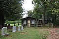 Church hall near the gate - geograph.org.uk - 2608892.jpg 1,024 × 683; 249 KB
-
 Club on The Green - geograph.org.uk - 2607220.jpg 1,024 × 683; 222 KB
-
 Cobbled path on the causeway - geograph.org.uk - 2613305.jpg 533 × 800; 184 KB
-
 Collapsed culvert beside footpath to Wood's Farm - geograph.org.uk - 5217139.jpg 1,024 × 683; 369 KB
-
 Cottages near the crossing - geograph.org.uk - 2613246.jpg 1,024 × 688; 197 KB
-
 Crop and Poles - geograph.org.uk - 2090809.jpg 3,648 × 2,736; 3.05 MB
-
 Date stone under the window - geograph.org.uk - 2617697.jpg 533 × 800; 123 KB
-
 Digging Up the Green - geograph.org.uk - 2661703.jpg 3,412 × 2,360; 1.62 MB
-
 Door to the reservoir - geograph.org.uk - 2621519.jpg 1,024 × 683; 147 KB
-
 East Drive of the Steventon Storage Facility - geograph.org.uk - 2760466.jpg 1,024 × 683; 143 KB
-
 East Hendred Brook - geograph.org.uk - 3017874.jpg 1,500 × 1,000; 294 KB
-
-
 Electricity pylons near Steventon - geograph.org.uk - 4642042.jpg 999 × 1,500; 140 KB
-
 Electricity sub-station by Steventon - geograph.org.uk - 1469305.jpg 640 × 417; 51 KB
-
 Entrance gateway at Steventon Storage Facility - geograph.org.uk - 2760122.jpg 683 × 1,024; 200 KB
-
 Entrance to the green - geograph.org.uk - 2607216.jpg 1,024 × 683; 220 KB
-
 Entrance to the Hall - geograph.org.uk - 2607820.jpg 1,024 × 683; 118 KB
-
 Excavator in the corner - geograph.org.uk - 2622610.jpg 1,024 × 683; 148 KB
-
 Farm Land near Steventon - geograph.org.uk - 2654018.jpg 1,600 × 1,152; 468 KB
-
 Farm track and farmhouse - geograph.org.uk - 2743422.jpg 1,024 × 683; 202 KB
-
 Farm track on Steventon Field - geograph.org.uk - 1469477.jpg 640 × 418; 81 KB
-
 Farmland and railway, Steventon - geograph.org.uk - 290161.jpg 640 × 480; 156 KB
-
 Farmland at Steventon - geograph.org.uk - 5171253.jpg 2,417 × 1,843; 757 KB
-
 Farmland by the railway - geograph.org.uk - 2607215.jpg 1,024 × 683; 127 KB
-
 Farmland near the junction - geograph.org.uk - 2621957.jpg 1,024 × 683; 150 KB
-
 Farmland, Steventon - geograph.org.uk - 2678868.jpg 640 × 480; 130 KB
-
 Farmland, Steventon - geograph.org.uk - 2679813.jpg 640 × 480; 165 KB
-
 Farmland, Steventon - geograph.org.uk - 5362680.jpg 640 × 325; 32 KB
-
 Field Line - geograph.org.uk - 5650305.jpg 640 × 480; 101 KB
-
 Field on Cow Common - geograph.org.uk - 3019566.jpg 1,500 × 1,000; 314 KB
-
 Footbridge over East Hendred Brook - geograph.org.uk - 3017878.jpg 1,500 × 1,000; 334 KB
-
 Footbridge over East Hendred Brook - geograph.org.uk - 3017880.jpg 1,500 × 1,000; 291 KB
-
 Footpath and East Hendred Brook - geograph.org.uk - 3017877.jpg 1,500 × 1,000; 370 KB
-
 Footpath and track - geograph.org.uk - 2613285.jpg 533 × 800; 138 KB
-
 Footpath by the track - geograph.org.uk - 2613604.jpg 533 × 800; 163 KB
-
 Footpath on the Causeway - geograph.org.uk - 2608194.jpg 1,024 × 683; 239 KB
-
 Footpath to Hill Farm - geograph.org.uk - 3019560.jpg 1,500 × 977; 110 KB
-
 Footpath to Steventon - geograph.org.uk - 3019558.jpg 1,500 × 1,000; 236 KB
-
 Fungi on a fallen tree - geograph.org.uk - 3019557.jpg 1,500 × 1,000; 243 KB
-
 Gates on the bridleway - geograph.org.uk - 4523523.jpg 1,500 × 999; 250 KB
-
 General Railway Pictures 2016 128.jpg 4,608 × 3,456; 4.4 MB
-
 General Railway Pictures 2018 195.jpg 3,264 × 2,448; 2.76 MB
-
 General Railway Pictures 2020 271.jpg 4,608 × 3,456; 5.22 MB
-
 Ginge Brook under Stocks Lane - geograph.org.uk - 5216791.jpg 1,024 × 683; 218 KB
-
 Goose Willow Cottage, Hanney Road - geograph.org.uk - 2743698.jpg 683 × 1,024; 228 KB
-

-

-
 Greater Knapweed by the bridleway - geograph.org.uk - 4523515.jpg 1,500 × 1,344; 169 KB
-
 Green Farm in Milton Lane, Steventon - geograph.org.uk - 5392339.jpg 640 × 360; 81 KB
-
 Hanney Road - geograph.org.uk - 2607859.jpg 1,024 × 683; 245 KB
-

-
 Hanney Road in Steventon - geograph.org.uk - 1469321.jpg 640 × 427; 71 KB
-
 Heading over the crossing - geograph.org.uk - 2613254.jpg 1,024 × 683; 172 KB
-
 Heading up the line - geograph.org.uk - 2613250.jpg 533 × 800; 137 KB
-
 Hidden in Nettles - geograph.org.uk - 2621565.jpg 533 × 800; 131 KB
-
 High on the wall - geograph.org.uk - 2613226.jpg 1,024 × 683; 211 KB
-
 High speed train at Steventon - geograph.org.uk - 215030.jpg 640 × 480; 47 KB
-
 High Street Bridge - geograph.org.uk - 6423600.jpg 1,200 × 805; 1.25 MB
-
 High Street Steventon at the junction of Abingdon Road - geograph.org.uk - 6065746.jpg 1,920 × 1,280; 1.57 MB
-
 High Street through the green - geograph.org.uk - 2607842.jpg 1,024 × 683; 230 KB
-
 High Street towards the Hall - geograph.org.uk - 2607899.jpg 1,024 × 683; 251 KB
-
 High Street, Steventon - geograph.org.uk - 5392219.jpg 640 × 360; 52 KB
-
 Hill Farm - geograph.org.uk - 6237878.jpg 2,048 × 1,536; 668 KB
-
 Hill Farm Cottages - geograph.org.uk - 5216816.jpg 1,024 × 683; 170 KB
-
 Hill Farm, Steventon - geograph.org.uk - 2655121.jpg 3,332 × 2,508; 1.8 MB
-
 Himalayan Balsam - geograph.org.uk - 2538772.jpg 2,748 × 2,160; 913 KB
-
 Himalayan Balsam beside the Ginge Brook - geograph.org.uk - 2538776.jpg 1,600 × 1,198; 821 KB
-

-

-
 House on High Street Steventon - geograph.org.uk - 6065743.jpg 1,920 × 1,280; 1.13 MB
-
 House with a postbox - geograph.org.uk - 2613599.jpg 1,024 × 683; 217 KB
-
 Houses along The Causeway - geograph.org.uk - 5393661.jpg 640 × 360; 84 KB
-

-
 Houses on The Green - geograph.org.uk - 2607867.jpg 1,024 × 683; 187 KB
-
 International Harvester 10-20 Steventon belt clutch.jpg 1,386 × 1,848; 578 KB
-
 International Harvester 10-20 Steventon belt drive.jpg 1,277 × 1,596; 570 KB
-
 International Harvester 10-20 Steventon head.jpg 1,188 × 1,486; 570 KB
-
 International Harvester 10-20 Steventon left quarter.jpg 1,362 × 1,090; 592 KB
-
 International Harvester 10-20 Steventon left.jpg 1,507 × 904; 570 KB
-
 International Harvester 10-20 Steventon magneto and oiler.jpg 1,751 × 1,167; 574 KB
-
 International Harvester 10-20 Steventon magneto.jpg 1,391 × 1,740; 594 KB
-
 International Harvester 10-20 Steventon oiler.jpg 1,459 × 2,043; 565 KB
-
 International Harvester 10-20 Steventon plaque.jpg 1,867 × 1,245; 580 KB
-
 International Harvester 10-20 Steventon rear.jpg 1,232 × 1,232; 571 KB
-
 International Harvester 10-20 Steventon right quarter.jpg 1,318 × 941; 586 KB
-
 International Harvester 10-20 Steventon right.jpg 1,462 × 877; 569 KB
-
 International Harvester 10-20 Steventon starter.jpg 1,696 × 1,131; 582 KB
-
 Into Steventon - geograph.org.uk - 2607002.jpg 1,024 × 683; 160 KB
-
 Into Steventon from the bridge - geograph.org.uk - 2607013.jpg 1,024 × 683; 229 KB
-
 Junction of ways - geograph.org.uk - 2621868.jpg 1,024 × 683; 211 KB
-
 Junctions of Hanney Road with footpath and track - geograph.org.uk - 5234570.jpg 1,024 × 683; 216 KB
-
 Land at Hill Farm, Steventon - geograph.org.uk - 4443388.jpg 3,808 × 2,824; 2.85 MB
-
 Level crossing, Steventon - geograph.org.uk - 64075.jpg 640 × 480; 76 KB
-
 Line to Didcot - geograph.org.uk - 2613291.jpg 1,024 × 683; 207 KB
-
 Looking across Steventon Field - geograph.org.uk - 1469354.jpg 640 × 410; 79 KB
-
 Looking across Steventon Hill - geograph.org.uk - 2621516.jpg 1,024 × 683; 105 KB
-
 Looking at the station - geograph.org.uk - 2606974.jpg 1,024 × 683; 185 KB
-

-
-
 Looking north on Steventon High Street - geograph.org.uk - 3552988.jpg 800 × 600; 101 KB
-

-
 Looking towards Hill Barn - geograph.org.uk - 2621959.jpg 1,024 × 683; 109 KB
-
 Looking towards Steventon - geograph.org.uk - 4701711.jpg 800 × 439; 86 KB
-
 Looking towards the footpath - geograph.org.uk - 2621520.jpg 1,024 × 683; 103 KB
-
 Looking towards the reservoir - geograph.org.uk - 2621567.jpg 533 × 800; 156 KB
-
 Looking up Church Lane - geograph.org.uk - 2613234.jpg 1,024 × 683; 195 KB
-
 Looking up Steventon hill - geograph.org.uk - 2606964.jpg 1,024 × 683; 207 KB
-

-
 Memorial between the roads - geograph.org.uk - 2607226.jpg 1,024 × 683; 216 KB
-
 Memorial on the wall - geograph.org.uk - 2608900.jpg 533 × 800; 170 KB
-
 Milestone by the Chapel - geograph.org.uk - 2608243.jpg 533 × 800; 172 KB
-
 Mill Street - geograph.org.uk - 2613620.jpg 1,024 × 683; 225 KB
-
 Milton Lane - geograph.org.uk - 2607224.jpg 1,024 × 683; 222 KB
-
 Milton Lane, Steventon - geograph.org.uk - 5392330.jpg 640 × 360; 70 KB
-
 Mobile phone mast near Hill Farm - geograph.org.uk - 4518826.jpg 999 × 1,500; 159 KB
-
 Monitoring Borehole, Steventon Field - geograph.org.uk - 3812147.jpg 1,600 × 1,264; 714 KB
-
 Mural on the wall - geograph.org.uk - 2617688.jpg 1,024 × 683; 162 KB
-
 Nettles in the way - geograph.org.uk - 2621570.jpg 533 × 800; 121 KB
-
 New Housing near The Green - geograph.org.uk - 2607883.jpg 1,024 × 683; 160 KB
-
 New housing on the High Street - geograph.org.uk - 2607877.jpg 1,024 × 683; 211 KB
-
 No longer the village shop, Steventon - geograph.org.uk - 6065744.jpg 1,920 × 1,280; 868 KB
-
 North side of Steventon Green - geograph.org.uk - 5392359.jpg 640 × 360; 69 KB
-
 Not the Canal - geograph.org.uk - 4257442.jpg 1,024 × 768; 199 KB
-
 Old and New Electricity - geograph.org.uk - 4257479.jpg 1,600 × 1,179; 373 KB
-
 Old Chapel on the High Street - geograph.org.uk - 2608856.jpg 1,024 × 683; 157 KB
-
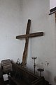 Old cross at the back - geograph.org.uk - 2610216.jpg 533 × 800; 59 KB
-
 Old Farmhouse on The Green - geograph.org.uk - 2607937.jpg 1,024 × 683; 177 KB
-
 Old Milestone by the B4017 in Steventon (geograph 5622194).jpg 578 × 800; 178 KB
-
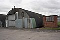
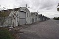
 Old Sheds at Steventon - geograph.org.uk - 2543121.jpg 3,460 × 2,608; 1,012 KB
-
 Parish boundary stone, Steventon Road - geograph.org.uk - 3307820.jpg 683 × 1,024; 287 KB
-
 Pasture above Steventon - geograph.org.uk - 2679571.jpg 640 × 480; 172 KB
-
 Path across the green - geograph.org.uk - 2608166.jpg 1,024 × 683; 109 KB
-
 Plough in the field - geograph.org.uk - 2621860.jpg 1,024 × 683; 166 KB
-
 Ploughed field south of the railway - geograph.org.uk - 5024717.jpg 640 × 426; 44 KB
-
 Ploughing in the manure at Steventon Field - geograph.org.uk - 2590827.jpg 1,024 × 683; 175 KB
-
 Postbox on the Causeway - geograph.org.uk - 2617646.jpg 533 × 800; 113 KB
-
 Postbox on the corner - geograph.org.uk - 2613258.jpg 683 × 1,024; 228 KB
-
 Priory Cottages (NT), Steventon - geograph.org.uk - 6449308.jpg 1,800 × 1,200; 401 KB
-
 Priory Cottages, Steventon - geograph.org.uk - 5393686.jpg 640 × 360; 54 KB
-

-
 Pub's on the High Street - geograph.org.uk - 2608235.jpg 1,024 × 683; 138 KB
-
 Pylon - geograph.org.uk - 5024719.jpg 640 × 426; 42 KB
-
 Pylon in field - geograph.org.uk - 5362676.jpg 640 × 424; 48 KB
-
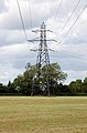 Pylon in the field - geograph.org.uk - 3017864.jpg 986 × 1,500; 184 KB
-
 Pylon, Steventon - geograph.org.uk - 5646409.jpg 640 × 426; 37 KB
-
 Pylons - geograph.org.uk - 6616373.jpg 1,024 × 684; 82 KB


_-_geograph.org.uk_-_2757884.jpg)


,_Orchard_Cottage,_Hanney_Road,_near_Steventon,_Oxon_-_geograph.org.uk_-_6449165.jpg)
,_Orchard_Cottage,_Hanney_Road,_near_Steventon,_Oxon_-_geograph.org.uk_-_6449180.jpg)


.jpg)


,_Steventon_-_geograph.org.uk_-_6449308.jpg)


