Category:Stereotypes on or around maps
Jump to navigation
Jump to search
English: Maps that not only depict geography, but also stereotypical images of people and/or their cultures. Note that these stereotypes are not necessarily true; ethnographical maps of the 19th and early 20th century are often particularly racist.
Media in category "Stereotypes on or around maps"
The following 17 files are in this category, out of 17 total.
-

-
 B26055918C - Asia noviter delineata.jpg 6,464 × 4,872; 12.73 MB
-

-
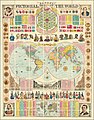 Bacon's Pictorial View of the World.jpg 18,717 × 23,860; 124.6 MB
-
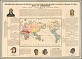 Ca. 1837 French ethnographic map of the world.jpg 11,466 × 8,223; 11.74 MB
-
 Carta Etnográfica de México (1885).jpg 11,102 × 8,853; 14.24 MB
-

-
 Cassell’s Children’s Book of Knowledge Wonder Map of the World.jpg 16,560 × 11,958; 87.36 MB
-

-
 Drawing lives and death Wikimania 2014 08.png 3,434 × 1,974; 776 KB
-
 France & Mappemonde - 4 cartes sur la même planche - btv1b53066669x (4 of 5).jpg 3,784 × 3,241; 2.23 MB
-
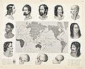
 Human races Berghaus.jpg 6,103 × 5,118; 23.66 MB
-
 Imagen-Estereotipo-portada.webp 800 × 445; 60 KB
-
 Kazakhstan culture map.jpg 1,440 × 1,001; 154 KB
-
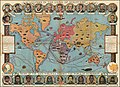
 Le Tour Du Monde En Un Clin D'Oeil.jpg 24,774 × 17,738; 165 MB
-
 Malaysia cultural map 2.jpg 2,048 × 1,422; 169 KB
-
 Mankind1ma6.jpg 1,160 × 951; 187 KB


.jpg)


.jpg)


