Category:Stereographic projection in cartography
Jump to navigation
Jump to search
English: Stereographic projection is an azimuthal projection from a surface point onto a tangent plane or secant plane. It is conformal and true of circles.
English: This map-projection-related category exists in the following hierarchy:
- Category:Map projections
- Category:Maps by projection
- Category:Stereographic projection in cartography – media related to the Stereographic projection in cartography other than maps
- Category:Maps with stereographic projection (“Category:stereographic projections”) – maps made using the Stereographic projection in cartography
type of conformal map projection  | |||||
| Upload media | |||||
| Subclass of |
| ||||
|---|---|---|---|---|---|
| Different from | |||||
| Said to be the same as | stereographic projection | ||||
| |||||
Subcategories
This category has the following 2 subcategories, out of 2 total.
M
Media in category "Stereographic projection in cartography"
The following 13 files are in this category, out of 13 total.
-
 Comparison azimuthal projections.svg 512 × 171; 113 KB
-
 Stereographic projection with Tissot's indicatrix centering 0°N 0°E.svg 3,600 × 3,600; 2.39 MB
-
 Usgs map stereographic.PNG 534 × 181; 49 KB
-
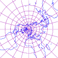
 Stereographic Projection Polar Extreme.jpg 2,048 × 2,048; 1.01 MB
-
 Stereographic Projection Polar.jpg 2,048 × 2,048; 1.09 MB
-
 Stereographic Projection Water Hemisphere.jpg 2,048 × 2,048; 1.16 MB
-
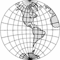 APN2002-figure317b.png 492 × 495; 112 KB
-
 Stereographic Projection Transversal Extreme.jpg 2,048 × 2,048; 1,018 KB
-
 Stereographic Projection Transversal.jpg 2,048 × 2,048; 1.04 MB
-

-

-
 Netzentwuerfe.png 797 × 2,161; 242 KB
-
 Stereographic projection 118.png 118 × 118; 12 KB


.jpg)
.jpg)
