Category:Stephanuskerk, Hardenberg
Jump to navigation
Jump to search
| Object location | | View all coordinates using: OpenStreetMap |
|---|
 | |||||
| Upload media | |||||
| Instance of |
| ||||
|---|---|---|---|---|---|
| Location | Hardenberg, Overijssel, Netherlands | ||||
| Street address |
| ||||
| Heritage designation |
| ||||
 | |||||
Kerk:
|
This is a category about rijksmonument number 20013
|
Toren:
|
This is a category about rijksmonument number 20014
|
| Address |
|
Media in category "Stephanuskerk, Hardenberg"
The following 8 files are in this category, out of 8 total.
-
 Exterieur - Hardenberg - 20100555 - RCE.jpg 812 × 1,200; 171 KB
-
 Exterieur - Hardenberg - 20100556 - RCE.jpg 795 × 1,200; 189 KB
-
 Interieur, aanzicht orgel, orgelnummer 599 - Hardenberg - 20349125 - RCE.jpg 803 × 1,200; 142 KB
-
 Overzicht noordwestgevel met kerktoren - Hardenberg - 20351004 - RCE.jpg 960 × 1,200; 219 KB
-
 Pomp, Oosteinde bij nr.9 - Hardenberg - 20100574 - RCE.jpg 789 × 1,200; 144 KB
-
 Stadsmuur, aanzicht - Hardenberg - 20100550 - RCE.jpg 796 × 1,200; 196 KB
-
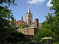
 Stephanuskerk.jpg 3,312 × 4,416; 12.24 MB
-
 Stephanuskerktoren.jpg 2,304 × 1,728; 1.64 MB


