Category:Steirische Kalkspitze
Jump to navigation
Jump to search
| Object location | | View all coordinates using: OpenStreetMap |
|---|
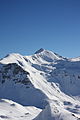
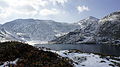
mountain in the Schladminger Tauern at the border Styria / Salzburg  | |||||
| Upload media | |||||
| Instance of | |||||
|---|---|---|---|---|---|
| Location |
| ||||
| Mountain range | |||||
| Topographic prominence |
| ||||
| Topographic isolation |
| ||||
| Elevation above sea level |
| ||||
 | |||||
Subcategories
This category has the following 2 subcategories, out of 2 total.
M
Media in category "Steirische Kalkspitze"
The following 127 files are in this category, out of 127 total.
-
 Blick von der Lungauer zur Steirischen Kalkspitze.jpg 1,600 × 1,200; 608 KB
-
 Giglachsee0008.JPG 1,944 × 2,592; 1.8 MB
-
 Giglachsee0009.JPG 2,592 × 1,944; 2.42 MB
-
 Giglachseehütte0111.JPG 3,888 × 2,592; 3.5 MB
-
 Lungauer von Steirischer Kalkspitze.JPG 4,608 × 2,592; 4.17 MB
-
 Meregg, Steirische Kalkspitze im September 2021.jpg 4,000 × 2,250; 3.05 MB
-
 Oberhüttensee 2111 2009-10-05.JPG 3,888 × 2,592; 5.8 MB
-
 Oberhüttensee+Kalkspitzen.JPG 3,000 × 4,000; 1.43 MB
-
 Oberhüttensee-Meregg-Steir.Kalkspitze.JPG 4,000 × 3,000; 1.71 MB
-
 Obertauern2015.jpg 2,048 × 1,536; 930 KB
-
 Schönalmsee, obere 29869 2016-07-10.JPG 3,888 × 2,592; 6.19 MB
-
 Steirische Kalkspitze von der Akarscharte (1).jpg 4,000 × 2,250; 2.41 MB
-
 Steirische Kalkspitze von der Akarscharte (2).jpg 4,000 × 2,250; 3.48 MB
-
 Steirischekalkspitze0002.jpg 1,536 × 2,048; 966 KB
-
 Steirischekalkspitze0003.JPG 1,536 × 2,048; 1.01 MB
-
 Steirischekalkspitze0005.JPG 2,592 × 1,944; 2.07 MB
-
 Steirischekalkspitze0006.JPG 1,944 × 2,592; 2.13 MB
-
 Steirischekalkspitze0011.JPG 2,592 × 1,944; 1.03 MB
-
 Steirischekalkspitze0012.JPG 2,592 × 1,944; 1.14 MB
-
 Steirischekalkspitze0025.jpg 2,592 × 1,944; 1.32 MB
-
 Steirischekalkspitze0026.JPG 2,592 × 1,944; 1.6 MB
-
 Steirischekalkspitze0027.JPG 1,944 × 2,592; 1.38 MB
-
 Steirischekalkspitze0028.JPG 2,592 × 1,944; 1.56 MB
-
 Steirischekalkspitze0029.JPG 2,592 × 1,944; 1.52 MB
-
 Steirischekalkspitze0030.JPG 2,592 × 1,944; 1.47 MB
-
 Steirischekalkspitze0031.JPG 2,592 × 1,944; 2.77 MB
-
 Steirischekalkspitze0032.JPG 2,592 × 1,944; 2.03 MB
-
 Steirischekalkspitze0033.JPG 2,592 × 1,944; 2.2 MB
-
 Steirischekalkspitze0034.JPG 2,592 × 1,944; 2.81 MB
-
 Steirischekalkspitze0035.JPG 1,944 × 2,592; 2 MB
-
 Steirischekalkspitze0038.JPG 2,592 × 1,944; 2.24 MB
-
 Steirischekalkspitze0040.JPG 2,592 × 1,944; 2.27 MB
-
 Steirischekalkspitze0045.JPG 2,592 × 1,944; 1.47 MB
-
 Steirischekalkspitze0047.JPG 2,592 × 1,944; 2.29 MB
-
 Steirischekalkspitze0048.JPG 2,592 × 1,944; 2.26 MB
-
 Steirischekalkspitze0049.JPG 1,944 × 2,592; 2.08 MB
-
 Steirischekalkspitze0056.JPG 2,592 × 1,944; 2.67 MB
-
 Steirischekalkspitze0059.JPG 2,592 × 1,944; 2.3 MB
-
 Steirischekalkspitze0060.JPG 3,888 × 2,592; 2.71 MB
-
 Steirischekalkspitze0061.JPG 3,888 × 2,592; 2.72 MB
-
 Steirischekalkspitze0062.JPG 3,888 × 2,592; 4.38 MB
-
 Steirischekalkspitze0063.JPG 3,888 × 2,592; 4.36 MB
-
 Steirischekalkspitze0064.JPG 2,592 × 3,888; 4.02 MB
-
 Steirischekalkspitze0065.JPG 3,888 × 2,592; 5.83 MB
-
 Steirischekalkspitze0066.JPG 3,888 × 2,592; 6.54 MB
-
 Steirischekalkspitze0069.JPG 2,592 × 3,888; 9.95 MB
-
 Steirischekalkspitze0070.JPG 3,888 × 2,592; 2.52 MB
-
 Steirischekalkspitze0071.JPG 3,888 × 2,592; 2.2 MB
-
 Steirischekalkspitze0072.JPG 3,888 × 2,592; 2.3 MB
-
 Steirischekalkspitze0073.JPG 2,592 × 3,888; 2.52 MB
-
 Steirischekalkspitze0074.jpg 3,888 × 2,592; 3.13 MB
-
 Steirischekalkspitze0075.JPG 3,888 × 2,592; 3.87 MB
-
 Steirischekalkspitze0076.JPG 2,592 × 3,888; 3.56 MB
-
 Steirischekalkspitze0077.JPG 3,888 × 2,592; 2.95 MB
-
 Steirischekalkspitze0078.JPG 2,592 × 3,888; 2.89 MB
-
 Steirischekalkspitze0079.JPG 2,592 × 3,888; 3.11 MB
-
 Steirischekalkspitze0080.JPG 2,592 × 3,888; 2.36 MB
-
 Steirischekalkspitze0081.JPG 2,592 × 3,888; 3.73 MB
-
 Steirischekalkspitze0082.JPG 2,592 × 3,888; 2.69 MB
-
 Steirischekalkspitze0087.JPG 3,888 × 2,592; 3.29 MB
-
 Steirischekalkspitze0088.JPG 3,888 × 2,592; 3 MB
-
 Steirischekalkspitze0090.JPG 3,888 × 2,592; 3.45 MB
-
 Steirischekalkspitze0101.JPG 2,592 × 3,888; 2.6 MB
-
 Steirischekalkspitze0102.JPG 2,592 × 3,888; 2.97 MB
-
 Steirischekalkspitze0103.JPG 3,888 × 2,592; 2.6 MB
-
 Steirischekalkspitze0104.JPG 3,888 × 2,592; 1.88 MB
-
 Steirischekalkspitze0105.JPG 3,888 × 2,592; 2.43 MB
-
 Steirischekalkspitze0106.JPG 3,888 × 2,592; 2.59 MB
-
 Steirischekalkspitze0107.JPG 3,888 × 2,592; 2.31 MB
-
 Steirischekalkspitze0108.JPG 2,592 × 3,888; 3.07 MB
-
 Steirischekalkspitze0109.JPG 2,592 × 3,888; 2.97 MB
-
 Steirischekalkspitze0115.JPG 3,888 × 2,592; 2.97 MB
-
 Steirischekalkspitze0116.JPG 2,592 × 3,888; 3.39 MB
-
 Steirischekalkspitze0117.JPG 2,592 × 3,888; 2.66 MB
-
 Steirischekalkspitze0118.JPG 2,592 × 3,888; 1.8 MB
-
 Steirischekalkspitze0119.JPG 3,888 × 2,592; 2.94 MB
-
 Steirischekalkspitze0122.JPG 2,592 × 3,888; 4.06 MB
-
 Steirischekalkspitze0123.JPG 2,592 × 3,888; 4.22 MB
-
 Steirischekalkspitze0124.JPG 3,888 × 2,592; 3.54 MB
-
 Steirischekalkspitze0125.JPG 2,592 × 3,888; 4.12 MB
-
 Steirischekalkspitze0128.JPG 2,592 × 3,888; 4.53 MB
-
 Steirischekalkspitze0129.JPG 3,888 × 2,592; 4.18 MB
-
 Steirischekalkspitze0130.JPG 2,592 × 3,888; 3.91 MB
-
 Steirischekalkspitze0131.JPG 3,888 × 2,592; 3.64 MB
-
 Steirischekalkspitze0132.JPG 3,888 × 2,592; 4.75 MB
-
 Steirischekalkspitze0133.JPG 3,888 × 2,592; 3.96 MB
-
 Steirischekalkspitze0134.JPG 3,888 × 2,592; 4.54 MB
-
 Steirischekalkspitze0135.JPG 3,888 × 2,592; 4.48 MB
-
 Steirischekalkspitze0136.JPG 3,888 × 2,592; 3.94 MB
-
 Steirischekalkspitze0138.JPG 3,888 × 2,592; 3.41 MB
-
 Steirischekalkspitze0139.JPG 3,888 × 2,592; 5.14 MB
-
 Steirischekalkspitze0148.JPG 3,888 × 2,592; 5.04 MB
-
 Steirischekalkspitze0151.JPG 3,888 × 2,592; 4.3 MB
-
 Steirischekalkspitze0152.JPG 3,888 × 2,592; 4.84 MB
-
 Steirischekalkspitze0153.JPG 3,888 × 2,592; 4.11 MB
-
 Steirischekalkspitze0154.JPG 3,888 × 2,592; 6.5 MB
-
 Steirischekalkspitze0155.JPG 3,888 × 2,592; 4.6 MB
-
 Steirischekalkspitze0156.JPG 3,888 × 2,592; 4.91 MB
-
 Steirischekalkspitze0161.JPG 3,888 × 2,592; 3.71 MB
-
 Steirischekalkspitze0162.JPG 3,888 × 2,592; 4.01 MB
-
 Steirischekalkspitze0163.JPG 3,888 × 2,592; 6.74 MB
-
 Steirischekalkspitze0164.JPG 2,592 × 3,888; 2.85 MB
-
 Steirischekalkspitze0165.JPG 3,888 × 2,592; 3.65 MB
-
 Steirischekalkspitze0166.JPG 3,888 × 2,592; 6.3 MB
-
 Steirischekalkspitze0167.JPG 3,888 × 2,592; 5.66 MB
-
 Steirischekalkspitze0168.JPG 2,592 × 3,888; 4.66 MB
-
 Steirischekalkspitze0169.JPG 3,888 × 2,592; 7.49 MB
-
 Steirischekalkspitze0170.JPG 3,888 × 2,592; 4.38 MB
-
 Steirischekalkspitze0171.JPG 3,888 × 2,592; 4.69 MB
-
 Steirischekalkspitze0172.JPG 3,888 × 2,592; 4.1 MB
-
 Steirischekalkspitze0173.JPG 3,888 × 2,592; 4.76 MB
-
 Steirischekalkspitze0175.JPG 3,888 × 2,592; 5.33 MB
-
 Steirischekalkspitze0176.JPG 3,888 × 2,592; 5.69 MB
-
 Steirischekalkspitze0179.JPG 3,888 × 2,592; 4.63 MB
-
 Steirischekalkspitze0180.JPG 2,592 × 3,888; 4.33 MB
-
 Steirischekalkspitze0181.JPG 3,888 × 2,592; 4.26 MB
-
 Steirischekalkspitze0182.JPG 2,592 × 3,888; 4.52 MB
-
 Steirischekalkspitze0183.JPG 3,888 × 2,592; 4.42 MB
-
 Steirischekalkspitze0184.JPG 3,585 × 2,390; 3.95 MB
-
 Steirischekalkspitze0185.JPG 2,592 × 3,888; 5.69 MB
-
 Steirischekalkspitze0186.JPG 3,888 × 2,592; 3.82 MB
-
 Steirischekalkspitze0187.JPG 3,888 × 2,592; 4.64 MB
-
 Steirischekalkspitze0188.JPG 3,888 × 2,592; 4.2 MB
-
 Steirischekalkspitze0189.JPG 3,888 × 2,592; 4.27 MB
-
 Steirischekalkspitze0190.JPG 3,888 × 2,592; 4.56 MB
-
 Steirischekalkspitze0191.JPG 2,592 × 3,888; 4.87 MB
-
 Unt. Giglachsee 2550.JPG 4,592 × 2,576; 3.7 MB


.jpg)
.jpg)


