Category:Steinhausstraße 72 (Bunde)
Jump to navigation
Jump to search
| Object location | | View all coordinates using: OpenStreetMap |
|---|
Subcategories
This category has the following 3 subcategories, out of 3 total.
G
K
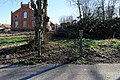
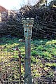
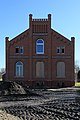
Media in category "Steinhausstraße 72 (Bunde)"
The following 19 files are in this category, out of 19 total.
-
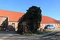 Bunde - Steinhausstraße - 72 + Kochhaus 01 ies.jpg 5,616 × 3,744; 19.29 MB
-
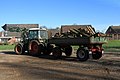
 Bunde - Steinhausstraße - 72 01 ies.jpg 5,616 × 3,744; 19.1 MB
-
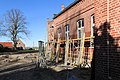
 Bunde - Steinhausstraße - 72 02 ies.jpg 5,616 × 3,744; 22.07 MB
-
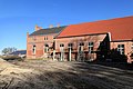
 Bunde - Steinhausstraße - 72 03 ies.jpg 5,616 × 3,744; 20.18 MB
-
 Bunde - Steinhausstraße - 72 04 ies.jpg 5,616 × 3,744; 24.23 MB
-
 Bunde - Steinhausstraße - 72 05 ies.jpg 5,616 × 3,744; 17.67 MB
-
 Bunde - Steinhausstraße - 72 06 ies.jpg 5,616 × 3,744; 18.73 MB
-
 Bunde - Steinhausstraße - 72 07 ies.jpg 3,744 × 5,616; 21.05 MB
-
 Bunde - Steinhausstraße - 72 08 ies.jpg 5,616 × 3,744; 20.59 MB
-
 Bunde - Steinhausstraße - 72 09 ies.jpg 5,616 × 3,744; 19.99 MB
-
 Bunde - Steinhausstraße - 72 10 ies.jpg 5,616 × 3,744; 20.42 MB
-
 Bunde - Steinhausstraße - 72 11 ies.jpg 5,616 × 3,744; 19.71 MB
-
 Bunde - Steinhausstraße - 72 12 ies.jpg 3,744 × 5,616; 20.23 MB
-
 Bunde - Steinhausstraße - 72 13 ies.jpg 5,616 × 3,744; 18.42 MB
-
 Bunde - Steinhausstraße - 72 14 ies.jpg 5,616 × 3,744; 25.67 MB
-
 Bunde - Steinhausstraße - 72 15 ies.jpg 3,744 × 5,616; 19.44 MB
-
 Bunde - Steinhausstraße - 72 16 ies.jpg 3,744 × 5,616; 18.11 MB
-
 Bunde - Steinhausstraße - 72 17 ies.jpg 5,616 × 3,744; 13.84 MB
-
 Bunde - Steinhausstraße - 72 18 ies.jpg 3,744 × 5,616; 22.44 MB


