Category:Steeple Morden
Jump to navigation
Jump to search
village and civil parish in Cambridgeshire, UK  | |||||
| Upload media | |||||
| Instance of | |||||
|---|---|---|---|---|---|
| Location | South Cambridgeshire, Cambridgeshire, East of England, England | ||||
 | |||||
Subcategories
This category has the following 3 subcategories, out of 3 total.
O
Media in category "Steeple Morden"
The following 200 files are in this category, out of 272 total.
(previous page) (next page)-
 A green house on Station Road - geograph.org.uk - 4879044.jpg 1,024 × 731; 1.01 MB
-

-
 A red roof on Ashwell Street - geograph.org.uk - 5319609.jpg 1,024 × 768; 1.06 MB
-
 A tanker at the lane end - geograph.org.uk - 5318919.jpg 1,024 × 768; 1.03 MB
-
 A tarmac bridle way - geograph.org.uk - 5318954.jpg 1,024 × 683; 806 KB
-
 A view into south Cambridgeshire - geograph.org.uk - 3023644.jpg 2,560 × 1,920; 1.03 MB
-
 A white house on Station Road - geograph.org.uk - 4879949.jpg 1,024 × 732; 1.03 MB
-
 Across the fields to Steeple Morden - geograph.org.uk - 5319691.jpg 1,024 × 732; 1.01 MB
-
 Ashwell Road - geograph.org.uk - 4880253.jpg 1,024 × 731; 1,016 KB
-
 Ashwell Street - geograph.org.uk - 3025083.jpg 2,560 × 1,920; 987 KB
-
 Ashwell Street - geograph.org.uk - 5168962.jpg 1,600 × 1,200; 924 KB
-
 Ashwell Street - geograph.org.uk - 5168967.jpg 1,600 × 1,200; 942 KB
-
 Ashwell Street - geograph.org.uk - 5168969.jpg 1,600 × 1,200; 875 KB
-
 Ashwell Street - geograph.org.uk - 5168984.jpg 1,600 × 1,200; 976 KB
-
 Ashwell Street - geograph.org.uk - 5168989.jpg 1,600 × 1,200; 855 KB
-
 Ashwell Street - geograph.org.uk - 5168991.jpg 1,600 × 1,200; 834 KB
-
 Ashwell Street, out with the dogs - geograph.org.uk - 4879076.jpg 1,024 × 732; 1.18 MB
-
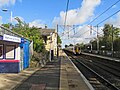
 Ashwell ^ Morden station (2) - geograph.org.uk - 5113981.jpg 640 × 480; 97 KB
-
 Ashwell ^ Morden station (3) - geograph.org.uk - 5113986.jpg 640 × 480; 92 KB
-
 Ashwell ^ Morden station - geograph.org.uk - 5113972.jpg 640 × 480; 106 KB
-
 Ashwell ^ Morden station approach - geograph.org.uk - 5727649.jpg 1,024 × 732; 793 KB
-
 Ashwell ^ Morden Station buildings - geograph.org.uk - 4880278.jpg 1,024 × 732; 1.16 MB
-
 Ashwell ^ Morden station buildings - geograph.org.uk - 5113989.jpg 640 × 480; 107 KB
-
 Ashwell ^ Morden, non-stop to Cambridge - geograph.org.uk - 5727644.jpg 1,024 × 768; 836 KB
-
 Ashwell ^ Morden, non-stop to King's Cross - geograph.org.uk - 4877603.jpg 1,024 × 732; 1.05 MB
-
 Ashwell ^ Morden, not stopping - geograph.org.uk - 5580736.jpg 1,024 × 768; 954 KB
-
 Ashwell ^ Morden, once the railway goods shed - geograph.org.uk - 4891289.jpg 1,024 × 1,024; 1.09 MB
-
 Ashwell ^ Morden, the green light - geograph.org.uk - 4880289.jpg 819 × 1,024; 1.14 MB
-
 At Morden Grange Farm - geograph.org.uk - 5318979.jpg 1,024 × 819; 915 KB
-
 Autumn sown cereal - geograph.org.uk - 5168929.jpg 1,600 × 1,200; 1.08 MB
-
 Autumn sown cereal - geograph.org.uk - 5168940.jpg 1,600 × 1,200; 1,017 KB
-
 Between two chalk pits - geograph.org.uk - 4891275.jpg 1,024 × 731; 1,011 KB
-
 Bogs Gap - Steeple Morden - geograph.org.uk - 222059.jpg 640 × 411; 111 KB
-
 Bridle path to Ashwell Street and Litlington - geograph.org.uk - 5319391.jpg 1,024 × 768; 1.03 MB
-
 Bridle path to Morden Grange Farm and the A505 - geograph.org.uk - 5319529.jpg 1,024 × 768; 1.1 MB
-

-
 Bridleway and power lines - geograph.org.uk - 5168864.jpg 1,600 × 1,200; 886 KB
-
 Bridleway junction - geograph.org.uk - 5168996.jpg 1,600 × 1,200; 871 KB
-
 Bridleway past Flecks Lane Farm - geograph.org.uk - 2558461.jpg 1,200 × 1,600; 1.12 MB
-
 Bridleway past New Part - geograph.org.uk - 5168874.jpg 1,600 × 1,200; 942 KB
-
 Bridleway to Ashwell Street - geograph.org.uk - 5168920.jpg 1,600 × 1,200; 810 KB
-
 Bridleway to Ashwell Street - geograph.org.uk - 5168931.jpg 1,600 × 1,200; 818 KB
-
 Bridleway to Ashwell Street - geograph.org.uk - 5168934.jpg 1,600 × 1,200; 962 KB
-
 Bridleway to Morden Grange Farm - geograph.org.uk - 5169001.jpg 1,600 × 1,200; 794 KB
-
 Byway across the landscape - geograph.org.uk - 3777624.jpg 640 × 430; 39 KB
-
 Cereal crop beside Flecks Lane - geograph.org.uk - 5424881.jpg 640 × 480; 85 KB
-
 Cereal crop off Flecks Lane - geograph.org.uk - 5424883.jpg 640 × 480; 82 KB
-
 Chain Walk - geograph.org.uk - 5203177.jpg 640 × 426; 49 KB
-
 Chain Walk - geograph.org.uk - 5203180.jpg 640 × 426; 47 KB
-
 Chain Walk - geograph.org.uk - 5222055.jpg 640 × 503; 37 KB
-
 Chalk conveyor at Station Quarry - geograph.org.uk - 4891266.jpg 1,024 × 731; 992 KB
-
 Chalk pit conveyor belt - geograph.org.uk - 5168834.jpg 1,600 × 1,200; 1.11 MB
-
 Chalk pits near Cheyneys Lodge - geograph.org.uk - 4740297.jpg 3,264 × 2,448; 3.87 MB
-
 Cobbs Lane - geograph.org.uk - 4999603.jpg 640 × 480; 62 KB
-
 Cobbs Lane - geograph.org.uk - 4999606.jpg 640 × 480; 62 KB
-
 Cobbs Lane - geograph.org.uk - 4999613.jpg 640 × 480; 67 KB
-
 Cobbs Lane - geograph.org.uk - 4999617.jpg 640 × 480; 65 KB
-
 Commuters' cars - geograph.org.uk - 4891240.jpg 1,024 × 731; 1.14 MB
-
 Conveyor belt from the chalk quarry - geograph.org.uk - 5168814.jpg 1,600 × 1,200; 859 KB
-
 Conveyor belt from the chalk quarry - geograph.org.uk - 5168843.jpg 1,600 × 1,200; 655 KB
-
 Corner of New Part - geograph.org.uk - 5326606.jpg 640 × 426; 34 KB
-
 Cottages at Morden Grange Farm - geograph.org.uk - 5319323.jpg 1,024 × 1,024; 1.19 MB
-
 Crop field off Flecks Lane - geograph.org.uk - 5424897.jpg 640 × 480; 99 KB
-
 Crop field, North Brook End - geograph.org.uk - 5424877.jpg 640 × 480; 80 KB
-
 Derelict house on Station Road - geograph.org.uk - 2765338.jpg 3,872 × 2,592; 3.49 MB
-
 Down hill from Omya Whiting Works - geograph.org.uk - 5727662.jpg 1,024 × 768; 728 KB
-
 Down the hill to the Mordens - geograph.org.uk - 4879970.jpg 1,024 × 731; 941 KB
-
 Fallow field - geograph.org.uk - 5195232.jpg 640 × 426; 53 KB
-
 Farm land and Tween Towns Wood, South of Steeple Morden - geograph.org.uk - 3479796.jpg 4,320 × 3,240; 2.93 MB
-
 Farm track and big fields - geograph.org.uk - 4878944.jpg 1,024 × 731; 968 KB
-
 Farm track off Cobbs Lane - geograph.org.uk - 4999611.jpg 640 × 480; 59 KB
-
 Farmland and copse by Next Odsey - geograph.org.uk - 5114017.jpg 640 × 480; 77 KB
-
 Farmland and Morden Grange Plantation - geograph.org.uk - 6478493.jpg 1,024 × 681; 111 KB
-
 Farmland at Morden Green - geograph.org.uk - 3771990.jpg 2,592 × 1,944; 1.95 MB
-
 Farmland east of Hill Farm - geograph.org.uk - 5114007.jpg 640 × 480; 84 KB
-
 Farmland north of Redlands Farm - geograph.org.uk - 5116087.jpg 640 × 480; 92 KB
-
 Field and hedgerow - geograph.org.uk - 5424902.jpg 640 × 480; 70 KB
-
 Field by Morden Grange Farm - geograph.org.uk - 5168897.jpg 1,600 × 1,200; 1.01 MB
-
 Field near Morden Grange Farm - geograph.org.uk - 5168916.jpg 1,600 × 1,135; 1.06 MB
-
 Filling station, A505 - geograph.org.uk - 5203183.jpg 640 × 426; 35 KB
-
 Flat arable land - geograph.org.uk - 4789575.jpg 640 × 426; 27 KB
-
 Flat farmland - geograph.org.uk - 3777638.jpg 640 × 371; 28 KB
-
 Flat farmland - geograph.org.uk - 4180654.jpg 640 × 430; 23 KB
-
 Flecks Lane - geograph.org.uk - 2558465.jpg 1,600 × 1,200; 864 KB
-
 Flecks Lane - geograph.org.uk - 4650599.jpg 640 × 480; 100 KB
-
 Flecks Lane - geograph.org.uk - 5424884.jpg 640 × 480; 91 KB
-
 Flecks Lane Farm - geograph.org.uk - 2558453.jpg 1,600 × 1,200; 819 KB
-
 Flecks Lane Farm - geograph.org.uk - 4999579.jpg 640 × 480; 49 KB
-
 Flecks Lane towards Wendy - geograph.org.uk - 5424899.jpg 640 × 480; 61 KB
-
 Flecks Lane towards Wendy - geograph.org.uk - 5424906.jpg 640 × 480; 93 KB
-
 Flitton's farm - geograph.org.uk - 3479695.jpg 4,320 × 3,240; 3.01 MB
-
 Flitton's Farm - geograph.org.uk - 4879909.jpg 1,024 × 732; 1.01 MB
-
 Flitton’s Farm - geograph.org.uk - 2765349.jpg 3,872 × 2,592; 2.8 MB
-
 Footpath entrance through the conifer arch - geograph.org.uk - 3025022.jpg 1,920 × 2,560; 908 KB
-
 Footpath from Ashwell Street - geograph.org.uk - 5168981.jpg 1,600 × 1,200; 777 KB
-
 Footpath from Ashwell ^ Morden Station - geograph.org.uk - 5168790.jpg 1,600 × 1,200; 550 KB
-
 Footpath from Morden Grange Farm - geograph.org.uk - 5169009.jpg 1,600 × 1,200; 721 KB
-
 Footpath to Gatley End - geograph.org.uk - 4878984.jpg 1,024 × 732; 1.06 MB
-
 Footpath to Steeple Morden - geograph.org.uk - 5168823.jpg 1,600 × 1,200; 913 KB
-
 Gatley End Farm - geograph.org.uk - 5319592.jpg 1,024 × 768; 989 KB
-
 Hedgerow and oilseed rape field - geograph.org.uk - 5168908.jpg 1,600 × 1,200; 962 KB
-
 High Farm, Station Road - geograph.org.uk - 4879059.jpg 1,024 × 731; 1.04 MB
-
 Hill Farm - geograph.org.uk - 4891221.jpg 1,024 × 732; 978 KB
-
 Horden Grange Plantation - geograph.org.uk - 5043253.jpg 640 × 426; 33 KB
-
 Horse ^ Groom - Baldock Road - geograph.org.uk - 5516670.jpg 640 × 480; 102 KB
-
 House near Flitton's farm - geograph.org.uk - 3479689.jpg 4,320 × 3,240; 3.12 MB
-
 Houses for sale on Station Road - geograph.org.uk - 5727895.jpg 1,024 × 732; 866 KB
-
 Long, straight road into Steeple Morden - geograph.org.uk - 3479753.jpg 4,320 × 3,240; 2.9 MB
-
 Morden Grange Farm - geograph.org.uk - 5168904.jpg 1,600 × 1,200; 844 KB
-
 Morden Grange Farm - geograph.org.uk - 5168910.jpg 1,600 × 1,200; 529 KB
-
 Morden Grange Plantation - geograph.org.uk - 3777629.jpg 640 × 227; 19 KB
-
 Morden Grange Plantation - geograph.org.uk - 3777631.jpg 640 × 351; 21 KB
-
 Morden Grange Plantation - geograph.org.uk - 4180637.jpg 640 × 475; 33 KB
-
 Morden Grange Plantation - geograph.org.uk - 4180641.jpg 640 × 430; 23 KB
-
 Morden Grange Plantation - geograph.org.uk - 4789529.jpg 640 × 426; 26 KB
-
 Morden Grange Plantation - geograph.org.uk - 5168867.jpg 1,600 × 1,116; 798 KB
-
 Morden Grange Plantation - geograph.org.uk - 5195202.jpg 640 × 426; 45 KB
-
 Morden Grange Plantation - geograph.org.uk - 5195206.jpg 640 × 426; 53 KB
-
 Morden Grange Plantation - geograph.org.uk - 5326603.jpg 640 × 426; 33 KB
-
 Morden Grange Plantation - geograph.org.uk - 6478489.jpg 1,024 × 681; 105 KB
-
 Morden Grange Plantation - geograph.org.uk - 6478495.jpg 1,024 × 681; 75 KB
-
 Morden Grange Plantation, New Part - geograph.org.uk - 4180645.jpg 640 × 430; 23 KB
-
 Morden Grange to Whiting Works - geograph.org.uk - 5319351.jpg 1,024 × 768; 1.1 MB
-
 Moyne's Wood - geograph.org.uk - 5424885.jpg 640 × 480; 108 KB
-
 Near The Thrift - geograph.org.uk - 3777637.jpg 640 × 329; 22 KB
-
 Nearing Steeple Morden on Trap Road - geograph.org.uk - 5319687.jpg 1,024 × 683; 977 KB
-
 New houses on Station Road - geograph.org.uk - 4879019.jpg 819 × 1,024; 1.37 MB
-
 New Part - geograph.org.uk - 3777635.jpg 640 × 430; 30 KB
-
 New Part - geograph.org.uk - 4789532.jpg 640 × 426; 24 KB
-
 New Part - geograph.org.uk - 4789533.jpg 640 × 426; 32 KB
-
 New Part - geograph.org.uk - 5043255.jpg 640 × 426; 29 KB
-
 New Part - geograph.org.uk - 5195198.jpg 640 × 426; 40 KB
-

-
 North Brook End - geograph.org.uk - 2558428.jpg 1,600 × 1,200; 746 KB
-
 North Brook End - geograph.org.uk - 5424879.jpg 640 × 480; 70 KB
-
 North Brook End farm - geograph.org.uk - 3025026.jpg 2,560 × 1,920; 1.05 MB
-
 Odsey Woodland - geograph.org.uk - 5203188.jpg 640 × 426; 92 KB
-
 Off Flecks Lane - geograph.org.uk - 4999586.jpg 640 × 480; 56 KB
-
 Oil seed rape field - geograph.org.uk - 2558442.jpg 1,600 × 1,200; 901 KB
-
 Oilseed rape crop - geograph.org.uk - 5169010.jpg 1,600 × 1,200; 929 KB
-
 Omya Steeple Morden plant - geograph.org.uk - 2765366.jpg 3,872 × 2,592; 2.96 MB
-
 Omya Whiting Works - geograph.org.uk - 5727703.jpg 1,024 × 819; 793 KB
-
 Omya Whiting Works, the top of the chalk conveyor - geograph.org.uk - 5727669.jpg 819 × 1,024; 1.17 MB
-
 On Ashwell Street in March - geograph.org.uk - 5319559.jpg 1,024 × 768; 1.03 MB
-
 On Ashwell Street near Upper Gatley End - geograph.org.uk - 5319575.jpg 1,024 × 768; 1,011 KB
-
 On North Brook End - geograph.org.uk - 6514290.jpg 768 × 1,024; 182 KB
-
 On the way to Ashwell Station - geograph.org.uk - 5318897.jpg 1,024 × 768; 1 MB
-
 On time at Ashwell ^ Morden - geograph.org.uk - 4877591.jpg 1,024 × 1,024; 1.33 MB
-
 Over the fields to Ashwell - geograph.org.uk - 4877625.jpg 1,024 × 768; 1.04 MB
-
 Path around Steeple Morden - geograph.org.uk - 5253449.jpg 640 × 480; 120 KB
-
 Path around Steeple Morden - geograph.org.uk - 5253451.jpg 640 × 480; 41 KB
-
 Path around Steeple Morden - geograph.org.uk - 5253453.jpg 640 × 480; 60 KB
-
 Path to Abington Piggots - geograph.org.uk - 4999576.jpg 640 × 480; 86 KB
-
 Path towards Steeple Morden - geograph.org.uk - 5253078.jpg 640 × 480; 86 KB
-
 Path towards Steeple Morden - geograph.org.uk - 5253079.jpg 640 × 480; 114 KB
-
 Path towards Steeple Morden - geograph.org.uk - 5253080.jpg 640 × 480; 121 KB
-
 Path towards Steeple Morden - geograph.org.uk - 5253081.jpg 640 × 480; 84 KB
-
 Path towards Steeple Morden - geograph.org.uk - 6514276.jpg 768 × 1,024; 323 KB
-
 RAF - USAAF Steeple Morden airfield memorial - geograph.org.uk - 6336022.jpg 4,608 × 3,072; 4.99 MB
-
 RAF - USAAF Steeple Morden airfield memorial - geograph.org.uk - 6336646.jpg 4,608 × 3,072; 5.67 MB
-
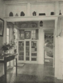 Ringdale, Steeple Morden, the entrance hall.png 719 × 951; 1.01 MB
-
 Road to Guilden Morden - geograph.org.uk - 4999573.jpg 640 × 480; 41 KB
-
 Road to Guilden Morden - geograph.org.uk - 4999574.jpg 640 × 480; 51 KB
-
 Road to Guilden Morden - geograph.org.uk - 4999581.jpg 640 × 480; 42 KB
-
 Road to Guilden Morden - geograph.org.uk - 4999584.jpg 640 × 480; 57 KB
-
 Road to Guilden Morden - geograph.org.uk - 4999589.jpg 640 × 480; 60 KB
-
 Road to Guilden Morden - geograph.org.uk - 4999590.jpg 640 × 480; 54 KB
-
 Road to Morden Grange Farm - geograph.org.uk - 5168889.jpg 1,600 × 1,200; 778 KB
-
 Road to Morden Grange Farm - geograph.org.uk - 5169005.jpg 1,600 × 1,038; 592 KB
-
 Road to Omya plant, Steeple Morden - geograph.org.uk - 2765357.jpg 3,872 × 2,592; 3.03 MB
-
 Roadside advertising - geograph.org.uk - 4891231.jpg 1,024 × 732; 1,012 KB
-
 Sign for the jester, Station Road - geograph.org.uk - 5114001.jpg 480 × 640; 68 KB
-
 Silos at Morden Grange Farm - geograph.org.uk - 5319369.jpg 1,024 × 731; 1.14 MB
-
 Skylark plots in a wheat field - geograph.org.uk - 3023641.jpg 1,727 × 1,295; 560 KB
-
 Some green in the hedges - geograph.org.uk - 5318865.jpg 1,024 × 768; 1.07 MB
-
 South-southeast from Ashwell Street - geograph.org.uk - 5319545.jpg 1,024 × 768; 987 KB
-

-
 St.Peter and St. Paul, Steeple Morden - geograph.org.uk - 5295341.jpg 1,600 × 1,067; 464 KB
-
 Station Quarry - geograph.org.uk - 4891256.jpg 1,024 × 732; 1.03 MB
-
 Station Quarry from the north - geograph.org.uk - 5318884.jpg 1,024 × 768; 1 MB
-
 Station Road and the entrance to Whiting Works - geograph.org.uk - 4879957.jpg 1,024 × 732; 999 KB
-
 Station Road and Whiting Works - geograph.org.uk - 4879962.jpg 1,024 × 732; 951 KB
-
 Station Road by Hill Farm - geograph.org.uk - 5114015.jpg 640 × 480; 128 KB
-
 Station Road near Cheyneys Lodge Farm - geograph.org.uk - 4880240.jpg 1,024 × 682; 909 KB
-
 Station Road to Ashwell Road - geograph.org.uk - 4878962.jpg 1,024 × 1,024; 1.12 MB
-
 Station Road, 'Save 3 Tuns Guilden' - geograph.org.uk - 5727903.jpg 1,024 × 731; 649 KB
-
 Station Road, turn left for Ashwell - geograph.org.uk - 4880260.jpg 1,024 × 732; 1.14 MB
-
 Steeple Morden church - geograph.org.uk - 5253450.jpg 480 × 640; 97 KB
-
 Steeple Morden Recreation Ground - geograph.org.uk - 4877738.jpg 1,024 × 731; 994 KB
-
 Steeple Morden village sign - geograph.org.uk - 1387891.jpg 480 × 640; 225 KB
-
 Steeple Morden, a jogger on Brook End - geograph.org.uk - 4878212.jpg 1,024 × 732; 1.13 MB
-
 Steeple Morden, allotments and Ashwell tower - geograph.org.uk - 4877721.jpg 1,024 × 732; 929 KB
-
 Steeple Morden, Ashwell Road - geograph.org.uk - 4878759.jpg 1,024 × 732; 1,017 KB
-
 Steeple Morden, Bogs Gap Lane - geograph.org.uk - 4878130.jpg 1,024 × 682; 968 KB
-
 Steeple Morden, Brook End - bend and barn - geograph.org.uk - 4878171.jpg 1,024 × 731; 892 KB
-
 Steeple Morden, Brook End - geograph.org.uk - 4878625.jpg 1,024 × 732; 1.08 MB
-
 Steeple Morden, Brook End Cottage - geograph.org.uk - 4878203.jpg 819 × 1,024; 1.43 MB
-
 Steeple Morden, bus stop on Hay Street - geograph.org.uk - 4877781.jpg 1,024 × 731; 1.07 MB
-
 Steeple Morden, churchyard and Church Street - geograph.org.uk - 4877731.jpg 1,024 × 732; 1.08 MB
-
 Steeple Morden, cyclists and tractor - geograph.org.uk - 4878631.jpg 1,024 × 682; 1.2 MB


_-_geograph.org.uk_-_5113981.jpg)
_-_geograph.org.uk_-_5113986.jpg)


