Category:Steeple, Cumbria
Jump to navigation
Jump to search
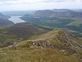
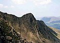
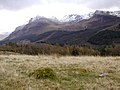
English: Steeple is a hill in the civil parish of Ennerdale and Kinniside, in the Copeland district, in the county of Cumbria, England.
mountain in United Kingdom  | |||||
| Upload media | |||||
| Instance of | |||||
|---|---|---|---|---|---|
| Location |
| ||||
| Mountain range | |||||
| Topographic prominence |
| ||||
| Elevation above sea level |
| ||||
 | |||||
Media in category "Steeple, Cumbria"
The following 20 files are in this category, out of 20 total.
-
 Approaching Steeple. - geograph.org.uk - 1671038.jpg 640 × 480; 69 KB
-
 Cairn, Steeple - geograph.org.uk - 892118.jpg 640 × 480; 106 KB
-
 From Steeple - geograph.org.uk - 892123.jpg 582 × 640; 62 KB
-
 Little Scoat Fell - geograph.org.uk - 1057737.jpg 640 × 424; 61 KB
-
 On the descent from Steeple - geograph.org.uk - 101685.jpg 640 × 369; 33 KB
-
 Pillar and Steeple - geograph.org.uk - 317923.jpg 640 × 426; 102 KB
-
 Ridge between Steeple and Scoat Fell - geograph.org.uk - 906129.jpg 640 × 472; 102 KB
-
 Ridge descending from Steeple - geograph.org.uk - 828974.jpg 640 × 480; 124 KB
-
 Steeple - geograph.org.uk - 828977.jpg 640 × 480; 138 KB
-
 Steeple from Scoat Fell - geograph.org.uk - 144998.jpg 480 × 640; 83 KB
-
 Steeple from Scoat Fell - geograph.org.uk - 160399.jpg 480 × 640; 84 KB
-
 Steeple from Scoat Fell - geograph.org.uk - 892113.jpg 640 × 480; 65 KB
-
 Steeple from Scoat Fell - geograph.org.uk - 906125.jpg 640 × 403; 74 KB
-
 Steeple from Wind Gap.jpg 1,548 × 1,104; 104 KB
-
 Steeple on the right - geograph.org.uk - 1057774.jpg 640 × 389; 78 KB
-
 Steeple summit - geograph.org.uk - 1057765.jpg 640 × 393; 80 KB
-
 Steeple summit view - geograph.org.uk - 1057773.jpg 640 × 435; 65 KB
-
 Steeple viewed from Little Scoat Fell - geograph.org.uk - 504166.jpg 426 × 640; 138 KB
-
 Summit cairn, Steeple - geograph.org.uk - 906127.jpg 640 × 404; 68 KB
-
 View of Pillar and Steeple - geograph.org.uk - 764096.jpg 640 × 480; 80 KB


