Category:Steenstraat 3, Hulst
Jump to navigation
Jump to search
| Object location | | View all coordinates using: OpenStreetMap |
|---|
 | |||||
| Upload media | |||||
| Instance of |
| ||||
|---|---|---|---|---|---|
| Location | Hulst, Zeeland, Netherlands | ||||
| Street address |
| ||||
| Located on street | |||||
| Heritage designation |
| ||||
 | |||||
|
This is a category about rijksmonument number 22765
|
| Address |
|
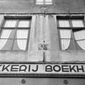
Media in category "Steenstraat 3, Hulst"
The following 14 files are in this category, out of 14 total.
-
 Gevelsteen met afbeelding van een standaardmolen - Hulst - 20118972 - RCE.jpg 1,190 × 1,200; 284 KB
-
 Hoekhuis Steenstr. - Hulst - 20118812 - RCE.jpg 804 × 1,200; 212 KB
-
 Hoekpanden Grote Markt Steenstr., gevels - Hulst - 20118814 - RCE.jpg 1,200 × 927; 272 KB
-
 Hulst - rijksmonument 22765 - Steenstraat 3 20120714.jpg 491 × 800; 185 KB
-
 HulstOude huizen.JPG 1,712 × 2,288; 796 KB
-
 Overzicht voorgevels waarvan twee met trapgevel - Hulst - 20352992 - RCE.jpg 1,174 × 1,200; 332 KB
-

-
 PM 149355 NL Hulst.jpg 371 × 600; 251 KB
-
 Steenstraat 3 Hulst 01.jpg 3,648 × 5,472; 16.92 MB
-
 Steenstraat 3 Hulst 02.jpg 5,472 × 3,648; 18.44 MB
-
 Voorgevels - Hulst - 20118884 - RCE.jpg 818 × 1,200; 202 KB
-
 Voorgevels - Hulst - 20118885 - RCE.jpg 1,200 × 807; 175 KB
-
 Voorgevels - Hulst - 20118888 - RCE.jpg 961 × 1,200; 224 KB
-
 Voorgevels - Hulst - 20118889 - RCE.jpg 959 × 1,200; 245 KB


