Category:Staustufe Dahlhausen
Jump to navigation
Jump to search
| Object location | | View all coordinates using: OpenStreetMap |
|---|
Media in category "Staustufe Dahlhausen"
The following 9 files are in this category, out of 9 total.
-
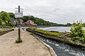
 Bochum Dahlhausen - Staustufe 01 ies.jpg 3,888 × 2,592; 1.47 MB
-
 Bochum Dahlhausen - Staustufe 02 ies.jpg 3,888 × 2,592; 1.82 MB
-
 Bochum Dahlhausen - Staustufe 03 ies.jpg 3,888 × 2,592; 2.02 MB
-
 Bochum Dahlhausen - Staustufe 04 ies.jpg 3,888 × 2,592; 2.18 MB
-
 BochumDahlhausen 061016 061.jpg 1,408 × 1,056; 345 KB
-
 Bootsgasse, Staustufe Dahlhausen in der Ruhr, Bochum-2515.jpg 6,720 × 4,480; 20.09 MB
-
 Bootsgasse, Staustufe Dahlhausen in der Ruhr, Bochum-2517.jpg 5,896 × 3,317; 16.08 MB
-
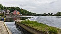 Staustufe Dahlhausen in der Ruhr, Bochum-2520.jpg 6,562 × 3,691; 16.54 MB
-
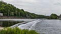 Staustufe Dahlhausen in der Ruhr, Bochum-2521.jpg 6,683 × 3,759; 15.9 MB


