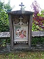
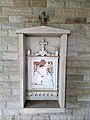
Category:Stations of the Cross in the cemetery wall (Vilchband)
Jump to navigation
Jump to search
| Object location | | View all coordinates using: OpenStreetMap |
|---|
 | |||||
| Upload media | |||||
| Instance of | |||||
|---|---|---|---|---|---|
| Location | Vilchband, Wittighausen, Grünsfeld VVG, Grünsfeld, Grünsfeld VVG, Grünsfeld, Grünsfeld VVG | ||||
| Heritage designation | |||||
 | |||||
Media in category "Stations of the Cross in the cemetery wall (Vilchband)"
The following 15 files are in this category, out of 15 total.
-
 Gusseiserne Kreuzwegstationen, 1899 bez..jpg 3,264 × 2,448; 4.07 MB
-
 Vilchband Kreuzweg 01.jpg 3,456 × 4,608; 5.87 MB
-
 Vilchband Kreuzweg 02.jpg 3,456 × 4,608; 5.71 MB
-
 Vilchband Kreuzweg 03.jpg 3,456 × 4,608; 5.87 MB
-
 Vilchband Kreuzweg 04.jpg 3,456 × 4,608; 6.21 MB
-
 Vilchband Kreuzweg 05.jpg 3,456 × 4,608; 5.33 MB
-
 Vilchband Kreuzweg 06.jpg 3,456 × 4,608; 6.3 MB
-
 Vilchband Kreuzweg 07.jpg 3,456 × 4,608; 5.54 MB
-
 Vilchband Kreuzweg 08.jpg 3,456 × 4,608; 5.8 MB
-
 Vilchband Kreuzweg 09.jpg 3,456 × 4,608; 4.87 MB
-
 Vilchband Kreuzweg 10.jpg 3,456 × 4,608; 5.01 MB
-
 Vilchband Kreuzweg 11.jpg 3,456 × 4,608; 4.6 MB
-
 Vilchband Kreuzweg 12.jpg 3,456 × 4,608; 4.09 MB
-
 Vilchband Kreuzweg 13.jpg 3,456 × 4,608; 4.64 MB
-
 Vilchband Kreuzweg 14.jpg 3,456 × 4,608; 4.75 MB


