Category:State Historical Survey Committee plaques
Jump to navigation
Jump to search
Subcategories
This category has only the following subcategory.
Media in category "State Historical Survey Committee plaques"
The following 43 files are in this category, out of 43 total.
-
 Ben Ficklin Cemetery.jpg 3,036 × 4,048; 3.8 MB
-
 Fernando De Leon (27700807264).jpg 1,655 × 1,549; 1.15 MB
-
 Indian Trails Historical Marker Livingston Texas.jpg 667 × 1,000; 588 KB
-
 Judge H. T. Brown (25357377415).jpg 1,080 × 1,080; 801 KB
-
 Matagorda Cemetery in Matagorda Texas 01 - Historical Marker.jpg 3,024 × 4,032; 4.27 MB
-
 Moscow Historical Marker Moscow Texas.jpg 600 × 900; 892 KB
-
 Salado-tx2016-51(salado-creek).jpg 1,383 × 2,074; 1.18 MB
-
 Schoenthal-school2016-1.jpg 1,625 × 2,437; 1.28 MB
-
 Schulenburg-tx2016-32.jpg 1,279 × 1,919; 1.17 MB
-
 Seguin-tx2016-37(juan-seguin)(@city-hall).jpg 1,383 × 2,074; 1.31 MB
-
 Serbin-tx2016-2.jpg 1,625 × 2,437; 1.3 MB
-
 Shiner-tx2016-28(spoetzl-brewery).jpg 1,401 × 2,100; 1.18 MB
-
 ShinerMarker.JPG 922 × 1,229; 259 KB
-
 ShiveTexasMarker-9306.jpg 900 × 1,401; 557 KB
-
 Site of El Camino Real.jpg 2,566 × 2,488; 1.39 MB
-
 Staples-tx2016-12(camp-clark-CSA).jpg 1,210 × 1,815; 1.22 MB
-
 Starr Cemetery.jpg 1,944 × 2,592; 1.12 MB
-
 Texas - Rancho de las Cabras - 20200807092959.jpeg 3,024 × 4,032; 4.19 MB
-
 Texas - Rancho de las Cabras - 20200807093039.jpeg 4,032 × 3,024; 2.47 MB
-
 Texas Historical Marker 6798 for Neiman Marcus.jpg 2,100 × 3,123; 1,001 KB
-
 Texas Historical Marker for Fort Bliss C.S.A.jpg 2,988 × 5,312; 3.9 MB
-
 Texas Historical marker for Mobeetie.jpg 2,988 × 5,312; 6.89 MB
-
 Texas Historical Marker for Texas Ranger Camp Roberts.jpg 2,448 × 3,264; 3.38 MB
-
 Texas Historical Site Marker for Burr's Ferry at Sabine River Bridge on TX Hwy 63.jpg 1,380 × 1,178; 347 KB
-
 Texas Livery Stable, Cooper, Texas Historical Marker (8588554262).jpg 3,456 × 5,184; 9.72 MB
-
 Texas State Capitol of the 1880s (8502813170).jpg 3,456 × 5,184; 5.54 MB
-
 Texas State Roadside Historical Marker - Don Pedro Jaramllo.jpg 720 × 960; 196 KB
-
 The Gotier Trace.jpg 2,209 × 2,387; 1,006 KB
-
 The Rock Spring, Rocksprings, Texas Historical Marker (7946609682).jpg 3,456 × 5,184; 6.33 MB
-
 Thomaston-tx2016-4.jpg 1,348 × 2,022; 1.23 MB
-
 Thurber, Texas Historical Marker (10999212126).jpg 3,456 × 5,184; 7.81 MB
-
 Titus County C.S.A., Mount Pleasant, Texas Historical Marker (6997904956).jpg 3,456 × 5,184; 8.39 MB
-
 V B Tunstall marker.jpg 1,936 × 2,592; 2.57 MB
-
 Vicinity of Bradbury Settlement, Junction, Texas Historical Marker (7987332596).jpg 3,456 × 5,184; 5.02 MB
-
 Washington on the Brazos Texas historical marker.jpg 2,988 × 5,312; 7.57 MB
-
 Weatherford, Texas Historical Marker (6831795920).jpg 5,184 × 3,456; 7.69 MB
-
 Wentworth, Sonora, Texas Historical Marker (7828901810).jpg 3,456 × 5,184; 7.8 MB
-
 West I 35 (144940849).jpeg 2,048 × 1,365; 574 KB
-
 Westhoff-tx2016-1.jpg 2,022 × 1,348; 1.15 MB
-
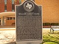 William Carey Crane historical marker, Crane, TX DSCN1368.JPG 640 × 480; 127 KB
-
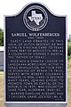 Samuel Wolfenberger Historical Marker.jpg 800 × 1,200; 843 KB
-
 Wortham-tx2015-1(city-of-wortham).jpg 1,245 × 1,867; 1.33 MB
-
 YsletaMission-Plaque.png 3,648 × 2,736; 6.39 MB

.jpg)

.jpg)


.jpg)


(@city-hall).jpg)

.jpg)


.jpg)


.jpg)
.jpg)


.jpg)

.jpg)
.jpg)

.jpg)

.jpg)
.jpg)
.jpeg)


.jpg)
