Category:Start Point
Jump to navigation
Jump to search
promontory in the South Hams district in Devon, England | |||||
| Upload media | |||||
| Instance of | |||||
|---|---|---|---|---|---|
| Location | Stokenham, South Hams, Devon, South West England, England | ||||
 | |||||
Start Point is a promontory in the South Hams distinct, one of the most southerly points in Devon, England, It marks the southern limit of Start Bay, which extends northwards to the estuary of the River Dart.
Subcategories
This category has the following 2 subcategories, out of 2 total.
G
- Great Mattiscombe Sand (32 F)
L
- Start Point Lighthouse (52 F)
Media in category "Start Point"
The following 106 files are in this category, out of 106 total.
-
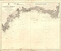
Admiralty Chart No 1267 Dodman Point to Start Point, Published 1962.jpg 15,191 × 8,411; 37.78 MB
-
Admiralty Chart No 1613 Prawle Point to Straight Point, Published 1955.jpg 11,080 × 16,140; 13 MB
-
Admiralty Chart No 1634 Start Bay, Published 1953.jpg 8,074 × 11,029; 12.5 MB
-
Admiralty Chart No 442 Lizard Head to Start Point, Published 1900.jpg 13,555 × 11,297; 49.12 MB
-
Artist at Start Point - geograph.org.uk - 1036417.jpg 640 × 463; 177 KB
-
Behind Start Point - geograph.org.uk - 314534.jpg 640 × 427; 54 KB
-
Black Stone - geograph.org.uk - 1040294.jpg 640 × 480; 46 KB
-
Black Stone - geograph.org.uk - 1336048.jpg 640 × 480; 169 KB
-
Black Stone - geograph.org.uk - 2900279.jpg 1,601 × 2,108; 1.08 MB
-
Black Stone off Start Point (3144).jpg 4,288 × 2,848; 4.29 MB
-
Bluebells above the cliffs near Start Point - May 2015 - panoramio.jpg 3,000 × 3,105; 1.86 MB
-
Boats off of Start Point - June 2015 - panoramio.jpg 4,000 × 2,000; 1.13 MB
-
Boats off Start Point - May 2015 - panoramio.jpg 2,669 × 2,989; 1.11 MB
-
Cliffs north of Start Point (3172).jpg 4,288 × 2,848; 4.87 MB
-
Coast northwest of Start Point - geograph.org.uk - 1490359.jpg 640 × 480; 69 KB
-
Coast path approaching Start Point - geograph.org.uk - 2456970.jpg 1,024 × 768; 255 KB
-
Coast Path heading away from the lighthouse - May 2015 - panoramio.jpg 4,000 × 3,000; 2.79 MB
-
Coast path sign Start Point.jpg 2,048 × 1,536; 1.4 MB
-
Coast path to Start Point - geograph.org.uk - 473912.jpg 640 × 414; 73 KB
-
Coastal Footpath - geograph.org.uk - 423032.jpg 640 × 480; 106 KB
-
Coastal footpath west of Start Point - geograph.org.uk - 932597.jpg 640 × 480; 61 KB
-
Coastal path between Peartree Point and Start Point - geograph.org.uk - 2534379.jpg 3,872 × 2,592; 4.78 MB
-
Coastal path near Start Farm - geograph.org.uk - 2534291.jpg 3,872 × 2,592; 4.48 MB
-
Coastline at Start Point - geograph.org.uk - 2746092.jpg 1,024 × 768; 262 KB
-
Coastline west of Start Point - geograph.org.uk - 1490294.jpg 640 × 480; 85 KB
-
Common seals on John Sims (Start Point) - geograph.org.uk - 2377239.jpg 3,072 × 2,048; 3.81 MB
-
Cove at Start Point - geograph.org.uk - 1335981.jpg 640 × 480; 238 KB
-
Crags and a winding road to the lighthouse - May 2015 - panoramio.jpg 4,000 × 2,000; 692 KB
-
Crags hiding the lighthouse - May 2015 - panoramio.jpg 4,000 × 3,000; 1.7 MB
-
Devon Start Point.png 156 × 131; 3 KB
-
Eroded path - geograph.org.uk - 1335963.jpg 480 × 640; 244 KB
-
Evening at Slapton Sands - May 2015 - panoramio.jpg 4,000 × 2,000; 1.21 MB
-
Flowers near Start Point (3148).jpg 4,288 × 2,848; 5.49 MB
-
Footpath to coast from Start Point car park - geograph.org.uk - 2377373.jpg 3,072 × 2,048; 2.77 MB
-
Froward Point from Start Point (3165).jpg 4,288 × 2,848; 3.86 MB
-
Froweder Point - geograph.org.uk - 1336000.jpg 640 × 480; 239 KB
-
Hallsands & Beesands 2.jpg 2,048 × 1,536; 1.46 MB
-
Hallsands.jpg 5,312 × 2,988; 2.32 MB
-
Long way round - panoramio (1).jpg 4,000 × 3,000; 2.87 MB
-
Near Start Point - geograph.org.uk - 16450.jpg 640 × 425; 61 KB
-
Near the lighthouse - May 2015 - panoramio.jpg 4,000 × 3,000; 2.31 MB
-
Off of Start Point - May 2015 - panoramio.jpg 3,000 × 4,000; 1.09 MB
-
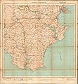
Ordnance Survey One-Inch Sheet 145 Torquay & Dartmouth, Published 1924.jpg 9,362 × 10,136; 9.19 MB
-
Ordnance Survey Sheet SX 73 Salcombe, Published 1968.jpg 14,827 × 7,000; 36.68 MB
-
Over the Valley to Start - geograph.org.uk - 1448201.jpg 640 × 426; 126 KB
-
Sailing off of Start Point - May 2015 - panoramio.jpg 4,000 × 3,000; 4.78 MB
-
Slapton Sands From The Top Deck, Devon-30575578680.jpg 4,608 × 2,592; 7.12 MB
-
Spring flowers - Start Point - May 2015 - panoramio.jpg 4,000 × 3,000; 3.59 MB
-
Start Point (23485021268).jpg 4,681 × 2,784; 3.24 MB
-
Start Point (23485064918).jpg 4,605 × 3,039; 7.55 MB
-
Start Point (23485070508).jpg 4,781 × 2,790; 3.36 MB
-
Start Point (23788160278).jpg 4,687 × 2,876; 3.19 MB
-
Start Point (3145).jpg 4,288 × 2,848; 6.89 MB
-
Start Point (3149).jpg 4,288 × 2,848; 5.33 MB
-
Start Point (3150).jpg 4,288 × 2,848; 6.48 MB
-
Start Point (3151).jpg 4,288 × 2,848; 5.05 MB
-
Start Point (3152).jpg 4,288 × 2,848; 4.98 MB
-
Start Point (3154).jpg 4,288 × 2,848; 7.02 MB
-
Start Point (3155).jpg 4,288 × 2,848; 5.61 MB
-
Start Point (3156).jpg 4,288 × 2,848; 5.49 MB
-
Start Point (3157).jpg 4,288 × 2,848; 6.01 MB
-
Start Point (3158).jpg 4,288 × 2,848; 6.93 MB
-
Start Point (3166).jpg 4,288 × 2,848; 6.17 MB
-
Start Point (3169).jpg 4,288 × 2,848; 5.42 MB
-
Start Point (3174).jpg 4,288 × 2,848; 5.65 MB
-
Start Point (36667075063).jpg 4,733 × 2,994; 4.63 MB
-
Start Point (36930671764).jpg 4,665 × 2,853; 3.4 MB
-
Start Point (37289223596).jpg 4,693 × 3,033; 2.59 MB
-
Start Point (37289236016).jpg 4,673 × 2,907; 3.33 MB
-
Start Point (37382772780).jpg 4,612 × 2,637; 3.42 MB
-
Start Point (37382779090).jpg 4,698 × 3,057; 3.89 MB
-
Start point - geograph.org.uk - 2627913.jpg 640 × 480; 55 KB
-
Start Point - geograph.org.uk - 2900274.jpg 3,000 × 4,000; 4.11 MB
-
Start point - geograph.org.uk - 368297.jpg 640 × 413; 73 KB
-
Start Point - geograph.org.uk - 423040.jpg 640 × 480; 103 KB
-
Start Point - geograph.org.uk - 932586.jpg 640 × 480; 58 KB
-
Start Point - May 2015 - panoramio (1).jpg 4,000 × 3,000; 2.28 MB
-
Start Point - May 2015 - panoramio.jpg 4,000 × 3,000; 1.43 MB
-
Start point - South Devon - geograph.org.uk - 98939.jpg 640 × 480; 125 KB
-
Start Point 5.jpg 2,048 × 1,536; 1.5 MB
-
Start Point and Black Stone - geograph.org.uk - 1336013.jpg 640 × 480; 201 KB
-
Start Point and Lighthouse - geograph.org.uk - 307101.jpg 640 × 426; 70 KB
-
Start Point South 1.jpg 3,800 × 2,848; 5.65 MB
-
Start Point South 3.jpg 3,976 × 2,747; 4.3 MB
-
Start Point, Devon RMG PT2101.tiff 4,800 × 2,940; 40.37 MB
-
Start Point, United Kingdom (Unsplash).jpg 3,420 × 2,280; 2.39 MB
-
Stokenham TQ7, UK - panoramio (4).jpg 4,000 × 3,000; 1.39 MB
-
Stokenham TQ7, UK - panoramio (5).jpg 4,000 × 3,000; 3.01 MB
-
Stokenham TQ7, UK - panoramio (6).jpg 4,000 × 3,000; 1.9 MB
-
Stokenham, near Frenchman's Rock - geograph.org.uk - 812011.jpg 640 × 427; 110 KB
-
Stokenham, rock outcrop near Start Point - geograph.org.uk - 812017.jpg 640 × 427; 143 KB
-
Stokenham, towards Start Point - geograph.org.uk - 812012.jpg 640 × 427; 121 KB
-
Sun on the cliffs - May 2015 - panoramio.jpg 4,000 × 3,000; 4.6 MB
-
The birds of Devon (1892) (14564729970).jpg 3,424 × 2,073; 585 KB
-
The birds of Devon (6140762004).jpg 3,427 × 2,073; 747 KB
-
The cliffs below the lighthouse - May 2015 - panoramio.jpg 4,000 × 3,000; 1.93 MB
-
The end of Start Point - geograph.org.uk - 2627915.jpg 640 × 480; 64 KB
-
The south side of Start point - geograph.org.uk - 2627920.jpg 640 × 480; 75 KB
-
The Start Point headland - geograph.org.uk - 1336093.jpg 640 × 480; 229 KB
-
This way to Start Point - geograph.org.uk - 2305202.jpg 640 × 454; 49 KB
-
Tinsey Head - geograph.org.uk - 473881.jpg 640 × 391; 39 KB
-
View across Start Bay - geograph.org.uk - 1336028.jpg 480 × 640; 223 KB


