Category:Starbotton
Jump to navigation
Jump to search
village in United Kingdom _001.JPG) | |||||
| Upload media | |||||
| Instance of | |||||
|---|---|---|---|---|---|
| Location | Kettlewell with Starbotton, Craven, North Yorkshire, Yorkshire and the Humber, England | ||||
 | |||||
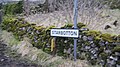
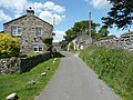
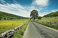
English: Starbotton is a hamlet (of around 70 houses) in the Craven district of North Yorkshire, England. It is situated in the Yorkshire Dales National Park, by the River Wharfe in Wharfedale. The resident population is only around 75 with many of the village houses being used as holiday accommodation. There are only two remaining working farms - one at either end of the village, the rest having being converted in one way or another. It is on the opposite bank of the River Wharfe to the Dales Way half way between Kettlewell and Buckden.
Subcategories
This category has the following 5 subcategories, out of 5 total.
Media in category "Starbotton"
The following 118 files are in this category, out of 118 total.
-
 Bridleway across the valley, Starbotton - geograph.org.uk - 2499331.jpg 2,000 × 1,500; 1.34 MB
-
 Buckden Gavel - geograph.org.uk - 502518.jpg 640 × 440; 174 KB
-
 Buckden Pike - geograph.org.uk - 10961.jpg 640 × 480; 104 KB
-
 Cam Head. - geograph.org.uk - 249946.jpg 640 × 480; 78 KB
-
 Cattle on the Horizon. - geograph.org.uk - 273949.jpg 640 × 480; 37 KB
-

-
 Cottages at Starbotton - geograph.org.uk - 1987471.jpg 3,264 × 2,448; 2.13 MB
-
 Entering Starbotton from Buckden (12th February 2013).JPG 3,872 × 2,176; 2.53 MB
-
 Farmhouse at Starbotton - geograph.org.uk - 1987509.jpg 3,025 × 1,632; 1.28 MB
-
 Footpath and tree, Starbotton - geograph.org.uk - 2500604.jpg 2,000 × 1,492; 1.22 MB
-
 Footpath, Starbotton - geograph.org.uk - 2499320.jpg 2,000 × 1,500; 1.09 MB
-
 Footpath, Starbotton - geograph.org.uk - 2499366.jpg 2,000 × 1,469; 1.01 MB
-
 Footpath, Starbotton - geograph.org.uk - 2499377.jpg 2,000 × 1,500; 1.1 MB
-
 Footpath, Starbotton - geograph.org.uk - 2499391.jpg 2,000 × 1,482; 969 KB
-
 Fosse Gill, Starbotton, Upper Wharfedale - geograph.org.uk - 748199.jpg 640 × 426; 114 KB
-
 Hillside track near Starbotton - geograph.org.uk - 2004210.jpg 2,048 × 1,536; 1.57 MB
-
 Houses in Starbotton - geograph.org.uk - 1987457.jpg 3,264 × 2,448; 2.25 MB
-
 Hunters Stone, Coverdale - geograph.org.uk - 25396.jpg 640 × 480; 70 KB
-
 In Upper Wharfedale - geograph.org.uk - 10958.jpg 640 × 480; 172 KB
-
 Limekiln - geograph.org.uk - 194799.jpg 640 × 480; 116 KB
-
 Ordnance Survey Sheet SD 97 (34 97) Buckden, Published 1946.jpg 7,150 × 9,599; 22.1 MB
-
 Ordnance Survey Sheet SD 97 Published 1952.jpg 5,043 × 5,234; 3.79 MB
-
 Sheep at Hunters Sleet. - geograph.org.uk - 284314.jpg 640 × 480; 103 KB
-
 Sheep on Knuckle Bone Pasture. - geograph.org.uk - 411404.jpg 640 × 480; 220 KB
-
 Spoil from a disused mine - geograph.org.uk - 1527742.jpg 640 × 426; 89 KB
-
 Spring Lathe, Starbotton - geograph.org.uk - 2499387.jpg 2,000 × 1,466; 1.03 MB
-
 Starbotton - geograph.org.uk - 1998926.jpg 4,592 × 3,056; 4.85 MB
-
 Starbotton - geograph.org.uk - 2023998.jpg 640 × 480; 139 KB
-
 Starbotton Fox and hounds. - geograph.org.uk - 1706488.jpg 640 × 480; 74 KB
-
 Starbotton Road. - geograph.org.uk - 139098.jpg 640 × 480; 81 KB
-
 Starbotton sign as the village is approached from Buckden (12th February 2013).JPG 3,872 × 2,176; 2.66 MB
-
 Starbotton Village - geograph.org.uk - 1365980.jpg 640 × 426; 71 KB
-
 Stile on Tor Mere Top - geograph.org.uk - 1211682.jpg 640 × 480; 82 KB
-
 Tennant OfByrkys Yorks Arms.svg 507 × 585; 442 KB
-
 The long wall on Old Cote Moor Top - geograph.org.uk - 732194.jpg 640 × 480; 58 KB
-
 The old road into Starbotton village - geograph.org.uk - 2499341.jpg 2,000 × 1,500; 1.11 MB
-
 The path to Tor Mere Top - geograph.org.uk - 1527684.jpg 640 × 426; 84 KB
-
 The remains of a wall - geograph.org.uk - 1527692.jpg 640 × 426; 86 KB
-

-
 Tor Dyke - geograph.org.uk - 194804.jpg 640 × 480; 108 KB
-
 Tor Mere Top - geograph.org.uk - 1527701.jpg 640 × 426; 99 KB
-
 Walden Road - geograph.org.uk - 91120.jpg 640 × 480; 99 KB
-
 Wall on Old Cote Moor - geograph.org.uk - 1106022.jpg 640 × 428; 95 KB
-

-
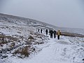
 A talk from the National Park Ranger - geograph.org.uk - 1154630.jpg 640 × 480; 307 KB
-
 A wooden safety cover over a pot hole - geograph.org.uk - 1517277.jpg 640 × 480; 141 KB
-
 Autumn Moorland on Windle Side. - geograph.org.uk - 273800.jpg 640 × 480; 106 KB
-
 Bell pits - geograph.org.uk - 194835.jpg 640 × 480; 108 KB
-
 Birks Wood Barn - geograph.org.uk - 421614.jpg 640 × 480; 144 KB
-
 Bleak House^ - geograph.org.uk - 1517272.jpg 640 × 480; 91 KB
-
 Bridge near Starbotton - geograph.org.uk - 322385.jpg 640 × 480; 165 KB
-
 Bridge Over The River Wharfe. - geograph.org.uk - 416031.jpg 480 × 640; 262 KB
-
 Bridge over the Wharfe, Starbotton - geograph.org.uk - 249353.jpg 480 × 640; 151 KB
-
 Bridleway at Little Hunters Sleet - geograph.org.uk - 1413191.jpg 640 × 426; 113 KB
-
 Cam Gill - geograph.org.uk - 101182.jpg 640 × 480; 35 KB
-
 Cam Gill - geograph.org.uk - 75381.jpg 640 × 427; 57 KB
-
 Coverdale Road at Hunters Sleet - geograph.org.uk - 644881.jpg 640 × 427; 267 KB
-
 Cross Wood - geograph.org.uk - 426620.jpg 640 × 480; 170 KB
-
 Dales Way at Wibbertons Fields - geograph.org.uk - 658623.jpg 640 × 480; 86 KB
-
 Dales Way below Firth Wood - geograph.org.uk - 658953.jpg 640 × 480; 79 KB
-
 Dales Way below Fosse Wood - geograph.org.uk - 658946.jpg 640 × 480; 62 KB
-
 Dales Way below Lords Wood - geograph.org.uk - 658950.jpg 640 × 480; 73 KB
-
 Dales Way near Starbotton - geograph.org.uk - 658944.jpg 640 × 480; 100 KB
-
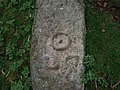 Detail of Marked Stone at Cam Head. - geograph.org.uk - 411439.jpg 640 × 480; 290 KB
-
 Disused Shaft on Hunters Sleet. - geograph.org.uk - 276218.jpg 640 × 480; 112 KB
-
 Droplets On A rusty Wire Fence. - geograph.org.uk - 410690.jpg 640 × 480; 39 KB
-
 Exposed Rocks above Hazel Bank. - geograph.org.uk - 284319.jpg 640 × 480; 119 KB
-
 Fence on North Moor. - geograph.org.uk - 276300.jpg 640 × 480; 93 KB
-
 Fence on Windle Side. - geograph.org.uk - 273804.jpg 640 × 480; 95 KB
-
 Field barns in Upper Wharfedale - geograph.org.uk - 160941.jpg 640 × 480; 97 KB
-
 Firth Fell and Step Gill - geograph.org.uk - 732199.jpg 640 × 480; 94 KB
-
 Footbridge over the River Wharfe - geograph.org.uk - 416034.jpg 480 × 640; 241 KB
-

-
 Footpath above Wharfedale - geograph.org.uk - 778563.jpg 640 × 473; 94 KB
-
 Ford across East Stone Gill. - geograph.org.uk - 284326.jpg 640 × 441; 99 KB
-
 Gate and finger post - geograph.org.uk - 1413172.jpg 640 × 426; 103 KB
-
 Gate on footpath near Tor Dyke - geograph.org.uk - 223948.jpg 640 × 480; 127 KB
-
 Gate on route to Great Whernside - geograph.org.uk - 223951.jpg 640 × 480; 76 KB
-
 Grouse Butts on North Moor. - geograph.org.uk - 273839.jpg 640 × 480; 94 KB
-
 Gwen M Banister Memorial Bench. - geograph.org.uk - 410624.jpg 640 × 480; 222 KB
-

-
 Hazel Bank Gill. - geograph.org.uk - 276308.jpg 640 × 480; 118 KB
-
 Hunters Stone - geograph.org.uk - 357850.jpg 640 × 426; 164 KB
-
 In Upper Wharfedale - geograph.org.uk - 10957.jpg 640 × 480; 183 KB
-
 Larsen Trap at Hunters Sleet. - geograph.org.uk - 284312.jpg 640 × 480; 100 KB
-
 Looking NE towards Starbotton - geograph.org.uk - 10959.jpg 640 × 480; 127 KB
-
 Looking towards Kettlewell - geograph.org.uk - 10960.jpg 640 × 480; 113 KB
-

-
 Marked Stone at Cam Head. - geograph.org.uk - 411435.jpg 640 × 480; 243 KB
-
 Moor End - geograph.org.uk - 160949.jpg 640 × 480; 121 KB
-
 More Spent Cartridges. - geograph.org.uk - 276210.jpg 640 × 480; 158 KB
-
 Old Cote Moor - geograph.org.uk - 637556.jpg 640 × 480; 39 KB
-
 On Hunters Sleets - geograph.org.uk - 115791.jpg 640 × 480; 40 KB
-
 Primary school at Kettlewell - geograph.org.uk - 421627.jpg 640 × 480; 102 KB
-
 Remains of a Grouse Butt. - geograph.org.uk - 276211.jpg 640 × 480; 132 KB
-
 River Wharfe at Kettlewell - geograph.org.uk - 658605.jpg 640 × 480; 74 KB
-
 Road through Starbotton - geograph.org.uk - 383847.jpg 585 × 437; 86 KB
-
 Road to Starbotton - geograph.org.uk - 194706.jpg 500 × 331; 123 KB
-
 Shake Hole on Hazel Bank. - geograph.org.uk - 284323.jpg 640 × 480; 105 KB
-
 Small Pond on Great Hunters Sleet. - geograph.org.uk - 273793.jpg 640 × 480; 97 KB
-
 Spent Cartridges. - geograph.org.uk - 276206.jpg 640 × 480; 151 KB
-
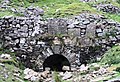
 Starbotton Bridge - geograph.org.uk - 421617.jpg 640 × 480; 146 KB
-
 Starbotton Bridge - geograph.org.uk - 421619.jpg 640 × 480; 153 KB
-
 Starbotton from the north - geograph.org.uk - 194207.jpg 640 × 528; 77 KB
-
 Starbotton Out Moor. - geograph.org.uk - 139111.jpg 640 × 480; 68 KB
-
 Starbotton Peat Ground. - geograph.org.uk - 139104.jpg 640 × 480; 78 KB
-

-

-
 Top Mere Road. - geograph.org.uk - 249952.jpg 640 × 480; 106 KB
-
 Top of Hazel Bank Gill. - geograph.org.uk - 276309.jpg 640 × 480; 99 KB
-
 Top of Middle Gill. - geograph.org.uk - 273870.jpg 640 × 480; 119 KB
-
 Tor Mere Top. - geograph.org.uk - 273787.jpg 640 × 480; 98 KB
-
 Tracks in Mud. - geograph.org.uk - 276230.jpg 480 × 640; 132 KB
-
 Trap above Hazel Bank - geograph.org.uk - 276215.jpg 640 × 480; 140 KB
-
 Walled Footpath At Starbotton. - geograph.org.uk - 416040.jpg 640 × 480; 275 KB
-
 Waterfall in East Stone Gill. - geograph.org.uk - 284325.jpg 640 × 480; 117 KB
-
 West Stone Gill. - geograph.org.uk - 276324.jpg 640 × 480; 83 KB
-
 Windle Side. - geograph.org.uk - 276296.jpg 640 × 480; 101 KB


.JPG)


_Buckden,_Published_1946.jpg)


.JPG)


