Category:Stanton Drew
Jump to navigation
Jump to search
English: Stanton Drew is a small village and civil parish within the Chew Valley in Somerset, England, situated north of the Mendip Hills, south of Bristol in the Bath and North East Somerset Unitary Authority.
village in the United Kingdom  | |||||
| Upload media | |||||
| Instance of | |||||
|---|---|---|---|---|---|
| Location | Bath and North East Somerset, Somerset, South West England, England | ||||
| Population |
| ||||
 | |||||
Subcategories
This category has the following 6 subcategories, out of 6 total.
B
C
- The Court, Stanton Drew (2 F)
D
- Druids Arms, Stanton Drew (10 F)
S
- Stanton Drew Round House (15 F)
Media in category "Stanton Drew"
The following 200 files are in this category, out of 251 total.
(previous page) (next page)-

-

-

-

-
 2010 , East from Pensford Lane - geograph.org.uk - 2022131.jpg 800 × 488; 119 KB
-
 2010 , East from Wick Lane, Pensford - geograph.org.uk - 1949640.jpg 800 × 439; 116 KB
-

-

-
 2010 , Field of maize near Belluton - geograph.org.uk - 1949681.jpg 800 × 534; 153 KB
-
 2010 , Highway Maintenance engineer - geograph.org.uk - 2021847.jpg 800 × 643; 127 KB
-
 2010 , House on Pensford Lane - geograph.org.uk - 2022132.jpg 800 × 375; 93 KB
-
 2010 , North east from Wick Lane - geograph.org.uk - 2023731.jpg 800 × 595; 163 KB
-
 2010 , North of east from Wick Lane - geograph.org.uk - 2023743.jpg 800 × 516; 159 KB
-
 2010 , North of east from Wick Lane - geograph.org.uk - 2023806.jpg 1,024 × 484; 214 KB
-

-
 2010 , Pastures and Pensford's Pride - geograph.org.uk - 1949712.jpg 800 × 453; 108 KB
-

-
 2010 , South east from Wick Lane - geograph.org.uk - 2023856.jpg 800 × 413; 86 KB
-
-
 2010 , View north from Stanton Wick Lane - geograph.org.uk - 1949539.jpg 800 × 546; 106 KB
-

-
 2010 , West from Stanton Wick Lane - geograph.org.uk - 2021833.jpg 800 × 395; 73 KB
-
 2010 , West from Wick Lane - geograph.org.uk - 2023763.jpg 1,024 × 683; 276 KB
-
 2012 , Bromley Road, Stanton Drew - geograph.org.uk - 2900552.jpg 3,153 × 2,214; 1.75 MB
-
 2012 , Combo muck heap and mud pile - geograph.org.uk - 3225822.jpg 4,752 × 3,168; 5.73 MB
-
 2012 , Paddock, Sandy Lane, Stanton Drew - geograph.org.uk - 2900861.jpg 4,622 × 2,084; 3.19 MB
-

-
 2012 , Twinway Farm with pasture and forsythia - geograph.org.uk - 2900535.jpg 3,940 × 2,611; 2.87 MB
-
 2012 -Bromley Road, south of Stanton Drew - geograph.org.uk - 2897348.jpg 3,854 × 2,681; 3.16 MB
-
 A chilly night - geograph.org.uk - 4326509.jpg 2,304 × 1,704; 1.75 MB
-
 A choice of paths - geograph.org.uk - 4889968.jpg 2,304 × 1,704; 1.57 MB
-
 A ditch around the field - geograph.org.uk - 5645818.jpg 1,704 × 2,304; 2.43 MB
-
 A few pippins - geograph.org.uk - 5860553.jpg 2,304 × 1,704; 1.7 MB
-
 A flowery roadside bank heading down into Stanton Drew - geograph.org.uk - 4589737.jpg 2,346 × 3,128; 2.33 MB
-
 A garden full of nettles - geograph.org.uk - 5026076.jpg 2,304 × 1,704; 1.58 MB
-
 A gathering at the cursus - geograph.org.uk - 5695631.jpg 2,304 × 1,704; 1.42 MB
-
 A Georgian letterbox in Stanton Wick - geograph.org.uk - 5861364.jpg 1,704 × 2,304; 1.67 MB
-
 A lesson in Neospora - geograph.org.uk - 5646140.jpg 2,304 × 1,704; 1.72 MB
-
 A lone poppy - geograph.org.uk - 3850939.jpg 1,704 × 2,304; 2.11 MB
-
 A Midsummer gathering - geograph.org.uk - 5815636.jpg 2,304 × 1,704; 1.27 MB
-
 A miniature mountain - geograph.org.uk - 5695663.jpg 1,704 × 2,304; 1.76 MB
-
 A new tradition^ - geograph.org.uk - 5816020.jpg 2,304 × 1,704; 1.3 MB
-
 A scene unchanged for millennia - geograph.org.uk - 4890512.jpg 1,704 × 2,304; 2.16 MB
-
 A short bridge - geograph.org.uk - 5861212.jpg 1,704 × 2,304; 1.72 MB
-
 A short path for a missing moggie - geograph.org.uk - 5025422.jpg 2,304 × 1,704; 1.75 MB
-
 A smaller circle - geograph.org.uk - 5695660.jpg 2,304 × 1,704; 1.7 MB
-
 A snowy south west circle - geograph.org.uk - 5695648.jpg 2,304 × 1,704; 1.57 MB
-
 A snowy Stanton Drew - geograph.org.uk - 5695637.jpg 2,304 × 1,704; 1.53 MB
-
 A stony igloo^ - geograph.org.uk - 5695653.jpg 2,304 × 1,704; 1.76 MB
-
 A tree in a field - geograph.org.uk - 5861194.jpg 2,304 × 1,704; 1.58 MB
-
 A vane on the wane - geograph.org.uk - 5860561.jpg 2,304 × 1,704; 1.36 MB
-
 A368 at the Stanton Wick junction - geograph.org.uk - 1225496.jpg 640 × 486; 186 KB
-
 Alice's Gate - geograph.org.uk - 4323533.jpg 1,704 × 2,304; 1.95 MB
-
 All in the game - geograph.org.uk - 5025754.jpg 2,304 × 1,704; 1.61 MB
-
 An ancient use for ancient stones - geograph.org.uk - 5877195.jpg 2,304 × 1,704; 1,020 KB
-
 Another solstice for the recumbent - geograph.org.uk - 5816050.jpg 1,704 × 2,304; 1.41 MB
-
 Arrows under camouflage - geograph.org.uk - 5860552.jpg 1,704 × 2,304; 1.7 MB
-
 As evening falls around the circle - geograph.org.uk - 5816026.jpg 2,304 × 1,704; 1.32 MB
-
 Avenues of stone - geograph.org.uk - 4326262.jpg 2,304 × 1,704; 1.63 MB
-
 Back across the little drain - geograph.org.uk - 5861288.jpg 1,704 × 2,304; 1.82 MB
-
 Bath And North East Somerset , Pensford Scenery - geograph.org.uk - 5442134.jpg 6,000 × 4,000; 6.6 MB
-
 Bath And North East Somerset , Stanton Drew Scenery - geograph.org.uk - 5442135.jpg 6,000 × 4,000; 6.54 MB
-
 Betrothed by A and C - geograph.org.uk - 5026081.jpg 1,704 × 2,304; 2.08 MB
-
 Bridge on the lane from Upper Stanton Drew to Pensford - geograph.org.uk - 2737951.jpg 4,000 × 3,000; 1.83 MB
-
 Bridge over the weir at Byemills Cottage - geograph.org.uk - 4215285.jpg 5,760 × 3,840; 7.39 MB
-
 Bus Stop. Stanton Drew - geograph.org.uk - 2746555.jpg 480 × 640; 76 KB
-
 Byway becomes Bridleway - geograph.org.uk - 1824276.jpg 2,592 × 1,944; 1.41 MB
-
 Byway, Stanton Drew - geograph.org.uk - 2746501.jpg 640 × 480; 102 KB
-
 Cattle in meadow - geograph.org.uk - 1278948.jpg 640 × 480; 205 KB
-
 Celebrating the longest day in traditional style - geograph.org.uk - 5816013.jpg 2,304 × 1,704; 1.33 MB
-
 Chew valley at Pensford from the air - geograph.org.uk - 5689008.jpg 4,288 × 2,848; 917 KB
-
 Chew valley from the air - geograph.org.uk - 5689009.jpg 4,288 × 2,848; 1,004 KB
-
 Chewed near the Chew - geograph.org.uk - 5646072.jpg 1,704 × 2,304; 1.75 MB
-
 Church Farm - geograph.org.uk - 2746609.jpg 800 × 709; 189 KB
-
 Convenient post for livestock - geograph.org.uk - 4326231.jpg 2,304 × 1,704; 1.66 MB
-
 Dead tree, Stanton Drew - geograph.org.uk - 1800576.jpg 588 × 441; 162 KB
-
 Didn't survive the winter - geograph.org.uk - 5695643.jpg 2,304 × 1,704; 1.67 MB
-
 Different signs of the times - geograph.org.uk - 5860700.jpg 1,704 × 2,304; 1.68 MB
-
-
 Disappearing into the long grass - geograph.org.uk - 5026073.jpg 2,304 × 1,704; 1.23 MB
-
 Don't get lost in the maize^ - geograph.org.uk - 5861350.jpg 2,304 × 1,704; 1.45 MB
-
 Down to the viaduct - geograph.org.uk - 5645826.jpg 2,304 × 1,704; 1.79 MB
-
 Draining from the old heap - geograph.org.uk - 5861221.jpg 1,704 × 2,304; 1.94 MB
-
 Driveway to converted chapel - geograph.org.uk - 2737949.jpg 4,000 × 3,000; 1.9 MB
-
 Due south on Maes Knoll - geograph.org.uk - 1389145.jpg 640 × 427; 137 KB
-
 Early gold - geograph.org.uk - 5860549.jpg 2,304 × 1,704; 1.8 MB
-
 Early Spring^ - geograph.org.uk - 4323515.jpg 2,304 × 1,704; 1.68 MB
-
 East end of Church Farm - geograph.org.uk - 1278922.jpg 640 × 480; 226 KB
-
 East side of the South West Circle - geograph.org.uk - 4890518.jpg 2,304 × 1,704; 1.7 MB
-
 Easy to smoke them out - geograph.org.uk - 5025456.jpg 2,304 × 1,704; 896 KB
-
 Emphasising a point - geograph.org.uk - 6433727.jpg 2,472 × 3,296; 2.96 MB
-
 Entrance stone to Stanton Drew - geograph.org.uk - 5861382.jpg 2,304 × 1,704; 1.71 MB
-
 Experiencing the last rays of the Midsummer sun - geograph.org.uk - 5815634.jpg 2,304 × 1,704; 1.1 MB
-
 Facing the sun to the north west - geograph.org.uk - 5815639.jpg 2,304 × 1,704; 1.31 MB
-
 Farmland and trees near Stanton Wick - geograph.org.uk - 1206946.jpg 640 × 539; 153 KB
-
 Farmland near Upper Stanton Drew - geograph.org.uk - 5898781.jpg 3,145 × 1,497; 1.19 MB
-
 Featherbed Lane - geograph.org.uk - 2666460.jpg 2,592 × 1,944; 947 KB
-
 Finally fallen - geograph.org.uk - 5695646.jpg 2,304 × 1,704; 1.89 MB
-
 Flat out in a tractor^ - geograph.org.uk - 5025466.jpg 1,704 × 2,304; 1.99 MB
-
 Footpath through Stanton Drew - geograph.org.uk - 1278918.jpg 640 × 480; 228 KB
-
 For God, King and Country - geograph.org.uk - 4323466.jpg 1,704 × 2,304; 2.01 MB
-
 Four-legged druids - geograph.org.uk - 4888857.jpg 2,304 × 1,704; 1.68 MB
-
 Fringe benefits - geograph.org.uk - 3850941.jpg 1,704 × 2,304; 2.12 MB
-
 From Curl's Wood - geograph.org.uk - 1206964.jpg 640 × 490; 186 KB
-
 Gate to the stones - geograph.org.uk - 4326522.jpg 2,304 × 1,704; 1.67 MB
-
 Goats at Stanton Drew - geograph.org.uk - 2746566.jpg 480 × 640; 103 KB
-
 Golden rows - geograph.org.uk - 5860572.jpg 2,304 × 1,704; 1.74 MB
-
 Growing around the old colliery - geograph.org.uk - 5861256.jpg 2,304 × 1,704; 1.57 MB
-
 Guy's Hill Byway - geograph.org.uk - 1824238.jpg 2,592 × 1,944; 4.63 MB
-
 Halfway to rack and ruin - geograph.org.uk - 5025747.jpg 2,304 × 1,704; 1.69 MB
-
 Heavy plant as an entrance sign - geograph.org.uk - 5861390.jpg 2,304 × 1,704; 1.83 MB
-
 Home from Home at Blackmore and Langdon's - geograph.org.uk - 5645785.jpg 2,304 × 1,704; 1.64 MB
-
 Housing near Stanton Drew - geograph.org.uk - 1670240.jpg 640 × 480; 131 KB
-
 If Druids caught buses - geograph.org.uk - 6028239.jpg 1,024 × 768; 175 KB
-
 It's getting dark now - back to the pub^ - geograph.org.uk - 5815642.jpg 2,304 × 1,704; 1.31 MB
-
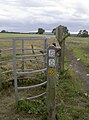
 Kissing gate, Stanton Drew - geograph.org.uk - 1670138.jpg 640 × 481; 167 KB
-
 Lane and public footpath cross here - geograph.org.uk - 2539208.jpg 640 × 480; 180 KB
-
 Lane in Upper Stanton Drew - geograph.org.uk - 163499.jpg 640 × 426; 191 KB
-
 Light on the hall - geograph.org.uk - 4323477.jpg 1,704 × 2,304; 1.51 MB
-
 Living after death - geograph.org.uk - 4326286.jpg 2,304 × 1,704; 1.74 MB
-
 Love on a mountain^ - geograph.org.uk - 5816039.jpg 1,704 × 2,304; 1.65 MB
-
 Marking the last of the light - geograph.org.uk - 5816031.jpg 2,304 × 1,704; 1.37 MB
-

-
 Methodist Church, Stanton Drew - geograph.org.uk - 163490.jpg 640 × 426; 118 KB
-
 Midsummer sentinel - geograph.org.uk - 5816053.jpg 1,704 × 2,304; 1.69 MB
-
 Mill weir on the River Chew at Byemills Farm - geograph.org.uk - 3989297.jpg 3,128 × 2,346; 2.15 MB
-
 Minor road near Bromley Farm - geograph.org.uk - 1225544.jpg 640 × 469; 151 KB
-
 Minor road passing Bromley Farm - geograph.org.uk - 1225556.jpg 640 × 524; 107 KB
-
 Mixed materials - geograph.org.uk - 6028174.jpg 640 × 480; 76 KB
-
 Moo - geograph.org.uk - 424567.jpg 490 × 640; 60 KB
-
 Motor vehicles only by invitation - geograph.org.uk - 5645797.jpg 2,304 × 1,704; 1.6 MB
-
 New tree on an old site - geograph.org.uk - 4326266.jpg 2,304 × 1,704; 1.8 MB
-
 No calls, but some good stories - geograph.org.uk - 5860579.jpg 2,304 × 1,704; 1.68 MB
-
 North near Bromley Farm - geograph.org.uk - 1225566.jpg 640 × 493; 117 KB
-
 Oil seed rape at an early stage - geograph.org.uk - 1225503.jpg 640 × 472; 130 KB
-

-
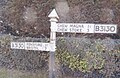
 Old Direction Sign - Signpost by the A368, Stanton Drew - geograph.org.uk - 6047697.jpg 1,337 × 1,953; 288 KB
-
 Old Red Sandstone beds neatly dovetailed into a stone wall - geograph.org.uk - 4589732.jpg 3,128 × 2,346; 2.11 MB
-
 One lying, one standing - geograph.org.uk - 5695675.jpg 2,304 × 1,704; 1.69 MB
-
 One of the major ring stones still erect at Stanton Drew - geograph.org.uk - 4901224.jpg 3,648 × 2,048; 1.86 MB
-
 Ordnance Survey Cut Mark - geograph.org.uk - 5118215.jpg 438 × 640; 115 KB
-
 Ordnance Survey Cut Mark - geograph.org.uk - 5118218.jpg 636 × 640; 142 KB
-
 Part of the Great Circle in the snow - geograph.org.uk - 5695640.jpg 2,304 × 1,704; 1.68 MB
-
 Part of the Two Rivers Way - geograph.org.uk - 4890448.jpg 2,304 × 1,704; 1.64 MB
-
 Pasture at Bromley Farm - geograph.org.uk - 1225561.jpg 640 × 524; 115 KB
-
 Pasture by The Cove - geograph.org.uk - 4323418.jpg 2,304 × 1,704; 1.54 MB
-
 Pasture near Bromley Farm - geograph.org.uk - 1670253.jpg 640 × 480; 127 KB
-
 Pasture with Chew Valley beyond - geograph.org.uk - 1225570.jpg 640 × 468; 107 KB
-
 Path to Moorledge - geograph.org.uk - 5025476.jpg 2,304 × 1,704; 1.6 MB
-
 Pensford viaduct from Belluton - geograph.org.uk - 6433742.jpg 3,296 × 2,472; 1.95 MB
-
 Pensford's magnificence - geograph.org.uk - 5646021.jpg 2,304 × 1,704; 1.59 MB
-
 Perhaps they were not designed for this^ - geograph.org.uk - 5815641.jpg 1,704 × 2,304; 1.34 MB
-
 Picked out by the snow - geograph.org.uk - 5695677.jpg 1,704 × 2,304; 1.47 MB
-
 Places of worship - geograph.org.uk - 4326275.jpg 2,304 × 1,704; 1.49 MB
-
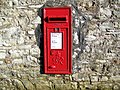 Postbox, Stanton Drew - geograph.org.uk - 1670154.jpg 640 × 480; 207 KB
-
 Pre-school care - geograph.org.uk - 4323556.jpg 2,304 × 1,704; 1.48 MB
-
 Protection for a trunk - geograph.org.uk - 4326285.jpg 2,304 × 1,704; 1.61 MB
-
 Reaching for the clouds - geograph.org.uk - 4888866.jpg 2,304 × 1,704; 989 KB
-
 Remains of Bye Mill - geograph.org.uk - 1171672.jpg 640 × 479; 162 KB
-
 Ring stone at Stanton Drew - geograph.org.uk - 4945651.jpg 1,800 × 3,200; 1.71 MB
-
 Road junction near Norton Hawkfield - geograph.org.uk - 2737911.jpg 4,000 × 3,000; 2.19 MB
-
 Road linking Stanton Wick and Stanton Drew - geograph.org.uk - 5861376.jpg 2,304 × 1,704; 1.57 MB
-
 Road through Stanton Drew - geograph.org.uk - 2539196.jpg 640 × 480; 149 KB
-
 Sandy Lane leaves the tarmac behind - geograph.org.uk - 2456421.jpg 2,592 × 1,944; 1.46 MB
-
 Sandy Lane narrows - geograph.org.uk - 2456396.jpg 2,592 × 1,944; 1.52 MB
-
 Seen it many times before - geograph.org.uk - 5695634.jpg 2,304 × 1,704; 1.44 MB
-
 Shortcut to Stanton Drew - geograph.org.uk - 5026068.jpg 1,704 × 2,304; 1.7 MB
-
 Sign down - geograph.org.uk - 6433715.jpg 3,296 × 2,472; 1.86 MB
-
 Sign of a busy winter - geograph.org.uk - 5646130.jpg 2,304 × 1,704; 1.88 MB
-
 Smothering snow - geograph.org.uk - 5695454.jpg 1,704 × 2,304; 1.61 MB
-
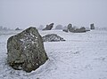
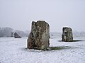
 Snowy circles - geograph.org.uk - 5695448.jpg 2,304 × 1,621; 1.47 MB
-
 Snowy sentinels - geograph.org.uk - 5695615.jpg 2,304 × 1,704; 1.67 MB
-
 Snowy stones - geograph.org.uk - 5695449.jpg 2,304 × 1,704; 1.62 MB
-
 South Bristol Service Centre - geograph.org.uk - 6124885.jpg 4,000 × 3,000; 2.5 MB
-
 South West Circle - geograph.org.uk - 4890493.jpg 2,304 × 1,704; 1.68 MB
-
 South West Circle - geograph.org.uk - 4890500.jpg 2,304 × 1,704; 1.75 MB
-
 South West Circle - geograph.org.uk - 4890524.jpg 1,704 × 2,304; 2.08 MB
-
 Southwest quadrant - geograph.org.uk - 4326235.jpg 1,704 × 2,304; 1.67 MB
-
 St Mary braced against the snow - geograph.org.uk - 5695681.jpg 2,304 × 1,704; 1.68 MB
-
 St Mary the Virgin in snow - geograph.org.uk - 5695679.jpg 2,304 × 1,704; 1.34 MB
-
 Stanton Drew 2000 - geograph.org.uk - 347248.jpg 640 × 426; 104 KB
-
 Stanton Drew Lecture Hall - geograph.org.uk - 2737919.jpg 4,000 × 3,000; 1.78 MB
-
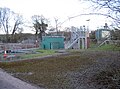 Stanton Drew Sewage Treatment Works - geograph.org.uk - 4890473.jpg 2,304 × 1,704; 1.79 MB
-
 Stanton Drew Stone Circle - geograph.org.uk - 4945657.jpg 3,200 × 1,800; 1.37 MB
-
 Stanton Drew Stone Circle - geograph.org.uk - 4945658.jpg 3,200 × 1,800; 1.35 MB
-
 Stanton Drew Stone Circle - geograph.org.uk - 5110224.jpg 1,024 × 683; 280 KB
-
 Stanton Drew Stone Circles - geograph.org.uk - 5110226.jpg 1,024 × 683; 181 KB
-
 Stanton Drew Stone Circles - geograph.org.uk - 5110238.jpg 1,024 × 683; 258 KB
-
 Stanton Drew Stone Circles - geograph.org.uk - 5110257.jpg 1,024 × 683; 259 KB
-
 Stanton Drew STW - geograph.org.uk - 4326282.jpg 2,304 × 1,704; 1.68 MB
-
 Stanton Drew tollhouse - geograph.org.uk - 2737914.jpg 3,000 × 4,000; 2.7 MB
-
 Stanton Drew village stone - geograph.org.uk - 5025414.jpg 1,704 × 2,304; 2.6 MB
-
 Stanton Drew war memorial - geograph.org.uk - 4323504.jpg 2,304 × 1,704; 1.73 MB
-
 Stanton Drew war memorial - geograph.org.uk - 5025447.jpg 2,304 × 1,704; 1.66 MB
-
 Stanton Drew's finest in the snow - geograph.org.uk - 5695625.jpg 2,304 × 1,704; 1.45 MB
-
 Stanton Drew's snowy stone circle - geograph.org.uk - 5695459.jpg 2,304 × 1,704; 1.33 MB
-
 Stanton Drew, North stone row - geograph.org.uk - 5683535.jpg 1,600 × 953; 800 KB
-
 Stanton Drew, South stone row - geograph.org.uk - 5683540.jpg 1,600 × 1,050; 1.05 MB
-
 Stanton Drew, St Mary - geograph.org.uk - 6365925.jpg 4,000 × 3,000; 4.97 MB
-
 Start of the Footpath from Stanton Drew to Moorledge - geograph.org.uk - 4589727.jpg 2,346 × 3,128; 2.31 MB


