Category:Stanstead St Margarets
Jump to navigation
Jump to search
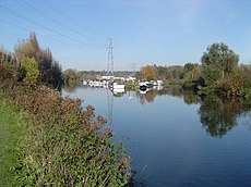
English: Stanstead St Margarets is a village and civil parish in the East Hertfordshire district, in the county of Hertfordshire, England. It is located half way between the towns of Hoddesdon and Ware. The village is separated from the village of Stanstead Abbotts by the River Lee.
village in the United Kingdom | |||||
| Upload media | |||||
| Instance of | |||||
|---|---|---|---|---|---|
| Location | East Hertfordshire, Hertfordshire, East of England, England | ||||
| Population |
| ||||
 | |||||
Subcategories
This category has the following 2 subcategories, out of 2 total.
Media in category "Stanstead St Margarets"
The following 65 files are in this category, out of 65 total.
-
2022-01-29 Bridge over the Lea, Stanstead Abbotts & Stanstead St Margarets.jpg 4,032 × 3,024; 4.31 MB
-
2022-01-29 The Jolly Fisherman pub, Stanstead St Margarets.jpg 2,976 × 2,232; 1.81 MB
-
310 bus on the B181 - geograph.org.uk - 4701660.jpg 2,048 × 1,536; 1.5 MB
-
A10, Hailey - geograph.org.uk - 4793447.jpg 640 × 426; 41 KB
-
A10, southbound - geograph.org.uk - 4793444.jpg 640 × 426; 36 KB
-
Amwell Roundabout - geograph.org.uk - 1978747.jpg 1,280 × 960; 474 KB
-
Amwell Roundabout bus stop - geograph.org.uk - 1978822.jpg 1,280 × 960; 487 KB
-
Chardingleye Farm, Great Amwell - geograph.org.uk - 1978727.jpg 1,280 × 960; 474 KB
-
Entrance to field in St Margarets - geograph.org.uk - 4701661.jpg 2,048 × 1,536; 991 KB
-
Entrance to stables in St Margarets - geograph.org.uk - 4701662.jpg 2,048 × 1,536; 1.55 MB
-
Heavy rain on Hoddesdon Road, St Margarets - geograph.org.uk - 6913291.jpg 1,920 × 1,280; 1.48 MB
-
High Street, St Margarets - geograph.org.uk - 6913283.jpg 1,920 × 1,280; 1.19 MB
-
Hoddesdon Road, St Margarets - geograph.org.uk - 6913294.jpg 1,920 × 1,280; 1.03 MB
-
Houses on St Margarets Road, Hailey - geograph.org.uk - 6912160.jpg 1,613 × 1,064; 959 KB
-
Old cottages on Hoddesdon Road, St Margarets - geograph.org.uk - 6913308.jpg 1,868 × 1,198; 1.21 MB
-
Path in St. Margaret's Community Wood - geograph.org.uk - 4328696.jpg 640 × 480; 146 KB
-
River Lea at St. Margaret's - geograph.org.uk - 3492697.jpg 640 × 480; 55 KB
-
River Lee Navigation at St. Margaret's - geograph.org.uk - 3582766.jpg 640 × 360; 100 KB
-
River Lee near St. Margaret's - geograph.org.uk - 3492724.jpg 640 × 480; 88 KB
-
Road sign on the approach to Amwell Roundabout - geograph.org.uk - 1980763.jpg 1,280 × 960; 473 KB
-
Rye Common Water Treatment Works - geograph.org.uk - 6912156.jpg 1,848 × 1,160; 989 KB
-
St. Margaret's station - geograph.org.uk - 4330226.jpg 640 × 480; 100 KB
-
Stanstead St Margarets marina 1 2020-08-23.jpg 4,032 × 2,268; 3.59 MB
-
Stanstead St Margarets marina 2 2020-08-23.jpg 4,032 × 2,268; 4.2 MB
-
Stanstead St. Margarets, Railway line - geograph.org.uk - 81157.jpg 640 × 480; 136 KB
-
The Amwell Roundabout - geograph.org.uk - 6913278.jpg 1,872 × 1,204; 1.17 MB
-
The Amwell Roundabout from Stanstead Road - geograph.org.uk - 3205761.jpg 2,048 × 1,536; 1.48 MB
-
The Jolly Fisherman at St Margarets - geograph.org.uk - 4824787.jpg 4,608 × 3,456; 3.67 MB
-
The Jolly Fisherman at St Margarets - geograph.org.uk - 5214478.jpg 4,608 × 3,456; 3.63 MB
-
The New River at the A414 bridge (2) - geograph.org.uk - 4329581.jpg 640 × 480; 104 KB
-
The New River at the A414 bridge - geograph.org.uk - 4329556.jpg 640 × 480; 127 KB
-
The New River north of the A414 bridge - geograph.org.uk - 4329576.jpg 640 × 480; 138 KB
-
The New River north of The Wilderness - geograph.org.uk - 4329611.jpg 640 × 480; 104 KB
-
The New River, Stanstead St. Margarets - geograph.org.uk - 81002.jpg 640 × 480; 176 KB
-
The Wilderness - geograph.org.uk - 4329586.jpg 640 × 480; 157 KB
-
Under Ware - geograph.org.uk - 6912154.jpg 1,920 × 1,280; 1.37 MB
-
Victorian House on Ware Road - geograph.org.uk - 4701664.jpg 2,048 × 1,536; 950 KB
-
View from a bridge at Stanstead Abbotts - geograph.org.uk - 5128893.jpg 4,608 × 3,456; 3.91 MB
-
Ware Road, St Margarets - geograph.org.uk - 4701663.jpg 1,986 × 1,448; 843 KB


