Category:Stanley Road, Liverpool
Jump to navigation
Jump to search
| Object location | | View all coordinates using: OpenStreetMap |
|---|
Stanley Road, Liverpool, connects Scotland Road to Bootle, where it becomes Stanley Road, Bootle.
Subcategories
This category has the following 14 subcategories, out of 14 total.
B
- Bankhall Girls' Institute (9 F)
C
- The Cunard, Kirkdale (2 F)
E
G
- The Grosvenor, Kirkdale (2 F)
K
- Kirkdale sign, Stanley Road (2 F)
- The Knowsley, Kirkdale (5 F)
P
R
- The Royal, Kirkdale (7 F)
S
- The Stanley Bar, Kirkdale (3 F)
T
- The Pitch Pine, Kirkdale (3 F)
W
Media in category "Stanley Road, Liverpool"
The following 15 files are in this category, out of 15 total.
-
 Benchmark at junction Stanley Road and Bankhall Street.jpg 3,456 × 4,608; 11.47 MB
-
 Benchmark on Stanley Road, Kirkdale south of railway bridge.jpg 4,547 × 3,410; 15.12 MB
-
 Chippy, Stanley Road, Liverpool - DSC00772.JPG 960 × 1,280; 593 KB
-
 Former cooking pot takeaway, Liverpool.jpg 4,608 × 3,456; 3.48 MB
-
 Ghost sign, 156 Stanley Road.jpg 4,227 × 3,702; 12.14 MB
-
 Kirkdale Library, Liverpool.jpg 4,770 × 3,276; 11.32 MB
-
 Post box at Portia Street, Kirkdale.jpg 3,129 × 4,437; 9.07 MB
-
 Post box on Stanley Road, Kirkdale.jpg 3,009 × 5,121; 8.98 MB
-
 Post box at Melrose Road, Kirkdale.jpg 3,030 × 4,830; 8.69 MB
-
 The Lighthouse, Kirkdale.jpg 4,608 × 3,456; 12.34 MB
-
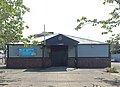
 Playing fields, Kirkdale - DSC00773.JPG 1,280 × 960; 481 KB
-
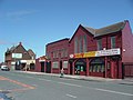
 Post office and shops, Stanley Road, Liverpool - DSC00771.JPG 1,280 × 960; 571 KB
-
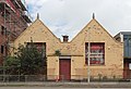
 Stanley Road, Kirkdale (1).jpg 1,280 × 960; 539 KB
-
 Stanley Road, Liverpool - DSC00768.JPG 1,280 × 960; 540 KB
-
 T. S. Mersey.jpg 4,338 × 3,162; 8.3 MB


.jpg)

