Category:Stanley Park bandstand, Liverpool
Jump to navigation
Jump to search
| Object location | | View all coordinates using: OpenStreetMap |
|---|
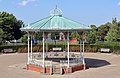
bandstand in Liverpool, Merseyside, England, UK .JPG) | |||||
| Upload media | |||||
| Instance of | |||||
|---|---|---|---|---|---|
| Location | Liverpool, Merseyside, North West England, England | ||||
| Heritage designation |
| ||||
 | |||||
This is a category about listed building number 1292149. |
Media in category "Stanley Park bandstand, Liverpool"
The following 11 files are in this category, out of 11 total.
-
 Bandstand, Stanley Park, Liverpool (1).JPG 3,000 × 4,000; 2.77 MB
-
 Isla Gladstone Conservatory, Stanley Park, Liverpool (4).JPG 4,320 × 3,240; 3.49 MB
-
 Isla Gladstone Conservatory, Stanley Park, Liverpool (7).JPG 4,320 × 3,240; 2.99 MB
-
 Stanley Park bandstand 2018-1.jpg 4,956 × 3,240; 11.38 MB
-
 Stanley Park bandstand 2018-2.jpg 4,601 × 3,375; 8.47 MB
-
 Stanley Park bandstand 2018-ceiling.jpg 5,125 × 3,360; 8.29 MB
-
 Stanley Park bandstand 2018-detail.jpg 4,572 × 3,357; 9.31 MB
-
 Stanley Park Feb 11 2010 (2).jpg 3,072 × 2,304; 1.2 MB
-
 Stanley Park, Liverpool - 2014-03-16 (19).JPG 4,608 × 3,456; 3.28 MB
-
 Stanley Park, Liverpool - 2014-03-16 (24).JPG 4,320 × 3,240; 2.83 MB
-
 Stanley Park, Liverpool - 2014-03-16 (5).JPG 2,736 × 3,648; 3.58 MB
.JPG)
.JPG)


.jpg)
.JPG)
.JPG)
.JPG)