Category:Stanford, Northamptonshire
Jump to navigation
Jump to search
English: Stanford is a civil parish in the English county of Northamptonshire. The village of Stanford is now deserted; the only settlement in the parish is the hamlet of Stanford-on-Avon.
civil parish in Northamptonshire, UK | |||||
| Upload media | |||||
| Instance of | |||||
|---|---|---|---|---|---|
| Location |
| ||||
| Population |
| ||||
 | |||||
Media in category "Stanford, Northamptonshire"
The following 116 files are in this category, out of 116 total.
-
 26 miles to Leicester - geograph.org.uk - 5539899.jpg 1,024 × 615; 121 KB
-
 A14 crosses the River Avon - geograph.org.uk - 3577720.jpg 640 × 480; 59 KB
-
 A14 east of Lilbourne - geograph.org.uk - 3577721.jpg 640 × 480; 46 KB
-
 Alongside Old Hemplow Wood - geograph.org.uk - 2096768.jpg 4,000 × 3,000; 2.94 MB
-
 Approaching Bridge 32 - geograph.org.uk - 3112363.jpg 3,072 × 2,048; 1.76 MB
-
 Arable fields containing blue crop - geograph.org.uk - 3112488.jpg 3,072 × 2,048; 2.08 MB
-
 Between Bridge 32 and Bridge 33 - geograph.org.uk - 3112379.jpg 3,072 × 2,048; 1.64 MB
-
 Bridge 31 - geograph.org.uk - 3112340.jpg 3,072 × 2,048; 2.01 MB
-

-
 Bridge 33 - geograph.org.uk - 3112389.jpg 3,072 × 2,048; 1.55 MB
-
 Bridge 34 - geograph.org.uk - 3112400.jpg 3,072 × 2,048; 1.22 MB
-
 Bridge 36 - geograph.org.uk - 3112555.jpg 3,072 × 2,048; 1.66 MB
-
 Bridge 37 - geograph.org.uk - 3112568.jpg 3,072 × 2,048; 2.01 MB
-
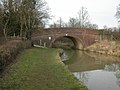
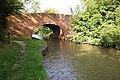 Bridge 37 on the Grand Union Canal - geograph.org.uk - 3612488.jpg 1,024 × 680; 279 KB
-
 Bridge 37, from the south - geograph.org.uk - 5539930.jpg 1,024 × 768; 276 KB
-
 Bridge No 33, from the north-east - geograph.org.uk - 5563054.jpg 1,024 × 768; 146 KB
-
 Bridge No 33, from the south-west - geograph.org.uk - 5539904.jpg 1,024 × 768; 131 KB
-
 Bridge No 34 on the Grand Union Canal - geograph.org.uk - 4592366.jpg 800 × 600; 199 KB
-
 Bridleway at Stanford Mear - geograph.org.uk - 4763008.jpg 800 × 593; 171 KB
-
 Bridleway by the Stanford Brook - geograph.org.uk - 4874570.jpg 5,344 × 3,006; 5.46 MB
-
 Bridleway by the Stanford Brook - geograph.org.uk - 4874574.jpg 1,600 × 900; 439 KB
-

-

-
-
 Canal south-west of Welford in Northamptonshire - geograph.org.uk - 5873355.jpg 1,280 × 875; 1.3 MB
-
 Cold Ashby Road towards Clay Coton - geograph.org.uk - 4762990.jpg 800 × 600; 187 KB
-
 Deserted medieval village site - geograph.org.uk - 2519211.jpg 640 × 480; 100 KB
-
 Downton Bridge (No 36), from the south-east - geograph.org.uk - 5539916.jpg 1,024 × 768; 133 KB
-
 Downtown Bridge No 36 - geograph.org.uk - 4590359.jpg 800 × 570; 139 KB
-
 Downtown Bridge west of Welford in Northamptonshire - geograph.org.uk - 5874342.jpg 1,280 × 836; 1.13 MB
-
 Downtown Bridge west of Welford in Northamptonshire - geograph.org.uk - 5874345.jpg 1,280 × 960; 1.59 MB
-
 Downtown Hill near the Grand Union Canal - geograph.org.uk - 4592349.jpg 800 × 600; 146 KB
-
 Downtown Hill, from the west - geograph.org.uk - 5539926.jpg 1,024 × 614; 175 KB
-
 Farm track near the Grand Union Canal - geograph.org.uk - 4592319.jpg 800 × 600; 183 KB
-
 Farmland in the Avon valley - geograph.org.uk - 5562811.jpg 1,024 × 768; 180 KB
-
 Farmland near Old Hemplow Wood - geograph.org.uk - 4874508.jpg 5,344 × 3,006; 4.64 MB
-
 Farmland next to the Grand Union Canal - geograph.org.uk - 4592339.jpg 800 × 624; 188 KB
-
 Farmland north of Old Hemplow - geograph.org.uk - 5539910.jpg 1,024 × 614; 112 KB
-
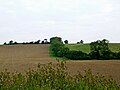
 Farmland west of Welford in Northamptonshire - geograph.org.uk - 5874276.jpg 1,280 × 900; 1.39 MB
-
 Footpath leading across farmland - geograph.org.uk - 4592358.jpg 800 × 564; 148 KB
-

-

-
 Grand Union Canal near Downtown Hill - geograph.org.uk - 4590353.jpg 800 × 600; 122 KB
-
 Grand Union Canal near Downtown Hill - geograph.org.uk - 4592346.jpg 800 × 600; 161 KB
-

-
 Grand Union Canal near Park Farm - geograph.org.uk - 4592382.jpg 800 × 600; 169 KB
-
 Grand Union Canal next to Bridge No 34 - geograph.org.uk - 4592363.jpg 800 × 568; 105 KB
-

-

-

-

-

-

-

-
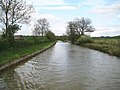
 Grand Union Canal, Leicester Section - geograph.org.uk - 3456874.jpg 640 × 480; 105 KB
-
 Grand Union Canal, Leicester Section - geograph.org.uk - 3465964.jpg 640 × 481; 103 KB
-
 Grand Union Canal, Leicester Section - geograph.org.uk - 3465973.jpg 640 × 480; 79 KB
-

-

-

-

-
-

-
 Hard edge, soft edge, below Hemplow Hills - geograph.org.uk - 5563049.jpg 1,024 × 768; 189 KB
-
 House and farmland near Stanford-on-Avon - geograph.org.uk - 4762995.jpg 800 × 546; 150 KB
-
 Jurassic Way emerging from Old Hemplow Wood - geograph.org.uk - 2096776.jpg 4,000 × 3,000; 2.87 MB
-
 Jurassic Way joining the Grand Union Canal - geograph.org.uk - 2096781.jpg 4,000 × 3,000; 2.9 MB
-

-
 Lake, Stanford Hall - geograph.org.uk - 2519241.jpg 640 × 480; 97 KB
-
 Lane near Stanford on Avon - geograph.org.uk - 2519175.jpg 640 × 480; 99 KB
-
 Lane to Stanford on Avon - geograph.org.uk - 4594866.jpg 800 × 552; 194 KB
-
 Maize growing alongside the Grand Union Canal - geograph.org.uk - 5539893.jpg 1,024 × 768; 182 KB
-

-
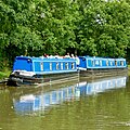 Moored narrowboats west of Welford, Northamptonshire - geograph.org.uk - 5874385.jpg 1,280 × 1,280; 2.17 MB
-

-

-
 Northamptonshire farmland west of Welford - geograph.org.uk - 5874281.jpg 1,280 × 960; 1.08 MB
-
 Old Boundary Marker - geograph.org.uk - 6587625.jpg 1,024 × 768; 367 KB
-
 Old Hemplow - geograph.org.uk - 4874499.jpg 5,344 × 3,006; 6.74 MB
-
 Old Hemplow - geograph.org.uk - 4874505.jpg 5,344 × 3,006; 3.91 MB
-
-

-

-
 Old Hemplow Wood from the Grand Union Canal - geograph.org.uk - 2096791.jpg 4,000 × 3,000; 2.85 MB
-
 Old Milestones - geograph.org.uk - 2998883.jpg 1,024 × 768; 319 KB
-
 Overflow into Steele's Hollow - geograph.org.uk - 3112332.jpg 3,072 × 2,048; 3.69 MB
-

-

-
-
 Pilcher monument - geograph.org.uk - 5440869.jpg 640 × 480; 118 KB
-
 Private Road - geograph.org.uk - 5826441.jpg 1,600 × 900; 315 KB
-
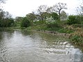
 River Avon - geograph.org.uk - 5440878.jpg 640 × 480; 187 KB
-
 Site of the deserted village of Downtown - geograph.org.uk - 4592326.jpg 800 × 600; 209 KB
-
 South Kilworth Road - geograph.org.uk - 3910222.jpg 640 × 480; 91 KB
-
 South Kilworth Road Bridge in Northamptonshire - geograph.org.uk - 5874908.jpg 1,280 × 1,280; 2.05 MB
-
 South Kilworth Road Bridge in Northamptonshire - geograph.org.uk - 5874910.jpg 1,280 × 868; 1.43 MB
-
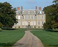 Stanford Hall.jpg 640 × 520; 115 KB
-
 Stanford Mear - geograph.org.uk - 3075747.jpg 640 × 480; 95 KB
-
 Stanford on Avon church - geograph.org.uk - 5440857.jpg 640 × 428; 115 KB
-
 Stanford Road - geograph.org.uk - 5440842.jpg 640 × 480; 181 KB
-
 Stanford Road - geograph.org.uk - 5440850.jpg 640 × 480; 141 KB
-
 Stanford, Downtown Hill - geograph.org.uk - 3466037.jpg 640 × 475; 115 KB
-

-
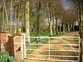 Stanford-on-Avon, the drive to Stanford House - geograph.org.uk - 2228173.jpg 1,024 × 768; 183 KB
-
-

-

-
 The Grand Union Canal - geograph.org.uk - 3910229.jpg 640 × 480; 87 KB
-
 The Grand Union Canal - geograph.org.uk - 4601863.jpg 640 × 480; 52 KB
-
 The wooded western flank of the Hemplow Hills - geograph.org.uk - 5539888.jpg 1,024 × 614; 214 KB
-
 Track leading to Bridge 36 - geograph.org.uk - 3112511.jpg 3,072 × 2,048; 1.92 MB
-
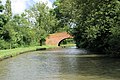
 Welford, canal bridge - geograph.org.uk - 1740084.jpg 640 × 480; 85 KB
-
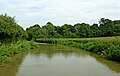
 Welford, canal scene - geograph.org.uk - 1740075.jpg 800 × 600; 143 KB
-
 Welford, towpath - geograph.org.uk - 1740066.jpg 640 × 480; 106 KB
-
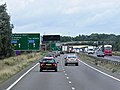 Westbound A14 - geograph.org.uk - 3822852.jpg 640 × 480; 240 KB
-


,_from_the_south-east_-_geograph.org.uk_-_5539916.jpg)


_near_Park_Farm_-_geograph.org.uk_-_5563064.jpg)
,_looking_south-west_-_geograph.org.uk_-_5562821.jpg)


