Category:Stambridge
Jump to navigation
Jump to search
English: Stambridge is a civil parish in the District of Rochford in Essex, England. It is located north of the River Roach between Rochford and Paglesham (→Stambridge)
Nederlands: Stambridge is een civil parish in het bestuurlijke gebied Rochford, in het Engelse graafschap Essex. In 2001 telde het dorp 696 inwoners. (→Stambridge)
Polski: Stambridge – wieś w Anglii, w hrabstwie Essex, w dystrykcie Rochford. Leży 25 km na południowy wschód od miasta Chelmsford i 61 km na wschód od Londynu. (→Stambridge)

civil parish in Rochford, Essex, England | |||||
| Upload media | |||||
| Instance of | |||||
|---|---|---|---|---|---|
| Location | Rochford, Essex, East of England, England | ||||
| Population |
| ||||
| official website | |||||
 | |||||
Subcategories
This category has the following 2 subcategories, out of 2 total.
B
- Ballards Gore (7 F)
G
Media in category "Stambridge"
The following 156 files are in this category, out of 156 total.
-
 A harvested field - geograph.org.uk - 3208563.jpg 640 × 430; 57 KB
-

-
 Across the mouth of Barton Hall Creek - geograph.org.uk - 1956817.jpg 2,095 × 1,389; 514 KB
-
 Apton Hall Rd - geograph.org.uk - 3201080.jpg 640 × 430; 64 KB
-

-
 Ballards Gore Golf Course - geograph.org.uk - 3201094.jpg 640 × 430; 71 KB
-
 Barn, Gore Farm - geograph.org.uk - 3203118.jpg 640 × 430; 54 KB
-
 Barton Hall Creek - geograph.org.uk - 3093346.jpg 640 × 429; 77 KB
-
 Barton Hall Grove - geograph.org.uk - 2844686.jpg 3,008 × 2,000; 2.36 MB
-
 Barton Hall Saltmarsh - geograph.org.uk - 3093344.jpg 640 × 429; 87 KB
-
 Bartonhall Creek, Great Stambridge - geograph.org.uk - 2346964.jpg 640 × 460; 77 KB
-
 Bend in the Sea Wall Near Waldens - geograph.org.uk - 3093332.jpg 640 × 429; 63 KB
-
 Biggins Farm - geograph.org.uk - 2844733.jpg 1,866 × 1,239; 370 KB
-
 Biggins Farm - geograph.org.uk - 3208549.jpg 640 × 430; 66 KB
-
 Biggins Farm workshops - geograph.org.uk - 3208558.jpg 640 × 430; 70 KB
-
 Biggins Farmhouse - geograph.org.uk - 3208554.jpg 640 × 413; 53 KB
-

-
 Boat resting on Mud, River Roach, Stambridge - geograph.org.uk - 6211175.jpg 2,785 × 1,721; 1.61 MB
-
 Borrowdike Near Finches - geograph.org.uk - 2997478.jpg 640 × 429; 53 KB
-
 Bridges over the Roach - geograph.org.uk - 2190111.jpg 2,000 × 1,500; 1.69 MB
-
 Bridges roach stambridge.jpg 3,296 × 2,472; 3.39 MB
-
 Broomhills Care Centre - geograph.org.uk - 2191341.jpg 1,024 × 768; 232 KB
-
 Broomhills Fisheries - geograph.org.uk - 3093317.jpg 640 × 429; 91 KB
-
 Bus shelter, Stambridge - geograph.org.uk - 5481744.jpg 640 × 480; 143 KB
-
 Coombes Farm buildings - geograph.org.uk - 5252015.jpg 5,184 × 3,456; 6.43 MB
-
 Copse and Borrowdyke - geograph.org.uk - 2928675.jpg 3,264 × 2,448; 2.85 MB
-
 Farm buildings at Great Stambridge Hall - geograph.org.uk - 6771214.jpg 1,600 × 1,037; 402 KB
-
 Farm Road at Hampton Barns - geograph.org.uk - 3093363.jpg 640 × 429; 58 KB
-
 Farm Road to Hampton Barns - geograph.org.uk - 3093373.jpg 640 × 429; 63 KB
-
 Farmland north of Paglesham Rd - geograph.org.uk - 3203198.jpg 640 × 430; 56 KB
-
 Farmland north of Paglesham Rd - geograph.org.uk - 3203218.jpg 640 × 430; 60 KB
-
 Farmland south of Paglesham Rd - geograph.org.uk - 3203196.jpg 640 × 430; 59 KB
-
 Farmland south of Paglesham Rd - geograph.org.uk - 3203202.jpg 640 × 430; 55 KB
-
 Farmland south of Paglesham Rd - geograph.org.uk - 3203212.jpg 640 × 430; 55 KB
-
 Farmland south of Paglesham Rd - geograph.org.uk - 3203219.jpg 640 × 430; 58 KB
-
 Farmland south of Paglesham Rd - geograph.org.uk - 3203242.jpg 640 × 430; 56 KB
-
 Farmland south of Paglesham Rd - geograph.org.uk - 3208541.jpg 640 × 430; 63 KB
-
 Farmland south off Gore Rd - geograph.org.uk - 3201095.jpg 640 × 430; 60 KB
-
 Field of linseed - geograph.org.uk - 5480934.jpg 640 × 480; 143 KB
-
 Finches - geograph.org.uk - 2856003.jpg 3,008 × 2,000; 2.95 MB
-
 Finches ^1 Sluice - geograph.org.uk - 2997494.jpg 640 × 429; 73 KB
-
 Fishing Lake - geograph.org.uk - 1960362.jpg 3,264 × 2,176; 2.64 MB
-
 Footbridge at Stambridge Mills looking south - geograph.org.uk - 5251992.jpg 5,184 × 3,456; 4.74 MB
-
 Footpath and drains - geograph.org.uk - 2844795.jpg 1,752 × 1,165; 457 KB
-
 Footpath behind the Royal Oak at Stambridge - geograph.org.uk - 5464082.jpg 4,160 × 2,340; 3.92 MB
-
 Footpath junction - geograph.org.uk - 2578899.jpg 3,008 × 2,000; 2.4 MB
-

-
 Footpath off Apton Hall Rd - geograph.org.uk - 3201084.jpg 640 × 430; 140 KB
-
 Footpath off Gore Rd - geograph.org.uk - 3203092.jpg 640 × 430; 66 KB
-
 Footpath to Canewdon - geograph.org.uk - 3483886.jpg 640 × 424; 123 KB
-
 Footpath to Hampton Barns - geograph.org.uk - 1956832.jpg 2,448 × 3,264; 2.56 MB
-
 Footpath to Hampton Barns - geograph.org.uk - 3881249.jpg 1,600 × 1,064; 309 KB
-
 Footpath to the Sewage Works - geograph.org.uk - 3208539.jpg 640 × 430; 50 KB
-
 Footpath ^ Finals - geograph.org.uk - 3093417.jpg 429 × 640; 40 KB
-
 Gore farm - geograph.org.uk - 3203093.jpg 640 × 430; 55 KB
-
 Gore Farm Workshop - geograph.org.uk - 3203099.jpg 640 × 344; 44 KB
-
 Gore Farmhouse - geograph.org.uk - 3203110.jpg 640 × 430; 64 KB
-
 Gore Rd, Paglesham Rd junction - geograph.org.uk - 3203119.jpg 640 × 430; 67 KB
-
 Great Stambridge church and school - geograph.org.uk - 3881259.jpg 1,600 × 1,064; 334 KB
-
 Great Stambridge Hall ^2 - geograph.org.uk - 3093326.jpg 640 × 446; 91 KB
-
 Hampton Barns Sluice - geograph.org.uk - 3093356.jpg 640 × 429; 66 KB
-

-
 Houses at the junction - geograph.org.uk - 5729590.jpg 640 × 428; 101 KB
-
 Land Drain - geograph.org.uk - 2844662.jpg 1,787 × 2,688; 1.18 MB
-
 Little Stambridge Hall - geograph.org.uk - 1978238.jpg 3,008 × 2,000; 1.56 MB
-
 Little Stambridge Hall Farm - geograph.org.uk - 5483218.jpg 640 × 480; 128 KB
-
 Lizard at Stambridge Mills - geograph.org.uk - 3093312.jpg 429 × 640; 85 KB
-
 Looking to Bartonhall Creek, River Roach, Great Stambridge - geograph.org.uk - 6260587.jpg 3,648 × 2,255; 3.03 MB
-
 Looking towards Great Stambridge church from Mill Lane - geograph.org.uk - 5252005.jpg 5,184 × 3,456; 4.74 MB
-
 Low Tide on Barton Hall Creek - geograph.org.uk - 3093351.jpg 429 × 640; 51 KB
-
 Memorial Plaque - geograph.org.uk - 3093403.jpg 640 × 435; 54 KB
-
 Mill Lane, looking towards Stambridge Road - geograph.org.uk - 5252001.jpg 5,184 × 3,456; 6.33 MB
-
 Mixed Farming in Great Stambridge - geograph.org.uk - 3093383.jpg 640 × 435; 69 KB
-
 Morning arrival at Southend airport - geograph.org.uk - 5251994.jpg 640 × 438; 31 KB
-
 Mudflats and River Roach, Stambridge - geograph.org.uk - 6211173.jpg 3,648 × 2,255; 1.63 MB
-
 Not Out^ - geograph.org.uk - 3093319.jpg 640 × 429; 54 KB
-
 Not The Roach Valley Way^ - geograph.org.uk - 2997387.jpg 640 × 429; 72 KB
-
 Old House, Ballards Gore - geograph.org.uk - 3203189.jpg 640 × 430; 91 KB
-
 Old Jetty at Barton Hall Creek - geograph.org.uk - 2997430.jpg 429 × 640; 85 KB
-
 Overgrown footpath Stambridge water treatment works - geograph.org.uk - 5464068.jpg 4,160 × 2,340; 4.99 MB
-
 Paddocks by Apton Hall Road - geograph.org.uk - 5483297.jpg 640 × 480; 138 KB
-
 Paglesham Rd - geograph.org.uk - 3203182.jpg 640 × 430; 80 KB
-
 Paglesham Rd - geograph.org.uk - 3203207.jpg 640 × 430; 54 KB
-
 Paglesham Rd - geograph.org.uk - 3203217.jpg 640 × 430; 47 KB
-
 Paglesham Village sign - geograph.org.uk - 3203235.jpg 430 × 640; 51 KB
-
 Paglesham Village Sign - geograph.org.uk - 6641470.jpg 768 × 1,024; 143 KB
-
 Path through cereal fields, Stambridge - geograph.org.uk - 5482576.jpg 640 × 480; 138 KB
-
 Pillbox on The Seawall - geograph.org.uk - 2997489.jpg 640 × 429; 61 KB
-
 Pillbox, River Roach - geograph.org.uk - 4611233.jpg 640 × 480; 109 KB
-

-
 Power Across the Saltmarsh - geograph.org.uk - 3093328.jpg 640 × 429; 53 KB
-

-
 Ragstone Lodge, Great Stambridge - geograph.org.uk - 3459051.jpg 800 × 539; 247 KB
-
 Rankin's Cricket Club, Stambridge - geograph.org.uk - 6211163.jpg 3,381 × 2,090; 2.41 MB
-
 Remains of Stambridge Mills - geograph.org.uk - 3881265.jpg 1,600 × 1,064; 360 KB
-
 River Roach - geograph.org.uk - 2190110.jpg 1,024 × 768; 184 KB
-
 River Roach - geograph.org.uk - 2346972.jpg 640 × 446; 53 KB
-
 River Roach - geograph.org.uk - 5481131.jpg 640 × 480; 134 KB
-
 River Roach at Low Tide - geograph.org.uk - 3093341.jpg 640 × 429; 52 KB
-
 River Roach east of Rochford - geograph.org.uk - 2346977.jpg 640 × 427; 67 KB
-
 River Roach mudflats - geograph.org.uk - 5251989.jpg 5,011 × 3,465; 2.72 MB
-
 River Roach Saltmarsh ^ Moorings - geograph.org.uk - 3093324.jpg 640 × 429; 56 KB
-
 Roach at Stambridge Mills - geograph.org.uk - 3093309.jpg 640 × 429; 50 KB
-
 Roach tq885903 stambridge.jpg 3,296 × 2,472; 3.23 MB
-
 Roach tq886902 stambridge.jpg 3,296 × 2,472; 2.91 MB
-
 Roach Valley Way - geograph.org.uk - 2997396.jpg 640 × 429; 60 KB
-

-
-
 Royal Oak sign - geograph.org.uk - 1994681.jpg 427 × 640; 82 KB
-
 Salt-marsh Pagelsham Reach - geograph.org.uk - 2997455.jpg 640 × 429; 53 KB
-

-
 Sea Wall and Road to Waldens - geograph.org.uk - 3093330.jpg 640 × 429; 72 KB
-
 Seawall Near Finches - geograph.org.uk - 2997470.jpg 640 × 429; 52 KB
-
 Signpost and Broomhills sign - geograph.org.uk - 5252008.jpg 4,633 × 3,093; 3.52 MB
-
 Sloppy Wood - geograph.org.uk - 2552416.jpg 2,000 × 3,008; 3.11 MB
-
 Sluice leading to River Roach, Stambridge - geograph.org.uk - 6211166.jpg 3,648 × 2,255; 2.77 MB
-
 Stables near Hampton Barns, Great Stambridge - geograph.org.uk - 6260577.jpg 3,648 × 2,255; 2.81 MB
-
 Stambridge - geograph.org.uk - 3483872.jpg 640 × 424; 76 KB
-
 Stambridge Fisheries - geograph.org.uk - 2578893.jpg 3,008 × 2,000; 2.51 MB
-
 Stambridge footpath from the Royal Oak to the Cherry tree - geograph.org.uk - 5464089.jpg 4,160 × 2,340; 3.24 MB
-
 Stambridge Meadows care home - geograph.org.uk - 5480922.jpg 640 × 428; 121 KB
-
 Stambridge Memorial Hall - geograph.org.uk - 3093396.jpg 640 × 429; 85 KB
-
 Stambridge Mill Bruhl.JPG 623 × 422; 126 KB
-
 Stambridge Mills - geograph.org.uk - 2190109.jpg 1,024 × 705; 167 KB
-
 Stambridge Mills - geograph.org.uk - 2190112.jpg 2,000 × 1,500; 1.43 MB
-
 Stambridge Mills - geograph.org.uk - 2191261.jpg 1,024 × 768; 137 KB
-
 Stambridge Mills demolition site - geograph.org.uk - 5251996.jpg 640 × 427; 70 KB
-
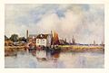
 Stambridge Mills, near Rochford - geograph.org.uk - 122515.jpg 640 × 476; 56 KB
-
 Stambridge Rd - geograph.org.uk - 3201093.jpg 640 × 430; 47 KB
-
 Stambridge Road - geograph.org.uk - 5252012.jpg 4,846 × 3,126; 3.16 MB
-
 Stambridge sign.jpg 2,281 × 3,126; 2.57 MB
-
 Stambridge Village Green - geograph.org.uk - 3093388.jpg 640 × 429; 86 KB
-
 Stambridge Village Sign - geograph.org.uk - 2191373.jpg 1,569 × 2,000; 1.68 MB
-
 Stambridge Village Sign - geograph.org.uk - 2191386.jpg 1,500 × 2,000; 2.1 MB
-
 Stanbridge Mills from Roach Valley Way - geograph.org.uk - 5251971.jpg 5,202 × 3,465; 3.56 MB
-
 Stannet's Creek - geograph.org.uk - 5328711.jpg 3,233 × 2,155; 1.24 MB
-
 Stannets Creek Reservoir - geograph.org.uk - 2997373.jpg 640 × 429; 71 KB
-
 Stewards Elm Farm - geograph.org.uk - 2578885.jpg 640 × 426; 96 KB
-
 Stubble fields, Paglesham Rd - geograph.org.uk - 3208551.jpg 640 × 430; 65 KB
-
 Stubble north of Paglesham Rd - geograph.org.uk - 3203210.jpg 640 × 430; 71 KB
-
 The End Of Barton Hall Creek - geograph.org.uk - 3093358.jpg 640 × 429; 50 KB
-
 The Path to Pagelsham - geograph.org.uk - 2997447.jpg 435 × 640; 64 KB
-
 The path to Pagelsham Jetty - geograph.org.uk - 2997439.jpg 435 × 640; 60 KB
-
 The Roach Valley Way - geograph.org.uk - 2844699.jpg 2,000 × 3,008; 2.94 MB
-
 The Roach Valley Way at Broomhills - geograph.org.uk - 3093321.jpg 429 × 640; 77 KB
-
 The Royal Oak - geograph.org.uk - 1994677.jpg 640 × 427; 96 KB
-
 The Royal Oak, Stambridge - geograph.org.uk - 3881245.jpg 1,600 × 1,064; 375 KB
-
 The Shepherd and Dog, Ballards Gore - geograph.org.uk - 3203100.jpg 640 × 430; 81 KB
-
 The Way Turns South - geograph.org.uk - 2997411.jpg 429 × 640; 88 KB
-
 Tree lit by the Setting Sun, near Little Stambridge Hall - geograph.org.uk - 6359799.jpg 2,736 × 2,736; 2.51 MB
-
 View from Roach Valley Way, Stambridge - geograph.org.uk - 6211170.jpg 3,584 × 2,215; 2.22 MB
-
 View from Sea Wall, Bartonhall Creek, Great Stambridge - geograph.org.uk - 6260632.jpg 3,648 × 2,255; 2.25 MB
-
 View to West Hall - geograph.org.uk - 3208546.jpg 640 × 430; 61 KB
-
 Waldens Sluice - geograph.org.uk - 3093338.jpg 640 × 435; 60 KB
-

-
 Jubilee Cottages, Paglesham - geograph.org.uk - 162724.jpg 640 × 480; 92 KB


