Category:Stakroge
Jump to navigation
Jump to search
village in Herning Municipality, Denmark  | |||||
| Upload media | |||||
| Instance of | |||||
|---|---|---|---|---|---|
| Location | Herning Municipality, Central Denmark, Denmark | ||||
 | |||||
Subcategories
This category has the following 2 subcategories, out of 2 total.
I
- Ilderhede Kirke (3 F)
S
- Stakroge Station (2 F)
Media in category "Stakroge"
The following 4 files are in this category, out of 4 total.
-
 StakrogeBeboerhus.jpg 2,592 × 1,936; 275 KB
-
 StakrogeKøbmand.jpg 2,592 × 1,936; 261 KB
-
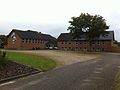 StakrogeSkole.jpg 2,592 × 1,936; 259 KB
-
 Troldhedebane51Borgergade.JPG 2,592 × 1,944; 2.31 MB


