Category:Staindrop
Jump to navigation
Jump to search
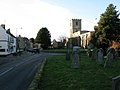
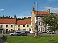
English: Staindrop is a village in County Durham, in England. It is situated to the east of Barnard Castle.Lord Barnard of Raby Castle also resides on the border.
village in United Kingdom  | |||||
| Upload media | |||||
| Instance of | |||||
|---|---|---|---|---|---|
| Location | County Durham, North East England, England | ||||
| Population |
| ||||
 | |||||
Media in category "Staindrop"
The following 200 files are in this category, out of 218 total.
(previous page) (next page)-
 13 Front Street, Staindrop - geograph.org.uk - 4891739.jpg 5,184 × 3,456; 4.47 MB
-
 17 and 19 Front Street, Staindrop - geograph.org.uk - 4892309.jpg 5,184 × 3,456; 2.9 MB
-
 3, 5 and 7 Front Street, Staindrop - geograph.org.uk - 6725895.jpg 5,184 × 3,456; 3.29 MB
-
 32 North Green, Staindrop - geograph.org.uk - 4899064.jpg 5,184 × 3,456; 4.21 MB
-
 5 and 6 North Green Staindrop - geograph.org.uk - 4891655.jpg 5,184 × 3,456; 3.64 MB
-
 A688 through Staindrop - geograph.org.uk - 4732916.jpg 640 × 480; 69 KB
-
 Almshouses in Staindrop - geograph.org.uk - 2993708.jpg 3,312 × 2,368; 1,006 KB
-
 Arrival of the post - geograph.org.uk - 5944660.jpg 2,000 × 1,052; 1.56 MB
-
 Ash tree by the path - geograph.org.uk - 5416881.jpg 3,239 × 4,308; 3.43 MB
-
 Autumnal tree beside the A688 - geograph.org.uk - 4732914.jpg 640 × 480; 83 KB
-
 B6279 entering Staindrop - geograph.org.uk - 4269940.jpg 1,500 × 882; 1.49 MB
-
 B6279 towards Darlington - geograph.org.uk - 4732965.jpg 640 × 480; 124 KB
-
 B6279 westbound - geograph.org.uk - 4733165.jpg 640 × 480; 93 KB
-
 Barn near Staindrop - geograph.org.uk - 2472531.jpg 640 × 480; 67 KB
-
 Barrier of poles and concrete posts beside A688 - geograph.org.uk - 4832618.jpg 1,500 × 1,125; 1.44 MB
-
 Beck, Staindrop - geograph.org.uk - 4732928.jpg 480 × 640; 115 KB
-
 Bench Mark, No 14 Office Square - geograph.org.uk - 2472292.jpg 480 × 640; 90 KB
-
 Big yellow buses, Staindrop - geograph.org.uk - 2468991.jpg 640 × 481; 100 KB
-
 Bistro on the main road - geograph.org.uk - 1296521.jpg 640 × 480; 66 KB
-
 Black Ellers Wood (Cattle Grid) - geograph.org.uk - 224379.jpg 640 × 479; 123 KB
-
 Bolton Hill - geograph.org.uk - 5917044.jpg 640 × 480; 64 KB
-
 Bolton Hill Farm - geograph.org.uk - 1341766.jpg 640 × 480; 78 KB
-
 Bolton Hill from the Friar Cote track - geograph.org.uk - 1736981.jpg 640 × 500; 122 KB
-
 Bow Bridge - geograph.org.uk - 2583537.jpg 3,875 × 2,573; 1.95 MB
-
 Bridleway around cropfield - geograph.org.uk - 5416763.jpg 4,320 × 3,240; 2.42 MB
-
 Bridleway off Snotterton Lane - geograph.org.uk - 5416761.jpg 4,320 × 3,240; 3.34 MB
-
 Bus stop and shelter, Staindrop - geograph.org.uk - 4732918.jpg 640 × 480; 94 KB
-
 Carr House Farm near Staindrop - geograph.org.uk - 2895342.jpg 2,984 × 2,189; 1.19 MB
-
 Cart bridge over Moor Beck at Staindrop - geograph.org.uk - 2992527.jpg 3,648 × 2,736; 1.97 MB
-
 Cattle by the beck - geograph.org.uk - 5416890.jpg 3,240 × 4,320; 3.94 MB
-
 Church View, Front Street - geograph.org.uk - 2468988.jpg 640 × 480; 80 KB
-
 Cleatham Bridge over Sudburn Beck - geograph.org.uk - 2992536.jpg 2,918 × 2,189; 1.8 MB
-
 Cottages, Staindrop - geograph.org.uk - 2177743.jpg 2,560 × 1,920; 1.63 MB
-
 Cottages, Staindrop - geograph.org.uk - 4732915.jpg 640 × 404; 57 KB
-

-

-
 Crop field and hedgerow - geograph.org.uk - 4732929.jpg 640 × 480; 93 KB
-
 Cut silage field and hedgerow - geograph.org.uk - 5917058.jpg 640 × 480; 88 KB
-
 Cut silage field near Scaife House - geograph.org.uk - 5917061.jpg 640 × 480; 68 KB
-
 Cut silage field off Moor Lane - geograph.org.uk - 5917046.jpg 640 × 480; 74 KB
-

-
 Date stone, Church View - geograph.org.uk - 2468989.jpg 640 × 481; 66 KB
-
 Drinking fountain, Staindrop - geograph.org.uk - 2472153.jpg 480 × 640; 93 KB
-
 Drive to West Farm - geograph.org.uk - 2473313.jpg 640 × 481; 75 KB
-
 Drive to West Lodge - geograph.org.uk - 2472567.jpg 640 × 480; 81 KB
-
 Duke Street - geograph.org.uk - 6406390.jpg 3,008 × 2,000; 7.31 MB
-
 Dunhouse Quarry. - geograph.org.uk - 184017.jpg 640 × 479; 95 KB
-
 East and West Masham House, 8 and 9 North Green, Staindrop - geograph.org.uk - 4899121.jpg 5,184 × 3,456; 3.24 MB
-
 Enclosure by Blakeley Quarry - geograph.org.uk - 1736963.jpg 640 × 500; 119 KB
-
 Entrance to Raby Park at the South Lodge - geograph.org.uk - 3332434.jpg 3,648 × 2,736; 2.7 MB
-
 Farm buildings, Blakeley - geograph.org.uk - 5917339.jpg 640 × 480; 60 KB
-
 Farmland southwest of Old Lodge Farm - geograph.org.uk - 6420480.jpg 1,024 × 768; 230 KB
-
 Field with emerging crop (2) - geograph.org.uk - 5945927.jpg 2,000 × 1,500; 3.24 MB
-
 Field with emerging crop - geograph.org.uk - 5262075.jpg 1,499 × 758; 871 KB
-
 Fields near Blakeley Farm - geograph.org.uk - 1341768.jpg 640 × 480; 71 KB
-
 Flower meadow seen from Cleatham Bridge - geograph.org.uk - 2992540.jpg 3,648 × 2,736; 2.8 MB
-
 Flush Bracket 2228, St Mary's Church - geograph.org.uk - 2468981.jpg 480 × 640; 101 KB
-
 Footpath below Snotterton Hall - geograph.org.uk - 5416765.jpg 4,320 × 3,240; 2.02 MB
-
 Footpath near Staindrop - geograph.org.uk - 2442758.jpg 640 × 480; 74 KB
-
 Footpath, Staindrop - geograph.org.uk - 2464981.jpg 480 × 640; 103 KB
-
 Friar Cote beyond Friars' Cote Gill - geograph.org.uk - 1595394.jpg 640 × 512; 143 KB
-
 Front Street (A688) in Staindrop - geograph.org.uk - 5323550.jpg 4,000 × 3,000; 3.02 MB
-
 Front Street Staindrop - geograph.org.uk - 6406384.jpg 3,000 × 2,000; 4.03 MB
-
 Front Street, Staindrop - geograph.org.uk - 2468985.jpg 640 × 481; 83 KB
-
 Front Street, Staindrop - geograph.org.uk - 2481818.jpg 1,280 × 960; 702 KB
-
 Garth Cottage, 34 South Green, Staindrop - geograph.org.uk - 4899053.jpg 5,184 × 3,456; 3.27 MB
-
 Gates on the track to Raby Hill - geograph.org.uk - 1725191.jpg 640 × 490; 109 KB
-
 Gateway opening from woodland into field - geograph.org.uk - 5944652.jpg 2,000 × 1,500; 3.53 MB
-
 Gawen House - geograph.org.uk - 2583020.jpg 3,175 × 1,709; 782 KB
-
 Grazing near Gawen House - geograph.org.uk - 5917036.jpg 640 × 480; 71 KB
-
 Grazing near Woodcroft Farm - geograph.org.uk - 4732913.jpg 640 × 480; 80 KB
-
 Grazing off Moor Lane - geograph.org.uk - 5917038.jpg 640 × 480; 77 KB
-
 Grazing towards Carr House Farm - geograph.org.uk - 4732933.jpg 640 × 480; 93 KB
-
 Green space in Staindrop - geograph.org.uk - 5944647.jpg 2,000 × 1,500; 3.61 MB
-
 Green space in Staindrop - geograph.org.uk - 6318963.jpg 2,592 × 1,944; 1.63 MB
-
 Heading north from Staindrop - geograph.org.uk - 4732925.jpg 640 × 480; 81 KB
-
 Hedge and fence separating fields - geograph.org.uk - 5944850.jpg 1,999 × 1,167; 2.37 MB
-
 Hedge near Staindrop - geograph.org.uk - 2463923.jpg 481 × 640; 100 KB
-
 Hedgerow with trees, Staindrop Moor - geograph.org.uk - 5917057.jpg 640 × 480; 83 KB
-
 Houses on Front Street, Staindrop - geograph.org.uk - 4732923.jpg 640 × 480; 60 KB
-
 In Ladyclose Wood - geograph.org.uk - 4269950.jpg 1,500 × 979; 2.56 MB
-
 In Staindrop - geograph.org.uk - 2177742.jpg 2,560 × 1,920; 1.66 MB
-
 Inside Ladyclose Wood - geograph.org.uk - 1716316.jpg 480 × 640; 118 KB
-
 Ladywood Lodge - geograph.org.uk - 1341779.jpg 640 × 480; 82 KB
-
 Ladywood Lodge - geograph.org.uk - 2472543.jpg 640 × 481; 65 KB
-
 Langley Beck, Staindrop - geograph.org.uk - 2465211.jpg 640 × 481; 82 KB
-
 Langley Beck, Staindrop - geograph.org.uk - 2468980.jpg 640 × 480; 112 KB
-
 Logo for the Cyclists' Touring Club - geograph.org.uk - 2468986.jpg 640 × 481; 112 KB
-
 Long shadows on field - geograph.org.uk - 4269294.jpg 1,500 × 975; 1.26 MB
-
 Looking southeast on the B6279 - geograph.org.uk - 5917037.jpg 640 × 480; 68 KB
-
 Malvern House, 7 Front Street, Staindrop.jpg 3,456 × 5,184; 3.14 MB
-
 Melrose House, 10 North Green, Staindrop - geograph.org.uk - 4899083.jpg 4,917 × 3,278; 3.7 MB
-

-
 Milestone, South Green - geograph.org.uk - 2472491.jpg 480 × 640; 91 KB
-
 Moor Lane (B6279) - geograph.org.uk - 5323576.jpg 4,000 × 3,000; 2.99 MB
-
 Moor Lane (B6279) - geograph.org.uk - 5917042.jpg 640 × 480; 110 KB
-
 Moor Lane (B6279) near Moor Close - geograph.org.uk - 5323553.jpg 4,000 × 3,000; 2.38 MB
-
 Moor Lane (B6279) towards Staindrop - geograph.org.uk - 5917051.jpg 640 × 480; 83 KB
-
 Moor Lane (B6279) towards Staindrop - geograph.org.uk - 5917056.jpg 640 × 480; 73 KB
-
 Moor Lane (B6279), Blakeley - geograph.org.uk - 5917343.jpg 640 × 480; 63 KB
-
 Moor Lane - geograph.org.uk - 2582992.jpg 3,442 × 2,520; 1.37 MB
-
 Neatly clipped hedge to north of Sudburn Beck - geograph.org.uk - 5944821.jpg 2,000 × 1,160; 2.19 MB
-
 No. 34 South Green, Staindrop - geograph.org.uk - 2472398.jpg 640 × 480; 73 KB
-
 North Green - Staindrop - geograph.org.uk - 6345436.jpg 2,664 × 1,011; 1.4 MB
-
 North Green, Staindrop - geograph.org.uk - 6333192.jpg 2,000 × 1,095; 2.58 MB
-
 North Green, Staindrop - geograph.org.uk - 6333193.jpg 2,000 × 1,331; 3.24 MB
-
 Oak - geograph.org.uk - 4268932.jpg 1,500 × 946; 1.31 MB
-
 Ordnance Survey Cut Mark - geograph.org.uk - 5362992.jpg 4,000 × 3,000; 4.05 MB
-
 Ordnance Survey Flush Bracket 2228 - geograph.org.uk - 3719452.jpg 1,920 × 2,560; 3.21 MB
-
 Ormulz House, 11 North Green, Staindrop - geograph.org.uk - 4899078.jpg 5,184 × 3,456; 3.19 MB
-
 Parish church (11) (geograph 7321764).jpg 4,320 × 3,240; 3.64 MB
-
 Parish church (12) (geograph 7321765).jpg 4,270 × 3,203; 3.14 MB
-
 Parish church (8) (geograph 7321761).jpg 4,176 × 3,132; 3.75 MB
-
 Pastures near Staindrop - geograph.org.uk - 5416757.jpg 4,320 × 3,240; 4.07 MB
-
 Path by Sudburn Beck - geograph.org.uk - 5416768.jpg 4,320 × 3,240; 5.92 MB
-
 Path, Staindrop - geograph.org.uk - 2465198.jpg 640 × 480; 68 KB
-
 Pigeon crees in Staindrop - geograph.org.uk - 2992524.jpg 2,918 × 2,189; 1.07 MB
-
 Play area in Stangarth Lane, Staindrop - geograph.org.uk - 2993596.jpg 3,648 × 2,736; 1.46 MB
-

-
 Post Office and newsagents, Staindrop - geograph.org.uk - 528219.jpg 640 × 359; 91 KB
-
 Post Office at Staindrop, Co. Durham. (3066096387).jpg 970 × 806; 227 KB
-
 Postbox, Staindrop - geograph.org.uk - 2472149.jpg 480 × 640; 67 KB
-
 Public footpath passing trees - geograph.org.uk - 6509358.jpg 1,999 × 1,334; 2.21 MB
-
 Raby Castle and grounds (25) (geograph 7321718).jpg 4,310 × 3,232; 4.1 MB
-
 Raby House across the green.jpg 4,320 × 3,240; 3.72 MB
-
 Raby Moor House - geograph.org.uk - 2583009.jpg 3,451 × 2,127; 1.16 MB
-
 Roundhouse , Raby Estate - geograph.org.uk - 224474.jpg 640 × 308; 69 KB
-
 Scaife House - geograph.org.uk - 2582982.jpg 3,835 × 2,183; 1.16 MB
-
 Shops on North Green, Staindrop - geograph.org.uk - 5917344.jpg 640 × 480; 89 KB
-
 Sign for the Black Swan - geograph.org.uk - 2472151.jpg 480 × 640; 84 KB
-
 Sign for the Royal Oak - geograph.org.uk - 2468983.jpg 478 × 640; 92 KB
-
 Sign for the Wheatsheaf - geograph.org.uk - 2472515.jpg 479 × 640; 88 KB
-

-
 Silage field, Staindrop Moor - geograph.org.uk - 5917054.jpg 640 × 480; 84 KB
-

-
 South Green Staindrop - geograph.org.uk - 6406394.jpg 3,008 × 2,000; 6.97 MB
-
 Spar shop, Staindrop - geograph.org.uk - 4732920.jpg 480 × 640; 50 KB
-
 St Gregory Close, Staindrop - geograph.org.uk - 2249217.jpg 640 × 480; 97 KB
-
 St Mary's Church - Staindrop - geograph.org.uk - 6345364.jpg 2,484 × 1,235; 1.04 MB
-
 St Mary's Church, Staindrop - geograph.org.uk - 4732924.jpg 640 × 480; 104 KB
-
 St. Mary's Church Staindrop - geograph.org.uk - 6406382.jpg 3,000 × 2,000; 5.83 MB
-
 St. Mary's Church, Staindrop - geograph.org.uk - 5249562.jpg 640 × 480; 66 KB
-
 Barn by Moor Lane - geograph.org.uk - 1716206.jpg 640 × 640; 122 KB
-
 Staindrop - geograph.org.uk - 2481813.jpg 1,280 × 960; 744 KB
-
 Staindrop - geograph.org.uk - 2582956.jpg 3,836 × 2,592; 1.57 MB
-
 Staindrop Church looking west - geograph.org.uk - 1296503.jpg 640 × 480; 60 KB
-
 Staindrop features (1) (geograph 7321719).jpg 4,035 × 3,026; 3.88 MB
-
 Staindrop Green - geograph.org.uk - 2481828.jpg 640 × 480; 197 KB
-
 Staindrop House, 14 Front Street - geograph.org.uk - 4898850.jpg 5,184 × 3,456; 2.14 MB
-
 Staindrop Methodist Church - geograph.org.uk - 2481834.jpg 640 × 480; 216 KB
-
 Staindrop Moor - geograph.org.uk - 2582969.jpg 3,572 × 1,677; 845 KB
-
 Staindrop Moor - geograph.org.uk - 6420483.jpg 1,024 × 768; 242 KB
-
 Staindrop Post Office - geograph.org.uk - 2481809.jpg 1,280 × 960; 733 KB
-
 Staindrop Post Office and newsagents - geograph.org.uk - 4732921.jpg 640 × 480; 86 KB
-
 Staindrop village - geograph.org.uk - 6406388.jpg 3,008 × 2,000; 5.13 MB
-
 Staindrop village entrance sign - geograph.org.uk - 2249200.jpg 640 × 480; 74 KB
-
 Staindrop, Front Street and St Mary's Church, 1989 - geograph.org.uk - 4293663.jpg 2,372 × 1,388; 4.32 MB
-
 Staindrop, St. Mary's Church - geograph.org.uk - 6299497.jpg 6,799 × 4,532; 7.11 MB
-
 Staindrop, St. Mary's Church, The nave - geograph.org.uk - 6299499.jpg 6,789 × 4,526; 7.48 MB
-
 Staindrop, St. Mary's Church, The nave - geograph.org.uk - 6299500.jpg 6,463 × 4,308; 5.33 MB
-
 Staindrop.jpg 1,600 × 1,200; 1.23 MB
-
 Stangarth Lane in Staindrop with public footpath status - geograph.org.uk - 2993601.jpg 3,648 × 2,736; 1.55 MB
-
 Street scene, Staindrop - geograph.org.uk - 2472211.jpg 640 × 480; 69 KB
-
 Sudburn Beck - geograph.org.uk - 2992545.jpg 3,648 × 2,736; 3.02 MB
-
 The Black Swan , Staindrop - geograph.org.uk - 224483.jpg 640 × 479; 91 KB
-
 The Black Swan, Staindrop - geograph.org.uk - 2472150.jpg 640 × 480; 73 KB
-
 The Black Swan, Staindrop - geograph.org.uk - 2481713.jpg 1,280 × 960; 436 KB
-
 The Lindens, 4 North Green, Staindrop - geograph.org.uk - 4891681.jpg 3,456 × 5,184; 2.73 MB
-
 The Royal Oak, Front Street - geograph.org.uk - 2468984.jpg 640 × 480; 78 KB
-
 The Scarth Memorial Hall, Staindrop - geograph.org.uk - 2481824.jpg 1,280 × 960; 741 KB
-
 The Shambles Bistro - geograph.org.uk - 528215.jpg 640 × 359; 73 KB
-
 The Village Green, Staindrop - geograph.org.uk - 2481830.jpg 640 × 480; 199 KB
-
 The Wheatsheaf Inn, Staindrop - geograph.org.uk - 4732917.jpg 640 × 480; 81 KB
-
 The Wheatsheaf, Staindrop - geograph.org.uk - 2472506.jpg 640 × 481; 78 KB
-
 Topiary House 8 to Fair View, 2 Front Street, Staindrop - geograph.org.uk - 4898908.jpg 5,184 × 3,456; 3.32 MB
-

-
 Track to Raby Moor House - geograph.org.uk - 5917048.jpg 640 × 480; 78 KB
-

-
 Trees alongside farm access road - geograph.org.uk - 5260510.jpg 1,212 × 1,600; 673 KB
-
 Trotting along Front Street - geograph.org.uk - 2472152.jpg 640 × 480; 76 KB
-
 Village green, Staindrop - geograph.org.uk - 2472315.jpg 640 × 480; 86 KB
-
 Weather vane, Staindrop - geograph.org.uk - 2465048.jpg 640 × 481; 50 KB
-
 West Farm - geograph.org.uk - 2582995.jpg 3,888 × 2,592; 1.76 MB
-
 West Farm track heading for Moor Lane - geograph.org.uk - 1736989.jpg 512 × 640; 118 KB
-
 West Lodge - geograph.org.uk - 1341775.jpg 640 × 480; 116 KB
-
 West Lodge - geograph.org.uk - 4269350.jpg 1,500 × 1,125; 2.35 MB
-
 West Lodge, Raby park - geograph.org.uk - 1716304.jpg 640 × 500; 120 KB
-
 West Lodge. - geograph.org.uk - 512631.jpg 640 × 480; 73 KB
-

-
 Across the Green, Staindrop. - geograph.org.uk - 528230.jpg 640 × 480; 102 KB
-
 Boundary Wall of Ladyclose Wood - geograph.org.uk - 405000.jpg 640 × 480; 149 KB
-
 Bridge , B6274 - geograph.org.uk - 224375.jpg 640 × 479; 77 KB
-
 Bridge over Langley Beck - geograph.org.uk - 512578.jpg 640 × 480; 139 KB
-
 Church Bridge , Staindrop - geograph.org.uk - 224469.jpg 640 × 479; 114 KB
-
 Cleatlam High Farm - geograph.org.uk - 138957.jpg 640 × 479; 70 KB
-
 Dunn House Farm - geograph.org.uk - 138967.jpg 640 × 479; 70 KB
-
 East Whorley Hill Farm and Reservoir - geograph.org.uk - 198843.jpg 640 × 249; 50 KB
-
 Gate. - geograph.org.uk - 512615.jpg 640 × 480; 152 KB
-

-
 Hay Store. - geograph.org.uk - 512600.jpg 640 × 480; 120 KB


_-_geograph.org.uk_-_224379.jpg)


_-_geograph.org.uk_-_5945927.jpg)


_in_Staindrop_-_geograph.org.uk_-_5323550.jpg)


_-_geograph.org.uk_-_5323576.jpg)
_-_geograph.org.uk_-_5917042.jpg)
_near_Moor_Close_-_geograph.org.uk_-_5323553.jpg)
_towards_Staindrop_-_geograph.org.uk_-_5917051.jpg)
_towards_Staindrop_-_geograph.org.uk_-_5917056.jpg)
,_Blakeley_-_geograph.org.uk_-_5917343.jpg)


_(geograph_7321764).jpg)
_(geograph_7321765).jpg)
_(geograph_7321761).jpg)


.jpg)


_(geograph_7321718).jpg)


_(geograph_7321719).jpg)


_towards_Scaife_House_-_geograph.org.uk_-_5917060.jpg)


