Category:Stadtwerke Eichstätt
Jump to navigation
Jump to search
| Object location | | View all coordinates using: OpenStreetMap |
|---|
| Upload media | |||||
| Instance of |
| ||||
|---|---|---|---|---|---|
| Location |
| ||||
| Headquarters location | |||||
| Legal form |
| ||||
 | |||||
Subcategories
This category has the following 3 subcategories, out of 3 total.
Media in category "Stadtwerke Eichstätt"
The following 2 files are in this category, out of 2 total.
-
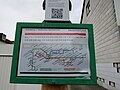
 Eichstätt - Fahrplanschild Stadtbus - Detail.jpg 3,518 × 2,532; 1.26 MB
-
 Eichstätt - Fahrplanschild Stadtbus.jpg 5,184 × 3,888; 3.22 MB

