Category:Stadtwald, Weener-Holthusen Meenteland
Jump to navigation
Jump to search
| Object location | | View all coordinates using: OpenStreetMap |
|---|
Media in category "Stadtwald, Weener-Holthusen Meenteland"
The following 10 files are in this category, out of 10 total.
-
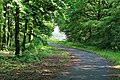
 Weener - Am Stadtwald + Stadtwald 01 ies.jpg 5,616 × 3,744; 25.72 MB
-
 Weener - Am Stadtwald - Stadtwald 01 ies.jpg 5,616 × 3,744; 19.27 MB
-
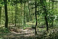
 Weener - Am Stadtwald - Stadtwald 02 ies.jpg 5,616 × 3,744; 19.31 MB
-
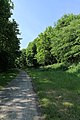
 Weener - Am Stadtwald - Stadtwald 03 ies.jpg 3,743 × 5,616; 23.51 MB
-
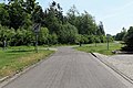
 Weener - Am Stadtwald - Stadtwald 04 ies.jpg 5,616 × 3,744; 21.77 MB
-
 Weener - Am Stadtwald - Stadtwald 05 ies.jpg 5,616 × 3,744; 23.12 MB
-
 Weener - Am Stadtwald - Stadtwald 06 ies.jpg 5,616 × 3,744; 28.87 MB
-
 Weener - Am Stadtwald - Stadtwald 07 ies.jpg 3,744 × 5,616; 23.42 MB
-
 Weener - Lange Straße + Am Stadtwald + Stadtwald 01 ies.jpg 5,616 × 3,744; 22.38 MB
-
 Weener - Melkpad - Stadtwald 01 ies.jpg 3,744 × 5,616; 19.48 MB


