Category:Stadthaus (Dornacherstrasse 1, Olten)
Jump to navigation
Jump to search
| Object location | | View all coordinates using: OpenStreetMap |
|---|
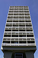
administration building in Olten in the canton of Solothurn, Switzerland  | |||||
| Upload media | |||||
| Instance of | |||||
|---|---|---|---|---|---|
| Part of | |||||
| Location | Olten, Olten District, Olten-Gösgen, Solothurn, Switzerland | ||||
| Street address |
| ||||
| Heritage designation |
| ||||
 | |||||
Media in category "Stadthaus (Dornacherstrasse 1, Olten)"
The following 5 files are in this category, out of 5 total.
-
 2005-Olten-Stadthaus.jpg 1,280 × 1,920; 1.84 MB
-
 20170712 Olten 0890 (36764875292).jpg 3,840 × 5,760; 5.67 MB
-
 20170712 Olten 0892 (36796225331).jpg 5,760 × 3,840; 5.91 MB
-
 Innenstadt, 4600 Olten, Switzerland - panoramio.jpg 3,120 × 4,160; 3.81 MB
-
 Picswiss SO-18-24.jpg 300 × 450; 33 KB
.jpg)
.jpg)

