Category:Stadhuis Vianen
Jump to navigation
Jump to search
| Object location | | View all coordinates using: OpenStreetMap |
|---|
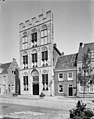
Nederlands: Afbeeldingen van het Stadhuis (of Raadhuis), Voorstraat 30, 4132 AS Vianen. Gelegen in het centrum van Vianen, Utrecht behorende tot de gemeente Vijfheerenlanden in de provincie Utrecht in het midden van Nederland
English: Pictures of the town hall, Voorstraat 30, 4132 AS Vianen. In Vianen belongs to the municipality Vijfheerenlanden in the province Utrecht in the middle of the Netherlands
|
This is a category about rijksmonument number 36311
|
 | |||||
| Upload media | |||||
| Instance of | |||||
|---|---|---|---|---|---|
| Location | Vianen, Vijfheerenlanden, Utrecht, Netherlands | ||||
| Street address |
| ||||
| Located on street |
| ||||
| Heritage designation |
| ||||
 | |||||
Subcategories
This category has the following 2 subcategories, out of 2 total.
I
- Interior of Stadhuis Vianen (3 F)
Media in category "Stadhuis Vianen"
The following 41 files are in this category, out of 41 total.
-
 Achtergevel in de Kerkstraat - Vianen - 20241786 - RCE.jpg 1,200 × 957; 221 KB
-
 Bovenlicht - Vianen - 20241778 - RCE.jpg 795 × 1,200; 230 KB
-
 Detail zijgevel - Vianen - 20241754 - RCE.jpg 954 × 1,200; 310 KB
-
 Exterieur - Vianen - 20241748 - RCE.jpg 885 × 1,200; 197 KB
-
 Exterieur - Vianen - 20241749 - RCE.jpg 888 × 1,200; 246 KB
-
 Exterieur OVERZICHT - Vianen - 20304611 - RCE.jpg 1,200 × 1,194; 275 KB
-
 Exterieur OVERZICHT - Vianen - 20308486 - RCE.jpg 1,195 × 1,200; 279 KB
-
 Exterieur OVERZICHT VOORGEVEL - Vianen - 20287022 - RCE.jpg 1,200 × 1,200; 264 KB
-
 Exterieur voormalige franse kerk - Vianen - 20241757 - RCE.jpg 1,200 × 953; 247 KB
-
 Gedeelte linkerzijgevel - Vianen - 20241787 - RCE.jpg 956 × 1,200; 228 KB
-
 Gedeelte van de noord zijgevel - Vianen - 20241756 - RCE.jpg 968 × 1,200; 291 KB
-
 Gedeelte voorgevel - Vianen - 20241777 - RCE.jpg 806 × 1,200; 228 KB
-
 Het stadhuis van Vianen Raad huis te Vianen (titel op object), RP-T-1888-A-1736.jpg 5,256 × 4,116; 2.21 MB
-
 Linkerzijgevel en achtergevel - Vianen - 20241784 - RCE.jpg 1,200 × 955; 242 KB
-
 Onderbouw voorgevel - Vianen - 20241753 - RCE.jpg 1,200 × 950; 257 KB
-
 Overzicht - Vianen - 20241780 - RCE.jpg 1,200 × 950; 215 KB
-
 Overzicht voorgevel en linker zijgevel - Vianen - 20241776 - RCE.jpg 894 × 1,200; 186 KB
-
 Raampartij - Vianen - 20241779 - RCE.jpg 807 × 1,200; 204 KB
-
 Rechterzij en achtergevel - Vianen - 20241785 - RCE.jpg 1,200 × 949; 267 KB
-
 Stadhuis van Vianen (provincie Utrecht).JPG 3,456 × 5,184; 7.64 MB
-
 Stadhuis Vianen DSCF8604.jpg 2,816 × 1,864; 2.43 MB
-
 Stadhuis Vianen DSCF8605.jpg 2,816 × 1,864; 2.72 MB
-
 Stadhuis Vianen DSCF8606.jpg 1,864 × 2,816; 2.46 MB
-
 Stadhuis Vianen DSCF8610.jpg 1,864 × 2,816; 2.61 MB
-
 Stadhuis Vianen DSCF8649.jpg 1,864 × 2,816; 2.62 MB
-
 Stadhuis Vianen DSCF8652.jpg 2,816 × 1,864; 2.45 MB
-
 Stadhuis Vianen DSCF8653.jpg 2,816 × 1,864; 2.71 MB
-
 Vianen - Voorstraat 30 - Stadhuis - Rijksmonument 36311.JPG 1,728 × 2,304; 1.21 MB
-
 Vianen 103.JPG 3,264 × 2,448; 1.94 MB
-
 Vianen RM Voorstraat 30 (1).jpg 2,460 × 4,007; 3.28 MB
-
 Vianen RM Voorstraat 30 (2).jpg 2,557 × 4,035; 3.39 MB
-
 Vianen stadhuis 2006.jpg 480 × 640; 261 KB
-
 Voorgevel - Vianen - 20241750 - RCE.jpg 961 × 1,200; 259 KB
-
 Voorgevel - Vianen - 20241751 - RCE.jpg 951 × 1,200; 253 KB
-
 Voorgevel - Vianen - 20241752 - RCE.jpg 955 × 1,200; 245 KB
-
 Voorgevel - Vianen - 20241781 - RCE.jpg 946 × 1,200; 269 KB
-
 Voorgevel - Vianen - 20241782 - RCE.jpg 954 × 1,200; 240 KB
-
 Voorgevel gemeentesecretarie - Vianen - 20241783 - RCE.jpg 952 × 1,200; 322 KB
-
 Voorgevel met ingangspartij - Vianen - 20241775 - RCE.jpg 1,200 × 954; 206 KB
-
 Voorstraat, Vianen DSCF8603.jpg 2,816 × 1,864; 2.53 MB
-
 Zijgevel naar het westen - Vianen - 20241755 - RCE.jpg 938 × 1,200; 281 KB


,_RP-T-1888-A-1736.jpg)


.JPG)


.jpg)
.jpg)


