Category:Stadbroekermolen, Sittard
Jump to navigation
Jump to search
| Object location | | View all coordinates using: OpenStreetMap |
|---|
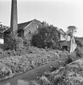
watermill in Sittard, Netherlands  | |||||
| Upload media | |||||
| Instance of | |||||
|---|---|---|---|---|---|
| Location | Sittard, Sittard-Geleen, Limburg, Netherlands | ||||
| Located in or next to body of water | |||||
| Street address |
| ||||
| Located on street |
| ||||
| Has use | |||||
| Heritage designation |
| ||||
| Source of energy | |||||
 | |||||
|
This is a category about rijksmonument number 33713
|
|
This is a category about rijksmonument number 521650
|
| Address |
|
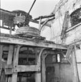
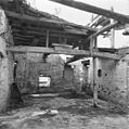
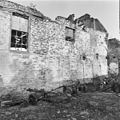
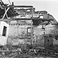
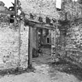
Media in category "Stadbroekermolen, Sittard"
The following 63 files are in this category, out of 63 total.
-
 Aanzicht - Sittard - 20200389 - RCE.jpg 3,054 × 3,090; 2.47 MB
-
 Detail - Sittard - 20200390 - RCE.jpg 1,192 × 1,200; 490 KB
-
 Foto's voor de restauratie - Sittard - 20200391 - RCE.jpg 1,192 × 1,200; 412 KB
-
 Foto's voor de restauratie - Sittard - 20200392 - RCE.jpg 1,200 × 1,190; 490 KB
-
 Foto's voor de restauratie - Sittard - 20200393 - RCE.jpg 1,183 × 1,200; 422 KB
-
 Foto's voor de restauratie - Sittard - 20200394 - RCE.jpg 1,188 × 1,200; 408 KB
-
 Foto's voor de restauratie - Sittard - 20200395 - RCE.jpg 1,190 × 1,200; 439 KB
-
 Foto's voor de restauratie - Sittard - 20200396 - RCE.jpg 1,185 × 1,200; 404 KB
-
 Foto's voor de restauratie - Sittard - 20200397 - RCE.jpg 1,192 × 1,200; 421 KB
-
 Foto's voor de restauratie - Sittard - 20200398 - RCE.jpg 1,200 × 1,197; 376 KB
-
 Foto's voor de restauratie - Sittard - 20200399 - RCE.jpg 1,193 × 1,200; 385 KB
-
 Foto's voor de restauratie - Sittard - 20200400 - RCE.jpg 1,186 × 1,200; 418 KB
-
 Foto's voor de restauratie - Sittard - 20200401 - RCE.jpg 1,181 × 1,200; 335 KB
-
 Foto's voor de restauratie - Sittard - 20200402 - RCE.jpg 1,190 × 1,200; 404 KB
-
 Foto's voor de restauratie - Sittard - 20200403 - RCE.jpg 1,181 × 1,200; 410 KB
-
 Foto's voor de restauratie - Sittard - 20200404 - RCE.jpg 1,188 × 1,200; 393 KB
-
 Foto's voor de restauratie - Sittard - 20200405 - RCE.jpg 1,200 × 1,200; 432 KB
-
 Foto's voor de restauratie - Sittard - 20200406 - RCE.jpg 1,188 × 1,200; 350 KB
-
 Foto's voor de restauratie - Sittard - 20200407 - RCE.jpg 1,195 × 1,200; 457 KB
-
 Foto's voor de restauratie - Sittard - 20200408 - RCE.jpg 1,195 × 1,200; 446 KB
-
 Foto's voor de restauratie - Sittard - 20200409 - RCE.jpg 1,192 × 1,200; 458 KB
-
 Foto's voor de restauratie - Sittard - 20200410 - RCE.jpg 1,190 × 1,200; 405 KB
-
 Foto's voor de restauratie - Sittard - 20200411 - RCE.jpg 1,188 × 1,200; 392 KB
-
 Foto's voor de restauratie - Sittard - 20200412 - RCE.jpg 1,183 × 1,200; 391 KB
-
 Foto's voor de restauratie - Sittard - 20200413 - RCE.jpg 1,192 × 1,200; 362 KB
-
 Foto's voor de restauratie - Sittard - 20200414 - RCE.jpg 1,188 × 1,200; 319 KB
-
 Foto's voor de restauratie - Sittard - 20200415 - RCE.jpg 1,197 × 1,200; 255 KB
-
 Foto's voor de restauratie - Sittard - 20200416 - RCE.jpg 1,193 × 1,200; 305 KB
-
 Foto's voor de restauratie - Sittard - 20200417 - RCE.jpg 1,195 × 1,200; 350 KB
-
 Foto's voor de restauratie - Sittard - 20200418 - RCE.jpg 1,197 × 1,200; 425 KB
-
 Foto's voor de restauratie - Sittard - 20200419 - RCE.jpg 1,195 × 1,200; 424 KB
-
 Foto's voor de restauratie - Sittard - 20200420 - RCE.jpg 1,197 × 1,200; 403 KB
-
 Foto's voor de restauratie - Sittard - 20200421 - RCE.jpg 1,192 × 1,200; 325 KB
-
 Foto's voor de restauratie - Sittard - 20200422 - RCE.jpg 1,195 × 1,200; 388 KB
-
 Foto's voor de restauratie - Sittard - 20200423 - RCE.jpg 1,195 × 1,200; 332 KB
-
 Foto's voor de restauratie - Sittard - 20200424 - RCE.jpg 1,190 × 1,200; 335 KB
-
 Foto's voor de restauratie - Sittard - 20200425 - RCE.jpg 1,192 × 1,200; 348 KB
-
 Foto's voor de restauratie - Sittard - 20200426 - RCE.jpg 1,200 × 1,200; 320 KB
-
 Foto's voor de restauratie - Sittard - 20200427 - RCE.jpg 1,195 × 1,200; 401 KB
-
 Foto's voor de restauratie - Sittard - 20200428 - RCE.jpg 1,190 × 1,200; 365 KB
-
 Foto's voor de restauratie - Sittard - 20200429 - RCE.jpg 1,195 × 1,200; 296 KB
-
 Foto's voor de restauratie - Sittard - 20200430 - RCE.jpg 1,183 × 1,200; 354 KB
-
 Foto's voor de restauratie - Sittard - 20200431 - RCE.jpg 1,195 × 1,200; 387 KB
-
 Foto's voor de restauratie - Sittard - 20200432 - RCE.jpg 1,200 × 1,190; 314 KB
-
 Foto's voor de restauratie - Sittard - 20200433 - RCE.jpg 1,200 × 1,195; 375 KB
-
 Foto's voor de restauratie - Sittard - 20200434 - RCE.jpg 1,188 × 1,200; 349 KB
-
 Foto's voor de restauratie - Sittard - 20200435 - RCE.jpg 1,183 × 1,200; 339 KB
-
 Foto's voor de restauratie - Sittard - 20200436 - RCE.jpg 1,200 × 1,200; 449 KB
-
 Foto's voor de restauratie - Sittard - 20200437 - RCE.jpg 1,192 × 1,200; 397 KB
-
 Foto's voor de restauratie - Sittard - 20200438 - RCE.jpg 1,188 × 1,200; 461 KB
-
 Foto's voor de restauratie - Sittard - 20200439 - RCE.jpg 1,195 × 1,200; 462 KB
-
 Foto's voor de restauratie - Sittard - 20200440 - RCE.jpg 1,200 × 1,197; 521 KB
-
 Foto's voor de restauratie - Sittard - 20200441 - RCE.jpg 1,200 × 1,192; 513 KB
-
 Foto's voor de restauratie - Sittard - 20200442 - RCE.jpg 1,192 × 1,200; 468 KB
-
 Foto's voor de restauratie - Sittard - 20200443 - RCE.jpg 1,195 × 1,200; 415 KB
-
 Foto's voor de restauratie - Sittard - 20200444 - RCE.jpg 1,197 × 1,200; 410 KB
-
 Foto's voor de restauratie - Sittard - 20200445 - RCE.jpg 1,191 × 1,200; 380 KB
-
 Foto's voor de restauratie - Sittard - 20200446 - RCE.jpg 1,190 × 1,200; 463 KB
-
 Foto's voor de restauratie - Sittard - 20200447 - RCE.jpg 1,186 × 1,200; 436 KB
-
 Foto's voor de restauratie - Sittard - 20200448 - RCE.jpg 1,190 × 1,200; 456 KB
-
 Sittard Stadbroekermolen 2-8-1999.jpg 1,640 × 1,072; 548 KB
-
 Stadbroekermolen-002.jpg 960 × 1,280; 284 KB
-
 Watermolen achter de Tempel - Sittard - 20200460 - RCE.jpg 1,200 × 1,195; 332 KB


