Category:Stackpole
Jump to navigation
Jump to search
site within the Pembrokeshire Coast National Park  | |||||
| Upload media | |||||
| Instance of | |||||
|---|---|---|---|---|---|
| Location | Stackpole and Castlemartin, Pembrokeshire, Wales | ||||
| Owned by | |||||
| Operator | |||||
| Maintained by | |||||
| Different from | |||||
| official website | |||||
 | |||||
Subcategories
This category has the following 7 subcategories, out of 7 total.
B
- Barafundle Bay (76 F)
E
G
- Greenala Point (14 F)
S
- St Petrox Church, St Petrox (9 F)
- Stackpole Head (17 F)
- Stackpole Quay (9 F)
Media in category "Stackpole"
The following 81 files are in this category, out of 81 total.
-
 2010 Wales Pembrokeshire Community Stackpole map.svg 512 × 393; 1,018 KB
-
 BHS Bosherston 2009.jpg 1,200 × 820; 354 KB
-
 Coastal Cruiser bus at Stackpole (16089622487).jpg 2,880 × 1,623; 2.62 MB
-
 Coastal path at Barafundle Bay - geograph.org.uk - 570561.jpg 480 × 640; 189 KB
-
 Gate on Trewent Point and Stackpole Head (6982).jpg 4,288 × 2,848; 6.21 MB
-
 Looking across the bay from the harbour wall at Stackpole. - panoramio.jpg 3,264 × 2,448; 2.89 MB
-
 Old Castle Head and Caldey Island from Trewent Point (7002).jpg 4,288 × 2,848; 4.56 MB
-
 Old Castle Head and Caldey Island from Trewent Point (7005).jpg 4,288 × 2,848; 4.44 MB
-
 Pembrokeshire Coast - panoramio (1).jpg 2,560 × 1,920; 1.03 MB
-
 Pembrokeshire Coast - panoramio (10).jpg 2,560 × 1,920; 1.06 MB
-
 Pembrokeshire Coast - panoramio (11).jpg 2,560 × 1,920; 1.07 MB
-
 Pembrokeshire Coast - panoramio (12).jpg 3,072 × 2,304; 2.75 MB
-
 Pembrokeshire Coast - panoramio (14).jpg 3,072 × 2,304; 2.74 MB
-
 Pembrokeshire Coast - panoramio (2).jpg 2,560 × 1,920; 952 KB
-
 Pembrokeshire Coast - panoramio (3).jpg 2,560 × 1,920; 1.27 MB
-
 Pembrokeshire Coast - panoramio (4).jpg 2,560 × 1,920; 1.04 MB
-
 Pembrokeshire Coast - panoramio (5).jpg 2,560 × 1,920; 1.69 MB
-
 Pembrokeshire Coast - panoramio (6).jpg 2,560 × 1,920; 1.19 MB
-
 Pembrokeshire Coast - panoramio (7).jpg 2,560 × 1,920; 1.41 MB
-
 Pembrokeshire Coast - panoramio (8).jpg 2,560 × 1,920; 1.48 MB
-
 Pembrokeshire Perfection.jpg 3,024 × 4,032; 3.14 MB
-
 Perfect Pembrokeshire.jpg 3,024 × 4,032; 3.35 MB
-
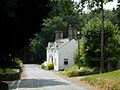 Stackpole - geograph.org.uk - 208744.jpg 640 × 480; 90 KB
-
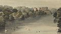
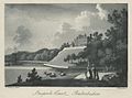
 Stackpole Court, Pembrokeshire - the seat of Earl Cawdor (1132130).jpg 1,000 × 762; 76 KB
-
 Stackpole Court, Pembrokeshire - the seat of Earl Cawdor.jpeg 1,496 × 832; 1.03 MB
-
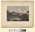
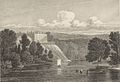 Stackpole Court, Pembrokeshire March 1 1822.jpeg 1,247 × 853; 895 KB
-
 Stackpole Court, Pembrokeshire.jpeg 900 × 670; 794 KB
-
 Stackpole Lily Ponds (May 2010).jpg 1,000 × 669; 178 KB
-
 Stackpole Quay - geograph.org.uk - 13806.jpg 640 × 423; 68 KB
-
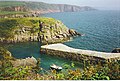 Stackpole Quay and Cliffs. - geograph.org.uk - 113105.jpg 640 × 430; 151 KB
-
 Stackpole Quay at low tide - geograph.org.uk - 1545037.jpg 640 × 480; 84 KB
-
 Stackpole SA71, UK - panoramio (1).jpg 4,000 × 3,000; 4.7 MB
-
 Stackpole SA71, UK - panoramio (2).jpg 4,000 × 3,000; 3.32 MB
-
 Stackpole SA71, UK - panoramio.jpg 4,000 × 3,000; 4.88 MB
-
 Stackpole Walled Garden - panoramio (1).jpg 3,072 × 2,304; 2.72 MB
-
 Stackpole Walled Garden - panoramio.jpg 3,072 × 2,304; 2.76 MB
-
 Stackpole Walled garden - panoramio.jpg 3,072 × 2,304; 2.76 MB
-
 Stackpoole Court June 1 1810 (1132579).jpg 1,277 × 954; 1.04 MB
-
 Stackpoole Court June 1 1810.jpeg 800 × 725; 164 KB
-
 Stackpoole Court, Pembrokeshire.jpeg 1,277 × 951; 965 KB
-
 The Sea Cliffs of Pembroke - panoramio.jpg 5,919 × 3,738; 5.48 MB
-
 Trewent Point (6988).jpg 4,288 × 2,848; 6.34 MB
-
 Trewent Point (6990).jpg 4,288 × 2,848; 6.93 MB
-
 Trewent Point (6992).jpg 4,288 × 2,848; 6.43 MB
-
 Trewent Point (6998).jpg 4,288 × 2,848; 7.03 MB
-
 Trewent Point (7000).jpg 4,288 × 2,848; 6.32 MB
-
 Trewent Point (7001).jpg 4,288 × 2,848; 6.46 MB
-
 Trewent Point (7003).jpg 4,288 × 2,848; 6.43 MB
-
 Trewent Point (7004).jpg 4,288 × 2,848; 6.48 MB
-
 Trewent Point (7008).jpg 4,288 × 2,848; 6.19 MB
-
 Walkers approaching Stackpole Quay - geograph.org.uk - 569369.jpg 640 × 432; 95 KB
-
 YStagbwllLB01.JPG 2,048 × 1,536; 618 KB
-
 YStagbwllLB02.JPG 2,048 × 1,536; 549 KB
-
 YStagbwllLB03.JPG 2,048 × 1,536; 658 KB
-
 YStagbwllLB04.JPG 2,048 × 1,536; 662 KB
-
 YStagbwllLB05.JPG 2,048 × 1,536; 652 KB
-
 YStagbwllLB06.JPG 2,048 × 1,536; 598 KB
-
 YStagbwllLB07.JPG 2,048 × 1,536; 706 KB
-
 YStagbwllLB08.JPG 2,048 × 1,536; 637 KB
-
 YStagbwllLB09.JPG 2,048 × 1,536; 741 KB
-
 YStagbwllLB10.JPG 2,048 × 1,536; 639 KB
-
 YStagbwllLB11.JPG 2,048 × 1,536; 623 KB
-
 YStagbwllLB12.JPG 2,048 × 1,536; 712 KB
-
 YStagbwllLB13.JPG 2,048 × 1,536; 779 KB
-
 YStagbwllLB14.JPG 2,048 × 1,536; 696 KB
-
 YStagbwllLB15.JPG 2,048 × 1,536; 683 KB
-
 YStagbwllLB16.JPG 2,048 × 1,536; 641 KB
-
 YStagbwllLB17.JPG 2,048 × 1,536; 634 KB
-
 YStagbwllLB18.JPG 2,048 × 1,536; 621 KB
-
 YStagbwllLB19.JPG 2,048 × 1,536; 690 KB
-
 Activity at Stackpole Quay - geograph.org.uk - 569362.jpg 480 × 640; 121 KB
-
 Beach at Barafundle Bay - geograph.org.uk - 570574.jpg 480 × 640; 159 KB
-
 Clifftop trees at Barafundle Bay - geograph.org.uk - 570580.jpg 640 × 480; 236 KB
-
 Dunes at Barafundle Bay - geograph.org.uk - 570539.jpg 640 × 480; 104 KB
-
 Gift wrapped. - geograph.org.uk - 56764.jpg 640 × 480; 157 KB
-
 Lane near Martledge - geograph.org.uk - 523977.jpg 640 × 480; 154 KB
-
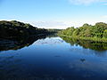
 Northern edge of the Lily Ponds - geograph.org.uk - 568987.jpg 480 × 640; 125 KB
-
 Northern edge of the Lily Ponds - geograph.org.uk - 568990.jpg 480 × 640; 90 KB
-
 Stackpole Quay - geograph.org.uk - 569382.jpg 480 × 640; 152 KB
-
 Stackpole Quay - geograph.org.uk - 569386.jpg 640 × 480; 128 KB
-
 View from near Stackpole. - geograph.org.uk - 56760.jpg 640 × 480; 165 KB


.jpg)

.jpg)

.jpg)
.jpg)
.jpg)
.jpg)
.jpg)
.jpg)
.jpg)
.jpg)
.jpg)
.jpg)
.jpg)
.jpg)
.jpg)
.jpg)


.jpg)


.jpg)


.jpg)
.jpg)

.jpg)


.jpg)


.jpg)
.jpg)
.jpg)
.jpg)
.jpg)
.jpg)
.jpg)
.jpg)
.jpg)


