Category:St Thomas, Rathlin Island
Jump to navigation
Jump to search
| Object location | | View all coordinates using: OpenStreetMap |
|---|
church building in Rathlin Island, County Antrim, Northern Ireland  | |||||
| Upload media | |||||
| Instance of | |||||
|---|---|---|---|---|---|
| Location | Rathlin Island, Atlantic Ocean, international waters | ||||
| Street address |
| ||||
| Heritage designation | |||||
 | |||||
|
This is a category about a listed building with HB number HB05/16/003. |
Subcategories
This category has only the following subcategory.
I
Media in category "St Thomas, Rathlin Island"
The following 18 files are in this category, out of 18 total.
-
 Church at Rathlin.jpg 4,864 × 2,736; 3.47 MB
-
 Church of Ireland in Rathlin harbour bay in Sept 2018.jpg 3,648 × 2,736; 2.16 MB
-
 Church of St Thomas, Rathlin Island - geograph.org.uk - 850020.jpg 640 × 480; 117 KB
-

-
 Graves in Church of Ireland and the view to Ireland from Rathlin.jpg 3,648 × 2,736; 2.41 MB
-
 Graves in Church of Ireland in Rathlin's harbour bay in 2018.jpg 3,648 × 2,736; 2.81 MB
-
 Graveset in Church of Ireland for the island's proprieter Robert Gage et al.jpg 3,648 × 2,736; 2 MB
-

-

-
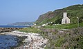
 Rathlin Island - geograph.org.uk - 443994.jpg 640 × 424; 68 KB
-
 Rathlin Island - geograph.org.uk - 446470.jpg 640 × 424; 72 KB
-
 Rathlin Island - geograph.org.uk - 468315.jpg 640 × 379; 225 KB
-
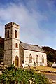
 St Thomas Church - geograph.org.uk - 469094.jpg 640 × 418; 243 KB
-
-
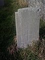
 War Grave to sailor from HMS Racoon in Rathlin's Church of Ireland in the harbour bay.jpg 2,736 × 3,648; 3.02 MB
-
 War Graves in Rathlin's Church of Ireland in the harbour bay R J Capella 1940.jpg 2,736 × 3,648; 2.51 MB
-
 War Graves in Rathlin's Church of Ireland in the harbour bay Sgt R A Ashmore.jpg 2,736 × 3,648; 2.59 MB
-
 War Graves in Rathlin's Church of Ireland in the harbour bay to a sailor.jpg 2,736 × 3,648; 3.19 MB


_-_geograph.org.uk_-_818541.jpg)
_-_geograph.org.uk_-_818545.jpg)


