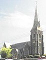
Category:St Swithin's, Magherafelt
Jump to navigation
Jump to search
| Object location | | View all coordinates using: OpenStreetMap |
|---|
church building in Magherafelt, County Londonderry, Northern Ireland .jpg) | |||||
| Upload media | |||||
| Instance of | |||||
|---|---|---|---|---|---|
| Location | Magherafelt, County Londonderry, Northern Ireland | ||||
| Street address |
| ||||
| Heritage designation | |||||
 | |||||
Media in category "St Swithin's, Magherafelt"
The following 3 files are in this category, out of 3 total.
-

-
 St Swithins C.o.I. Magherafelt 2394571.jpg 245 × 319; 26 KB
-
 St Swithins Church of Ireland, Magherafelt (geograph 2394571).jpg 640 × 480; 48 KB

