Category:St Peter and St Paul's church, Brockhall, Northamptonshire
Jump to navigation
Jump to search
| Object location | | View all coordinates using: OpenStreetMap |
|---|
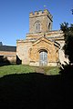
church in Brockhall, Northamptonshire, England, UK  | |||||
| Upload media | |||||
| Instance of | |||||
|---|---|---|---|---|---|
| Dedicated to | |||||
| Location | Brockhall, West Northamptonshire, Northamptonshire, East Midlands, England | ||||
| Diocese | |||||
| Heritage designation |
| ||||
| Religion or worldview | |||||
 | |||||
Media in category "St Peter and St Paul's church, Brockhall, Northamptonshire"
The following 5 files are in this category, out of 5 total.
-
 Brockhall Church - geograph.org.uk - 1705247.jpg 640 × 480; 98 KB
-
 Brockhall Church - geograph.org.uk - 1714643.jpg 640 × 480; 78 KB
-
 Brockhall St Peter & St Paul fr SE GeoUK.jpg 1,482 × 1,068; 234 KB
-
 Church of St Peter and St Paul - geograph.org.uk - 1734072.jpg 427 × 640; 60 KB
-
 The Hall, Brockhall - geograph.org.uk - 199717.jpg 640 × 480; 104 KB


