Category:St Mellor's Church, Linkinhorne
Jump to navigation
Jump to search
| Object location | | View all coordinates using: OpenStreetMap |
|---|
church in Linkinhorne, Cornwall, England, UK  | |||||
| Upload media | |||||
| Instance of | |||||
|---|---|---|---|---|---|
| Dedicated to | |||||
| Location | Linkinhorne, Cornwall, South West England, England | ||||
| Diocese | |||||
| Heritage designation |
| ||||
| Inception |
| ||||
| Religion or worldview | |||||
 | |||||
This is a category about listed building number 1311136. |
Media in category "St Mellor's Church, Linkinhorne"
The following 10 files are in this category, out of 10 total.
-
 Churchyard and Pub - geograph.org.uk - 409704.jpg 640 × 427; 133 KB
-
 From the gate - geograph.org.uk - 409718.jpg 640 × 423; 141 KB
-
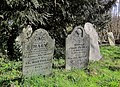 Gravestones, Linkinhorne - geograph.org.uk - 4375501.jpg 1,920 × 1,399; 1.23 MB
-
 Inner door of porch, Church of St Melor, Linkinhorne - geograph.org.uk - 4375460.jpg 1,920 × 2,560; 921 KB
-
 Linkinhorne Parish Church - geograph.org.uk - 404867.jpg 430 × 640; 87 KB
-
 Porch, Church of St Melor, Linkinhorne - geograph.org.uk - 4375431.jpg 1,920 × 2,453; 1.41 MB
-
 South Porch, Linkinhorne Church - geograph.org.uk - 409723.jpg 640 × 427; 110 KB
-
 St Mellor Church, Linkinhorne - geograph.org.uk - 1092474.jpg 640 × 428; 101 KB
-

-
 Wall paintings, Church of St Melor, Linkinhorne - geograph.org.uk - 4375435.jpg 1,938 × 2,626; 800 KB


