Category:St Mary, West Horsley
Jump to navigation
Jump to search
| Object location | | View all coordinates using: OpenStreetMap |
|---|
church in West Horsley, Surrey, England, UK  | |||||
| Upload media | |||||
| Instance of | |||||
|---|---|---|---|---|---|
| Dedicated to | |||||
| Location | West Horsley, Guildford, Surrey, South East England, England | ||||
| Diocese | |||||
| Heritage designation |
| ||||
| Religion or worldview | |||||
 | |||||
Subcategories
This category has the following 2 subcategories, out of 2 total.
S
Media in category "St Mary, West Horsley"
The following 40 files are in this category, out of 40 total.
-

-

-
-

-

-

-

-
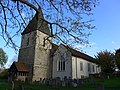
 St Mary the Virgin, West Horsley - geograph.org.uk - 2705703.jpg 2,560 × 1,920; 1.91 MB
-
 St Mary West Horsley - geograph.org.uk - 4190114.jpg 1,000 × 667; 182 KB
-
 St Mary's Church Centre (Wheelhouse), East Lane, West Horsley (May 2014) (1).JPG 2,600 × 2,000; 887 KB
-
 St Mary's Church Centre (Wheelhouse), East Lane, West Horsley (May 2014) (2).JPG 2,600 × 2,000; 789 KB
-
 St Mary's Church Centre (Wheelhouse), East Lane, West Horsley (May 2014) (3).JPG 3,200 × 2,400; 1.35 MB
-
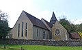
 St Mary's Church, Epsom Road, West Horsley (May 2014) (1).JPG 3,200 × 2,000; 1.06 MB
-
 St Mary's Church, Epsom Road, West Horsley (May 2014) (2).JPG 3,600 × 2,400; 1.54 MB
-
 St Mary's Church, Epsom Road, West Horsley (May 2014) (3).JPG 3,600 × 2,700; 1.8 MB
-
 St Mary's Church, Epsom Road, West Horsley (May 2014) (4).JPG 3,200 × 2,600; 1.58 MB
-
 St Mary's Church, Epsom Road, West Horsley (May 2014) (5).JPG 3,600 × 2,600; 1.75 MB
-
 St Mary's Church, Epsom Road, West Horsley (May 2014) (6).JPG 3,600 × 2,600; 1.74 MB
-
 St Mary's Church, Epsom Road, West Horsley (May 2014) (7).JPG 3,600 × 2,200; 1.39 MB
-
 St Mary's Church, Epsom Road, West Horsley (May 2014) (8).JPG 3,400 × 2,400; 1.4 MB
-
 St Mary's Church, Epsom Road, West Horsley (May 2014) (Noticeboard).JPG 2,200 × 2,600; 1.08 MB
-
 St Mary's Church, Epsom Road, West Horsley (May 2014) (Porch).JPG 2,600 × 3,400; 1.63 MB
-
 St Mary's Church, West Horsley - geograph.org.uk - 4180918.jpg 1,536 × 2,048; 3.03 MB
-
 St Mary's Church, West Horsley - geograph.org.uk - 453562.jpg 640 × 390; 56 KB
-
 St Mary's, West Horsley - geograph.org.uk - 897461.jpg 480 × 640; 102 KB
-
 St. Mary's Church, West Horsley 01.jpg 4,128 × 3,096; 4.65 MB
-
 St. Mary's Church, West Horsley 02.jpg 4,128 × 3,096; 4.92 MB
-
 St. Mary's Church, West Horsley 04.jpg 4,128 × 3,096; 6.44 MB
-
 St. Mary's Church, West Horsley 05.jpg 4,128 × 3,096; 6.18 MB
-
 St. Mary's Church, West Horsley 06.jpg 4,128 × 3,096; 6.24 MB
-
 St. Mary's Church, West Horsley 09.jpg 4,128 × 3,096; 6.07 MB
-
 St. Mary's Church, West Horsley 10.jpg 3,096 × 4,128; 4.84 MB
-
 St. Mary's Church, West Horsley 11.jpg 4,128 × 3,096; 7.38 MB
-
 St. Mary's, West Horsley - geograph.org.uk - 69626.jpg 640 × 481; 101 KB
-

-
 St Mary's Church, Epsom Road, West Horsley (May 2014) (Spire).JPG 2,600 × 3,400; 1.74 MB
-
 West Horsley church, tower and spire (1) - geograph.org.uk - 6242921.jpg 768 × 1,024; 215 KB
-
 West Horsley church, tower and spire (2) - geograph.org.uk - 6242933.jpg 750 × 1,024; 214 KB
-
 West Horsley, St Mary - geograph.org.uk - 6368057.jpg 4,608 × 3,456; 5.3 MB
-
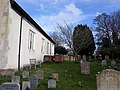
 West Porch, St Mary's Church - geograph.org.uk - 2288311.jpg 1,920 × 2,560; 1.69 MB
_-_geograph.org.uk_-_4288156.jpg)
_-_geograph.org.uk_-_4288158.jpg)
_-_geograph.org.uk_-_4288159.jpg)
_-_geograph.org.uk_-_4288160.jpg)
_-_geograph.org.uk_-_4288164.jpg)
_-_geograph.org.uk_-_4288165.jpg)


,_East_Lane,_West_Horsley_(May_2014)_(1).JPG)
,_East_Lane,_West_Horsley_(May_2014)_(2).JPG)
,_East_Lane,_West_Horsley_(May_2014)_(3).JPG)
_(1).JPG)
_(2).JPG)
_(3).JPG)
_(4).JPG)
_(5).JPG)
_(6).JPG)
_(7).JPG)
_(8).JPG)
_(Noticeboard).JPG)
_(Porch).JPG)


_(Spire).JPG)
_-_geograph.org.uk_-_6242921.jpg)
_-_geograph.org.uk_-_6242933.jpg)

