Category:St Mary's church, Westwood, Wiltshire
Jump to navigation
Jump to search
| Object location | | View all coordinates using: OpenStreetMap |
|---|
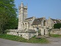
church in Westwood, Wiltshire, England, UK  | |||||
| Upload media | |||||
| Instance of | |||||
|---|---|---|---|---|---|
| Dedicated to | |||||
| Location | Westwood, Wiltshire, South West England, England | ||||
| Diocese | |||||
| Heritage designation |
| ||||
| Inception |
| ||||
| Religion or worldview | |||||
 | |||||
Media in category "St Mary's church, Westwood, Wiltshire"
The following 7 files are in this category, out of 7 total.
-
 Church of St Mary the Virgin and Westwood Manor (geograph 4035898).jpg 3,557 × 2,619; 1.01 MB
-
 St Marys church (geograph 2169661).jpg 696 × 800; 122 KB
-
 St Marys church, Westwood (geograph 2518567).jpg 640 × 480; 171 KB
-
 St Marys Church, Westwood (geograph 3694336).jpg 2,000 × 1,500; 892 KB
-
 St. Marys, Westwood churchyard (geograph 3679300).jpg 2,448 × 3,264; 1.69 MB
-
 Westwood Church - geograph.org.uk - 517099.jpg 640 × 399; 80 KB
-
 Westwood, Wiltshire.JPG 4,608 × 3,053; 1.79 MB
.jpg)
.jpg)
.jpg)
.jpg)
.jpg)
